The middle of the Jam, with the Monster Stone uphill to the left of centre.
Image credit: A. Brookes (19.12.2020)
The middle of the Jam, with the Monster Stone uphill to the left of centre.

Looking east towards Clatford Bottom.

The Jam from its eastern (Clatford Bottom) end.

29 August 2021 CE


The Mother’s Jam, from the northwest.

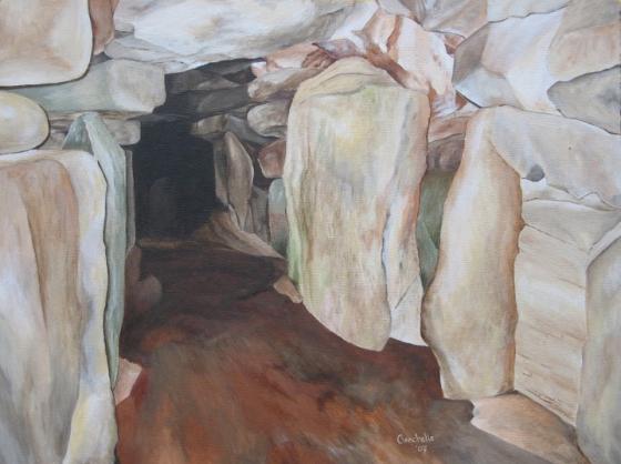
up close!


“Jam Central”

02.03.02CE

On the way to Jam Central from the Devil’s Den, 02.03.02CE.
When the delightful Jane and I arrived in Avebury on Midsummer’s Day, we were able to drive through hordes of affable people, and leave the car by a farm. It was lovely weather, blue skies, puffy white clouds, warm, breezy and sunny, but with denser cloud slowly moving in from the southwest.We set off eastwards along the white chalk track that met the end of the lane.
The map told us we were on the Wessex Ridgeway, and that a mile ahead, we would cross the Ridgeway itself. To our left, fields of green, slow-ripening wheat rolled away into shallow valleys and dells, every so often punctuated by occasional tumuli. The whole of this part of Wiltshire must have resembled something like the Valley of the Kings in its heyday. To our right, on the steeply climbing hill, yellow barley whispered and swayed with the strong breeze, while all around us skylarks circled higher and higher, their melodious, exaltative songs filling the skies.
It was a little bit like hard work for two non-walkers to trudge to the top of the down in the warm sun, getting thirstier with each dusty step, but it was worth it to turn and look westwards at Avebury and its henge nestling low in the broad, basin-like valley. Soft hills rose up on the far horizons, with all manner of greens and yellows washed across them in patches and swathes, broken up by dells and copses every so often.
We crossed the Ridgeway, then entered a huge green field that was on another rise upwards. The grass was close cropped by the flock of sheep wandering around, and the skylarks were even louder and more exuberant. Cresting the down, a beautiful piece of woodland called Delling Copse fell away to our left, while in front of us, the path led down into a steep, grassy valley which ran away to our right. The floor of this small valley was covered with huge grey stones, as far as the eye could see. Clearly, it was a glacial moraine, but seemed oddly out of place in the soft rolling Wiltshire countryside; you would expect to see this sort of thing in Scotland, Wales, or the Lake District – but in Wiltshire?!
The best part, though, was that we were completely on our own! A mile and a half out of Avebury, and not a soul to be seen. Admittedly, we had seen seven people on the way there, but there was probably something like 700+ in Avebury itself, so we weren’t doing too badly. We rested by the nearest comfortable stone in the valley, desperate by now to stop and have a drink. We looked down the valley, at the stunning view in front of us, and as Jane was getting her sketchbook and paints out of her bag, she spotted a hare across to our left, which was great.
Having revived, I left Jane painting a water-colour of the scene, and wandered off to take some black and white photographs. These stones are intriguing, and after a short while moving amongst them, it’s easy to imagine they are recumbent souls, sleeping in Rip van Winkle style. It is a place to stop and look, to see the images in the stones, hear the silence, and to enjoy everything surrounding you. Very healing for the soul.
As I was moving between the stones in the ankle-deep undergrowth, balancing briefly on one stone, I heard a rustle to my right, and saw a rabbit loping strangely through the undergrowth. ‘Strange gait that rabbit’s got’, I thought to myself. ‘Must have myxamotosis’ – then I saw a black-tipped tail, and realised that the rabbit was actually in the jaws of a stoat, which presumably was carrying lunch back to its kits. I was frozen for a few seconds, before realising I had a camera in my hand, but the stoat and its prey were out of shot. I ran after it, just as the stoat reached a hole, and disappeared with it’s prize in next to no time. Very exciting. Not so healing for bunnikins, however.The weather by now was beginning to get a little cooler and cloudier, so we decided to head back to the car and onto another site, the Devil’s Den. . .
[visited 19/4/3] An interesting and bracing walk from Avebury, especially with a fierce cold wind straight into your face for the majority of the walk. But cross the ridgeway and head down over the gallops into the fields of stone and the heart lifts.
I walked to the south of the copse, then round the back with the density of stones ever increasing. It was a cold day but I spent about an hour here, searching for the elusive Polisher. I had to give up in the end, if only cos my Avebury carpark ticket was in danger of running out. However I didn’t go home entirely empty handed, I found two stones with holes in and a nice sense of well being.
This little valley of Sarsens tucked away between Fyfield and Overton Downs is as magical as ever.
Merrick’s directions below are spot on. As you walk into the valley (after truning right off the track) the altar stone of the Mother’s Jam lies 20 yards to the right of the biggest and most striking Sarsen. My strongest reaction was of a sarsen holiday camp, or more darkly, a megalithic version of invasion of the bodysnatchers – these were the pods ready to replace Avebury. The lichen and erosion patterns on these Sarsens are so familiar to the erect stones in the henge and avenues.
We joked about a Bronze Age geezer presiding over this huge Sarsen yard “Nah mate, can’t do anything for your in that size or colour. We’ve got this big grey one though”.
On Midsummer’s Day, whilst Avebury heaved, Treaclechops and I walked up here to Fyfield Down and had this landscape to ourselves. (Apart from hares, weasels, buzzards, kestrels, a small deer, a stonechat, some wagtails and countless other feathered friends.)
Stones litter the landscape. Sit a while and take it in. There’s so much to enjoy.
There’s so much to see on the Avebury landscape that you really shouldn’t make do with the OS Landranger map. Splash out on Explorer 157. It’s twice the scale, so you can easily find everything, and they’ve coincidentally put Avebury in the centre. If you have this map you’ll find otherwise fiddly things like the Mother’s Jam really easily.
=========================================
Head east out of Avebury on the trackway that was, until 200 years ago, the main London to Bath road. It takes you over the Ridgeway, across the top of the hill, and then you cross a mad horse track and go downhill, with the trees of Delling Copse on your left.
And as you go down, you see them on your right. recumbent sarsens, littered across the ground. At the valley floor turn right and walk along. And there it is, the vast oracle stone of the Mother’s Jam. The hill to the west is bare, except for it’s cleft with a trickle of stones leading to the biggest of all at the bottom. The slope to the east is covered in sarsen. It is totally weird. You cannot believe this is natural, it feels so arranged, so ordained.
The few bushes and trees that grow there are weird to, all intense and twisty.
This would be worth visiting just to see the place where the Avebury stones came from. But it would also be worth visiting even if it were not. The weird crackling magic is tangible here, every time you visit.
Truly, the strangest and most intense place in all the natural world I have ever seen.
The centre – the big stone – is at grid ref 135708
Visited 6/8/00
Due to a combination of not reading TMA properly and Bovine Intervention, we didn’t get into the Mother’s Jam proper. You head up Eastwards out of Avebury, past the scaggy farm and up on to the Ridgeway (you can just see the crest of Silbury above Waden Hill). Cross straight across (following the coloured bridleway sign) along the unbelievably sheep-shit coated path (I swear the sheep do it on purpose – the rest of their field isn’t that bad) until you get to the horse gallop thing (looks like a racecourse).
Attentive readers of the TMA will now cross these gallops, and “descend to a sea of stones”.
Fellow Gibbons will not cross the gallops, but instead head down into the field on the “wrong” (Western) side, and no doubt, like us, find themselves literally marooned on top of an enormous stone, eating sandwiches, and looking back at the 10+ curious cows gathered around the base of the stone.
There was loads of them! We were sat down by a large stone, and had decided against sitting on it, due to possible damage to lichens, “what if every who came here did it?” and so on, got the butties out, and generally admired the view. Mrs Gibbon let out a bit of hoot as she spotted a young calf, followed by several others, coming in about 15 ft away. We scrambled up the stone (there’s 2 quite big ones, at the south-western end of the gallops, on the Avebury side), and watched in horror as the couple of cows mooed as loudly as they could, calling in the others for a look, surrounding the whole stone, looking at us.
We were up there for over half an hour. Occasionally the odd cow would drift off, but it would soon be replaced by another, galloping in from over the horizon, in response to the signal. We were praying that no-one was going to come past and see us, perched up there. It wasn’t as if we were *frightened* or anything. Oh no. Just that the cows had formed a very solid circle around us. And they were looking at us. Ruminating.
We were finally saved by the rattle of the feedbucket. All the cows all legged it off down to the farm at the bottom of the hill, and we were left to have a root about. As it turns out, we were in the “wrong” side, but there’s still plenty to amuse. Down at the bottom of the field, there’s a whole heap of stones, many arranged in various straight lines. Follow the field straight up (there’s a long-barrow shaped tumulus, with poles in the top – not sure exactly what it is), and there’s at least 2 more “destroyed” circles, one on a small hillock, the other around a small ditch. Not quite the “natural earth altar” we were expecting, but that’s what you get for not paying attention, and being scared of cows.
Possible the most beautiful part of the Avebury complex we’ve visited so far. Well worth the visit just to try and imagine what a shocker of a job it must have been to bring the stones in, and to see the Henge of Avebury from a new angle. Will return, avoiding the cows. Probably get aliens next time or something ...
Samuel Pepys visited the area in 1668 and described the sarsens as ‘Stones of considerable bigness, most of them certainly growing out of the ground.‘
(quoted in Aubrey Burl’s ‘Prehistoric Avebury’)
The idea that stones grew in the ground was probably fairly widespread? as you can see from the Growing Stone in Wales, and the East Anglian Blaxhall Stone.