Groovy.
Images
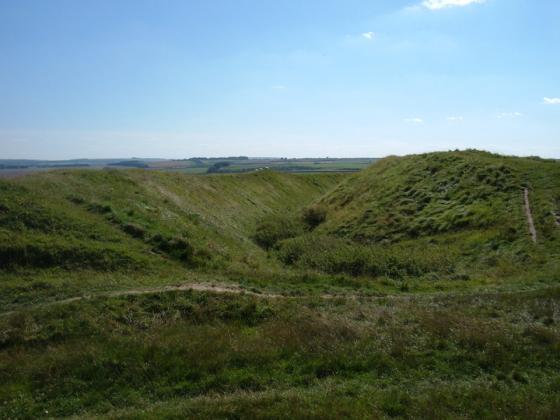
The Avenue Polisher. Is it of significance that the Avenue changes course at this section?
Close up of the polishing area.
Close up of the grinding marks.
An avenue stone revealing a former life.
Polishing area and 2 Axe grinding grooves above.
West Kennett Avenue Stone 19b showing position in the avenue
The “Polisher Stone” within its setting within the Avenue. As a help to those who wish to find it. There is a tiny layby, the"other side” of the yellow lines opposite.
Jim.
The “Polisher Stone” in the Avenue. The polished bit, centre bottom, is glassy smooth but in a position to be almost impossible to use. Was the stone originally in a horizontal position for this purpose before being raised vertically?
Jim.
10/02 Axe polishing marks. Last stone before it crosses road
Articles
Visited 14.6.14
I followed Chance’s directions and before too long was at the stone in question. The strange thing is it ‘felt’ like you were walking in the ‘wrong’ direction walking away from Avebury. The Avenue ‘feels’ right when walking towards the circle/henge – make of that what you will?
As stated, the marks are on the fence-side of the stone, about 1 foot above the ground.
I spotted 3 fairly deep groove lines and possibly another 3 slight grooves.
The grooves are not that obvious unless you are looking specifically for them.
Worth looking out for if walking along the Avenue.
Half way down the restored West Kennet Avenue, The inner (eastern) face of Stone 19b of the West Kennet Avenue bears near the base a group of small but typical marks of the kind thought to have been produced by the grinding and sharpening of flint or stone axes.
A few simple notes, on how to find this stone.
From the Red Lion pub, cross over the road to the Southern or Sun circle.
Walk up to the portal stones and follow the path to the right, close to the wire fence and the trees.
Take care on this stretch as the tree roots can be tricky under foot.
Look carefully and you will find the broken stump of Avenue Stone no.3. Go through the gate and watch for traffic as you cross the road.
Go through the gate and pass of Avenue stone No.4, The Bison.
Walk further down the Avenue, through the concrete plinths. You won’t reach any more sarsens until you get to Stones 13A and B. Count down the stones, 14A, 15 A and B. At number 16, the Avenue jumps into the road and 16A is buried beneath the asphalt, leaving 16B alone. Stones No.17A and B are gone for good but 18A sites right next to the fence, with the stump of 18B on the other side of the road. The Stone in front of you is now 19B. The inner face nearest the fence shows the polissoir marks, a hollowed out flat surface and several grooves.
Other items of intersest include part of a polished patch on Avenue Stone 32a, above the broken part on the damaged face and more diffuse smoothed areas also occur on Stones 24 and 31 of Avebury’s Outer Circle.
Smith, I. F., Windmill Hill and Avebury: Excavations by Alexander Keiller 1925-1939, London, OUP, 1965.
Section 5. ARTIFICIAL MARKINGS ON STONES – Page 223
Far more easy to find than the Polisher but lacking the ambience of the downs.
Chance
Sites within 20km of Avenue stone with axe grinding marks
-
West Kennett Avenue
photo 130forum 5description 12link 3 -
Falkners Circle Long Barrow
description 1 -
West Kennet Avenue Settlement Site
photo 25description 4 -
Falkner’s Circle
photo 25forum 2description 13link 2 -
Falkners Circle mounds and barrows
photo 1description 2 -
Avebury
photo 339ondemand_video 2forum 222description 89link 12 -
Waden Hill
photo 5forum 1description 2 -
The Cove
photo 54forum 1description 5link 2 -
West Kennet Hollow Way
description 1 -
Silbury Hill
photo 155forum 180description 44link 15 -
Silbaby
photo 17forum 17description 7 -
Beckhampton Road Enclosures
description 2 -
Beckhampton Avenue
photo 8forum 4description 3link 1 -
Wagon and Horses Barrow Cemetery
description 1 -
Avebury Down
photo 26description 1 -
South Street
photo 6description 4link 1 -
West Kennett Palisaded Enclosures
photo 2description 2link 1 -
The Longstone Cove
photo 62forum 2description 13link 2 -
Swallowhead Springs
photo 34ondemand_video 1forum 5description 9link 1 -
Long Stones
photo 10forum 1description 6 -
West Kennet Long Barrow
photo 175ondemand_video 1forum 14description 36link 7 -
Penning
photo 12description 2 -
The Sanctuary
photo 59ondemand_video 1forum 1description 16link 4 -
Penning Barn
photo 1description 2 -
The Shelving Stones
description 1 -
Horslip
photo 3forum 1description 3 -
Beckhampton Penning Enclosure
description 1 -
Overton Hill
photo 106ondemand_video 1forum 3description 6 -
Winterbourne Monkton (Churchyard)
photo 3description 3link 2 -
Winterbourne Monkton oval mound
description 1 -
Beckhampton Plantation Stone Circle
photo 1description 2 -
Down Barn standing stones
photo 4description 1 -
Windmill Hill
photo 79forum 4description 15link 3 -
Beckhampton Penning Barrow Cemetery
description 1 -
Experimental Earthwork
photo 6description 2link 2 -
Pickledean Stone Circle
photo 10description 2 -
Overton Down
photo 18description 2 -
Harepit Way
description 1 -
Millbarrow
photo 1description 1 -
East Kennett Long Barrow
photo 56forum 5description 8link 1 -
Fox Covert Barrow Group
photo 2description 2 -
The Mother’s Jam
photo 15forum 1description 7 -
Monkton Down
photo 10description 3 -
Knoll Down Barrows
photo 1description 1 -
Monster Stone
photo 6description 1 -
Harestone Down Stone Circle
photo 21forum 2description 3 -
Fyfield Down
photo 17description 4link 1 -
Yatesbury Field Cursus
description 1 -
Harestone Down barrow
photo 5 -
West Down Roman Road Barrows
photo 7description 2 -
West Down Long Barrow
description 1 -
Old Bath Road Barrow
photo 9description 2 -
Little London Pair
photo 4description 4 -
Piggle Dene
photo 18description 2 -
Fyfield 1 and 2 barrows
photo 2description 1 -
West Down Gallops Barrows
photo 6description 2 -
Fyfield Down settlement
photo 4 -
Little London Barrow
description 1 -
Yatesbury Field Barrow
description 1 -
Little Avebury
photo 18description 2 -
Old Chapel
description 2 -
Allington Down
photo 12description 3 -
North Down
photo 31description 7link 1 -
Long Tom (Fyfield)
photo 6forum 1description 4link 1 -
White Barrow (Lockeridge)
description 1 -
Yatesbury Village Barrow
description 1 -
Lockeridge Dene
photo 20description 5 -
Berwick Bassett Down
photo 3description 1 -
Manton Down
photo 10forum 2description 6 -
Rough Hill Barrows
description 1 -
Devil’s Den
photo 90forum 4description 27link 2 -
Rough Hill Row
description 1 -
Horton Down
photo 1description 1 -
Cherhill 4
photo 6 -
Clatford Barrows
description 1 -
Tan Hill (east)
photo 10 -
Noland’s Farm Barrow
description 1 -
Temple Bottom
photo 1description 3 -
Knoll Down Earthwork
photo 1description 1 -
Easton Down
photo 22description 1 -
Cherhill Down and Oldbury
photo 52forum 4description 13link 2 -
Knap Cottage Stone
photo 2description 1 -
Tan Hill (west)
photo 15description 3 -
Hackpen Hill (Wiltshire)
photo 3forum 1description 7 -
White Horse Barrow
photo 9description 2 -
Oldbury Long Barrow
photo 3description 2 -
Broad Stones (Clatford)
forum 1description 2 -
Tan Hill
photo 6forum 2description 5link 1 -
Knap Hill and Walker’s Hill
photo 4description 4 -
Calne Without
photo 7description 1 -
Manton Round Barrow
photo 6description 6 -
Rybury
photo 32description 2link 1 -
Golden Ball Hill
photo 10description 3 -
Winterbourne Bassett
photo 34forum 5description 14link 1 -
Knap Hill
photo 33forum 1description 13link 1 -
Cherhill cross dyke
photo 4 -
Knap Hill Pass
photo 2 -
Kitchen Barrow
photo 8description 3 -
Adam’s Grave
photo 51description 18 -
Fiddlers Hill
photo 1description 1 -
Roughridge Hill
photo 4description 3link 1 -
Barrow Copse
photo 25description 4link 1 -
Barton Copse Barrows
description 1 -
Cherhill Hill (West)
photo 10description 1 -
Draycott Hill
photo 25description 2link 1 -
Baltic Farm
photo 2description 2 -
Adam’s Grave Fallen Stone
photo 3description 2 -
Ogbourne Maizey Down Barrows
photo 1description 1 -
Easton Hill
photo 1 -
Mount Wood
photo 6description 4 -
Brade Wyll
photo 2description 1 -
Morgan’s Hill (eastern group)
photo 10description 1 -
Shepherds Shore Long Barrow
description 1 -
Alton Priors
photo 12forum 2description 7link 1 -
Marlborough Common Golf Course Barrows
description 3 -
Granham Hill
description 2 -
Ridgeway (Southernmost Remains)
photo 8forum 1description 1 -
Huish Hill
photo 8description 1 -
Marlborough Mound
photo 14forum 7description 11link 2 -
Morgan’s Hill
photo 25description 3 -
Barbury Castle
photo 40forum 3description 18link 1 -
Picked Hill
photo 8description 5 -
Ogbourne St Andrew Barrow
photo 15forum 1description 8 -
Ogbourne St Andrew Church
photo 6description 3 -
Giant’s Grave (Martinsell)
photo 16forum 1description 3 -
The Hanging Stone
photo 3description 3 -
Martinsell
photo 14description 7 -
Roundway Hill
photo 9description 1 -
Swanborough Tump
photo 3forum 1description 6 -
Bincknoll Castle
photo 11description 2 -
Woodborough Holed Stone
photo 3description 3 -
King’s Play Hill
photo 20description 3 -
Forest Hill Farm
photo 3description 2 -
Whitefield Farm
description 1 -
Pewsey Church
photo 7description 1 -
Roundway Hill Covert
photo 3 -
Pewsey
photo 6description 3 -
Oliver’s Castle
photo 30ondemand_video 1description 14 -
Marden Henge (and Hatfield Barrow)
photo 7forum 3description 23link 3 -
Savernake
photo 8description 3 -
Mud Lane Barrow
description 1 -
Mother Anthony’s Well
photo 4forum 1description 1link 3 -
Laggus Farm Mound
description 1 -
Savernake Temple
description 1 -
Square Copse Barrows
description 1 -
Savernake Lodge
photo 5description 1 -
Bowood Park Mound
description 1 -
Burderop Wood Stone Circle
description 1 -
Devil’s Footprint
description 1 -
Bowood
description 1 -
Hoare Stone
description 1 -
Giant’s Grave (Milton Hill)
photo 15description 3 -
Broadbury Banks
description 2 -
Broome Long Stone
description 1 -
Broome Temple
description 2 -
Rushy Platt Bowl Barrow
photo 2description 1link 1 -
Liddington Castle
photo 30description 4link 3 -
Coate Mound
description 2 -
Shipley Bottom
photo 3description 1 -
Easton Clump
photo 2description 1 -
Coate Stone Circle
photo 13forum 7description 19link 1 -
Loxwell
description 3 -
Down Farm Group
photo 2description 3 -
Aldbourne (west of Giant’s Grave)
photo 7description 1 -
Warren Farm
photo 1description 1 -
Everleigh Barrows
photo 11forum 1description 3 -
The Giant’s Grave (Aldbourne)
photo 20description 1 -
Liddington Warren Farm
photo 13forum 1description 3 -
Oldhat Barrow
photo 12description 1link 1 -
Aldbourne 'Cup Barrow'
photo 1description 1 -
Casterley Camp
photo 2description 2 -
Sugar Hill
photo 9description 1 -
Grant’s Firs Group
description 1 -
Godsbury
photo 3description 2 -
Aldbourne Four Barrows
photo 11forum 1description 5link 2 -
Chisenbury Camp
description 1 -
Aldbourne 7
photo 3description 1 -
Naish Hill
photo 2description 3 -
Aldbourne Blowing Stone
photo 3description 2link 1 -
The Aldbourne Way
description 1 -
Crofton
description 2 -
Lidbury Camp
description 1 -
Ringsbury
photo 16description 5 -
Chisbury
photo 7description 3 -
Enford
photo 3forum 1description 2 -
Slay Barrow
description 1 -
Ell Barrow
description 1 -
Summer Down
photo 14description 3 -
Ballards Copse Long Barrow
photo 3description 1 -
Weather Hill Long Barrow
description 1 -
Weather Hill
photo 5description 3link 1 -
Fairmile Down
photo 19description 2