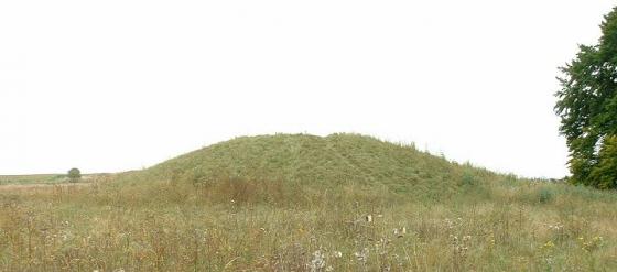
Details of the enclosure on Pastscape
A large, 3 sided earthwork enclosure, open to the south, and originally consisting of a bank with exterior ditch, enclosing circa 8 hectares. Only a length of the western side survives as earthworks, the remainder having been ploughed flat. Excavations in 1958 included an unsuccessful attempt to locate a presumed fourth side on the south. One cutting on the eastern side identified a small ditch running parallel to the main ditch. This smaller ditch contained postholes, and appears to have held a palisade. It was traced north and south from the excavation trench, in the latter case running beyond the southern limit of the enclosure. A cutting through the extant earthworks on the western side recovered late Neolithic and early Bronze Age pottery from beneath the bank, hinting at an early date for the enclosure. This was subsequently supported by an RCHME suggestion that disc barrow Wilsford 45b (SU 14 SW 478) overlay the enclosure earthworks. An excavation through the western side in 1983 again found Beaker sherds on the ground surface beneath the bank, and a quantity of Neolithic and early Bronze Age pottery (including Peterborough Ware and Beaker sherds) in the buried soil. Thus an early Bronze Age date seems possible for the construction of the enclosure, while it is also clear that the earthworks formed a focal element in the later Bronze Age linear ditch system on Wilsford Down (see SU 14 SW 127, 128, 129, 502). The enclosure is visible as an earthwork and a cropmark on aerial photographs. Analysis of lidar data suggests a possible slight banked feature running from SU11254030 – SU11404028. It is not clear from the data whether this feature actually joins up with the eastern edge of the Kite enclosure and because it runs parallel to the earthwork bank to the south (SU14SW 707) it may be related to this.


