
Looking approx north-west toward distant Pen-y-Garn rising above the nascent Afon Ystwyth (the river’s course highlighted by the prominent ‘notch’)
Image credit: Robert Gladstone
Looking approx north-west toward distant Pen-y-Garn rising above the nascent Afon Ystwyth (the river’s course highlighted by the prominent ‘notch’)


Then the sun returned and the Elenydd is transformed in character.

The monument affords views of the Craig Goch Reservoir.... although it wouldn’t have originally, of course. Just the Afon Elan, then. Wonder what they called it?

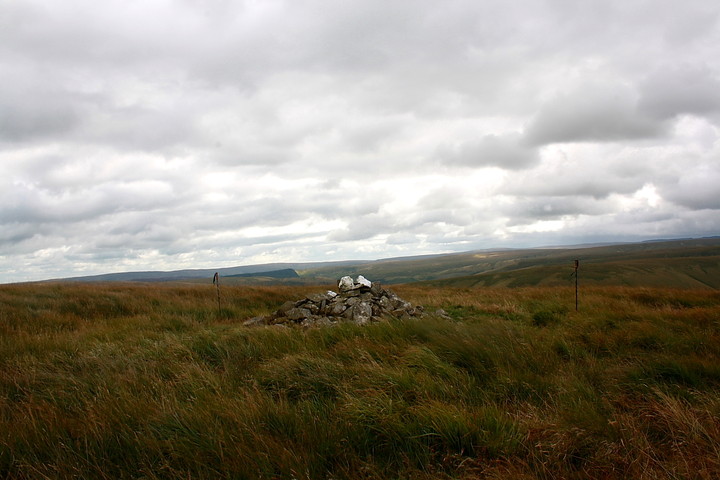

The poles were an attempt to try and define the pretty substantial footprint of this cairn... not an original feature. Reckon that should be Pen y Garn crowning centre horizon.

A dodgy marker cairn – presumably modern – crowns a rather large, grassy footprint.
This cairn lies a little downhill from, and to the approx south-west of the 1,765ft summit of Esgair y Llwyn (’ridge of the grove / bush’ ... an indication of how the topography of Y Elenydd has changed over the years, I guess, since tussocky grass reigns supreme nowadays). It is not indicated upon either the current 1:25K or 1:50K OS maps.
As I approach, the initial impression is that of modern ‘marker cairn’ occupying a classic Bronze Age location overlooking the Afon Elan, arguably the finest such position in the immediate locality. Pity. However, what’s this? Yeah, closer inspection strongly suggests – to myself, as well as (retrospectively) Coflein – that, although the marker cairn is no doubt modern, it is actually set upon a much larger, grassy footprint of probable ancient origin. What other credible explanation is there up here upon such an obscure hill? Furthermore, it could be argued that the ‘greener cairn’s’ circumference is, albeit intermittently, defined by traces of a kerb.
To be honest I wish I had more time to spend here, the vista south beyond Pont ar Elan toward the Graig Goch Reservoir and Cwmdeuddwr skyline proving to be excellent, as is that looking north-west to the Gors Lwyd wetlands and distant Pen-y-Garn. However I’ve promised myself a short sojourn at the superb Rhiw Afon cairn before the final descent back down to Pen-yr-ochr farm.... such is life.
Needless to say Banc Cynnydd is not at all bad for a bonus site and, in my opinion well worth primary focus. From the south, perhaps? I would say instinct brought me here. But there are enough gobshites in this world already, thank you very much.
The Coflein entry by J.J. Hall [8 Sept 09] notes the following:
“A low cairn, up to 0.5m high and measuring 6m north to south by 5m. Most of the cairn body is in fact very low, less than 0.2m high, but stone has been piled up to create a marker cairn... on the northern side of the monument. There is no evidence of any intrusive activity.”
Yeah, I’d concur with that. Incidentally Coflein cites the cairn to be located at SN8922773383, slightly off from what I made it. Happy to be subsequently corrected.


