For years, Hunebed D7 Kniphorstbos—sometimes referred to as D7 Schipborg—was a neglected, out of the way passage grave that was hard to find in the woodlands of Strubben/Kniphorstbos, a few kilometres west of the village of Annen. Until just a few years ago this area was a military training ground, and visitors were discouraged; hence there were no signposts, and there was a multitude of tracks through the woods that could lead visitors badly astray.
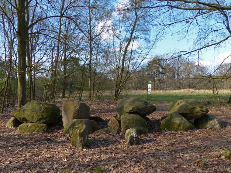
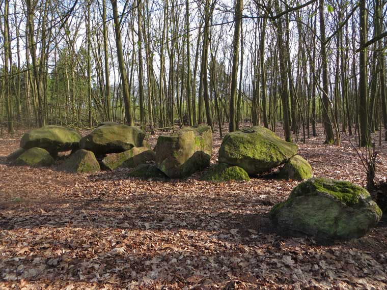
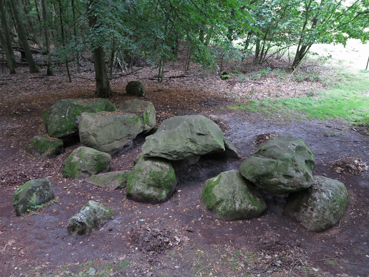
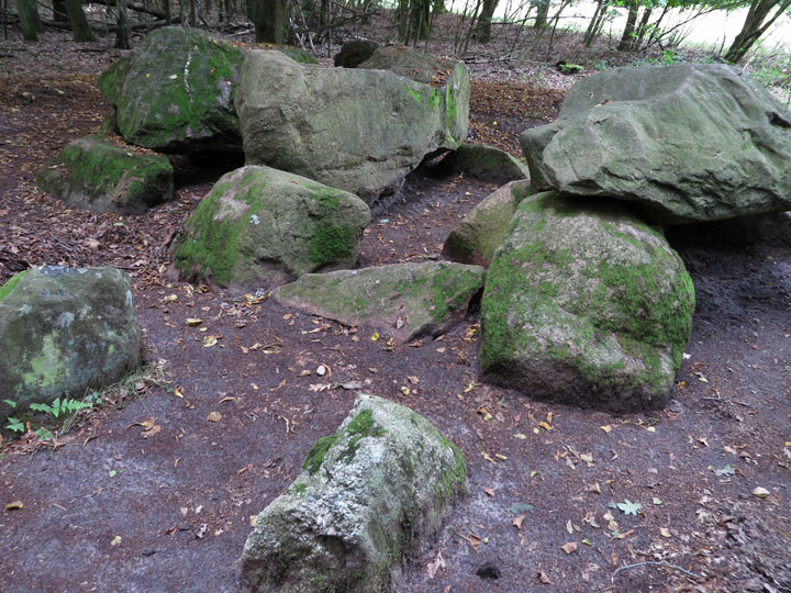
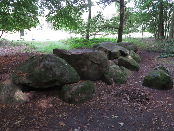
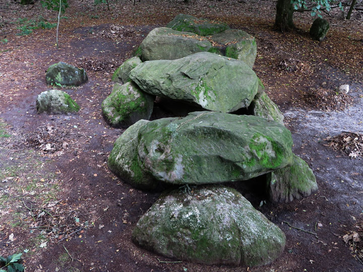
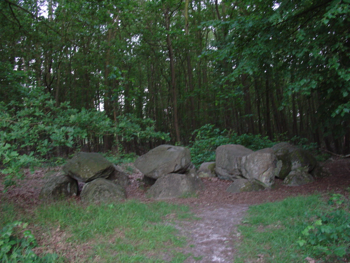
But all that changed in 2012 when the Staatsbosbeheer (the Dutch equivalent of the Forestry Commission) provided new direction signs and information boards for all the hunebedden. At last Hunebed D7 Kniphorstbos, restored in 1952, is relatively easy to track down, partly hidden by trees, just off the boundary of a forest clearing. Heavily shaded by foliage for much of the year, the stones of this hunebed are green with a coating of mosses. There are eight sidestones, deeply buried in the sand, and four capstones, one of which is damaged and has slipped down into the grave.
The best way to reach Hunebed D7 is on foot from Annen, passing Hunebed D8 on the way. Start just north of the roundabout on Zuidlaarderweg at the very north of the village, and follow Schipborgerweg westwards for 700 metres to the underpass below the N34 highway (see map below). On the other side of the highway, follow the forest path west for 250 metres until you reach a crossroads: from here, D8 lies in a clearing just a few metres along the road to your left. But to reach D7, carry along your original route—which veers slightly to the right—for 150 metres until you arrive at a point where the path forks in two. Here on your left stands the mound of the Galgenberg. Now follow the left hand path, which curves back and forth a few times, for 800 metres, until you emerge on to (another) Schipborgerweg, a metalled road. Turn right, and immediately on your right-hand side is a large car-park with a colourful information board about the Strubben/Kniphorstbos. This includes a somewhat simplified map detailing where to find Hunebed D7.
The yellow line on the map indicates the route, crossing below the N34 Rijksweg and through the woods to the car park.
For the final short distance to D7, follow the footpath that leads north from beside the Information Board. After a few metres you come to a gate. Pass through this gate and follow the sinuous path that leads to the right through the trees. After about 200 metres this crosses another path at right angles. Do not follow this second path but continue forward just a few paces towards the obvious woodland clearing ahead, and a green 'hunebed sign' comes into view. Now turn left and follow the narrow grassy footpath along the edge of the clearing—after about 150 metres you will come upon Hunebed D7, set a few metres back in the woods on your left.
Don't be put off by this wealth of instructions. The total distance walked is only 2½ kilometres, and should take no longer than 45 minutes. The hunebed is relatively complete and undamaged, and well worth visiting. Of course, if you are in a hurry, you can drive directly to the car-park along Schipborgerweg from either of the villages Anloo or Schipborg. But that is a much less satisfying proposition than following the forest paths on foot.
The Strubben Kniphorstbos is an area of some 150 hectares of predominently oak woodland, located between Anloo and Schipborg in the Dutch province of Drenthe. It contains two hunebedden (D7 and D8) as well as some 60 Bronze Age burial mounds, and was declared the Netherlands' first (and currently only) archaeological reserve in 2001. Its double name derives from the special way in which its native oak trees were originally cultivated (strubben), and from Gerrit Kniphorst, a 19th century lawyer and politician who was the landowner.
'Strub' is the Dutch word for 'Stump'. When this woodland was originally planted, the oak trees bordering the fields and moors were cut down to stumps to encourage the growth of a thick oak coppice with typically squat stems. The idea was that the coppice would act as barriers to keep sheep in their fields. But the constant nibbling of the young oak stems by sheep meant that tall growth was impossible, turning the trees into gnarled shrubby specimens—the so-called 'strubben'.

 Posted by LesHamilton
 Posted by Jane