|
|

|
|
Burledge HillHillfort
|
||||||||||||||||||||||||
|
|
|
Images (click to view fullsize) |
|
|
Fieldnotes |
|
|
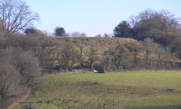
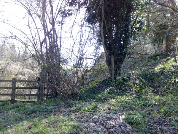
[visited 22/03/09] This is a pretty little promontory fort with well defined ramparts, certainly to the East, South and West. Not sure about the North however. I finally made it back here after making it within half a mile along the ridge a few years back and discovering nowhere to park at the top of the hill. There are beautiful views in 3 directions, but you'll need to trespass to see them. This is my least favourate type of hillfort, that where the only public access is straight across the middle. Of course the rest of the hill is covered in pasture so locking gates and thus stopping curious and lawabiding visitors from actually seeing much of this fort, is slightly annoying. Though the nature of the owner becomes clearer when you realise its nigh on impossible to get to the Open Access land which the North rampart is supposedly on. I gave up after fighting felled bushes, hedges being grown in the way and a scrambler track making it v. hard to proceed. Access for me was straight up the hill using the footpath that starts at the West end of Bishop Sutton. I wouldn't recommend it if you are very unfit though. I presume you could get a wheelchair from somewhere on top of the ridge. The bridleway is not passable by a car... All in all, worth visiting if only to annoy the farmer, otherwise go to Maes Knoll. |
 Posted by juamei
22nd March 2009ce Edited 22nd March 2009ce |
Miscellaneous |
|
|
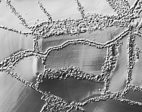
Details of Hillfort on Pastscape Pastscape (ST 58205850) Camp (GT). (1) A promontory-type hill-fort with double defences on the east. Both the inner and outer banks are mainly of stone, with indications of walling. The original entrance was probably on the east. (2-3) Surveyed at 1:2500. (4) Burledge Hill-fort is at the end of a spur and is univallate except at the E. end where there is an additional rampart. The N. side has been largely obliterated by quarrying, which has also caused a scarp connecting the inner and outer ramparts. The original entrance is on the W., with modern gaps in the E.and S. sides. In 1955 test cuttings in the platform within the hill fort produced post-holes, pits, possible paving, gullies and a ditch. Pieces of iron slag with clay adherent suggested a local iron smelting furnace. Pottery of the second Phase I.A. was similar to that from Chew Park (ST 55 NE 3) and included grooved, decorated ware. The only other finds were a saddle quern rubber, the spring from an iron brooch, abd bones of ox, pig and sheep. A cutting across the main rampart showed it to be formed of lias blocks. The ditch produced First Phase I.A. pottery in the lower levels and Second Phase in the upper filling. (5) Published survey (1:2500) correct. Burledge Camp was "discovered" in the 1940s but is shown as an 'ancient fortification' by Strachy, and is the "Bow Ditches" mentioned by Stukeley. (6) Published excavation report with information as per Authority 6. See plan. The finds and records have been placed in the University of Bristol Spelaeological Society Museum. (7) Earthworks and former house sites discovered on and around Burledge hillfort during a landscape survey in 1983 (9) The hillfort referred to by the above authorities is visible as an earthwork on aerial photographs and has been mapped as part of the Mendip Hills AONB NMP project. The hillfort is as described though only the southwest and south side were visible due to dense vegetation cover. The south side comprises of an internal bank and external ditch with an outer south facing scarp slope. In the southwest corner only the main rampart and a slight external ditch is visible. The outer defence on the eastern side of the hillfort is visible as a ditch extending from ST 5839 5840 to ST 5840 5853, the bank presumably covered by the dense vegetation. The hillfort earthworks are still visible on the south and west sides on aerial photographs taken in 2000. (11-12) |
 Posted by Chance
12th April 2015ce |