|
|

|
|
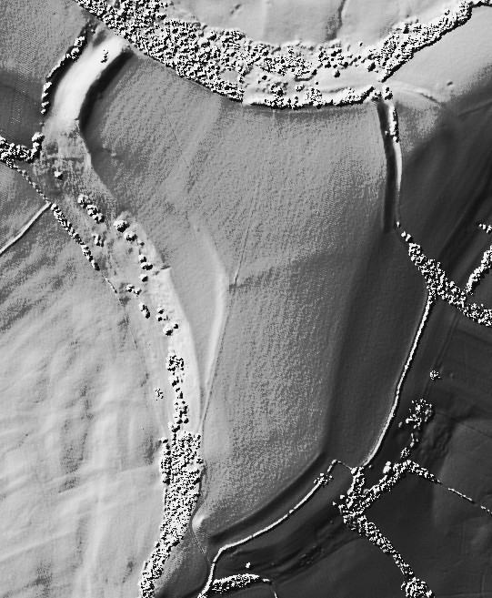
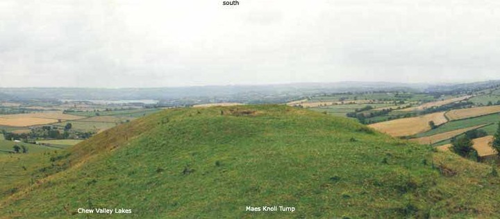
Maes KnollHillfort
|
|
|
|
Images (click to view fullsize) |
|
|
Fieldnotes |
|
|
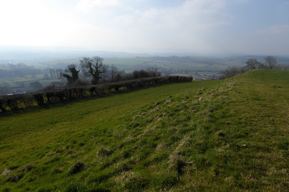
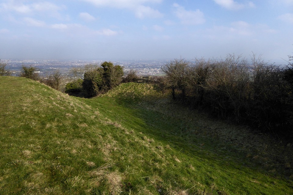
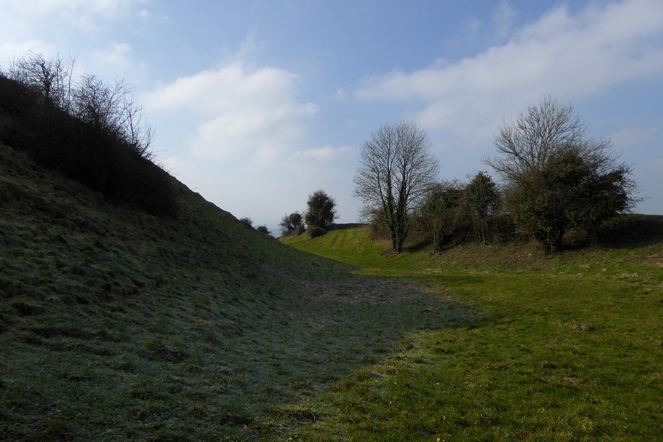
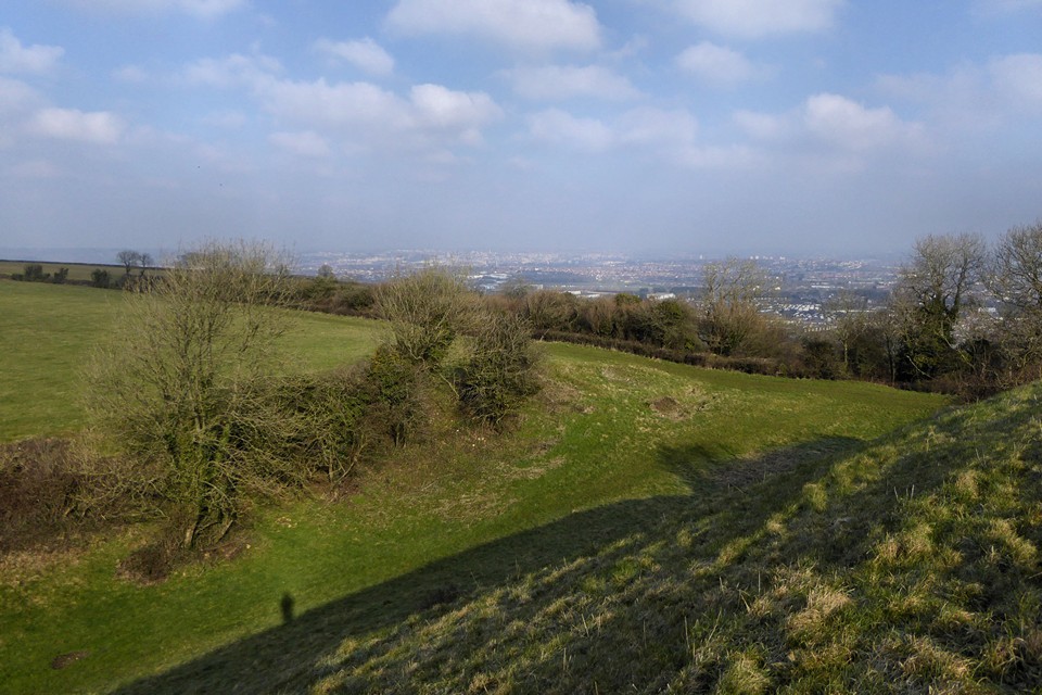
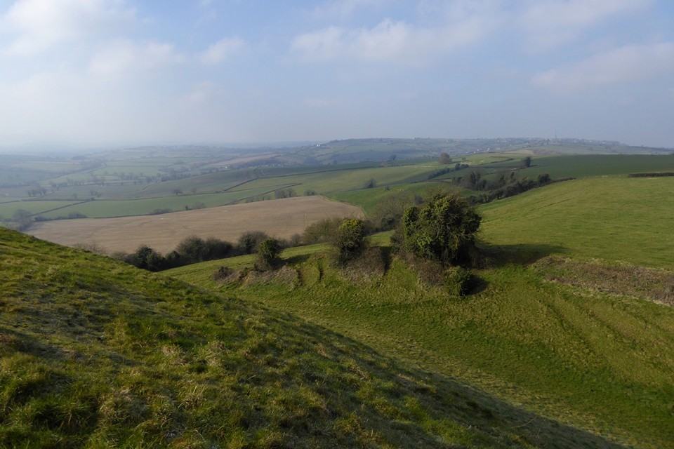
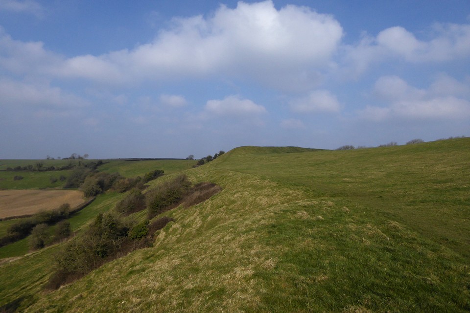
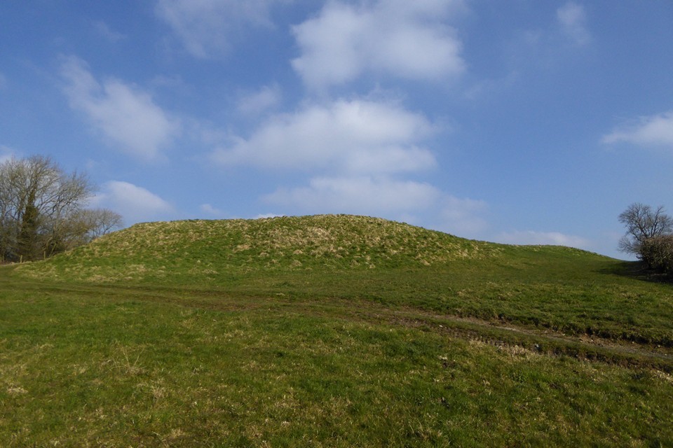
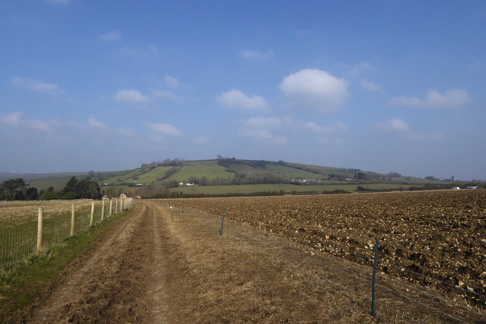
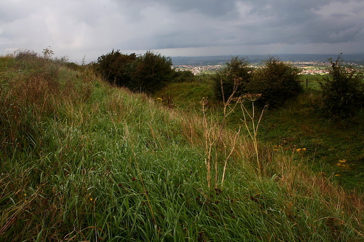
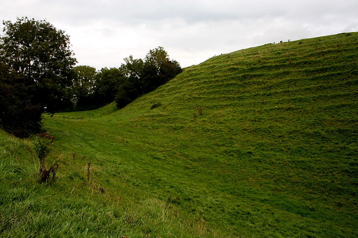
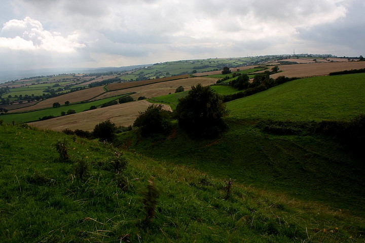
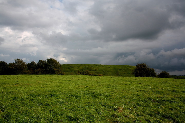
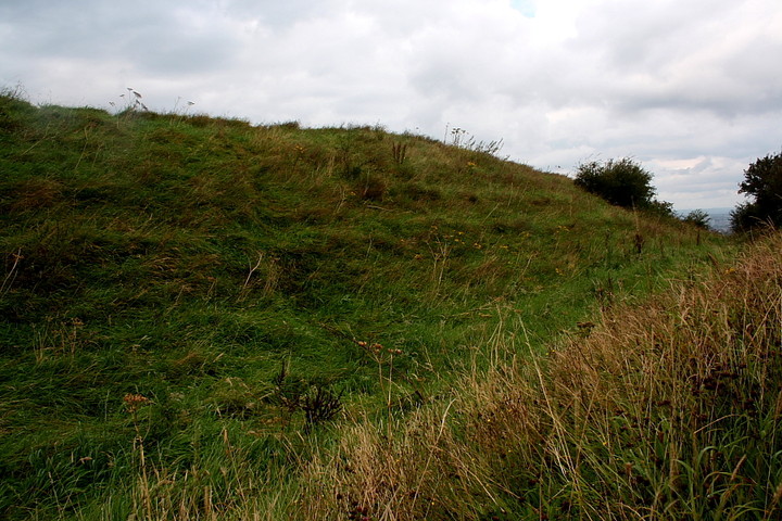
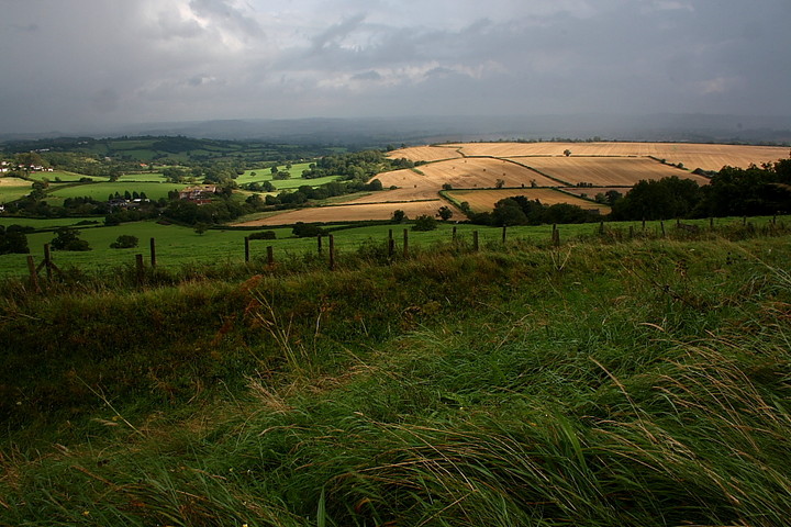
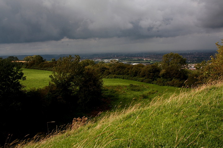
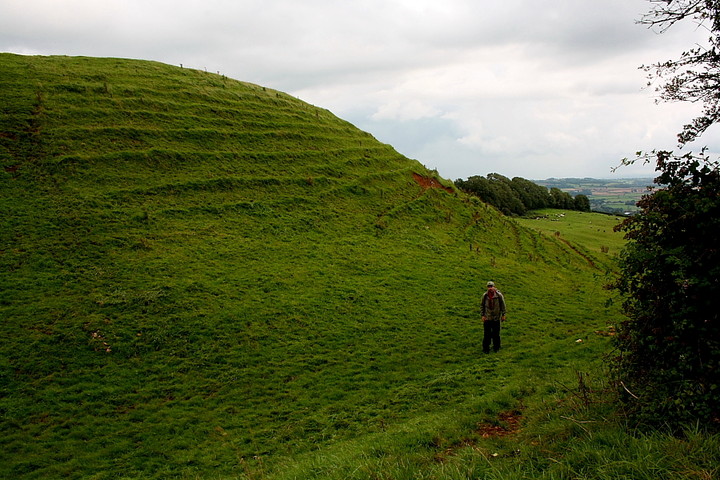
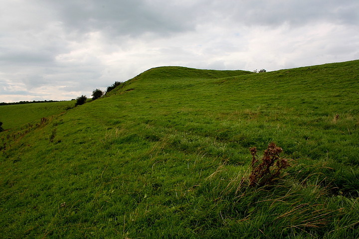
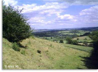
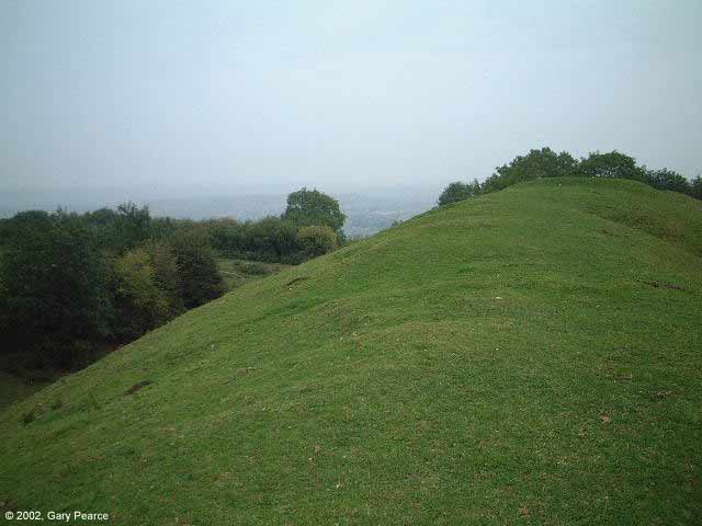
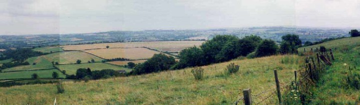
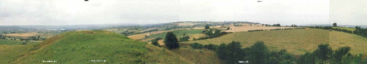
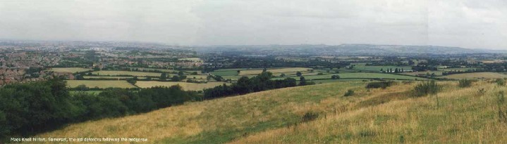
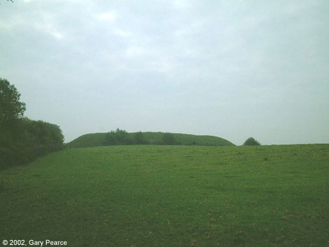
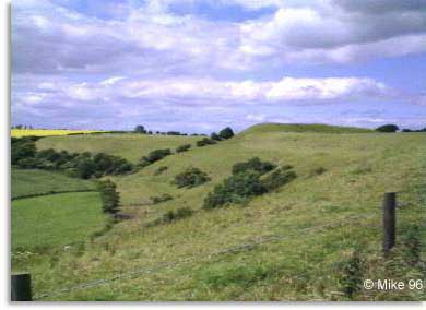
I'm sorry to start like this, but I have discovered it is a fact that some people (some people) from Whitchurch are pure scum. I'd driven up a tiny lane from this suburb of Bristol, up onto the plateau where the fort is, in a lazy attempt to avoid a climb. The views are fantastic - 'panoramic' doesn't even begin to cover it - the Clifton suspension bridge, the Severn crossings, the Welsh mountains behind. But some people don't register this. Some people prefer to sneak up here to dump their rubbish, set fire to bits of cars, and generally behave like complete fwits. What a complete shame - and shame on them. (If they can be bothered to make the effort to dump stuff up here, why don't they exert the same energy and take it to the tip? It's beyond understanding really. I'll probably be writing to the Daily Mail in a minute:). I backed the car up to a large forlorn sarsen blocking the entrance into a field, got out.. and decided that despite it being a quiet midday on a weekday I was too afraid to leave the car alone for fear of the wheels disappearing by the time I got back. So I'm sorry, if you can't handle a steep hill, you'll either have to park here or forget it. Fuming I drove round to the other side of the hill at Norton Malreward and braced my unfit body for the climb. It's infinitely worth it though. Indeed, what can't you see from up here? I could easily spy the stones of Stanton Drew, looking like cows grazing in their field. Over to the east was Lansdown and Bathampton; straight ahead, Stantonbury; over the back the edge of Salisbury Plain where Bratton Castle is; the strange shape of Cley Hill; and to the south the Mendips and Beacon Batch. Recovering, I followed the footpath to the Tump. Visiting this just underlines for me the absolute necessity of spending time at a place, not just assuming from a map. The tump (as RichardZ says in his comments on the attached forum post) - when you reach and climb it, the view opens out into 360 degrees. It's fantastic. It's a huge lump of earth and presumably it must have been created for the very purpose of raising you up above everything else to see. The view includes all the places I've mentioned so far, and would also include the line of the Cotswold Hills, if it weren't for some ill-positioned trees. Is it really part of the later Wansdyke, as has been suggested elsewhere here on tma? It feels as though it is older, part of the fort, because you 'need' this extra vantage point for visibility and defence, surely? It was marvellously relaxing eating my lunch on the tump, with Bristol strangely still and quiet below, and listening to the sounds of insects, hay harvesting and dogs barking. Maes Knoll is directly on the flight path to Bristol Airport and the strangest effect happened when planes went over. The sun was bright and cast a clear shadow of the planes which moved quickly over the ground. It looked to me like a huge bird undulating over the landscape. In fact the whole place was 'birdy' today - there were crowds of crows sitting on the slope below like a van Gogh painting, and I'd surprised a bird of prey out of the hedge as I'd climbed up. More birds sat in a nearby ash tree like big black fruit, watching me, and flocks of pigeons wheeled over my head. It was hot though and there's no shelter (that probably explains a lot eh. But maybe, as I thought much later, they were just the legendary Birds of Rhiannon come to see me, as they might). You can't walk across the inside of the fort, but you don't need to - the inside of the fort is not the point. Visit - it's so worth the climb. |
 Posted by Rhiannon
13th August 2005ce Edited 28th February 2006ce |
|
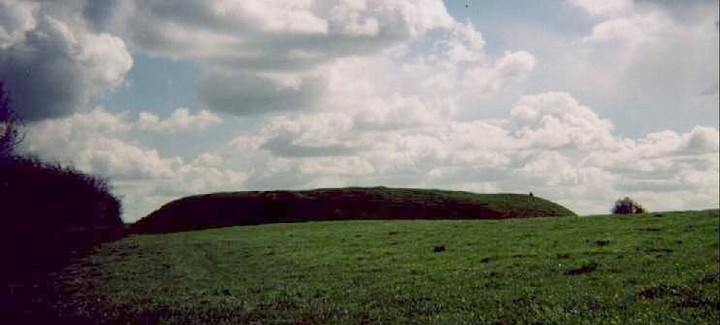
The large and very beautiful hillfort Maes Knoll lies just south of Bristol, and besides being a very beautiful hillfort, it also figures as western terminus of West Wansdyke. On the NW side there's a large earthwork, know today as 'The Tump', which blocks the access to the fort from the ridge. This may be the actual place where Wansyke starts/ends. The name 'Maes' comes from AS 'merces' meaning 'border'. Visited 1996. Website: http://www.wansdyke21.org.uk/wansdyke/wanwesteast/wanwest1.htm Literature: Tratman, E.K. (1963): Maes Knoll Camp, Dundry, Somerset, 2: The Iron Age Defences and Wansdyke, in: Proceedings of the Spalæological Society, University of Bristol 10, pp 11-15 |
 Posted by Vortigern
12th November 2002ce |
Folklore |
|
The stone called "Hawkwell's Quoit" is accounted for by a [...] legend. An ancient knight, whose name was Hawkwell, and whose effigy is preserved in Chew Magna church, is reported to have been a giant of immense strength and of a very wicked and malignant disposition. Amongst his other exploits he is reported to have dug a spadeful of earth out of the side of Dundry-hill and flung it from the hole (which is still to be seen in the hill side) to the top of a hill above Norton Malreward, two miles distant, where it forms a considerable tumulus, or barrow, visible many miles round. On his jumping to where the earth had fallen, and having the capabilities of "Spring-heel Jack," he did so at one bound, he scraped his feet on his shovel and so formed a second but smaller barrow; then being an excellent quoit player he threw one of his quoits from the top of the heap intending to knock down the steeple of Stanton Drew church, distant about two and a half miles; in this instance, however, his aim was deficient, and the stone quoit fell short of the mark.'The Cheerful Visitor' writing in The Bristol Mercury, September 2nd, 1854. |
Posted by Rhiannon 13th November 2016ce |
|
This is where Hautville's Quoit was thrown from, by Sir John Haut(e)ville (you can read more about this on the Hautville's Quoit page). He was just rehearsing for a throwing match with the Devil, which he ended up winning by throwing a rock from Shute Shelve to Compton Bishop (about a mile and a half) - the Devil threw 3 furlongs shorter. (from Grinsell's folklore book I think). Sir John is apparently bured in Chew Magna church, where there's an oak effigy of him. This gentleman was remarkable for prodigious strength, as the Irish oak is probably intended to denote. Vulgar tradition informs us, that Edward the First having requested Sir John to shew him a specimen of his abilities, the knight undertook to convey three of the stoutest men in England to the top of Norton Tower [Norton Malreward is at the foot of Maes Knoll], situated in a neighbouring parish. Accordingly, taking one under each arm, and a third in his teeth, he proceeded on his task. The two in his arms, making some resistance, were squeezed to death, but the other was carried up without sustaining the smallest injury.From 'The Beauties of England' by John Britton. Vol 13 pt 2, p628. |
Posted by Rhiannon 13th August 2005ce Edited 22nd August 2007ce |
| Legend gives us a pretty traditional and widespread 'earth from the spade' story. The story goes that a giant called Gorm (uuuum, Gorm? Gormless?) was wandering around with aload of earth on his spade. Not remembering what it was for he dumped it and made the tump on Maes Knoll. |
 Posted by pure joy
25th March 2003ce Edited 30th November 2005ce |
Links |
|
Maes Knoll at the Wansdyke21 websiteMaes Knoll described as section 1 of Wansdyke Project 21. Wansdyke Project 21 aims to support the preservation of the ancient monument known as Wansdyke by discussing all aspects of this unique Dark Ages earthwork. |
Posted by Vortigern 12th November 2002ce |