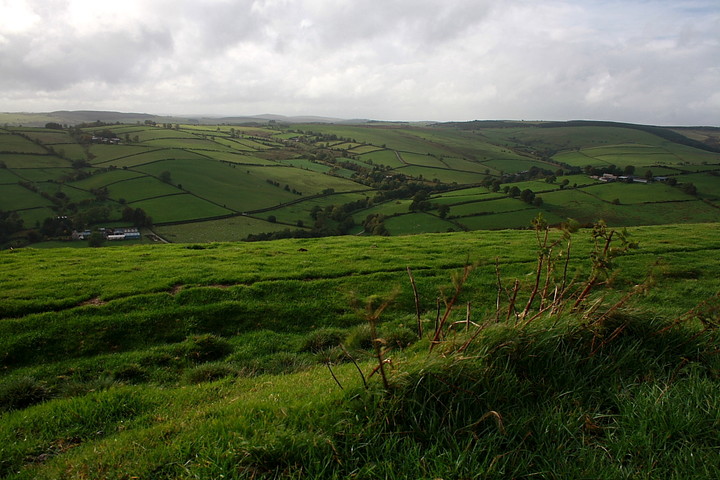
Following on from a morning spent at the excellent Fron Camp, early afternoon is characterised by a series of very heavy showers. Nevertheless, with an hour or so available before I must push on to Pumlumon for the night, the Caer-din Ring, sited immediately west of a high level moorland road penetrating the Clun Forest uplands, appears to fit the bill nicely, thank you very much.
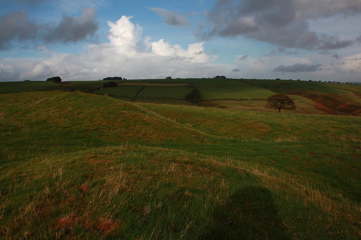
Heading east(ish) past St John's Church (below Fron Camp) I take the very steep first left (Mardu Lane) subsequently veering left again soon after. The road climbs toward the summit, providing some excellent panoramic views as it does so, the ancient enclosure eventually seen crowning the rise to the left. After a bit of customary indecision I park at the entrance to the access track for Foxhole farm, more or less opposite the site. Another torrential deluge hammers upon the car roof.... but unfortunately I've no time to lose. A couple of farm workers career by on quad bikes flashing each other a smile as if to say 'what a nutter!' Hey, the thought had crossed my mind as well, to be fair. Mindful that barbed-wire fences and expensive waterproofs are mutually exclusive, I head down the road a short distance to use the gate before making the short ascent to the enclosure (as it happens there is another gate near the cattle grid to north-west).
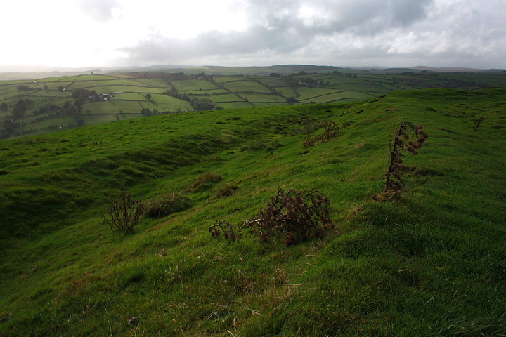
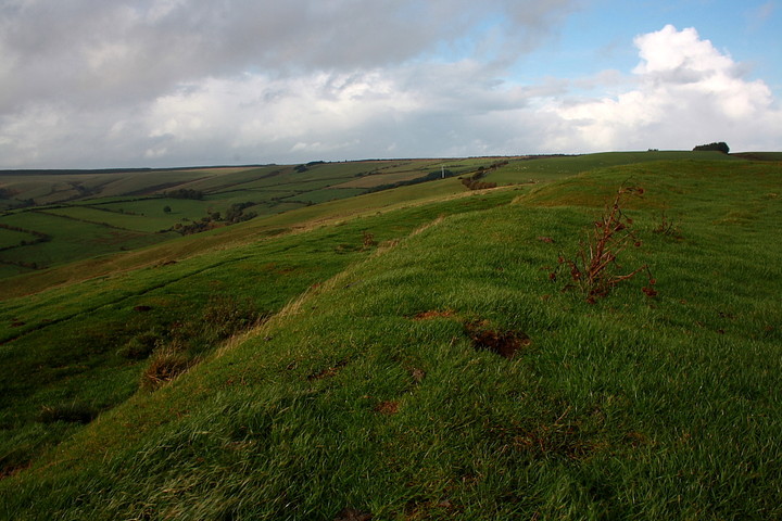
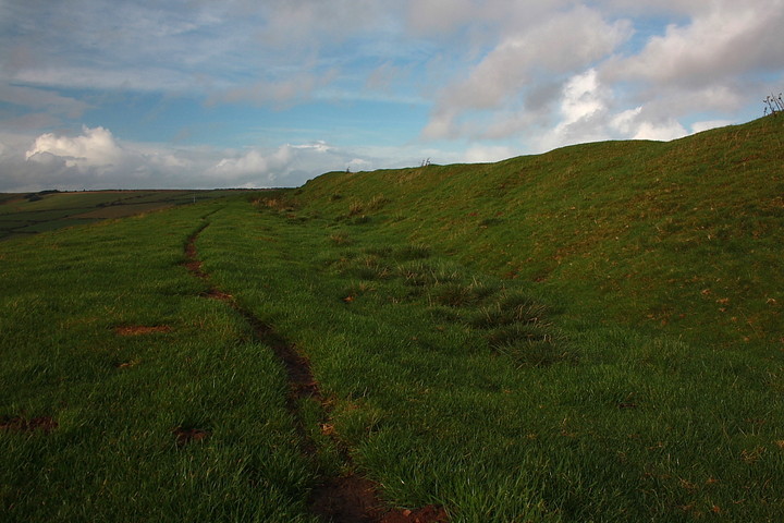
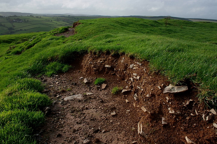
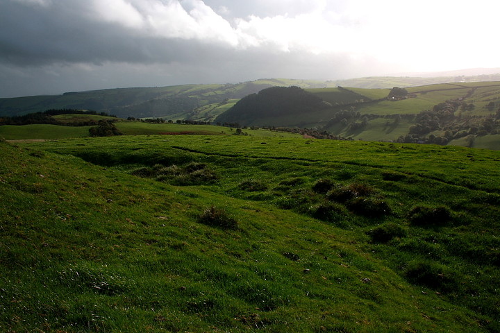
The initial bank encountered is not part of the main enclosure defences, appearing to have been erected to provide additional screening protection to the most vulnerable eastern flank of the site, therefore suggesting that the Caer-din Ring was indeed a serious defended settlement... and not a fortified animal pound as I tentatively surmised from earlier conjecture. Always nice to be proven incorrect in such a manner. The main bank rises to approx 6ft and encloses a significant area (see TSC's misc note). However it is the location, not the archaeology, which is surely this settlement's primary asset? The downpour having taken an appropriate rain-check, the sun takes the opportunity to break through the cloud mantle to periodically illuminate the landscape. In such light the views to be had from the Caer-din Ring are found to be truly wondrous indeed, particularly looking toward the southern and western arcs. Hey, I'm even able to pick out Castle Idris, a visit there having been abandoned earlier in the day. Looks well worth another attempt, to be honest. As I walk around the circumference, breathing in the oxygenated goodness, all manner of land rovers, 4x4s and quad bikes pass by on the road returning from somewhere or other. Clearly something's been going down in the locality. Nothing to do with me, of course. But then why would any decent person have an issue? Exactly. It would appear the people of Clun Forest are just that. Decent.
Yeah, pity I've not more time, but there you are. 'Take what you can get' would appear sound advice. Now, however, Pumlumon beckons.... and I can not resist the siren's call.
Caer-Din Ring is sub-rectangular in plan. Its overall dimensions are approximately 114m east-west by 122m north-south, and its internal area is about 0.85ha. The earthworks which define the interior of the settlement consist of a bank, constructed of earth and stone, and an external ditch. The bank is between 6m and 9.5m wide, and stands up to 1.8m high. The width of the ditch is between 3m and 4.5m, and along part of the outer edge on the north western side its steep rock-cut face is still plainly visible. The original entranceway into the settlement is on the eastern side and is 4m wide. A smaller entranceway at the north west corner of the enclosure appears to be a later feature. Within the interior there are a series of level platforms, some of which are partially cut into the gently sloping ground. These platforms provided level areas for the construction of houses and ancillary buildings.

 Posted by GLADMAN
 Posted by thesweetcheat