|
|

|
Jane’s TMA Blog |
|
Crozon crazy
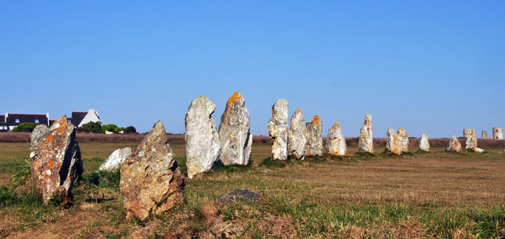
27 SeptemberWhen out and about in Brittany I recommend not only Aubrey Burl's 'Megalithic Brittany' (we have the 1984 edition ) but also you must get a copy of Pierre-Roland Giot''s 'La Bretagne des Megaliths' published by Editions OUEST-FRANCE (Itineraires de Decouvertes), (ISBN 978-2-7373-4236-3). It's a complete inventory of all Brittany's prehistoric sites. In French.If you imagine the far west of Brittany as a trident of peninsulas reaching out into the Atlantic, the middle prong is the Crozon peninsula. Like pretty much the rest of Brittany, it is stuffed full of Neolithic monuments of the highest quality and diversity and with one or two surprises. We began at the far end, the most western tip of Crozon, early in the morning to see the Lagatjar alignments. Lagatjar — Fieldnotes10.10.09ceHere 84 bright white quartzy stones of varying shapes are lined up on their parade ground, a sandy heath by the sea. The tallest is 2.5ms, but on average about they're about 1.8ms. The principal alignment is about 200ms long running NE to SW and has two shorter rows running away from it to the west. It feels incomplete (was this once a quadrilateral? Did the lines run further – I bet they did) but no less beautiful or impressive for that. They don't overwhelm the visitor like the squillions of stones Carnac, instead they invite you to almost be part of them, to line up with them and join in the fun.. The whole shebang is on a human scale and had an ambience of Callanish about it. And with the bright sunshine casting long shadows on the dewy grass it felt very like this monument was something to do with telling the time, the seasons and calendars. They are worth the trip out as far west as this. Absolute magic. Lagatjar — Images14.10.09ce
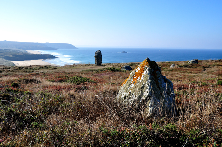
Lostmarch — Fieldnotes11.10.09ceOn a spectacular high rocky, heathy promentary facing west once stood some more alignments at Lostmarch. Now there are very few left, but enough to interest the more anorakky megalith-hunter, including a couple of very large menhirs. The beach to the south was obviously a favourite with surfers, catching the great Atlantic rollers. The whole place reminded me a lot of Rhossili on the Gower. Lostmarch — Images14.10.09ce
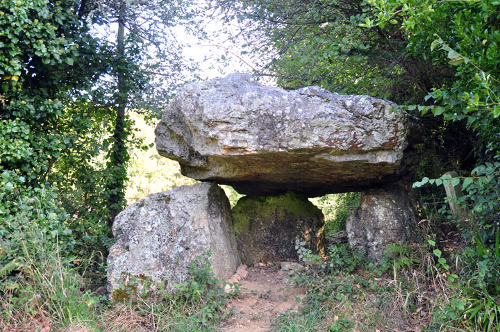
Pen an Run — Fieldnotes11.10.09ceThis is a very simple and small dolmen of three stones holding up a capstone. It sits on a small bank at the laneside in the hedgerow on the edge of a pretty hamlet near the main road. Pen an Run — Images14.10.09ce
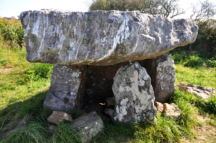
Menez Lié — Fieldnotes11.10.09ceLike at Poulyot we saw the sign but couldn't immediately see it. Moth noticed something lurking 50ms away from the laneside to the right at the edge of a field of tall maize (I thought it was old farm equipment) but he got out to have a closer look. And there it was. A tight group of uprights leaning inwards like the swords of the three musketeers support a really square and flat capstone, just like a rustic table. It was richly veined with quartzy stripes, which is surely the reason why this stone was selected for this purpose. Menez Lié — Images14.10.09ce
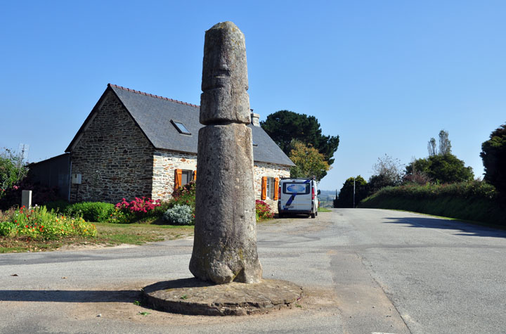
On the way to Douarnenez, where we intended to stop and find a 'tabac' with a telly on so we could watch the Singapore Grand Prix, we took a short detour to see the menhir at Ste Barbe. Ste Barbe — Fieldnotes11.10.09ceNow isolated on a lonely crossroads (it stands in the middle of the crossroads) this menhir of about 2.5ms tall is a rounded pillar. It is probably quite different from its original form, and felt very much to us as if it had been tinkered with, rounded and sculpted into a more innocuous stele than a heathen menhir of the 'old' religion. That's happened a lot to many stones in Brittany. Ste Barbe — Images14.10.09ce
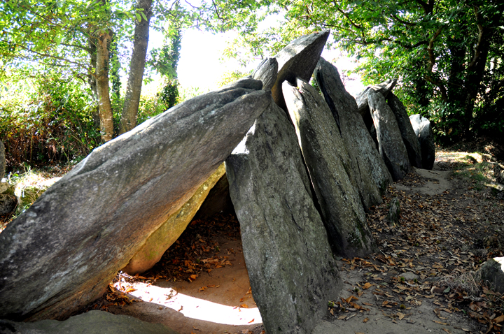
Ty ar Chorriket — Fieldnotes11.10.09ceThe allée couverte of Ty ar Chorriket, near the hamlet of Lesconil, is built in a very unusual style of which only half a dozen or so examples are known. This 'arc boutée' style involves two rows of slabs leaned in towards each other to form a tent-like structure or house of cards, perhaps in the way that Ray Mears might build a forest bivouac. Six or seven large triangular(ish) slabs down each side lean in to form a dramatic passage 12ms long. It's even got some of its original kerbstones and enough of its barrow material left to get a really good impression of its spectacular size. I liked to think that the pointy tops of the stones might have protruded through the top of the barrow. Now how cool would that have been to see? Spectacular and worth driving a long way to see. Ty ar Chorriket — Images12.10.09ce
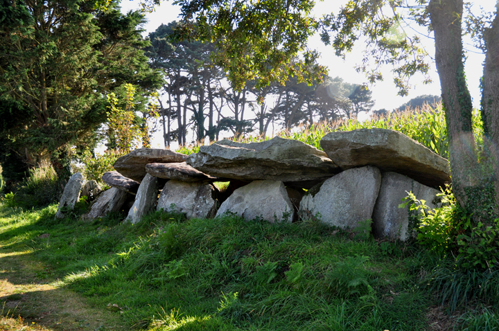
At a hamlet called Kerbalanec near Beuzec Cap Sizun we found a very nice allée couverte lurking behind some farm buildings on the edge of farm track. Kerbalanec — Fieldnotes11.10.09ceIt's about 12ms long and with five large capstones the largest over 2ms long, and still has plenty of mound, which we liked. Don't be confused by the interchangability of its name. Many places round here have multiple names, both French and Breton, but also folkloric names. Kerbalanec is the name of the hamlet on the road sign, and in one or two books we've got. Aubrey Burl in his 1984 edition of 'Megalithic Brittany' calls it Kerbanalec, as does the blokey on the Megalithes Breton website: http://megalithes-breton.fr Well, whatever it's called it's the same place. Kerbalanec — Images14.10.09ce
And that is the subject of my next blog... |
 Posted by Jane
17th October 2009ce Edited 4th November 2009ce
Jane's TMA Blog
Latest TMA Blog Posts
|
Comments (0) |
|
| You must be logged in to add a comment | |