|
|

|
|
Wet WithensStone Circle
|
|
|
|
Images (click to view fullsize) |
|
|
Fieldnotes |
|
|
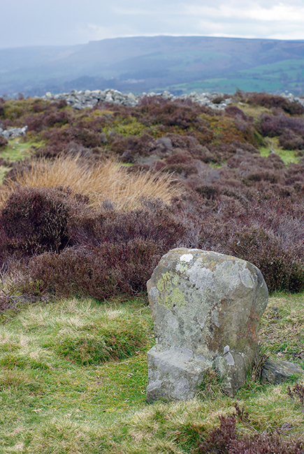
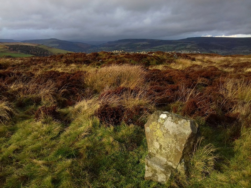
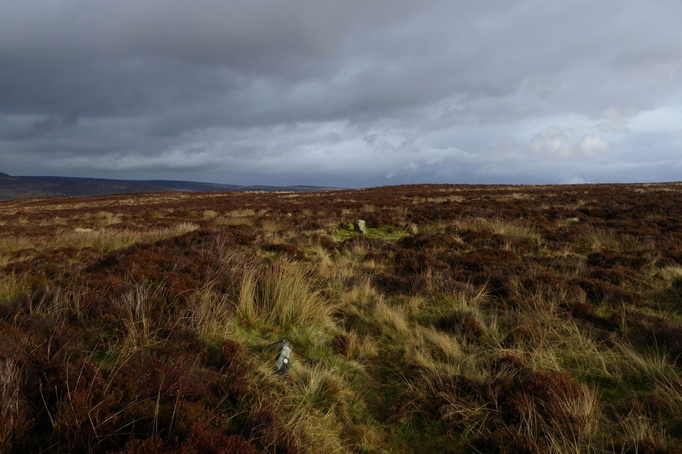
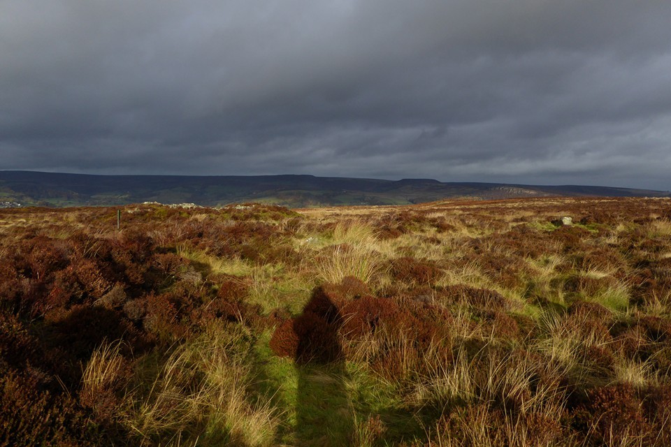
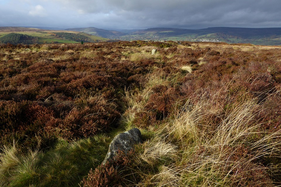
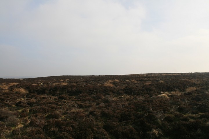
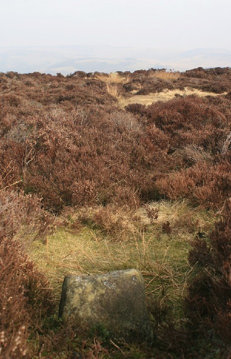
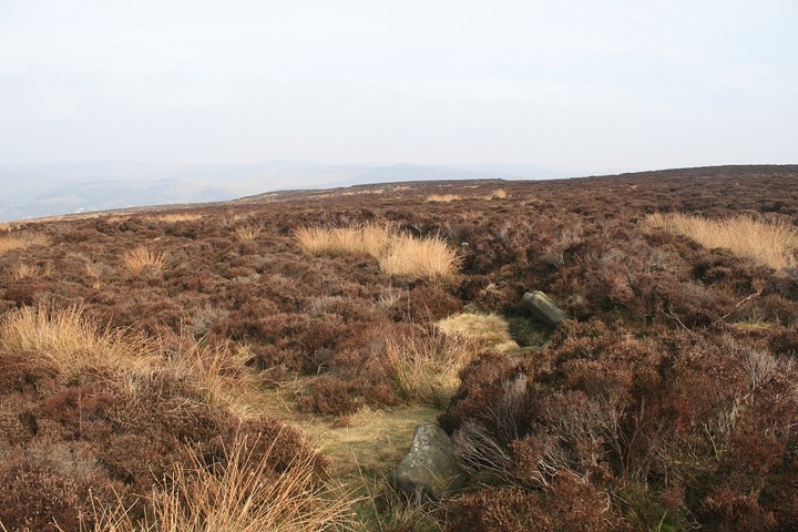
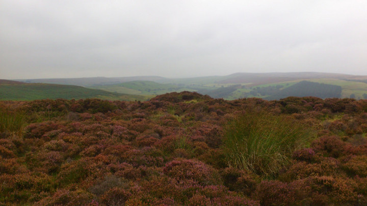
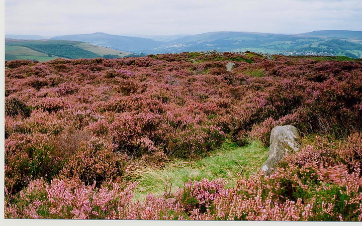
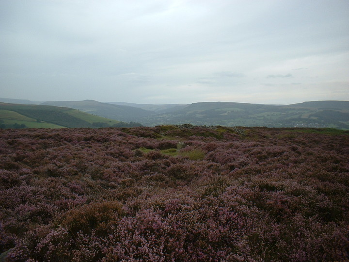
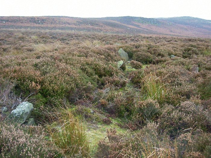
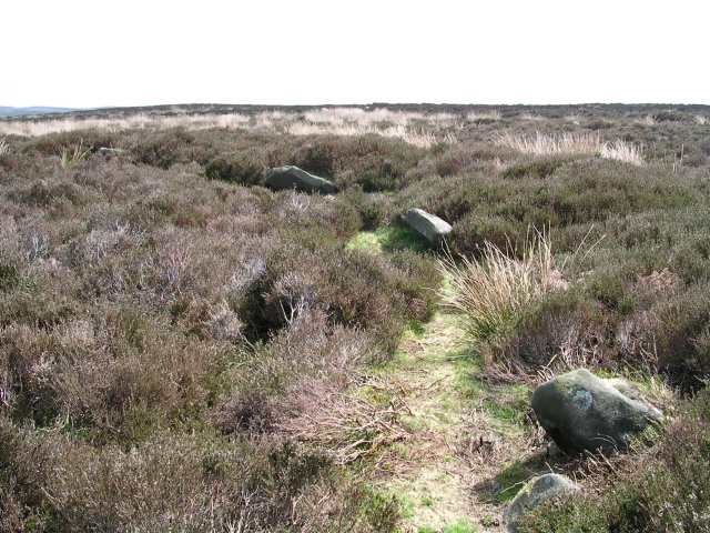
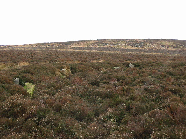
As the sun starts to come out, it picks out a light grey amongst the browns and reds, revealing the presence of the mutilated cairn next to Wet Withins. With that fixed, the eye then finds the darkly curving bank of the stone circle itself, with one larger stone standing out at its edge. Wet Withens is another Peaks site that has lived in my mind and on my imaginary list for a long time. A feature in Burl’s guide, apart from the one swiftly abandoned attempt so long ago it’s eluded me up until now. Rather like Gibbet Moor yesterday, some of the joy of coming here is undoubtedly borne from relief and satisfaction at actually getting here. But as well as that, it’s a terrific site. Bigger than I expected, the clearly defined bank and neatly placed stones make it a wonderful example of the ubiquitous Peak District embanked stone circle. Add to that the colours of the moor, freshly scrubbed from the recent soaking and illuminated by the sun against the dark backdrop of billowing clouds, and we’ve got a bit of a classic going on. This post appears as part of the weblog entry Raving on the Moors Part II – Eyam Moor 10 November 2016
|
 Posted by thesweetcheat
27th November 2016ce Edited 27th November 2016ce |
|
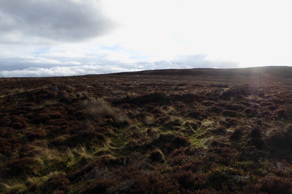
Visited 30.4.14 The idea for an Easter break in Chesterfield was in order to knock several English Heritage sites off the list (I have now visited just over half of the 400 or so sites). Due to time constraints I hadn’t intended to visit the Wet Withens stone circle but each day I looked at the map the little blue square surrounding it called out to me. In the end it all became too much and I just had to somehow squeeze a visit in. The chance came one evening as we were heading back to the Travelodge. Although it was still quite early (about 6.30pm) it was already starting to get dark. The sky was filled with black clouds and it was obvious a storm was on the way – confirmed by the weather forecast. We parked at the point where the road out of Grindleford takes a sharp turn to the south towards Eyam. There is plenty of room to park here. The rest stayed in the car as I tried to work out the best way towards the site. There is a stone stile leading to a path which runs to the north-west and another path which leads north-east. I opted for the north-west which in hindsight was a mistake. The path runs parallel to a drystone wall and after walking for a bit it was obvious I was going way off course and I had to climb over the wall in order to head in an eastern direction towards the circle. It would have been better to have approached via the other path and have avoided the wall altogether. Despite previous TMA site reports I could find no path which lead to the circle. All I could see was a sea of knee-high heather. Luckily it had been dry for several days and the dry bracken crunched under my feet. In wet weather I am sure it would be quite bogy. With compass in hand I headed for where I thought the circle should be. I could see nothing but heather. I headed further east but again nothing. All of a sudden a bolt of forked lightening made me jump as it struck the hilltop opposite. A loud rumble of thunder quickly followed. The sky was black and the storm was clearly heading my way. I looked around – it dawned on me that I was the highest point on this open moorland hilltop. Not the ideal place to be in a lightening storm! Time to get a move on. To my relief not much later I spotted the tops of several stones sticking out just above the heather. In all honesty the circle was a disappointment. Perhaps it would have looked better had the heather been cleared away? The tops of some stones sticking out of a sea of heather did not seem much of a reward for the effort it took in getting to the circle. Although the views are pretty good to be fair. The Cairn slightly north of the circle was easier to make out. I could not spot any of the cairns shown on the map south of Wet Withens. At this point large raindrops began to fall. Time to get back to the car. I had been gone for over an hour and the gang were restless by the time I got back. As we drove down into Eyam the heavens opened. We had to pull over as it was like driving in a power shower. The road turned into a stream and all was black. After about 10 minutes the cloudburst had run its course and things started to dry up. I was glad I had made the effort to visit the stone circle but in all honesty I thought it was a lot of effort to see not much. Why this circle appears on a ‘normal’ AA map when many other better (and more accessible) stone circles don’t, I don’t know. I prefer the AA map to others produced as I find it clearer and easier to use. I do however wonder what criteria they use when deciding which standing stones / circles / hillforts etc to put on the map. You would expect to see the Stonehenge / Avebury type sites but Wet Withens? I would say your average holiday maker would have no chance of finding this site and even if they did, would be very disappointed with what they found. Perhaps I will E-Mail the AA to ask them? |
Posted by CARL 7th May 2014ce |
|
The first time I came here I gave up after losing my map, the second time I had one or both kids with me and the visit didn't really stay with me and I can barely remember it at all, this time I was all tooled up for a proper visit, much prior planning, and most importantly, it's just me. I took the long route as per usual (wont next time though) and spotted the cairn first, after a perusal of this impressive stone gathering I sit atop a rather suspicious mound and survey the Wet Withens. What is a Withen I wonder, and why are they wet ? as strange site names go this is a good one. What impressed me most was the bank around the stones, its dead visible on Google earth and from the mound that I sit upon. I walk slowly over to the ring and enter it somewhat reverentially. A really good feeling came over me, it was like I was seeing it for the first time. Like an Indian man meeting his chosen intended for the first time, and, Wow shes a looker. It was also much bigger than I remember it, god, how long has it been, this was one of the first non Big Orange Book sites I went to. And more stones too, plus Ive no recollection of there being carved initials in many of the stones, but there are. Its like ive never been here before, is it just the passage of time or did I not see it all properly or did I travel to an alternate reality, probably the former. In the middle of the circle is a weird depression, first time ive seen that too. But no matter how wonderful and ridiculous my time spent here, the higher rocks over to the east are pulling me away, to that other Eyam target of mine Stanage ring cairn and it's fantastical carved stone. |
 Posted by postman
8th March 2013ce Edited 10th March 2013ce |
|
For my money the easiest approach is from the point where Sir William Hill Road coming out of Grindleford meets two footpaths and turns into a track at SK2245 7742. Easy parking on the lane. Between the two footpaths is a third track visible on Google Earth though not shown on the OS map. It heads towards the circle and forks - take L fork and then you can pick up track(s)on R to the circle. However, the ease is relative, and I would recommend using GPS. My interpretation of the site would be that it feels as if its designed for an 'audience' to the S observing activity with the dramatic skyline as a backdrop. |
Posted by Ubik 3rd April 2011ce |
|
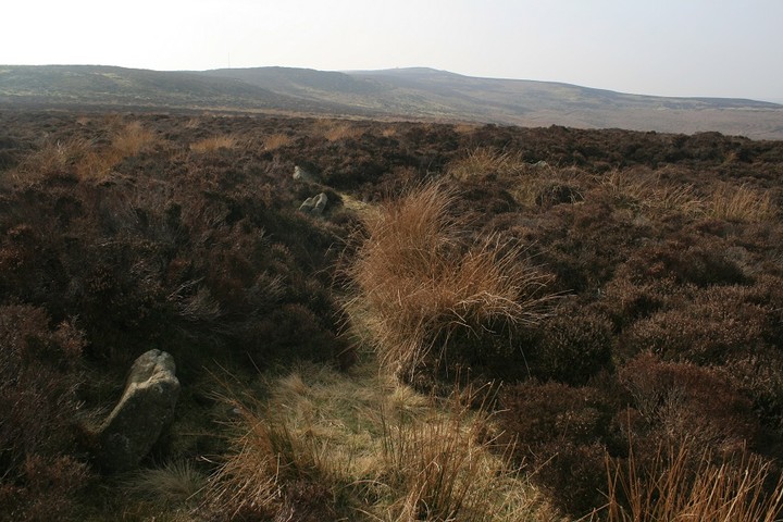
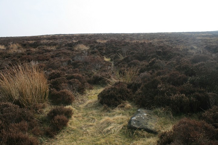
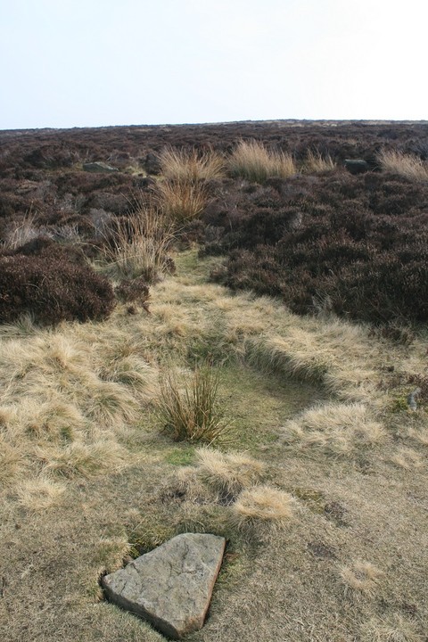
A new path has been cut across the moor and passes with in 150 metres or so of the circle and the barrow. They've basically mown a 3 metre wide section through the heather and bilberry. At one point the path seems to end, but carry on a few metres and you'll find it again, you'll still have to keep your eyes peeled for the barrows though, then head off the path towards it through the heather. This is by far the easiest access i've known to the area of the monuments. |
29th August 2010ce |
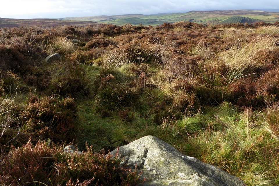
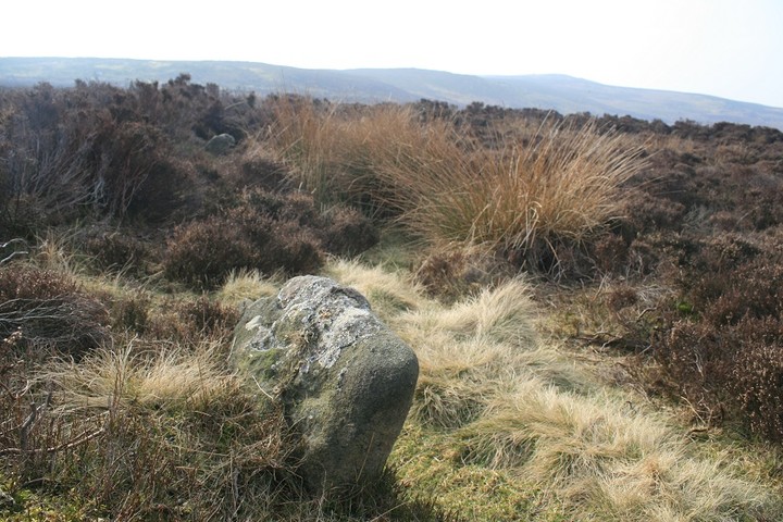
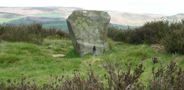
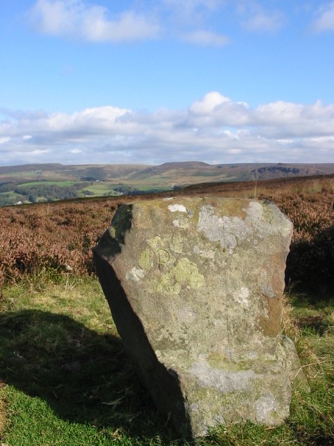
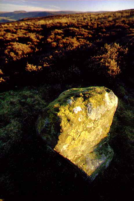
| I can echo most of what's already been said about this site – it's difficult to get to, takes a while to work out what's here, and has some great views. I approached it northwest from the footpath to Leam where the 550 metres on the map don't look difficult - they are. The first 400 metres are uphill through thick heather with the added complication of some fairly deep holes to watch out for. Once you're over the top it's down hill to the circle but even then it doesn't really become clear until you reach it (the nearby Ministry of Works sign has now gone) and initially it's the heather on the raised bank that gives away its form. This bank has an internal diameter of around 30 metres and once you're in the centre of it, it seems huge with many of the stones barely visible in the vegetation although the chair stone sticks out like a sore thumb and it's top does indeed resemble Higger Tor two and a half miles away to the northeast. There seems to be some stones missing from the western side of the circle but theres a good run of stones towards the south and southeast while the views are all to the northwest round to the northeast along the Derwent valley. Incidentally considering it's isolated position it's one of the busiest sites I've visited in the Peak District, as I approached it a bloke who was photographing the cairn wandered off, there were a couple of walkers taking a break in the circle and as I left another couple with a dog were just coming over the hill asking for directions to the stones. |
 Posted by Chris Collyer
22nd August 2008ce |
|
Went to Wet Withins again today (27th August 2007). It was easier to find this time, the paths seem more defined. Well worth a visit. Main reason for posting is that we had GPS and tried to get a point but there was no signal anywhere near the stones. Also, someone had been there quite recently and left lots of cigarette buts and remnants of a fire in the centre of the circle. Cheers. A truly beautiful and magical place. |
Posted by Karris 28th August 2007ce |
|
Visited this circle today and it was slightly difficult to find. The village of Eyam is worth a look at, many lovely walks around there. However, we found a site on the internet that gives instructions for a tour of this area, google keywords barbrook moor wet withens and you should find it. One again blown away with the fantastic panoramic views. Went to Hordron edge yesterday and we were surprised by the similarity of the view. Managed to identify the mother landscape before it started raining. This stone cirle, whilst hidden in the heather, is well defined and not that difficult to identify as it is very near the cairn. However, there are many many more potential circles on eyam moor, and evidence of many cairns. Thanks for the information below, it made this easier to find. |
Posted by Karris 25th August 2006ce |
|
Even once actually inside the circle, it doesn't become apparent until pointed out. The low stones, the high heather, deep bracken and the broken outline of the circle all conspire to camoflague the place almost entirely. I was glad I didn't attempt this one without a stubob! I think even a GPS would find this tough to locate. The views over the surround country are quite lovely. Access: Impossible except by the hardy and able-bodied! This post appears as part of the weblog entry Six of the best with a wounded knee
|
 Posted by Jane
19th November 2003ce Edited 19th November 2003ce |
|
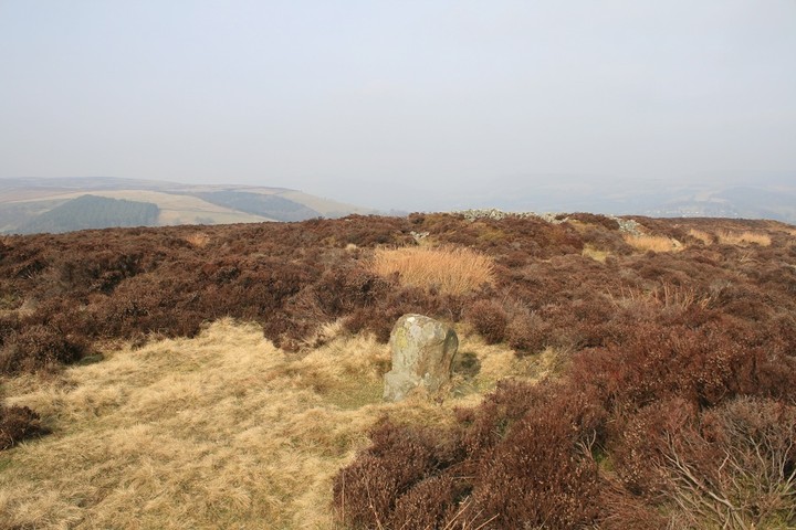
I have been here before, albeit unknowingly. I visited a couple of years ago in early summer and think I may actually have walked through the circle without actually spotting it. This time however we were in good company - Stubob led us straight to the spot. The circle is pretty easy to distinguish (once it's been pointed out!) - the bank especially. It is quite large despite the diminuitive stones (the highest is 0.7m) and while not majorly impressive in itself, when seen in context with the amazing scenery surrounding the site it becomes well worth the effort. |
 Posted by IronMan
17th November 2003ce |
| Very difficult to find but as has been mentioned earlier, the chair does mimic the hills beyond, how intentional this is I don't know but quite impressive. I will visit again at a time the heather isn't so obtrusive |
 Posted by daveyravey
8th August 2003ce |
|
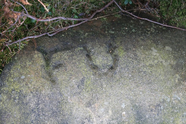
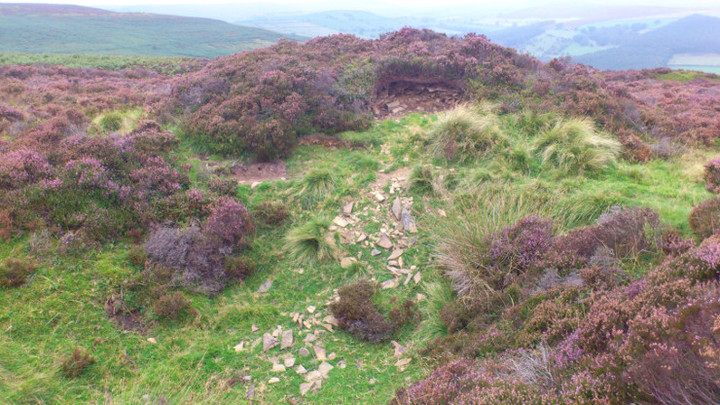
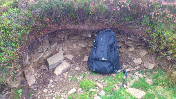
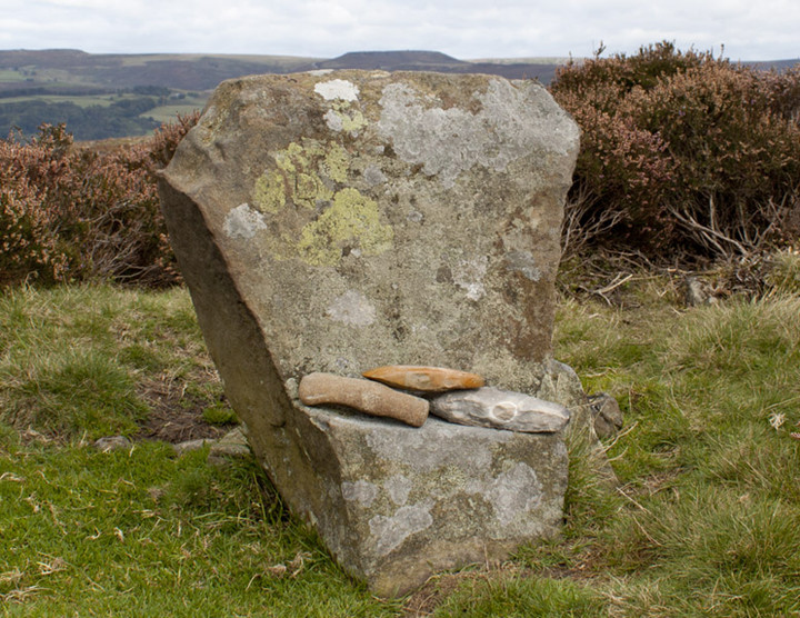
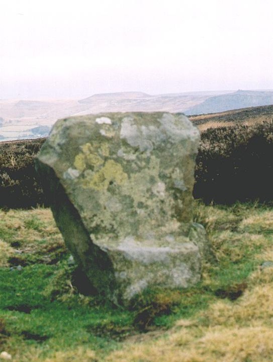
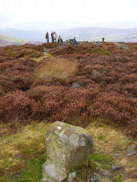
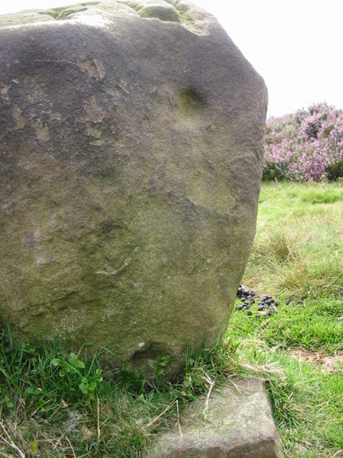
A circle of 10 short stones, most of them not initially visible from some angles. Surrounded immediately by a low earth/pebble bank. Covered by gorse except for a path around, paths to the centre and the centre. a recessed circle at the centre and some small stones, making a fire place, though who knows how old this is. 180 degrees of fine view; weather systems traipsing over peaks & troughs; deep greys, light blues, bright whites; warm sunny days suddenly ripped apart; boxed in, poured upon. The most upright stone has a flat face facing inward and a ledge cleanly carved out of it about an index fingers' length deep, as though a seat but its too small to be. Letters carved in that face (FR**), an enormously deep 'FU' in olde English type in its top; 3, maybe 4 cup marks in its outer face. There are other stones with a 'U', 'FU' and 'FU100*'. most stones have fallen or are in the process of doing so. A few feet away is the ruins of the large Eyam Moor Barrow. Made of stones, of which there are many left; hinting at inner structure but its hard to tell. An obtrusive Ministry of Works sign uprooted from beside and placed at one end amongst the stones of the barrow itself. 1 May 2002 |
Posted by FlopsyPete 2nd May 2002ce Edited 14th May 2003ce |
|
Derbyshire's biggest embanked circle and so tricky to find, well off the paths and well hidden in the heather. Keep a look out for sign planted in the stones of Eyam Moor Barrow, the circle is right behind it. Burl mentions old reports of a supposed stone avenue in the SW, nothing has ever been found. The circle has one of the best alignments in Derbyshire when the midsummer sun rises above Higgar Tor. The chair shaped stone mirrors the shape of the Tor on the horizon. |
28th February 2002ce Edited 12th January 2003ce |
Miscellaneous |
|
|
From Norrie Ward 'Yorkshire's Mine' Dent 1969 - Ward is describing 'midsummer's night of 1967'. "We were lucky; both sunset and sunrise took place in a cloudless sky. The setting sun moved majestically along the ridge two miles away, 'seeming to roll into a flat V-shaped feature of the skyline where Shatton Edge gives way to the line of distant Edale Moor' as I wrote in my notes of the weekend. 'Sunrise was yet more spectacular. Across the mist filled valley the hilltops were aglow with the rich rose-pink of first light as we plodded through the heather to the circle. Across the valley to the north-east was flat topped Higger Tor. ...It was a moment that was over all too quickly..the sun wheeled upward into the sky. Here was a clear point on the skyline by which to know the time of the summer solstice; here was a place to greet it with surety and confidence. Those of our ancestors who lived on these hills had as certain a method of determining high summer as the men who made Stonehenge. On Eyam Moor they needed no Heel Stone; Higger Tor served them well." |
Posted by Ubik 16th October 2012ce |
| "Blacks Guide To Derbyshire 1881" mentions a stone in the centre of the circle, it wasn't there at the time the guide was written, and Barnatt seems to think it may not have been there at all. The book also mentions the sizes of the barrows on the moor. The Eyam Moor Barrow was approx. 90ft in diameter and 35ft high. And one at Hayley's Piece being 66ft wide and 36ft high. |
27th March 2003ce Edited 14th May 2003ce |
Links |
|
stone-circles.org.uk360 degree java panorama of Wet Withens. |
Posted by Chris Collyer 22nd August 2008ce |