Extract from English Heritage's record of scheduled monuments, via the MAGIC site.
Please Note - this link takes you directly to a PDF document. You will need a PDF viewer such as Adobe Acrobat Reader to view it.
|
Extract from English Heritage's record of scheduled monuments, via the MAGIC site.
Please Note - this link takes you directly to a PDF document. You will need a PDF viewer such as Adobe Acrobat Reader to view it.
|
Extract from English Heritage's record of scheduled monuments, via the MAGIC site.
Please Note - this link takes you directly to a PDF document. You will need a PDF viewer such as Adobe Acrobat Reader to view it.
|
Extract from English Heritage's record of scheduled monuments, via the MAGIC site.
Please Note - this link takes you directly to a PDF document. You will need a PDF viewer such as Adobe Acrobat Reader to view it.
|
Extract from English Heritage's record of scheduled monuments, via the MAGIC site.
Please Note - this link takes you directly to a PDF document. You will need a PDF viewer such as Adobe Acrobat Reader to view it.
|
Extract from English Heritage's record of scheduled monuments, via the MAGIC site.
Please Note - this link takes you directly to a PDF document. You will need a PDF viewer such as Adobe Acrobat Reader to view it.
|
Extract from English Heritage's record of scheduled monuments, via the MAGIC site.
Please Note - this link takes you directly to a PDF document. You will need a PDF viewer such as Adobe Acrobat Reader to view it.
|
Extract from English Heritage's record of scheduled monuments, via the MAGIC site.
Please Note - this link takes you directly to a PDF document. You will need a PDF viewer such as Adobe Acrobat Reader to view it.
|
Extract from English Heritage's record of scheduled monuments, via the MAGIC site.
Please Note - this link takes you directly to a PDF document. You will need a PDF viewer such as Adobe Acrobat Reader to view it.
|
The National Trust booklet 'The Cerne Giant & Dorset Hill-Forts' (2000) which is definately available at the Kingston Lacy house and might be available at other Dorset properties, gives the following directions to the hill fort at Coney's Castle, "From the track leading to Lambert's Castle continue on along the B3165 for 300m. Turn left to Fishpond's Bottom. At Fishpond's take the third turning to Wootton Fitzpaine. This road passes through the centre of Coney's Castle. You will see the car park on the left just before the road enters the hill-fort".
It adds that the name 'Coney's Castle' means a fortified place frequented by rabbits and that the earliest documented reference to the place name dates from 1322.
Note - the car park is at about SY371977.
|
The National Trust booklet 'The Cerne Giant & Dorset Hill-Forts' (2000) which is definately available at the Kingston Lacy house and might be available at other Dorset properties, gives the following directions to the hill fort at Lambert's Castle, "from Pilsdon continue along the B3164 for 2 km and turn left onto the B3165. Drive a further 3km, the track to Lambert's Castle is on the left".
It adds that the name 'Lambert's Castle' comes from the Anglo-Saxon personal name of 'Lambert' and that the earliest documented reference to the place name dates from 1044.
Note - the car park is at about SY366988.
|

|

|

|
  
|

|

|

|

|

|

|
The National Trust booklet 'The Cerne Giant & Dorset Hill-Forts' (2000) which is definately available at the Kingston Lacy house and might be available at other Dorset properties, gives the following directions to the hill fort at Eggardon Hill, "From Dorchester take the main road west (A35) towards Bridport......At first the Bridport road follows the Roman road and is characteristically straight. After 5km the main road leaves the old route and drops down into the village of Winterbourne Abbas. The Roman road still exists as a minor road cutting across the downland towards the ancient landmark of Eggardon. Take this quiet road. After 5km the ramparts of the hill-fort are visible at a crossroads. Turn left here towards Askerwell and drive for 200m. Park in the lay-by on the left. Cross the road and take the footpath towards the southern ramparts".
It adds that the name 'Eggardon' is an Old English place name, the hill or down belonging to a man called Eohhere. The earliest documented reference to the place name dates from the Domesday Book in 1086.
|
The National Trust booklet 'The Cerne Giant & Dorset Hill-Forts' (2000) which is definately available at the Kingston Lacy house and might be available at other Dorset properties, gives the following directions to the hill fort at Pilsdon Pen, "Take the B3164 west out of Broadwindsor. This winding road skirts the northern edge of the Marshwood Vale. After 4km you will see the ramparts and ditches of Pilsdon Pen hill-fort come into view at the southern end of a high flat topped ridge. Park in the lay-by just after the turning to the hamlets of Pilsdon and Bettiscombe. Cross the road and walk up the steep slope".
It adds that the name 'Pilsdon' is Old English for a hill with a peak. The earliest documented reference to the place name dates from the Domesday Book in 1086.
|
The National Trust booklet 'The Cerne Giant & Dorset Hill-Forts (2000) which is definately available at the Kingston Lacy house and might be available at other Dorset properties, gives the following directions to the hill fort at Hod Hill, "From Blandford Forum take the Lower Shaftesbury Road (A350) and beyond Stourpaine village turn left to Child Okeford. The Hod Hill car park is about 1km along this road on the left. The footpath from the car park follows a steep incline first through woodland and then along the edge of a field to the north-west corner of the hill-fort".
It adds that the name 'Hod Hill' is Old English for hood or shelter and that 'hill' was added to Hod in the 18th Century. The earliest documented reference to the place name dates from 1270.
|
Badbury Rings - 3.4.2004
A lovely big hill fort, but so popular that there are obvious signs of erosion.
As others have said the trees on top aren't as bad as you might think. At first I scoffed when I saw a panoramic plate on the summit. But given a day with better visibility I imagine you could actually see quite a lot from here (including neighbouring hill forts), through the trees.
Two car parks available. The main car park is the signposted one at ST960033 and is open 9am to 8pm between April and October, and from 9am to 4pm between November and March. The car park is used for point to point races on a few days each year, when a charge is made, and it might get full. The three races for 2004 have all now been and gone, so I think visitors shouldn't find any problems for the rest of this year.
There is also a smaller car park, a bit further away at ST967023. This is on the south east side of the hill fort, next to the main road.
Or if you've just visited the Kingston Lacy Estate you could walk from there. It's about 2½ to 3 kms.
|
Badbury Rings Barrow Cemetery - 3.4.2004
Three well preserved barrows, in a line, just to the west of the hill fort (next to the track to the main car park). Like three big jelly mounds of earth! Compared to all sorts of degraded and scrubby barrows I had just visited in Cornwall, these are almost like picture perfect barrows.
Very easy to find as you need to drive past them to get to the main car park, or you will walk past them if you walk into the National Trust land from the main entrance.
|
not surprisingly, some nice photographs of Golden Cap. Plus some useful links.
|
not surprisingly, some nice photographs of Badbury Rings. Plus some useful links.
|
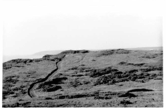
Halfway Wall Cairn - 30.3.2004
This cairn is only about 100m north of halfway wall. Despite it's tiny height (the English Heritage report says 0.11m high - that's 11cm!) this is easier to spot than many of the other cairns on the island, because 1, it's a relative high point in the area, 2, it's close to the 4x4 track, and 3, there are lynchets running from it.This post appears as part of the blog post " Not a perky puffin in sight" |
Chambered Stone Dwelling - 30.3.2004
Full 8 figure grid ref (from English Heritage scheduling) = SS13274613
Well I thought I had found this. I was definitely in the right place but the English Heritage directions fail to mention that there are two rocky outcrops in the area. After the natural spring there is an outcrop of rocks after barely 10 metres, and then another 20/30m further on. And the directions say the dwelling is "tucked under a rock outcrop" - do they mean literally under the rock on the cliff edge? So which one is it closest to? Well there is some sort of dwelling between the two, on the cliff top, and it's pretty stunning, with rooms that can be made out. BUT a pic on the National Trust leaflet ('The Archaeology of Lundy') shows what I think I found and labels it as a "ruined medieval building on the east coast". The more I think about it, the more I think I didn't find the ancient site. Needed more time. I'm disappointed because this is a unique dwelling on Lundy and sounded cool.This post appears as part of the blog post " Not a perky puffin in sight" |
Ackland's Moor Cairns (North) - 30.3.2004
There are two Cairns listed, very close together towards the north part of the moor. One is at SS13234478. As this is clipped by a shallow quarry pit on the south west side, it's pretty easy to locate. As with most Lundy Cairns there is little to see. But the quarry pit pond does add a little photogenic quality to this one though.
The other is at SS13194473. Given limited time I gave this one a miss, but given that the other nearby cairn is easy to locate, I imagine this could be found via that cairn if need be.This post appears as part of the blog post " Not a perky puffin in sight" |
Ackland's Moor Standing Stone (West) - 30.3.2004
Full 8 figure grid ref (from English Heritage scheduling) = SS13084458
Thanks to the detailed English Heritage directions I definitely found this stone. I would add though that this is not in a 'wall' as you and I might think of as a field wall. It should really be described as the last remains of an old field wall, i.e. you can clearly see a few stones that are in some sort of line, but that's all. The 'standing stone' does stand out because it is very wide (1.4m - actually slightly wider than it is tall) and like most of the Lundy stones it is not earthfast (i.e. it is set on the ground rather than in the ground and has stones packed around its base to keep it upright).This post appears as part of the blog post " Not a perky puffin in sight" |
Ackland's Moor Hut Circle & Enclosure - 30.3.2004
Full 8 figure grid ref (from English Heritage scheduling) = SS13044451
This is a probable Bronze Age hut circle & enclosure. I was definitely in the right area for this (well, I was definitely in the area English Heritage described; 30m from the cliff edge and 30m south of a natural spring) but not convinced I could see on the ground exactly what the English Heritage report mentions. Stunning location though. Not a bad place to live on a nice day like this, but being on the west side of the island it would get the Atlantic winds!This post appears as part of the blog post " Not a perky puffin in sight" |
Ackland's Moor Cairn Stones - 30.3.2004
Full 8 figure grid ref (from English Heritage scheduling) = SS13244460
Took me quite some time to be relatively happy that I had found this site. There are a lot of stones in the area and this cairn is not obvious! And if I did find this cairn then I didn't find the standing stone that the English Heritage focuses on. Maybe it has fallen? There were definately no 1.4m tall standing stones in this whole area.
There is a very distinct large stone on the ground, and apart from spotting this stone there is no obvious way of getting to this spot again. This large stone looks like a classic schoolboy drawing of a penis and scrotum!This post appears as part of the blog post " Not a perky puffin in sight" |
Ackland's Moor Standing Stone (north) -30.3.2004
Full 8 figure grid ref (from English Heritage scheduling) = SS13264445
Another easy one to spot! Probably even easier to spot that the Ackland's Moor Standing Stone (south) just 70m to the south, because this one is a really thick stone.This post appears as part of the blog post " Not a perky puffin in sight" |
Ackland's Moor Standing Stone (south) - 30.3.2004
Full 8 figure grid ref (from English Heritage scheduling) = SS13284435
At last, something easy to find! This stone, despite still only being 1.45m tall, sticks out like a sore thumb, about 100m north east of the Old Light. I took a pic with a lamb close to it - aaah.This post appears as part of the blog post " Not a perky puffin in sight" |
Beacon Hill Settlement - 30.3.2004
Full 8 figure grid ref (from English Heritage scheduling) = SS13224425
The Iron Age hut circles here are not that easy to spot except one which stands out as quite an obvious circle (but it's still not exactly Chysauster!). The circles are in the area 20m or so south of the wall of the 'Old Light' (the old Lighthouse).This post appears as part of the blog post " Not a perky puffin in sight" |
Beacon Hill Stones - 30.3.2004
Full 8 figure grid ref (from English Heritage scheduling) = SS13194409
I think I found this standing stone. It's not obvious. In general I need to point out that the principle of 'livestock rubbing posts' doesn't seem to exist on Lundy because most of the nine standing stones recognised by English Heritage on the island are not the right size to be considered as Bronze Age menhirs in Cornwall.This post appears as part of the blog post " Not a perky puffin in sight" |
South West Field Stone & Cairn - 30.3.2004
Full 8 figure grid ref (from English Heritage scheduling) = SS13314381
I think I found this site. A small standing stone with a flat cairn behind it.This post appears as part of the blog post " Not a perky puffin in sight" |
Rocket Pole Pond Chambered Tomb - 30.3.2004
Full 8 figure grid ref (from English Heritage scheduling) = SS13624372
I'm really annoyed that I didn't find this because it's the only chambered tomb on the island. Although the English Heritage directions say "165m north east of Rocket Pole Pond", at this point I couldn't find it (!) and was wondering if it was covered in one of the pockets of bracken that inhabit this area of the west side. When I got home I realised that the 8 digit grid ref places it actually only 20m south and 20m west of the Tent Field Fives Stones Monolith; which I had found (SS13624372 & SS13644374). Shame I didn't realise this at the time. I suspect that either the EH directions are wrong (North north east maybe?), or the grid ref of one of the sites is wrong.This post appears as part of the blog post " Not a perky puffin in sight" |
Tent Field Menhir (south west) - 30.3.2004
Due to the lack of time I just peered at this from over the wall. It is right next to the wall in the south west corner of the field (called 'Tent Field'). This is 2.2 m long and would have been a very substantial stone when erect (if erect?).This post appears as part of the blog post " Not a perky puffin in sight" |
The whole day was great, but fraught with small problems. It was great to see 100 people interested enough to want to visit this island and help keep it alive. I'd like to go again, but with more knowledge of these problems, and either on a longer day trip, or to stay for several days.
Be warned, traffic in Barnstaple can be a nightmare, especially if you need to get through Barnstaple to get to Illfracombe. Cars stretched along the A3125 back from the centre to the A39. After a while in a jam I realised the car in front had a sticker that read 'Barnstaple - Home of the Traffic Jam'. Nice one!
Parking info for Illfracombe was poor. The letter with my ticket said info would be given when you arrive. When I phoned up I was given a vague "long term parking is on the other side of the quay". It seems stupid to give this info out just before the ship sails when people are trying to book late tickets, collect tickets etc. And then the advice was dodgy, sending us up to a £2 car park a long way up the hill opposite the quay, whereas I learnt later that the car park at the bottom of this hill was only £2.80 a day, which if you ask me is worth the extra 80p, especially if the Barnstaple gridlock has made you later than you expected. If you come before mid May, or later in the season, there is also a chance you could park in one of the Illfracombe streets for free. Check the restrictions.
The boat trip is currently (2004) £28 for a day return (£25 concessions, including National Trust members). Or £42 for a period return. Helicopters run in the winter for £69. All these are for adult prices. Fine website (see link below) including online booking facility for day trips.
The road/path from the jetty on Lundy is long and steep. Not surprising really considering Lundy is like a huge slab of granite plonked in the ocean, but I thought I'd warn you all. The top of the island is mainly a plateau (120 to 140 metres above sea level), however, even this plateau is undulating and although the coastal paths are quite obvious, not all the paths are. Luckily you can walk just about anywhere you want as long as you abide by the common sense country code and close the few gates that are around. There is also a 4x4 track running the length of the island, which you might prefer to use to get places. It is quite rocky but still easier walking for some than the smaller paths. Lundy and the boat (MS Oldenburg) have no special disability facilities, however they say they will try to help and adapt as best they can for people with disabilities.
Weather conditions change rapidly and even on a nice day (like my day) you can still have bad sea (or land) conditions. It took us 20 minutes to dock and only later I heard there had been a strong possibility that we wouldn't be able to get off the boat. So don't assume anything and be prepared for possible changes / disappointments.
The boat says it takes up to 267 passengers. I'd hate to see it with that many on it! Most places to sit (inside and outside) were taken with only 120 people on board and on a nice day. The booking section on their website tells you how many tickets have been sold so far so you could use this to pick a quiet-ish trip, however I'm not sure how accurate it is.
The boat also seems to make up the rules as it goes along and doesn't always tell you things. We were clearly told the boat would leave at 3.30pm (incidentally, slightly earlier than we expected when booking) and you can embark from 3pm. So, as I returned through the village at 3.05, knowing I'd make it by 3.10/3.15 I felt pretty happy with my timing. But no, I was told by the shopkeeper they were sailing at 3. Rush etc! I was met by a Land Rover on the coast road that took me the last 500 metres, and was given the impression by some people that I had held everyone up. In reality we had actually left 15 mins early. What they don't tell you is that once everyone expected is aboard they will leave, so 3.30 was the latest time, not necessarily the actual time it will leave. I'm not saying they would have left without me, but I was narked for having to feel like I'd been late (I'm a pretty punctual person), and for having to worry that they might leave without me! Half of me felt grateful they had 'waited', half felt annoyed they made me look like a latecomer and people were asking me 'what happened?' Note - remember that most people just go for a quick walk on the south bit of the island and settle down in the village. Most won't go wandering like I did (and you might).
And the shopkeeper had said "Didn't you hear the foghorn blasts? That means they are ready to leave". Well, fecking sorry if my father didn't give me a seafaring lesson when I was 4 years old! How am I supposed to know things that I'm not informed about? I'm an intelligent enough person. Inform me of something and I'll do my best to understand it and ask questions if I need to, but this assumption of knowledge / lack of info was really annoying.
A National Trust leaflet called 'The Archaeology of Lundy' was available on the boat for 50p. Apparently a more substantial booklet might be available at the Island shop but I never got the chance to find out more due to the above problems.
A free Lundy leaflet, advertising the island and the boat schedule, includes a slightly magnified version of the 1:25,000 OS map, so no need to buy the OS map unless you really want to.This post appears as part of the blog post " Not a perky puffin in sight" |
Fine website, including online booking facility for day trips to the island.
|
|
Although mainly known as a medieval settlement, this diamond-shaped enclosure actually also contains several Bronze Age and Iron Age features. The link below tells you more. Several large terraced field headlands, known as lynchets, are generally attributed to the Iron Age. A hut circle settlement also exists, which is similar to Bronze Age settlements elsewhere on Lundy. There are also five cairns scattered within the enclosure of which at least two are Bronze Age burial cairns. This is at least 3,000 years of history all in one enclosure!
|
|
This is considered to be one of the more important cairns on the island as it is larger and more elaborately constructed than the others (it's a kerbed cairn)
|
|
Interestingly this is not mentioned on the MAGIC site and not given a schedule by English Heritage, but it is mentioned in the handy National Trust leaflet 'The Archaeology of Lundy' which writes "John O'Groats is a ruined post-medieval building on top of a prehistoric burial mound or cairn. The building may have been a link to the lookout posts further down the steep cliffs. The cairn is one of a number situated on high points across the island."
|
Trehundreth Downs Stone Setting - 31.3.2004
Full 8 figure grid ref = SX12587292
I found this from the Trehundreth Downs Stone Row. There is a good picture of this in Peter Herring and Peter Rose's 'Bodmin Moor's Archaeological Heritage' (Cornwall County Council - 2001). This excellent book writes "next to a cairn on Trehundreth Downs is a setting of three uprights in an arc, as if to define a forecourt-like area where rites could be performed against hills under the great expanse of the upland sky". Although their description is a bit strange to what is on the ground and their interpretation surprisingly flowery compared to the rest of the book, it proved very useful to help me find this.This post appears as part of the blog post " Don't get me down....." |
Trehundreth Downs Stone Row - 31.3.2004
Full 8 figure grid refs = SX12477292 to 12757302
Not that much to see. I was tired by this point so didn't count or plot what I could see. I found this difficult to find from the west. Easier to find from either Greenbarrow or the Greenbarrow Downs Cairns. From any of these walk north west and you should walk right through the row! The row is low and small. One bonus is that you can clearly spot the Trehundreth Downs Stone Setting from this row. If you want to see a totally different type of row (tall, long and chunky) pop over the A30 and try to find Colvannick Tor Stone Row.This post appears as part of the blog post " Don't get me down....." |
My real name is Martin, but there is already a Martin vigorously posting on this fantastic web site so I decided to use 'Pure Joy'; which was the title of the Teardrop Explodes and Julian Cope fanzine that I set up in 1988 and ran until 1991/2. Strangely my interest in ancient sites pre-dates the knowledge that Julian was also into them. However Julian's book has certainly led me to visit more, and plan holidays and pit-stops around places to visit! Studying History (and International Relations) at Uni and coming from the West Country led to a healthy fascination with ancient sites and the countryside.
I was born in 1970 in Colerne, a historic village between Bath and Chippenham (mentioned in the Domesday Book) and have spent time in Bath, Reading, Manchester, West Africa, and Ethiopia. I'm currently living near London, but itching to live in the countryside, preferably Cornwall, or Africa. Reality check! little money and inertia creep.
Most of my working life has been in the voluntary sector, usually by supporting voluntary and community groups with advice and information. I enjoy doing quite a bit of voluntary work with our Credit Union, and as an elected Council member of the National Trust.
I'm no photography expert but I like to take photos (nearly always black and white) of places I visit. Some of the earlier ones looked good but it was only with a £25 point and shoot camera that was amazing unreliable. I've now got an old Pentax SLR, but at the moment I refuse to use filters and special effects. You get what you see.
Up side of ancient site = the sense of history, the countryside, the walk, the sense of adventure, the tranquillity, and the weird things that sometimes happen.
Downside = the loneliness, territorial cows, and the cravings to get back to the countryside
|
|