|

|

|

|

|

|

|

|

|

|

|

|

|

|

|

|

|

|

|

|

|

|

|

|

|

|

|

|

|
  
|
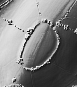
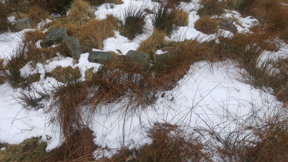
[visited 4/3/18] Out on a hike up Hurst hill, I remembered on my way back I'd never actually found this cairn despite walking within 100m of it many times. So, with the aid of the images on here and some rough guesstimation I found this really good condition small cairn. Turns out I was always the other side of a slight rise and even when I'd climbed it I was looking for a circular bank not a mound, should have checked the images earlier!
This is a really good condition cairn, seemingly untouched by robbers, antiquarians or farmers. The mound is poking out of the peat and has a clearly defined kerb about a metre or so up enclosing a 2-3 metre space. I wonder if there is a second kerb under the peat defining the bottom of the cairn, I poked about a bit but couldn't see anything obvious. Looking at the previous pictures on here I think the peat may have denuded a bit over the last 15 years or so.
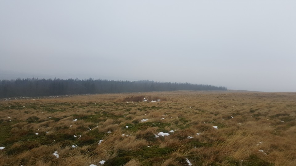
The views are really good and before the trees went up you would have had a great view of pikestones and round loaf, this mound lying between the two. Also a lovely vista all the way round the eastern end of anglezarke, winter hill and then onto the lancashire plains out to the sea.
Access is good for Anglezarke, however it will probably be boggy underfoot depending on the time of year. You'll need to cross a couple of stiles and the cairn is just off a footpath.
|

|

|
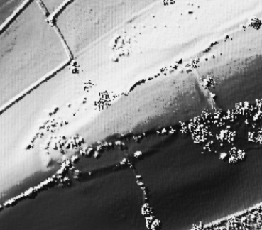
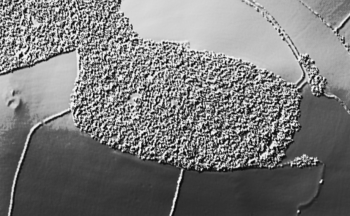
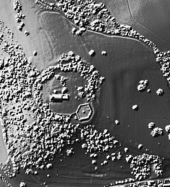
[Visited 18/02/18] I've been looking for an excuse to pop up here for a while, so a power walk bit of exercise seemed perfect. I went up the side of winter hill hoping to spot the small cairn on the north edge of the top, but I wasnt sure which of the humps qualified. This one didn't have that issue...
This is a large cairn still clearly defined, with the remains of a kerb on the southern side. The builders making use of a natural knoll to make two sides appear much bigger. The modern pile of stones on top has been flattened slightly since the earlier photos on here and I think is just spoil from the robber or excavation pit in the centre. I had a close look at the possible cups on the large stone nearby, I'm thinking natural due to lack of definition and irregular shape, but the light was very poor. If the stone was standing I think it's been flat for a fair while.
All in all a nice barrow, worth the effort. Access would be easiest from the old road which goes round the bottom off the hill following easily navigable paths.
|

|
Spot the Hunter-Gatherers!
https://www.facebook.com/events/2128530017175633/
Got a spare day between Tuesday 6 and Sunday 11 March 2018?
Join our survey team and help find Spodden Valley's ancient hunting camps. Lancashire has one of the highest concentrations of hunter-gatherer sites in Europe. 8,000 years ago, it was prime territory. Today, it still bristles with the remains of ancient hunting camps... if you know where to look.
In March the DigVentures team are heading to Spodden Valley to help us begin a MASSIVE survey of its hunter-gatherer sites, and we are going to need LOADS of people. Together, we'll sweep across the valley looking for clues, but it's only a few weeks away and we need to assemble our team FAST
|

|

|
Blog post about the photogrammetry survey of the rock art on the top of the Quoit.
|
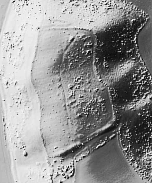
[visited 4/12/16] My what a beast this is. Magic.gov.uk has this as an oversized bowl barrow akin to the much smaller mounds on the hills to the north and west, I disagree entirely. This is surely one of the neolithic round cairns that dot the landscape of the southern white peak.
Its lovely here on a cold sunny winters day with low light spreading the shadows. The two pits are clear as are the original quarry pits in the surrounding fields. Its placement in the landscape is suggestive of a different purpose to the cairns on the steep hills nearby, this one much closer to the valleys and the water sources, not so much a statement to the gods but a usable monument for the everyday folk.
Access is ok. About 15-20 minutes walk from Alstonfield over muddy fields.
|
Developer plans to move London Stone out of WH Smith and onto public plinth
http://www.standard.co.uk/news/london/developer-plans-to-move-london-stone-out-of-wh-smith-and-onto-public-plinth-a3200061.html
In legend, it formed part of London’s foundations and was the resting place of King Arthur’s sword Excalibur.
But for years the London Stone has lain in a case behind a pavement-level grille in the Cannon Street WH Smith.
Now, the Grade II listed lump of oolitic limestone is set to be restored as a centrepiece of the Square Mile.
It ended up in the Sixties block housing WH Smith after its former berth, St Swithin’s Church, was bombed in the Blitz.
Under plans to turn the block into an eight-storey office tower, developer Applegarth has revealed plans to give the stone pride of place on a plinth.
An application to the City of London Corporation says: “The plinth and the London Stone would be reinstated at the height they were in St Swithin’s Church prior to its destruction in the Second World War. This would make it more prominent to public viewing than is currently the case.”
Giles Clapp, clerk of the Worshipful Company of Masons, which helps protect the history of the City of London, said: “We support giving the stone the prominence it deserves. It is very important in the telling of the London story.”
The relic — also known as the Stone of Brutus after the legendary Roman founder of the capital — is mentioned in historical documents as early as 1100.
It was written about by Shakespeare and Dickens and has become the subject of countless myths, including claims it was the stone from which Arthur drew Excalibur.
The 17th-century poet William Blake believed the site of the relic was a druidic sacrificial stone circle, while another theory holds it was the symbolic point from which all distances in Roman Britain were measured.
An application by developers Minerva to move the stone into the foyer of nearby offices sparked a row with heritage groups in 2012. The latest plan has been broadly welcomed, with Historic England raising no objections.
The CLC has called the new proposal “an appropriate development”. Its ruling, after a meeting tonight, could have wider repercussions for the City. An ancient warning comes with the block, which says: “So long as the Stone of Brutus is safe, so long will London flourish.”
|
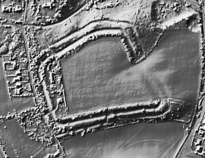
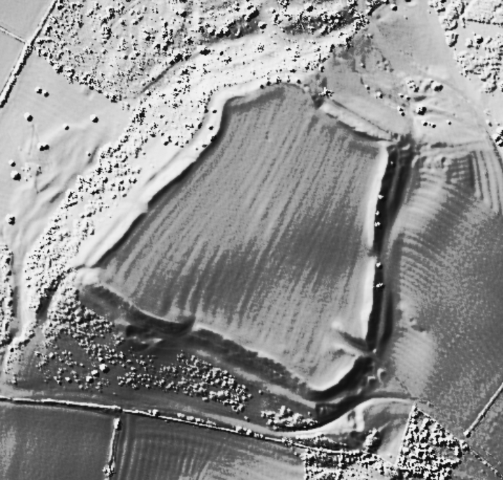
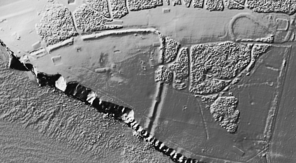
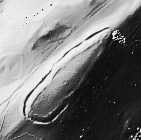
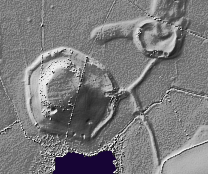
"Our new survey aimed to identify evidence for an external bank and to locate other unrecorded archaeological features within the scheduled area. Evidence for a bank would potentially inform understanding of the chrono-typological development of later Neolithic monuments across north-west Atlantic Europe, in Ireland, Wales and Scotland."
|

|
http://www.pastscape.org.uk/hob.aspx?hob_id=117437
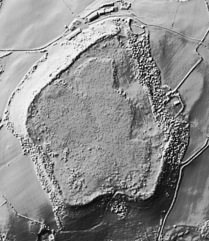
A Neolithic promontory enclosure comprising a projecting spur of Birdlip Hill with two curving concentric earthworks cutting across the axis of the promontory. The site was surveyed by RCHME in 1996 as part of the Industry and Enclosure in the Neolithic Project. Quarrying has lowered the tip of the promontory and eroded the north and south sides; the east area is intact. The promontory is cut off by two earthworks across the spur, about 90 metres apart, with vestigial banks which appear virtually continuous. The outer would originally have enclosed an area of more than a hectare. The inner earthwork consists of a bank; the outer, 55 metres to the south east, is a bank with slight external ditch. The area narrows in width from 95 metres at the south eastern end to 15 metres on the northwest. Excavations were undertaken by T Darvill (who referred to the site as Peak Camp) in 1980-1, comprising a trench across the outer earthwork and a small trench towards the western end of the promontory. The outer earthwork comprised a single rock-cut ditch with an internal bank of limestone rubble. The ditch featured at least one causeway, and had seen at least four phases of recutting. Finds included flints, animal bones, and pottery. The second trench revealed a ditch or gulley, which contained further Neolithic pottery, flints and a quantity of bone. The lithic material included leaf-shaped arrowheads and a flake from a polished axe. Research into the dating of Early Neolithic enclosures indicates a construction date for the outer circuit of probably of 3655-3540 cal BC. The enclosure at Peak Camp may have been used into the 33rd century cal BC, although this late date is dependent on a single measurement. The research also highlighted the relationship with the Crickley Hill enclosure nearby, suggesting they were probably built within a generation of each other and were in concurrent use, at least until the destruction of Crickley in the mid-35th century cal BC.
|

|
http://www.pastscape.org.uk/hob.aspx?hob_id=1075209
The site of a probable Neolithic causewayed enclosure at Springfield Lyons, visible as cropmarks and tested by small-scale excavation. The cropmarks were transcribed and interpreted by RCHME in 1997 as part of the Industry and Enclosure in the Neolithic Project. See the archive report for full details. The existence of the enclosure was realised following excavation of the adjacent Late Bronze Age enclosure (TL 70 NW 86). Excavation in 1990 and 1991 plus air photographs indicate the presence of an arc of pits and/or ditch segments immediately to the east of the Late Bronze Age site, and which appear to cut off a small gravel promontory between two streams which run into the River Chelmer. Trial trenching so far has recovered around 2000 sherds of Mildenhall-style plain bowl sherds, plus Grooved Ware and Beaker sherds from superficial deposits and pits. Much of the Neolithic material appears to have been deliberately placed. Of the two fully-excavated features along the enclosure circuit, one comprised an almost shaft-like pit, and contained deposits of Mildenhall pottery often comprising up to half a complete vessel. One of the pits had a narrow slot associated with Beaker pottery cut into its upper fills. A by-product of the excavation of the Late Bronze Age enclosure is that it is clear that much activity associated with the causewayed enclosure was occurring outside the ditch circuit. It is also intriguing to note that the Late Bronze Age enclosure is itself causewayed, and its principal entrance directly faces the Neolithic enclosure.
|
Rumours I found one folklore piece to complete my rainbow are true
|
|