
Image Credit: Environment Agency copyright and/or database right 2015.
Image credit: Open Source Environment Agency LIDAR
Image Credit: Environment Agency copyright and/or database right 2015.

View south from the isolated Mount Caburn to the South Downs ridge separated by the River Ouse and Glynde Reach. The dark line in the foreground is the very slight defensive bank of the hill fort’s south side, but at a height of around 150m is barely necessary.

Inner and outer ramparts looking north west.

This strange little earthwork is shown as a tumulus on the OS map sitting on the edge of the outer IA ramparts of The Caburn, but it bares little resemblance to any barrow I’ve ever come across.

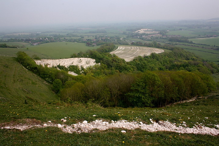
The view from Caburn Bottom to The Bible Earthwork and field systems. Not sure if these are contemporary with the the surrounding sites or possibly medieval.

The view from the edge of the dreaded Lewes Golf course through Oxteddle and Caburn Bottoms to The Caburn and Ranscombe Camp.
The powerful northern defences.

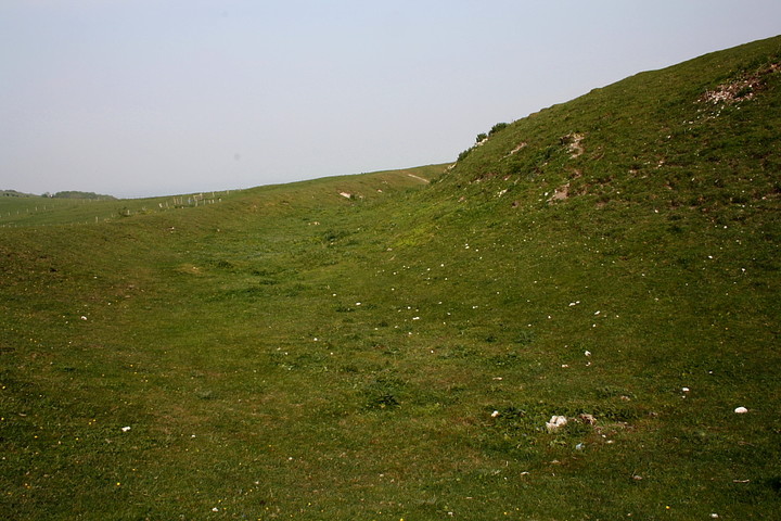
The far slighter defences to the south... but then, look at that hillside.

Mount Caburn from the rampart of Ranscombe Camp to the approx west.

Looking across a round barrow to the hillfort

The round barrow a little way to the north of the enclosure.
Looking approx eastwards towards Glynde. The very steep slope perhaps explains why overwhelming consideration was given to the defences of the northern arc.

The powerful ditch to west.... note Ranscombe Camp, beyond.

Impressive multi-vallate defences face the only practical direction of approach. Ranscombe Camp’s mightly rampart can be seen beyond, top right.

Panorama on the outer rampart looking South West

180 degree view from the outer earthworks on Mount Caburn

View of Mount Caburn from Ranscombe Camp

Panorama view approaching Mount Caburn... with Windover Hill and Firle Beacon to the left of picture – Mount Caburn enclosure – and Ranscombe Camp to the right.

sheep nibbling away around the barrow located nearest to Mount Caburn: grid ref TQ445092. Firle Beacon and Windover Hill in the distance!
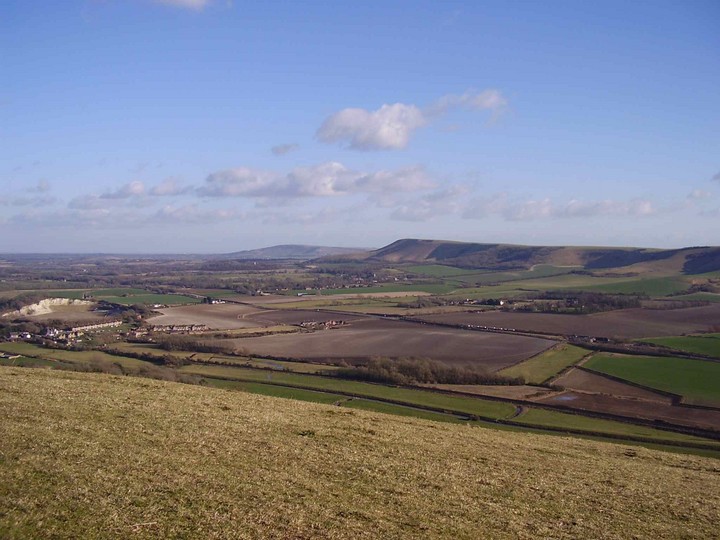
The view to the south east from the summit of Mount Caburn. 26/2/06
In the distance is Windover Hill, home to the Long Man of Wilmington, while the ridge on the right ends at Firle Beacon, home to the Giant’s Grave.
For a hill of only 150 metres in height the view is almost 360 degrees and very impressive.
For the reverse view see here: themodernantiquarian.com/post/14626

Mount Caburn from the path to the north. 26/2/06

The west ditch of Mount Caburn from the northern entrance. 26/2/06

Mount Caburn from the North West 26/2/06
18/03/2016 – Walking over from Alfriston to Lewes we had only one chance for a coffee shop and that was when we passed through Glynde. Our luck was in as the Little Cottage Tea Rooms is located just across the road from the footpath up to Mount Caburn. Refuelled on coffee and carrot cake, we made the short but steepish climb up to the hillfort. I’d seen the hillfort from the train the day before and it had looked a good one. Crossing over the defences, we made our way over to the bench on the south side for a sit. This really is a nice hillfort and well worth a visit. The location and view is very good. We headed north to Cliffe Hill and then down into Lewes. There looks to be quite a few good walks round here that take in the hillfort. Top area.
Mount Caburn means a lot to many people in the town of Lewes I think.
It was the nearest settlement of any size to the site that Lewes was eventually founded on by the Saxons and can be seen from much of the town.
The skyline of the hill from the town means that the ditch and bank of the fort seems to cut it off from the rest of the ridge on which it stands. The hill the fort was built upon is fairly distinctive anyway, being a dome with broad slopes sweeping down from it to the south, while it seems almost to be the head of a giant downland animal, the rest of the downland ridge that it forms part of trailing behind the hill to the north. This ridge is the only block of the South Downs that is not a part of the main ridge along which the South Downs Way runs, having been cut off from it by the Glynde Reach river, that you will see joining the river Ouse to the south west.
When you approach the fort from the north the ditch and bank are very prominent, but the part of the hill still inside the fort protrudes above it still, giving an impression of a round hat, or, one might say, a flattened Dalek’s head!
Once inside the fort one seems simply to be on a hill, as the whole ditch and bank becomes far less obvious. This is particularly true on the southern side, where the defences are far less spectacular. I have always been told this is because on this side any attacker would have had quite a climb first. I’m not entirely convinced though, as this does not take account of attackers circling from the northern side. For me, the steep hill suggests some erosion of the defences on this side, though I have no evidence for this either way.
In any case the view is very impressive for a hill that is not actually that high (150m above sea-level), particularly of the downland ridge to the south. Firle Beacon and Windover Hill, home to the Long Man of Wilmington, can also be seen to the south east.
If you make seven circles of Mount Caburn the Devil will jump out at you – according to a local chap this tale was seriously believed c.1914 when he was a boy.
Apparently cited in a letter to? Jacqueline Simpson in 1973, and mentioned in a footnote in
Circling as an Entrance to the Otherworld
Samuel Pyeatt Menefee
Folklore, Vol. 96, No. 1. (1985), pp. 3-20.
An Iron Age hillfort crowns this hill, traditionally formed from a clod of earth thrown here by the Devil while feverishly digging out the Devil’s Dyke. Another legend says that a giant called Gill who reputedly lived on the Downs would throw his hammer from the summit of the Caburn. Somewhere in the hill a silver coffin and a knight in golden armour are said to be buried.
Compelling little leaflet about the history of the Caburn.
The story is told as a series of six “windows in time”,
falling on midsummer days throughout the history of the site
and its people, from 3,000 BC to the present day.
The Caburn – Hillfort or ritual enclosure? Article by Mike Haigh.


