The Modern Antiquarian
Log in
|
Register
Home
Latest Posts
Forums
Maps
Help
Browse Sites
News
Blog
Contributors
The Books
Select
-
Belgium
Denmark
Eire
France
Germany
Greece
Italy
The Netherlands
Norway
Portugal
Republic of Malta
Spain
Sweden
Switzerland
United Kingdom
Scotland
Aberdeenshire
Colpy
Stone Circle (Destroyed)
Colpy (Stone Circle) on The Modern Antiquarian, the UK & Ireland's most popular megalithic community website. 1 fieldnote, 1 weblink, plus information on many more ancient sites nearby and across the UK & Ireland.
No image available
Nearest Town:
Huntly (12km WNW)
OS Ref (GB):
NJ6332 /
Sheets: 29, 37
Latitude:
57° 22' 37.18" N
Longitude:
2° 36' 55.35" W
Added by
drewbhoy
Fieldnotes (1)
Links (1)
0 discussions
Start a topic
Show |
Hide
Web searches for Colpy
Flickr
Google
Google Images
MAGIC
The Megalithic Portal
Bing
Stone Pages
Streetmap.co.uk
Wikipedia
Show map
(inline Google Map)
- Sites within 20 km -
-
Fallow Hill (0.98km E) (5 posts)
Culsalmond (1km ENE) (4 posts)
Mellenside (2.53km E) (8 posts)
Inschfield (2.66km S) (12 posts)
Mummer's Reive (2.83km ENE) (6 posts)
Candle Hill (3.73km WSW) (35 posts)
Dunnydeer (3.75km SSW) (6 posts)
South Lediken (3.88km ESE) (4 posts)
Newton Stone (3.94km E) (12 posts)
Lenchie (3.99km WSW) (4 posts)
Dunnydeer Farm (4.07km SW) (21 posts)
Dunnideer (4.2km SSW) (31 posts)
Stonehead (4.32km SW) (34 posts)
Wantonwells (4.75km SSW) (26 posts)
Brownhills 2 (near Ardoyne) (4.98km ESE) (3 posts)
Brownhills (near Ardoyne) (4.98km ESE) (5 posts)
Pitmachie (5.05km ESE) (4 posts)
Newton Of Wardhouse Farm (5.35km WSW) (3 posts)
Hill Of Christ's Kirk (5.37km SW) (14 posts)
Newton Of Wardhouse (5.71km WSW) (8 posts)
Burryhillock (5.86km SSE) (5 posts)
Hatton of Ardoyne (5.94km ESE) (17 posts)
Hill Of Rothmaise (6.02km ENE) (7 posts)
Wardhouse (6.19km WSW) (5 posts)
North Rayne (6.28km E) (4 posts)
Fallow Hill (6.3km WSW) (6 posts)
Fallow Cairn (6.31km WSW) (4 posts)
Old Rayne (6.38km ESE) (35 posts)
Westerton Of Petmathen (6.5km ESE) (11 posts)
Bowman Stone 2 (6.65km E) (4 posts)
Bowman Stone (6.65km E) (4 posts)
Stonyfield (6.92km WNW) (13 posts)
The Tow Stone (7.03km ENE) (5 posts)
Cobrigdale Hill (7.07km SE) (5 posts)
Braehead (7.51km SW) (14 posts)
Berryhill (7.59km ESE) (6 posts)
Logie Newton (7.65km NNE) (8 posts)
Berryhill (7.71km ESE) (9 posts)
Tillymuick (7.73km SE) (8 posts)
Gowk Stane, Oyne (7.84km ESE) (8 posts)
The Good Man's Fauld (7.91km SSW) (2 posts)
Kirkton Of Oyne (7.97km ESE) (9 posts)
Hill Of New Leslie (8.03km SW) (5 posts)
Hawk Hill (8.08km SSW) (9 posts)
The Law (8.12km E) (14 posts)
Auchaber (8.32km N) (5 posts)
The Ringing Stone (8.56km SW) (6 posts)
Mill of Carden (8.61km ESE) (11 posts)
Ardlair (8.7km WSW) (35 posts)
Upper Third (8.75km NE) (18 posts)
Backley Hill 1 (8.91km E) (8 posts)
Backley Hill (8.97km E) (5 posts)
Backley Hill 2 (8.98km E) (7 posts)
Fullerton/Bogcoup (9.04km NNW) (3 posts)
Durno (9.16km E) (4 posts)
Newlands Of Oyne (9.28km ESE) (2 posts)
Leith Hall Policies (9.53km WSW) (9 posts)
Tofthills (9.6km WSW) (9 posts)
Little Oxen Craig (9.75km SE) (6 posts)
Druidstones (9.8km S) (20 posts)
The Candy Stone (9.81km WSW) (5 posts)
Hill Of Knockollochie (9.86km ESE) (5 posts)
Pittodrie Quarry (9.87km ESE) (5 posts)
Newtongarry Hill (9.88km WNW) (7 posts)
Oxen Craig (9.91km SE) (32 posts)
Bennachie (9.91km SE) (43 posts)
Socket Stone Rock (9.95km SE) (4 posts)
Maiden Castle (Pittrodie) (9.95km ESE) (20 posts)
Oxen Craig Peak 2 (9.96km SE) (2 posts)
Oxen Craig South Western Descent (9.97km SE) (16 posts)
Satter Hill (10.12km SSW) (8 posts)
Knock Saul (10.23km SW) (7 posts)
Pitscurry (10.65km E) (8 posts)
Frendraught (10.96km NNW) (13 posts)
Mither Tap (10.98km ESE) (73 posts)
Clatt Bankhead (11.23km WSW) (6 posts)
Altar Stone, Hillhead (11.32km WSW) (2 posts)
Drumel Stone (11.34km WSW) (3 posts)
Clatt Hillhead (11.55km WSW) (5 posts)
South Balnoon (11.62km N) (6 posts)
Raich (11.64km NNW) (22 posts)
New Craig (11.69km E) (20 posts)
Battle Hill (11.76km WNW) (8 posts)
New Craig (11.85km E) (12 posts)
Gouk Stane, Bennachie (12.05km ESE) (5 posts)
Loanhead of Daviot (12.09km E) (104 posts)
Cothiemuir Wood (12.25km S) (78 posts)
Harestane, Feith Hill (12.26km NNE) (6 posts)
The Barmkyn (12.33km SSW) (19 posts)
Hill Of Airlie (12.37km SSW) (7 posts)
Mains of Hatton (12.53km NE) (16 posts)
Huntly (12.57km WNW) (9 posts)
Leggetsden (12.58km E) (4 posts)
White Hill (12.65km WSW) (6 posts)
Pitglassie (12.67km NNE) (14 posts)
Hill Of Whitecross (12.78km ESE) (9 posts)
Corrstones (12.88km WSW) (27 posts)
Millstone Hill East (12.9km ESE) (10 posts)
Old Keig (13km SSW) (48 posts)
Balquhain (13.04km E) (34 posts)
Millstone Hill East 2 (13.29km ESE) (8 posts)
Mill of Noth (13.33km WSW) (10 posts)
Burreldales (13.36km NE) (5 posts)
Cairnton (13.38km NW) (10 posts)
Smallburn (13.43km WSW) (6 posts)
East Blairbowie (13.5km ESE) (8 posts)
Liggars' Stane (13.56km E) (7 posts)
Midtown Of Pitglassie (13.56km NE) (8 posts)
Lumphart Hill (13.73km E) (7 posts)
Broadsea Farm (13.73km ESE) (6 posts)
Midtown Of Pitglassie 2 (13.75km NE) (4 posts)
Corrie (13.86km SW) (10 posts)
Clashmach (13.93km W) (10 posts)
Rhynie Standing Stones (13.96km WSW) (9 posts)
Auchencleith (13.99km E) (6 posts)
Rhynie Graveyard (14.07km WSW) (7 posts)
Yonder Bognie (14.08km NNW) (19 posts)
Newton Of Fortrie (14.2km NNE) (4 posts)
Crookmore (14.21km SSW) (2 posts)
Bell Knowe (14.24km WSW) (6 posts)
Barflats (Rhynie) (14.37km WSW) (7 posts)
Cairn More (14.44km WSW) (4 posts)
Drimmies (14.49km E) (5 posts)
Newseat 2 (14.54km WSW) (4 posts)
Newseat (14.56km WSW) (9 posts)
Roddantree (14.6km WNW) (12 posts)
Corrydown (14.65km NE) (16 posts)
Clashmach Hill (14.66km W) (9 posts)
Tap o' Noth (14.79km WSW) (73 posts)
West Drachlaw (14.85km NNE) (13 posts)
Clochmaloo (14.85km WSW) (5 posts)
Scotsmill (14.91km SSW) (6 posts)
The Ark Stone (14.97km ESE) (4 posts)
Balhalgardy (14.98km E) (5 posts)
Crofts of Shielburn (14.99km NNE) (11 posts)
Backhill of Drachlaw (15km NNE) (20 posts)
Middleton (15.03km ESE) (3 posts)
Easter Aquhorthies (15.1km ESE) (135 posts)
Chapel O'Sink (15.11km ESE) (8 posts)
Carlin Stone (15.12km NNE) (29 posts)
Giant's Stone (15.14km WSW) (12 posts)
Dilly Hill 2 (15.18km ESE) (4 posts)
Rumfold (15.19km WSW) (3 posts)
Conglas 2 (15.21km E) (6 posts)
Dilly Hill (15.23km E) (4 posts)
Druidsfield (15.25km SSW) (17 posts)
Conglas (15.31km E) (5 posts)
Dilly Hill 3 (15.31km ESE) (4 posts)
Ord Hill (15.37km WSW) (8 posts)
Dilly Hill Cairn (15.41km ESE) (4 posts)
Upper Ord (15.6km WSW) (13 posts)
Baldyvin (15.7km SSW) (4 posts)
Cairn Of Pitmansy (15.81km ENE) (11 posts)
Allrick Hill (15.89km W) (8 posts)
Wheedlemont (15.93km WSW) (16 posts)
Balcairn (16.15km E) (3 posts)
Brandsbutt (16.17km E) (20 posts)
The Peirk (16.28km WSW) (8 posts)
Bar Hill (16.42km W) (9 posts)
Brawland (16.42km WSW) (5 posts)
Hill Of Laithers (16.69km NNE) (5 posts)
Wheedlemont (16.74km WSW) (13 posts)
Arn Hill (16.78km WNW) (15 posts)
Lord Arthur's Hill (16.81km SW) (14 posts)
Garran Burn (16.85km W) (11 posts)
Auld Kirk Of Alford (16.95km SSW) (11 posts)
Hill Of Avochie (16.97km WNW) (8 posts)
Luath's Stone (17km SSE) (23 posts)
Corskellie (17.04km NW) (14 posts)
Avochie South 1 (17.05km WNW) (8 posts)
Avochie South 2 (17.07km WNW) (4 posts)
Avochie South 3 (17.11km WNW) (6 posts)
Avochie (17.23km WNW) (4 posts)
Deer Park (17.23km SE) (25 posts)
Nether Balfour (17.33km SW) (2 posts)
Hill Of Old Merdrum (17.4km WSW) (3 posts)
Avochie Stone (17.4km WNW) (16 posts)
Marnoch Lodge (17.5km NNW) (9 posts)
Gallow Hill (17.53km SSW) (9 posts)
Hawk Law (17.57km E) (5 posts)
Hillhead Of Barra (17.61km E) (7 posts)
Hill of Old Merdrum (17.65km WSW) (3 posts)
Hill of Backside (17.78km W) (10 posts)
Bruce's Seat (17.84km E) (4 posts)
Finglenny (17.86km WSW) (11 posts)
Wormy Hillock (17.97km WSW) (16 posts)
Cuning Hill (18.08km E) (8 posts)
Newells (18.12km E) (6 posts)
Nether Coullie (18.16km SE) (8 posts)
Hill of Barra (18.25km E) (30 posts)
Wallace Stone (18.25km E) (3 posts)
Tombeg (18.33km SE) (8 posts)
Rothiemay (18.43km NW) (41 posts)
St Marnan's Chair (18.46km NNW) (23 posts)
Kirkton of Bourtie (18.49km E) (56 posts)
Whitehills (18.52km SSE) (50 posts)
Bellman's Wood (18.55km NNW) (8 posts)
The Reesk (18.57km W) (6 posts)
Bellman's Stone (18.64km E) (5 posts)
Cairn Of Beith (18.67km NW) (11 posts)
Damil (18.72km SSW) (5 posts)
North Strone (18.74km SSW) (17 posts)
Backtack (18.83km W) (5 posts)
Piper's Stone (18.85km E) (6 posts)
Bruce's Camp (18.94km ESE) (7 posts)
Little Hillbrae (19.06km E) (6 posts)
Hill Of Selbie (19.07km E) (8 posts)
Whitehill Wood, Cairn Ennit (19.08km NNE) (5 posts)
Hill Of Backtack (19.16km W) (9 posts)
White Cow (19.2km NNW) (4 posts)
Broomend of Crichie (19.26km ESE) (69 posts)
Hill Of Cairns (19.26km NW) (4 posts)
Aswanley Wood (19.37km W) (9 posts)
Monkshill (19.37km ENE) (17 posts)
Broomend (19.42km ESE) (6 posts)
Langstane o' Craigearn (19.42km ESE) (13 posts)
Cleanhill (19.42km NNW) (8 posts)
Whitehillock (19.43km WSW) (6 posts)
Cairnborrow Lodge (19.45km W) (6 posts)
Deil's Stane (19.47km ESE) (8 posts)
Hill Of Cairns 2 (19.49km NW) (5 posts)
Hill Of Milleath (19.5km W) (7 posts)
Broomend 2 (19.51km ESE) (5 posts)
Broomend Cist(s) (19.62km ESE) (7 posts)
The Grinago Stone (19.62km E) (10 posts)
Findlatree (19.68km S) (5 posts)
Camies Stone (19.7km ESE) (6 posts)
Clovenstone Farm (19.73km ESE) (5 posts)
Wolf Stone (19.8km SSE) (10 posts)
Newton Hill (19.88km W) (5 posts)
Black Hill (19.92km W) (5 posts)
Cairnborrow (19.94km W) (5 posts)
- Add -
-
Add news
Add an image
Add fieldnotes
Add folklore
Add miscellaneous
Add a link
-
Add a site
Add a nearby facility
Add an alternative name/spelling
Fieldnotes
Add fieldnotes
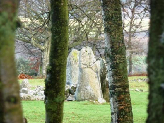
Leave the A96 at Colpy and follow the Jericho road. Just outside the hamlet the circle would have stood on the way to the, long shut and ruined, distillery. The circle, as well as a cairn, was destroyed to make the road. Another sad end!
Driven past most weeks.
Comments (0)
|
Add a comment
|
Permalink
Posted by
drewbhoy
19th May 2009ce
Links
Add a link
ADS.AHDS
Not much about Culsalmond. Even less about Colpy on page 90.
Comments (0)
|
Add a comment
|
Permalink
Posted by
drewbhoy
19th May 2009ce