As soon as we moved away from the circle, the cows rushed to surround the recumbent.
Images
Bovine acolytes come to check us out. Fourman Hill provides the sunlit background.
The recumbent.
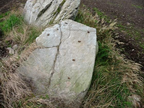
Tiny sample of the cupmarks covering the top of the recumbent.
Two of the remaining circle stones.
Under sunny autumn skies.
The upper surface of the recumbent.... looking across the cup-marked adorned face to the ‘jagged bit’ .... an circle stone stands beyond.
The recumbent is heavilly cup-marked... including on top.
Ah... exquisite!
From certain angles – including this one – Rothiemay remains a stone circle. Nevertheless there is a symmetry to the site which I did not expect.
The wonderful recumbent – sadly minus flankers – and two of the remaining circle uprights.
From the gate..... windy, then?
Full circle looking W.
Outer face of recumbent 4.3m x 1.5m
Some of the cupmarks and cup and ring marks on the inner face of the recumbent.
Recumbent from inside the circle.
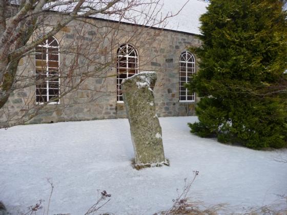
From the road.
Cup and ring-marked recumbent on the left of the picture.
Articles
I missed out on Rothiemay during a short tour of north-RSC land a few years back. One of those sites that, in retrospect, I wished I had pushed a little harder to see... since the massive recumbent, according to Burl, features ‘an astonishment of megalithic art, over a hundred cupmarks and several cup and ring marks’ upon its inner face. As usual, he’s not wrong.... in respect of the ‘astonishment’ part, that is. I’ll take his word for it concerning the mathematics...
Aside from the massive, 20 ton recumbent, sadly now minus flankers, four approx 6ft circle stones still stand to give the impression of stone settings, rather than that of a bone-fide stone circle. Nevertheless they are impressive uprights, that located that to the east of the recumbent also cupmarked. However the substantial recumbent is the reason you should come to Rothiemay.... I give up counting the profusion of rock art which graces this mighty basalt block when I run out of fingers... hey, what else is a guy of my generation to do without a calculator?
The entrance to the lush pasture in which the Rothiemay ring stands now features a ‘Rothiemay Standing Stones’ sign. So access is not an issue.... assuming you’re good at opening very stiff field gates, that is. I’m not, but I can still climb. A bit. The River Deveron flows to the south beyond stables, the equine inhabitants galloping around under a striking blue sky filled with fast moving clouds serving to diffuse the sharp light. As I sit, buffeted by the wind, I ponder how great this stone circle would look if more had survived to actually ponder over. On second thoughts, though, there’s quite enough here to occupy a few hours of anyone’s time with exquisite thoughts.... verily, my cup marks runneth over.
I was really looking forward to seeing this one as the sheer blocky bulk of the heavily cupmarked recumbent really appealed to me in papery TMA. But I didn’t dare enter the field though as there was a herd of cattle present complete with bull. Moth dared, but he runs faster than me. So I sat on the non-prehistoric stone gatepost to observe. Its flankers are gone but there are still four beautiful evenly placed stones of the circle still standing.
As I sat observing, the farmer drove up and stopped. “Just looking at your stone circle” I said. “That’s fine” he said, “but I don’t think anyone really owns a stone circle, do they. It’s just on my land.”
Nice site .... shame about the military jets flying low overhead every 30 seconds.
I stayed just long enough to get some photos then headed off somewhere quieter.
Visited 17 March 2005
without OS map impossible – with it still really difficult – well for us it was! with releif we finally found the place – I guess we felt a bit dissappointed but looking at the photos now I am glad we made the effort.
“Cup marks on the Rothiemay recumbent stone represented the Pole Star, the constellation of the Great Bear (Ursa Major) and the brightest stars such as Artacus, Bootes, Aldebaran, Capella, Vega and Altair.”
Revd. G. F. Browne.
On Some Antiquities in the Neighbourhood of Dunecht House.
Pics of Rothiemay stone circle
Picture and some information.
Topics
Sites within 20km of Rothiemay
-
Corskellie
photo 10 description 1 link 3 -
Cairn Of Beith
photo 10 description 1 -
Avochie Stone
photo 14 description 1 link 1 -
Avochie
photo 3 description 1 -
Avochie South 3
photo 5 description 1 -
Hill Of Avochie
photo 7 description 1 -
Avochie South 2
photo 3 description 1 -
Avochie South 1
photo 7 description 1 -
Hill Of Cairns 2
photo 4 description 1 -
Hill Of Cairns
photo 3 description 1 -
Conjure Cairn
photo 7 description 2 link 1 -
Kemps Cairn
photo 3 description 2 -
Arn Hill
photo 12 description 2 link 1 -
St Marnan’s Chair
photo 20 description 3 -
Wether Hill
photo 1 description 1 link 1 -
Monk’s Cairn
photo 7 description 2 -
Cairnton
photo 5 description 3 link 2 -
White Cow
photo 2 forum 1 description 2 -
Battlefield
photo 3 description 1 -
Marnoch Lodge
photo 8 description 1 -
Bellman’s Wood
photo 6 description 1 link 1 -
King’s Chair
photo 3 description 1 -
Yonder Bognie
photo 15 forum 1 description 4 -
Knock Hill
photo 14 description 2 link 1 -
Oakenknowes
photo 7 description 1 -
Whitehill
photo 4 description 1 -
Knock Hill
photo 22 description 2 -
White Stone
photo 5 description 1 -
Thorax
photo 5 forum 2 description 2 link 3 -
Cleanhill
photo 7 description 1 -
Roddantree
photo 10 description 2 -
Cloven Stone
photo 2 description 2 -
Frendraught
photo 8 description 4 link 1 -
Raich
photo 20 forum 1 description 2 -
Newtongarry Hill
photo 4 description 2 link 1 -
Battle Hill
photo 6 description 2 -
Huntly
photo 5 forum 1 description 4 -
Hill Of Milleath
photo 6 description 1 -
Fullerton/
Bogcoup photo 2 description 1 -
Black Hill
photo 4 description 1 -
Tam’s Chamber
photo 6 description 2 -
South Balnoon
photo 5 description 1 -
Hill Of Backtack
photo 7 description 2 -
Backtack
photo 4 description 1 -
Garran Burn
photo 9 description 2 -
Clashmach Hill
photo 8 description 1 -
Clashmach
photo 9 description 1 -
Auchaber
photo 4 description 1 -
Stonyfield
photo 10 description 2 link 1 -
Bar Hill
photo 7 description 2 -
Hill of Backside
photo 8 description 2 -
North Whiteley A
photo 3 description 1 -
Glenshee 1
photo 4 description 1 link 1 -
Allrick Hill
photo 7 description 1 -
North Whiteley B
photo 4 description 1 -
Cairnborrow
photo 2 description 2 link 1 -
Newton Hill
photo 4 description 1 -
West Drachlaw
photo 11 description 2 -
Harestane, Feith Hill
photo 3 description 2 link 1 -
Cairnborrow Lodge
photo 4 forum 1 description 2 -
Edintore
photo 2 description 1 -
Cairds Hill
photo 3 description 1 -
Hill Of Laithers
photo 2 description 2 link 1 -
Backhill of Drachlaw
photo 16 description 2 link 2 -
Carlin Stone
photo 21 description 5 link 3 -
Glenshee 2
photo 4 description 1 link 1 -
Glenshee 3
photo 4 description 1 -
Crofts of Shielburn
photo 8 description 2 link 1 -
Newton Of Fortrie
photo 3 description 1 -
Whitehill Wood, Cairn Ennit
photo 2 description 2 link 1 -
Westfolds
photo 6 description 1 -
Both Hill
photo 9 description 1 -
Norry Hill
photo 5 description 1 -
St Brandan’s Stanes
photo 11 description 4 link 3 -
Both Hill 2
photo 7 description 1 -
Aswanley Wood
photo 8 description 1 -
North Burreldales
photo 5 description 2 link 1 -
Hill Of Janetstown
photo 4 description 1 -
Logie Newton
photo 6 description 2 -
Pitglassie
photo 9 description 2 link 3 -
King’s Cairn
photo 6 description 1 -
Hill Of Janetstown 2/
3 photo 5 description 1 -
Killiesmont
description 2 -
Hillside
photo 4 description 1 -
Forglen
photo 5 description 1 -
Durn Hill
photo 6 description 2 link 1 -
Tor Sliasg
photo 10 description 1 -
Upper Third
photo 17 description 1 -
Ten Rood Wood
photo 7 description 1 -
Barbara’s Hillock
photo 6 description 1 link 1 -
Midtown Of Pitglassie
photo 6 description 1 link 1 -
Midtown Of Pitglassie 2
photo 3 description 1 -
Mains of Hatton
photo 10 description 4 link 2 -
Corrydown
photo 12 description 3 link 1 -
Hill Of Alvah
photo 2 description 1 link 1 -
The Reesk
photo 5 description 1 -
Davie’s Castle
photo 11 description 2 link 1 -
Carlinkist Cairn
photo 6 description 1 -
Nether Dumeath
photo 10 description 1 link 2 -
Stirling Cairn
photo 5 description 1 link 1 -
Sandend
photo 2 description 3 -
Meikle Hill
photo 6 description 2 -
South Sandlaw
photo 2 description 1 -
Lenchie
photo 3 description 1 -
Moss Hill Plantation
photo 3 description 1 link 1 -
Chalmers Slack
photo 4 description 1 -
Foulford Bridge
photo 3 description 1 -
Cairnhead Wood
photo 5 description 1 -
Drumel Stone
description 3 -
Newton Of Wardhouse
photo 6 description 2 -
Colpy
description 1 link 1 -
Crathie Point
photo 5 description 1 link 1 -
The Candy Stone
photo 3 description 2 -
Newton Of Wardhouse Farm
photo 2 description 1 -
Wardhouse
photo 4 description 1 -
Colleonard
photo 5 description 1 link 1 -
Woodside, Delgaty
photo 4 description 1 -
Culsalmond
photo 1 description 2 link 1 -
Mummer’s Reive
photo 4 description 1 link 1 -
Tarrieclerack
photo 2 description 2 -
Mill Of Boyndie
photo 10 -
Fallow Hill
photo 4 description 1 -
Candle Hill
photo 28 description 7 -
Leith Hall Policies
photo 8 description 1 -
Woodside
photo 3 description 2 -
Lusy Law
photo 9 description 2 -
Fallow Hill
photo 5 description 1 -
Fallow Cairn
photo 3 description 1 -
Burn Of Delgaty
photo 3 description 1 -
Craig Dorney
photo 26 description 5 link 1