02/01/2013 – Corrstones stone circle with Tap o’Noth through the trees
Images
02/01/2013 – stones lying were they fell
02/01/2013 – Corrstones stone circle
A bit of landscape perspective. The circle.... or rather the sad, surviving fragment of it... resides within the copse of trees to the far centre left of the image. Tap O’ Noth overwhelms all, top right.
The recumbent and flankers from outside of the circle.
This was a big circle in its prime.
Broken-off stump of one of the stones, still in position.
Looking across the sunlit circle. The recumbent and standing flanker are on the left of the picture. Various stones are lying where they have fallen. A contender for sensitive restoration?
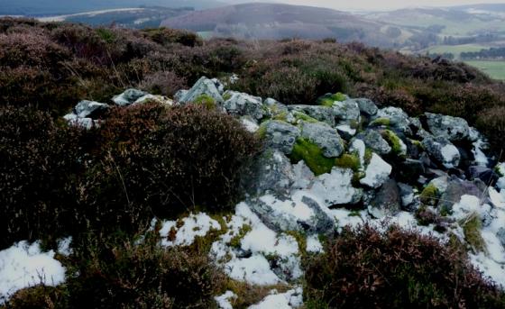
One of the fallen stones, damaged by machine tools (presumably it was eyed-up as a gate or fence post).
The recumbent and flankers (one fallen).
The 4.3m long broken recumbent and the W flanker from inside the circle.
The recumbent and both flankers from outside the circle.
Articles
02/01/2013 – Slowly working my way through the recumbent stone circles. I’ve looked at this one from Tap o’Noth a few times but never visited. Today the weather was good so after we got back to the car from visiting the hillfort I thought we’d give it a go. The circle is in a small copse of trees not far from the road. We parked pretty much south and walked along the edge of a field to get to it. Barbed wire fence blocked our way but with a New Year spring in our step we were soon over and into the wood (if only that was true, we got over eventually though). What a cracking circle this must have been back in the day. Just one stone still standing with a few others lying where they fell. I liked this one very much.
There was no sign of the “discarded cack” on this visit – just the “beautifully tranquil place”
Visited 18 October 2005
(notes in the evening sunshine looking west to Tap O’Noth, 2 July 00)
These Corrstones stand on the hilltop overlooking the foot of the Tap O’Noth. Although the Silbury aspect is decreased by the revealing of the whole mountain, Tap O’Noth still has a powerful presiding feeling here. Corrstones is certainly a near ruin, but, as at Hawk Hill, the positioning is very arresting. A gentle conical hill surrounded on all sides by farmland, this place has become a monster farm dump. These trees around the stones are shelter not only for so much field clearance stone that only a couple of fallen Corrstones are distinguishable but there’s also an assortment of other discarded cack, even an old 1960s-looking car on its side!
Still, the grove, the situation and the view are big enough not to be dominated by it, and a tremendous sense of place affects us, and others too; a small patterned stone had been recently reverentially placed at the recumbent.
Following from the recumbent to the south-western edge of the copse we find that from here six hills in four layers conspire to make a straight-lined horizon! Moving westward round the edge of the trees to face Tap O’Noth, some inquisitive bullocks and the setting sun, the composite horizon is still a straight line but already from this angle it’s stopped being level and now slopes down to the left. Corrstones hill, where the Tap O’Noth starts in the valley below and the south-western horizon is horizontal! What must the ancients have made of *that*?
This is a beautifully tranquil place and truly I could stay here for hours, here in the sunshine being sniffed at by bovines, but it’s our last full day up here and the call across the valley to Cnoc Cailliche is just too strong.
Sites within 20km of Corrstones
-
Mill of Noth
photo 8 description 2 -
Rhynie Standing Stones
photo 8 description 1 -
Rhynie Graveyard
photo 5 description 2 -
Bell Knowe
photo 4 description 1 link 1 -
Barflats (Rhynie)
photo 5 description 2 -
Clatt Bankhead
photo 4 description 1 link 1 -
Clatt Hillhead
photo 2 description 2 link 1 -
Altar Stone, Hillhead
description 2 -
Cairn More
photo 3 description 1 -
Newseat 2
photo 3 description 1 -
Newseat
photo 8 description 1 -
Ord Hill
photo 7 description 1 -
Upper Ord
photo 11 description 2 -
Smallburn
photo 5 forum 2 description 1 -
Wheedlemont
photo 13 description 2 link 1 -
Rumfold
photo 2 description 1 -
Clochmaloo
photo 3 description 2 -
White Hill
photo 4 description 1 link 1 -
Tap o’ Noth
photo 65 description 5 link 3 -
Giant’s Stone
photo 7 description 5 -
Drumel Stone
description 3 -
Leith Hall Policies
photo 8 description 1 -
Brawland
photo 4 description 1 -
The Peirk
photo 5 description 2 link 1 -
The Candy Stone
photo 3 description 2 -
Wheedlemont
photo 10 description 2 link 1 -
Tofthills
photo 5 description 2 link 2 -
Ardlair
photo 28 description 3 link 3 -
Hill Of Old Merdrum
photo 2 description 1 -
Hill of Old Merdrum
photo 2 description 1 -
Whitehillock
photo 5 description 1 -
Finglenny
photo 10 description 1 -
Fallow Cairn
photo 3 description 1 -
Fallow Hill
photo 5 description 1 -
Wardhouse
photo 4 description 1 -
Wormy Hillock
photo 11 description 5 -
The Ringing Stone
photo 3 description 2 link 1 -
Newton Of Wardhouse
photo 6 description 2 -
Lord Arthur’s Hill
photo 10 description 4 -
Newton Of Wardhouse Farm
photo 2 description 1 -
Hill Of New Leslie
photo 3 description 1 link 1 -
Clayshooter Hill
photo 6 description 1 -
Corrie
photo 5 description 4 link 1 -
Knock Saul
photo 5 description 2 -
Braehead
photo 10 description 2 link 2 -
Lulach’s Stone
photo 8 description 3 -
Clova 1
photo 11 description 2 link 1 -
Lenchie
photo 3 description 1 -
Hill Of Christ’s Kirk
photo 10 description 3 link 1 -
Candle Hill
photo 28 description 7 -
Stonehead
photo 25 description 8 link 1 -
Clova 2
photo 16 description 1 link 1 -
Wester Clova
photo 2 description 1 -
Satter Hill
photo 6 description 2 -
Hawk Hill
photo 6 description 3 -
Scotsmill
photo 2 description 3 link 1 -
Dunnydeer Farm
photo 17 description 3 link 1 -
The Good Man’s Fauld
photo 1 description 1 -
Kildrummy Kirk
photo 3 description 1 -
Dunnideer
photo 26 description 5 -
Nether Balfour
description 1 link 1 -
Dunnydeer
photo 5 description 1 -
The Reesk
photo 5 description 1 -
Wantonwells
photo 23 description 3 -
Clashmach
photo 9 description 1 -
Clashmach Hill
photo 8 description 1 -
The Barmkyn
photo 16 description 2 link 1 -
Hill Of Airlie
photo 6 description 1 -
Druidstones
photo 15 forum 1 description 5 -
Inschfield
photo 9 description 3 -
Daugh Of Corinacy
photo 4 description 1 -
Old Keig
photo 43 description 3 link 2 -
Allrick Hill
photo 7 description 1 -
Crookmore
description 1 link 1 -
Druidsfield
photo 16 description 1 -
Auld Kirk Of Alford
photo 9 description 1 link 1 -
Bar Hill
photo 7 description 2 -
Damil
photo 4 description 1 -
Gallow Hill
photo 8 description 1 -
Mill Of Brux
photo 3 description 1 -
Cairnhead Wood
photo 5 description 1 -
Huntly
photo 5 forum 1 description 4 -
Colpy
description 1 link 1 -
Garran Burn
photo 9 description 2 -
Cothiemuir Wood
photo 61 description 14 link 3 -
Burryhillock
photo 4 description 1 -
Stonyfield
photo 10 description 2 link 1 -
Battle Hill
photo 6 description 2 -
Corrie Cairn, Glenkindie
photo 4 description 1 -
Hill of Backside
photo 8 description 2 -
Craig Dorney
photo 26 description 5 link 1 -
Cairncoullie
photo 3 description 1 -
Baldyvin
photo 3 description 1 -
Cairn Fichlie
photo 4 description 1 -
Cairn Ley
photo 4 description 1 link 1 -
Fallow Hill
photo 4 description 1 -
Nether Dumeath
photo 10 description 1 link 2 -
Aswanley Wood
photo 8 description 1 -
The Lang Stane
photo 4 description 2 -
Culsalmond
photo 1 description 2 link 1 -
Tillymuick
photo 6 description 1 link 1 -
Pitcandlich
photo 5 description 1 -
Pitcandlich
photo 2 description 1 -
Cobrigdale Hill
photo 4 description 1 -
South Lediken
photo 3 description 1 -
Elphhillock
photo 3 description 1 -
Cairnborrow Lodge
photo 4 forum 1 description 2 -
Newtongarry Hill
photo 4 description 2 link 1 -
Backtack
photo 4 description 1 -
Hatton of Ardoyne
photo 14 description 3 -
High Wood
photo 4 description 1 -
Brownhills 2 (near Ardoyne)
photo 2 description 1 -
Mellenside
photo 7 description 1 -
Roddantree
photo 10 description 2 -
Monael 2
photo 3 description 1 -
Brownhills (near Ardoyne)
photo 4 description 1 -
Monael 3
photo 2 description 1 -
Monael 1
photo 3 description 1 -
Monael Hill
photo 8 description 3 -
Hill Of Backtack
photo 7 description 2 -
Newton Hill
photo 4 description 1 -
Both Hill
photo 9 description 1 -
Cairnborrow
photo 2 description 2 link 1 -
Glenkindie
photo 1 description 2 -
North Strone
photo 14 description 3 -
Carnaveron
photo 3 description 1 -
Both Hill 2
photo 7 description 1 -
Newton Stone
photo 10 description 2 -
Westerton Of Petmathen
photo 8 description 2 link 1 -
Pitmachie
photo 3 description 1 -
Dalrossach North
photo 8 description 1 -
Dalrossach
photo 8 description 1 -
Mummer’s Reive
photo 4 description 1 link 1 -
Glenkindie House
photo 7 description 1 link 1 -
Berryhill
photo 5 description 1 -
Glenkindie 'Dun'
photo 8 description 1 -
Bennachie
photo 33 description 9 link 1 -
Little Oxen Craig
photo 5 description 1 -
Berryhill
photo 8 description 1 -
Oxen Craig
photo 29 description 3 -
Oxen Craig Peak 2
photo 1 description 1 -
Oxen Craig South Western Descent
photo 15 description 1 -
Socket Stone Rock
photo 3 description 1 -
Kirk Wood (Leochel)
photo 6 description 1 -
Trancie Hill
photo 6 description 1 link 1 -
Glenshee 1
photo 4 description 1 link 1 -
Hill Of Milleath
photo 6 description 1 -
Glenshee 2
photo 4 description 1 link 1 -
Westfolds
photo 6 description 1 -
Black Hill
photo 4 description 1 -
Creag An Sgor
photo 13 description 1 -
Glenshee 3
photo 4 description 1 -
Leochel-Cushnie
photo 4 description 1 -
Norry Hill
photo 5 description 1 -
Gowk Stane, Oyne
photo 7 forum 1 description 1 -
Findlatree
photo 4 description 1 -
Upper Culquoich
photo 8 description 1 -
Drumfours
photo 3 description 2 link 2 -
Old Rayne
photo 28 description 5 link 2 -
Upper Culquoich 2
photo 10 description 1 -
South Brideswell 2
photo 3 description 1 link 1 -
Kirkton Of Oyne
photo 8 description 1 -
South Brideswell
photo 7 description 1 link 1 -
Cardlunchart Hill
photo 4 description 1 -
Culag Hill
photo 4 description 1 -
Fullerton/
Bogcoup photo 2 description 1 -
Luath’s Stone
photo 18 description 5 -
Mither Tap
photo 64 description 7 link 2 -
Cairnbeg
photo 6 description 1 -
Auchaber
photo 4 description 1 -
Craigievar
photo 7 description 3 link 1 -
Ben Newe
photo 19 description 3 -
Buchaam
photo 5 description 1 link 1 -
Deskry Hill
photo 2 description 1 -
Mill of Carden
photo 9 description 1 link 1 -
Pressendye
photo 16 description 3 link 1 -
Gallows Hill (Woodside)
photo 4 description 1 -
Arn Hill
photo 12 description 2 link 1 -
Frendraught
photo 8 description 4 link 1 -
Pittodrie Quarry
photo 4 description 1 -
Newlands Of Oyne
description 1 link 1 -
Hill Of Janetstown
photo 4 description 1 -
Maiden Castle (Pittrodie)
photo 17 description 2 link 1 -
Gallows Hill
photo 4 description 1 -
Deskry
photo 3 description 1 -
Bowman Stone
photo 3 description 1 -
Bowman Stone 2
photo 3 description 1 -
Cairnhill
photo 2 -
Holmhead
photo 16 forum 1 description 1 -
North Rayne
photo 3 description 1 -
Hill Of Rothmaise
photo 5 description 1 link 1 -
Drumquhil Burn
photo 3 description 1 -
Logie Newton
photo 6 description 2 -
Gouk Stane, Bennachie
photo 2 description 1 link 2 -
Auchindoun
photo 19 description 3 link 1 -
The Law
photo 11 description 3 -
Cairnton
photo 5 description 3 link 2 -
Whitehills
photo 44 description 5 link 1 -
Hill Of Janetstown 2/
3 photo 5 description 1 -
Pittenderich
photo 14 description 1 -
Hill Of Knockollochie
photo 4 description 1 -
Millstone Hill East
photo 7 description 2 link 1 -
Avochie South 1
photo 7 description 1 -
Hill Of Avochie
photo 7 description 1 -
Avochie South 2
photo 3 description 1 -
Raich
photo 20 forum 1 description 2 -
Avochie South 3
photo 5 description 1 -
Newe
photo 2 description 1 link 1 -
Avochie
photo 3 description 1 -
The Tow Stone
photo 2 description 3 -
Millstone Hill East 2
photo 6 description 1 link 1