The “propped” stone.
Image credit: A. Brookes (22.9.2017)
The “propped” stone.

Another view of the “propped” stone, showing it to have a nicely tapering shape.

On the western slope of the valley, a little above from the main sarsen drift in the bottom, I came across this isolated “propped” stone. It almost looks as though it could have been standing at one time.


Piggle Dene from the south.


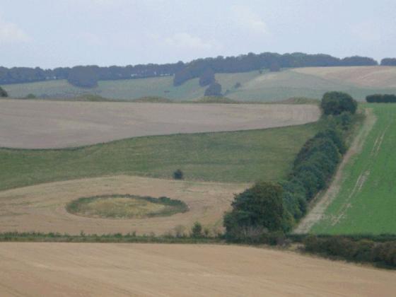
Piggledene valley

Stones and trees


In 1644, diarist Richard Symonds described Fyfield as ‘a place so full of grey pibble stone of great bignes as is not usually seen ... they lie so thick as you may go upon them all the way. They call that place the Grey-weathers because afar off they look like a flock of Sheepe.‘

In 1644, diarist Richard Symonds described Fyfield as ‘a place so full of grey pibble stone of great bignes as is not usually seen ... they lie so thick as you may go upon them all the way. They call that place the Grey-weathers because afar off they look like a flock of Sheepe.‘


In consequence of a recent change of ownership.. there is every probability that the work of breaking up the Sarsens will be undertaken on a greatly extended scale.. the Grey Wethers in Pickle Dean and Lockeridge Dean would be the first to go, owing to their situation adjacent to high roads – while for the same reason their disappearance would be a greater loss to the public than the disappearance of those in more remote parts of the Downs.

Piggle Dene stones were bought by the National Trust in 1907.
In 1644, diarist Richard Symonds described Fyfield as ‘a place so full of grey pibble stone of great bignes as is not usually seen ... they lie so thick as you may go upon them all the way. They call that place the Grey-weathers because afar off they look like a flock of Sheepe.‘
Inspired by the arrival yesterday of the book “An English Countryside Explored – The Land of Lettice Sweetapple” (By Peter Fowler and Ian Blackwell) I set off this morning to do a circular walk through Piggledene over to Fyfield Down (now a designated nature reserve) and up to Devil’s Den.
As Rhiannon pointed out in her fieldnotes, the A4 is fast and dangerous at the point of entry into Piggledene. The friend I walked with today left their car in Lockeridge Road at the small village of Fyfield (SU 145685) and we walked along a footpath for about a quarter of a mile before crossing over the A4.
My first visit to Piggledene was several years ago when I was still quite new to the area; subsequently I always thought without transport or a thorough knowledge of the landscape it would be difficult to access. I have since discovered the Wilts & Dorset bus route 96 (Swindon to Pewsey) also stops on the A4 at Fyfield.
As we climbed over the stile today, it was clear nothing had changed – no fox this time as there was on my first visit though still the strong sense of time standing still. A valley of greywethers with curious sheep in the morning sunshine; venerable old hawthorns and a clear trodden path to follow around to Fyfield Down. The obvious path is on higher ground above the stony valley, it was an incredibly peaceful walk along to Devil’s Den. The knowledge that Devil’s Den dolmen never existed in its present form until the early part of the 20th century (being on the remains of a genuine neolithic long barrow) does not detract from its stony charm.
This walk with clear directions and a map is available as a Ramblers publication “12 Walks Around Marlborough” either directly or from the Swindon Tourist Information Centre.
The A4 is a race track here and there is nowhere safe to park – I left the car up the road at Fyfield (a bus between Calne and Marlborough would stop here too). There is a footpath all the way back, though it’s a bit terrifying with the lorries flying past, and then you still have to make a mad dash across the road. But then it’s a quick hop over the stile, you’re in, and it’s an oasis of calm.
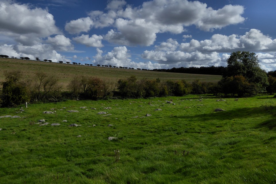
Fittingly there were lots of sheep mixed in with the stoney ‘greywethers’. But they weren’t impressed with my intrusion and quickly set off, bleating madly.
I had had some daft idea to walk from here to the stones at Fyfield Down, but soon realised that there was more than enough to occupy me here (and also it was way too far for me today). If you can’t get to Fyfield Down, but want to see the sarsens in somewhere that feels a little bit more remote than Lockeridge Dene, then Piggle Dene would be the place.
Some of the stones are little, and some are really huge. Lots of them have extraordinary shapes – sticky up bits, curvy bits, dippy bits. Most of them are smothered in lichens of all colours, many of which are rare (contributing to the SSSI status of the site).
Some of the stones have been split – I found a few where I could see where someone had attacked them, but others to the untrained eye looked unchiselled. I wish I knew more about the subject.
I stayed here for a couple of hours and didn’t see a single person – though I was the star attraction for many many pairs of sheepy eyes.
I couldn’t help feeling that the stones were like a river in their dry valley – a valley that feeds down into the Kennet. I also had this strange feeling that they were bursting out of the ground – that the ground was producing them. It’s true I wanted to lay my head on them and see what I dreamt. More practically, because they’re in the bottom of the valley, you can examine just about all of them without doing any climbing up and down slopes. You just have to watch out for the nettles and the sheep poo.