|
|
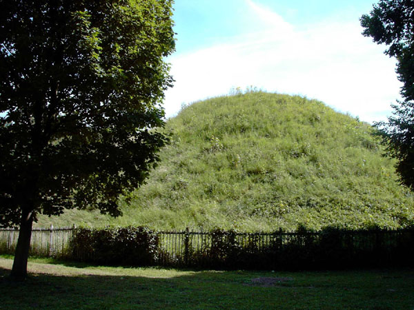
This Iron Age burial mound dates from around 10 BC and may have contained the body of Addedomaros of the Trinovantes. The grave goods give an insight into the extent of Romanisation of the local aristocracy more than 50 years before the Claudian invasion. There were 17 wine jars, chain mail and a coin of Augustus struck in 17 BC which had been mounted as a portrait medallion. Other items included a statuette of Cupid and figurines of bull, boar and griffin. Trade with Roman Gaul was already influencing fashions among the rich.
|

|
|
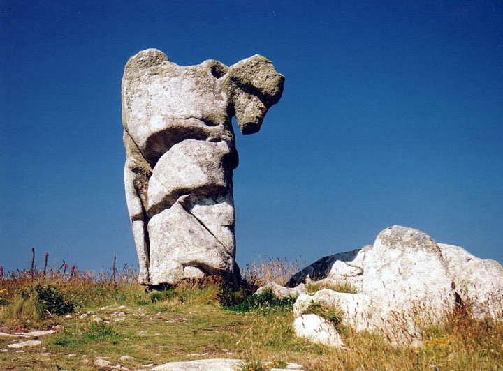
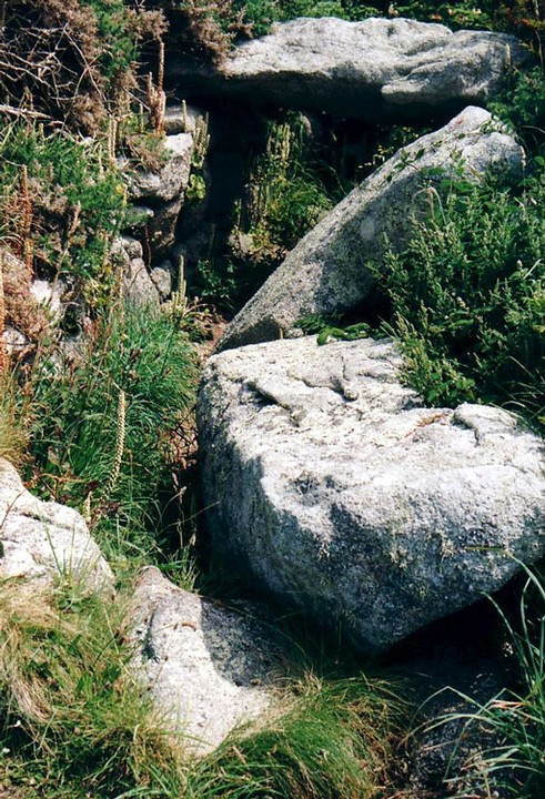
The Nag's Head is a natural rock sculpture on Wingletang Down. (see also Wingletang Cairn Cemetry). This area is fully exposed to the Atlantic and the hard granite has been cut into fantastic shapes by wind and water. The Cornish antiquarian, William Borlase, saw the weird shapes, cup marks and hollows as being "Druidic". All are natural and Borlase's "Druids' chalices and bowls" are not cup and ring marks. This should signal caution to modern antiquarians when looking at similar depressions elsewhere in Britain.
|
|
Forty-three cairns have been found in the heather of this exposed moorland. Some are retained by kerbs of granite bouders. Field walls to the north-east connect some of the cairns.
|

|

|

|
|
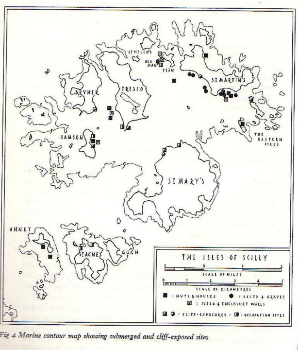
The Isles of Scilly were formerly one island and many archaeological sites now lie beneath the sea. Excavations have only been possible at the lowest tides and there are certain to be more sites permanently under water (there are more than 500 sites above the high water line). Normally submerged sites that have been excavated include: 10 hut circles, 7 cists and graves, 4 field wall enclosures and 12 other occupational sites and partial exposures in eroding cliffs. See marine contour map.
|
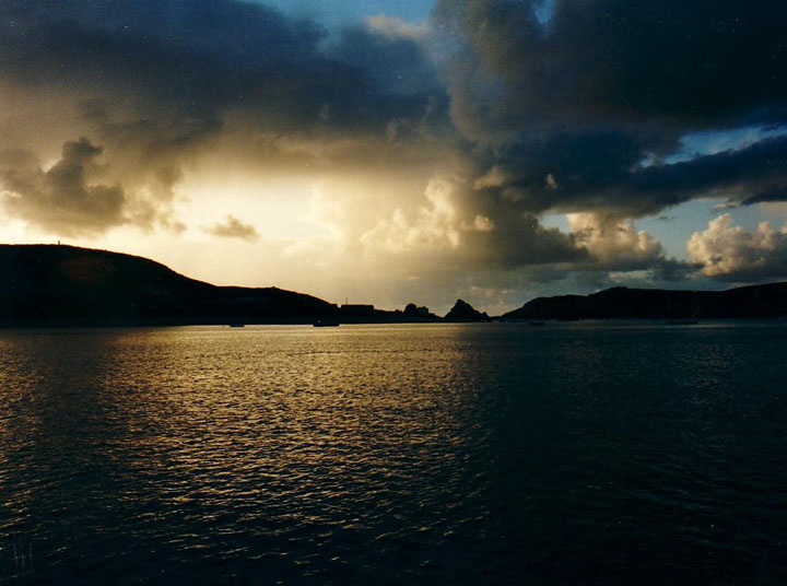
There is a persistent legend that the Lost Land of Lyonesse once stretched from Scilly to Land's End. This realm was said to be the home of Tristan who went on to woo Iseult etc. The capital of Lyonesse was the City of Lions and was built around the hill which is now the treacherous reef of the Seven Stones. One night a huge wave (tsunami?) swept over Lyonesse and only one man escaped. This was Trevilian who galloped ahead of the flood on a white horse and survived to found the Cornish Trevelyan family.
There are many field walls and hut circles to be seen at the lowest tide when it is possible to walk from Samson to Bryher and from Bryher to Tresco. In Roman times, all of the islands were one (variously referred to as Sylina Insula and Siluram Insulam - singular, not plural ie The Scilly Island) with the exception of St Agnes and Annet. This has given rise to the legend that Scilly is a remnant of the Lost Land of Lyonesse. The legend further relates that the rest of Lyonesse lies beneath the sea between Scilly and Lands End and over towards the Lizard. There really is a submerged forest in Mount's Bay and fishermen have reported seeing the tops of houses near the Longships lighthouse. The legend is further related in Cheryl Straffon's excellent guide to Ancient Sites on the Isles of Scilly (Meyn Mamvro). Whatever else may lie beneath the waves, there are the remains of hundreds of shipwrecks awaiting the marine archaeolgist.
|
|
The area around Tregarthen Hill contains 78 mound cairns, some with retaining kerbs. 5 entrance graves are on the south side, 4 being in a line fron NE to SW.
|
The island of Nornour (SV 944147) is less than four acres in size and is joined to Great Ganilly at low tide. Yet the excavations of the late 60's and early '70's revealed the remains of a major settlement which was occupied from the middle of the Bronze Age to the Romano-British Iron Age. Nornour clearly reveals the effects of rising sea levels, as this tiny scrap of land could never have supported such a thriving community. Many more houses are doubtless lost beneath the sea and right up until Tudor times, the islands of the Scillies were one island - known then as Ennor. Did the inundation of Ennor give rise to the legend of the Lost Land of Lyonesse? (see Scilly-Lyonesse)
On Nornour, there are eleven circular stone houses each having a main room with a smaller chamber alongside. Later, in the Iron Age, the site became a shrine to the goddess Silina and a number of goddess figurines have been found. The island also housed a workshop for brooches and other items. Over 3000 brooches, 35 bronze rings, 11 bracelets, 24 glass beads and 84 Roman coins have been excavated. The photographs were taken in 1970, soon after wind and waves exposed the site that was previously covered by sand. Since then, the sea has subsequently damaged much of the site. The settlement is still visible, but access is discouraged. All of the finds are displayed in the museum on St Mary's.
|
|
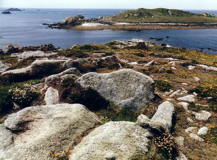
This tiny scrap of land contains two chambered cairns, five cairns, a pentagonal stone built hut and two cup marked rocks.
|

|
|
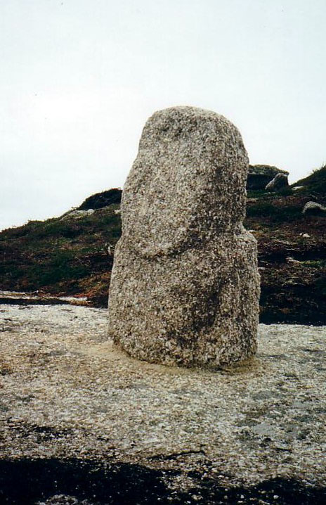
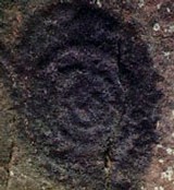
This head was found early last century and then lost. Rediscovered in 1989, it is now cemented to the rock. Often hidden in the bracken and heather, it can be found by searching near the path to the very conspicuous red and white daymark. It seems to be the head of a lost statue and bears a resemblance to those found in the Channel Islands and Brittany. Prehistoric field system, an entrance grave and cairns nearby.
|

|

|

|
|
A ruined entrance grave crowns the summit of Gweal Hill with two cairns nearby. One cairn is surrounded by five kerbstones.
|
|
This massive cairn site consists of 134 cairns most of which are small circular platforms linked by lines of stones forming rectilinear alignments.
|
|
Across the neck of the promontory is a low stone rampart of the cliff fort.
|
|
A line of at least four cairns along the crest of the hill.
|
|
Accessible on foot from St Martins at low tide. At least five cairns and an entrance grave
|
|
A ruined entrance grave incorporating a massive outcrop of natural rock. 50ft in diameter with a chamber 12ft in length. Glass, amber and faience beads found in 1912.
|
|
11 Iron Age cists in this cemetry with another 5 nearby. Bronze brooches found
|
|
An Iron Age cliff fort with four ramps and ditches. Finds include pottery dated to 300 bce.
|
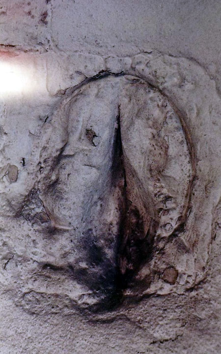
Often blind to things on our own doorstep, I revisited our local mystery with a view to seeking opinions from TMA. The Devil's Hoofprint is carved in clunch (a soft chalky rock) and located in the south porch of St Michael's, Bishops Stortford. What is it?
Like other churches dedicated to the warrior saint, St Michael's is a hilltop church built on a pagan site. The church guide is coy about the carving and describes it as "possibly pagan". Other views maintain that it is the result of someone sharpening their arrows in the porch! Now, I am not one to see vulvas in every megalithic nook and cranny, but this one look pretty explicit to me. Given the church's pagan association, could it be a fertility symbol? Ignored and unnoticed - I'd love to bring it out of the closet and would welcome your thoughts.
|

|
|
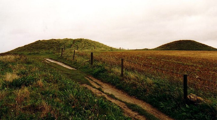
The twin barrows of Trevelgue were where it all began for me. I've been tump hunting ever since.
|

|

|

|

|
|
An impressive hillfort with complex defences second only to Maiden Castle. Occupied from the 6th century to the Roman occupation. I have only seen it from the A5, but its at the top of my "must visits". Surprised the site is not already covered on TMA.
|
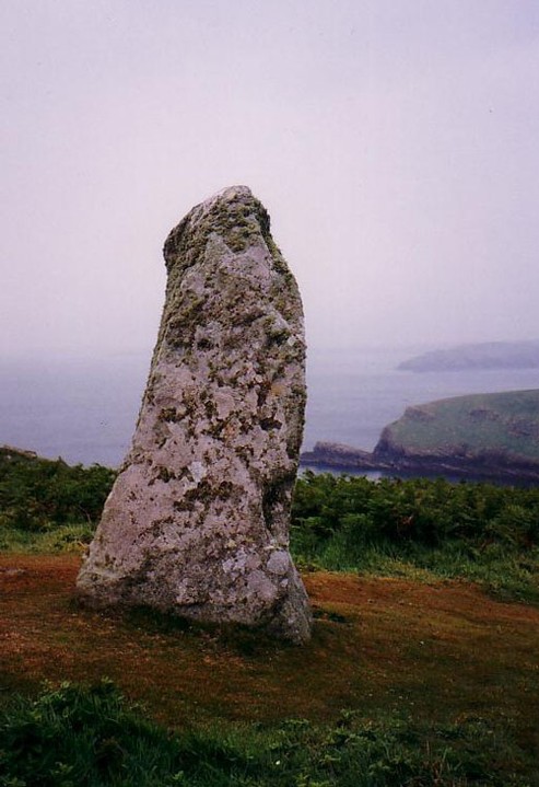
This stone is not on the map so may be modern, but there are no less than four early settlements on this tiny island with numerous hut circles and a promontory fort. RSPB reserve with access by launch from Martins Haven.
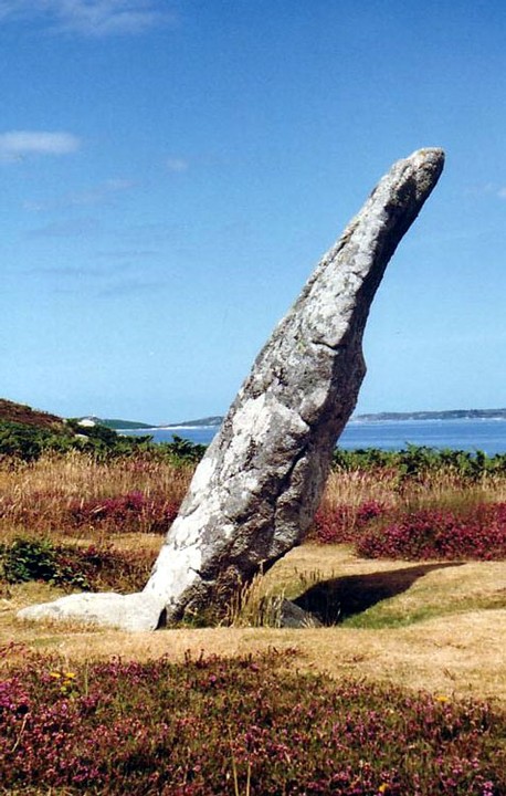
I cannot quite remember the exact location as I photographed it while running from a ferocious thunderstorm. Some of the early settlements may be monastic. Local name for this stone is "John's" stone. Perhaps it is just a cattle scratchpost.
|

|
Close by this chamber are the ruined cottages of the last people to live on Samson. The island was abandoned in the 19th century when almost all of the men were drowned while attempting to rescue people from a shipwreck.
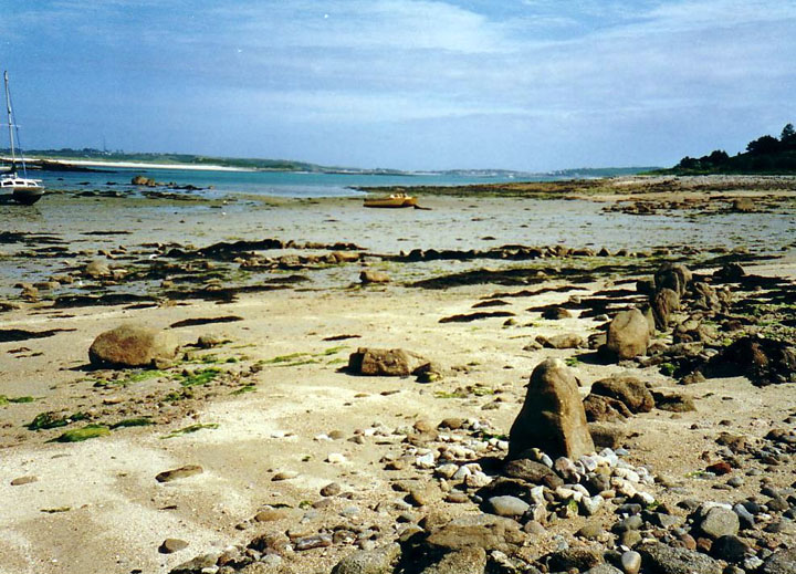
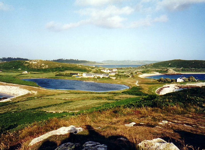
In the background, can be seen field walls on the sands which are only uncovered at low tide. There are many field walls and hut circles to be seen at the lowest tide when it is posible to walk from Samson to Bryher and from Bryher to Tresco. (See entry for Lyonesse)
|
|
There are four entrance graves on the rocky summit of South Hill with a dozen or more on the North Hill. The two hills of Samson ar very similar to the Paps of Jura in Scotland and the Paps of Anu in Ireland.
|

|

|

|

|

|
|
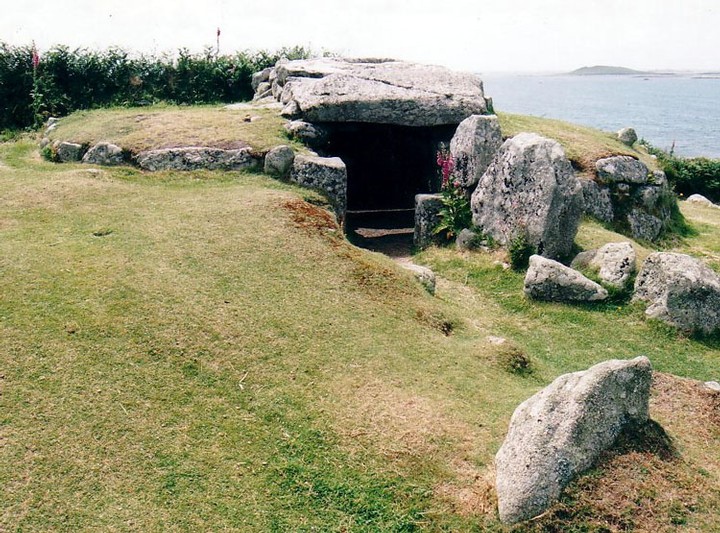
This excellent entrance grave is in a mound 26ft in diameter. The entrance passage is no less than 18ft and is roofed with five capstones. Well signposted on the circular footpath around St Mary's and impossible to miss.
|

|
|
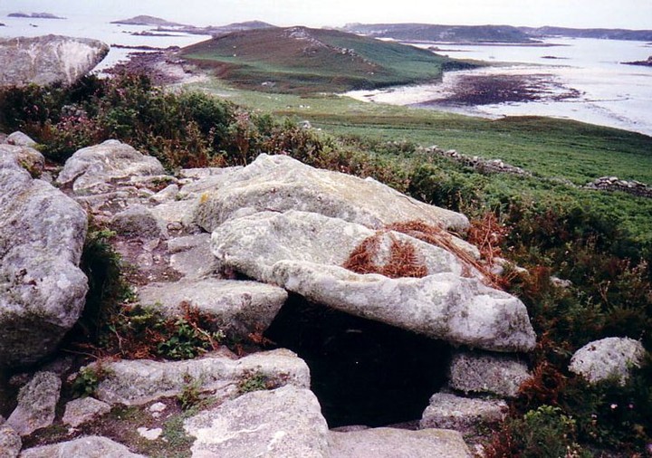
An angled passage of about 16ft leads to the chamber. Two of the six capstones have collapsed leaving the site in a delightfully unrestored state. Excavations revealed a male skeleton, ashes and twelve inverted urns.
|
| |