|
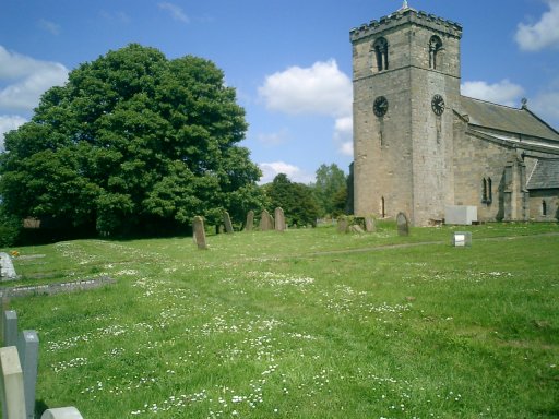
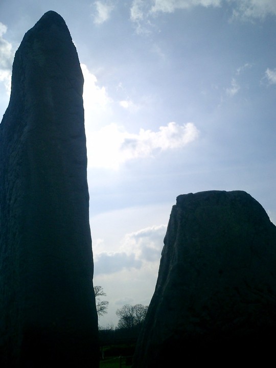
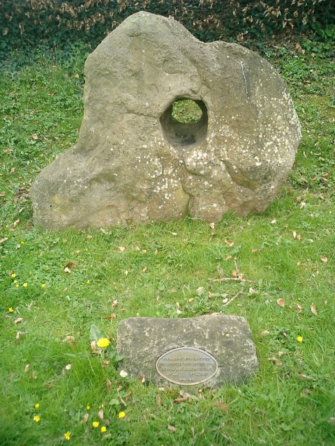
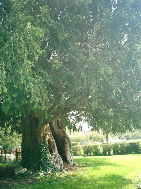
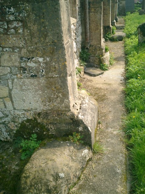
The Rudston Monolith stands proud in the yard of the local church. A truly massive and awe-inspiring feature it stands 26 feet above ground with a lot more below. The monolith from the road gives the impression that it is much smaller, indeed my companion said to me at the time that it only looked the same size as the stones of Callanish. As soon as you get close though, it really does hit you. It is gargantuan, enormous, huge, this is something else, a lone monolith standing proud. How many odds must it have defied to stay standing in a place which has clearly been Christianised. I would wager that the only reason it did survive is because of its size. Indeed at one point in its history a cross had been placed upon its top. Not there any more I hasten to add! Now its crown is adorned by a metal helmet to help prevent erosion.
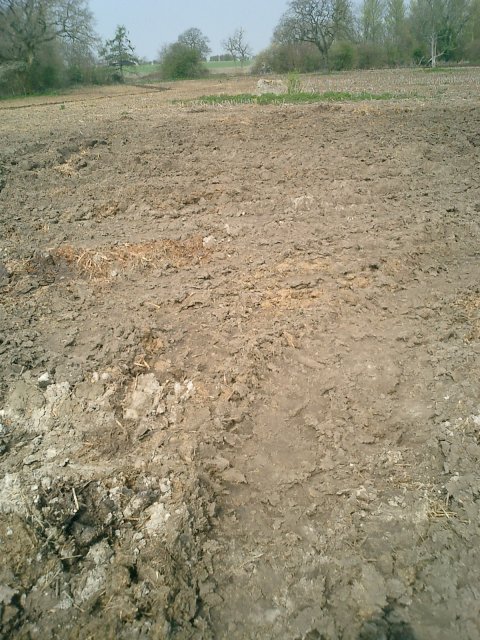
I had heard a rumour that the site was formally surrounded by a stone circle. I do not feel that this is folly! Of all the places that a stone circle should have stood this is surely it although there are no real remains of it left. The outer wall church yard is made up of red brick so no clues there. No sarsens remain in the walls to tell us their story. But the fact that a church has been built slap bang next to a clear Neolithic structure should be clue enough. Also part of the boundary walls look as though they could have once been circular. If that isn't enough there are earthworks in the grounds of the churchyard which go round in a circular motion. Maybe I'm reading too much into things but its all very coincidental. Plus it also appears that the church and the churchyard have been built on a mound with clear earthworks visible - further signs?
|
We followed this with a trip to its neighbour, Sharpe Howe, again Julian marks this on his map of the region in the TMA. Our initial disappointment of not being able to see Spell Howe immediately had been overcome when we actually did find it. How we hoped that Sharpe Howe would continue our jubilation.
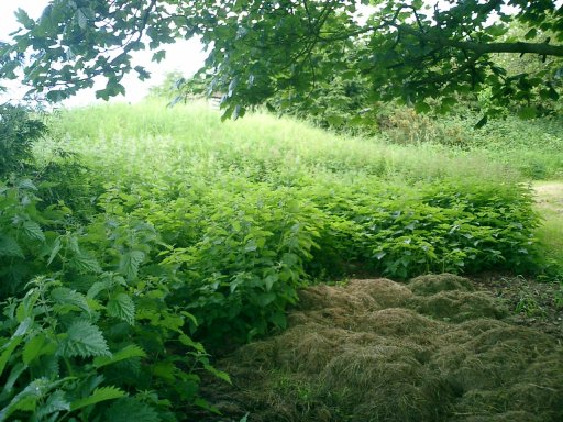
Unfortunately the ancient Neolithic monument of sharpe Howe is now a farmers dumping ground with sacks of rubbish, bails of hay and farm equipment strewn around it. The mound looks sad and more akin to a rubbish pile than the once proud hill that it probably once was.
|
|
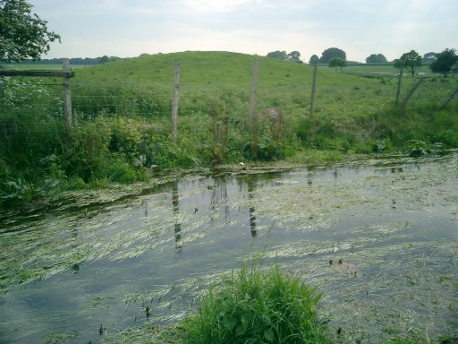
We returned inland and back through the Dyke, again looking mightily impressive from the road. This time the plan was to visit Spell Howe, a tumulus mentioned in the TMA but not covered on this website. I could not understand why this was but as soon as I found it I understood. The tumulus of Spell Howe is located within the grounds of a farmers garden. Not just any farm but a fort knox type place with beware of the dog signs, intercom and infra-red gate opening mechanisms. I had initially been confused by what my OS map was telling me and I walked all around the field at the side of the house to see if I could catch a glimpse of the mound. I was wrong, the mound is actually very easy to see, its just beyond the gate and is bang next to the roadside. We tried buzzing the intercom for a better look but nobody was home so the pictures that we took were from the outside. Again the placing is obvious, on the brow of a hill overlooking a valley, Spell Howe is at the top most point and could probably have been seen for miles.
|
 
|

|
 
|

|
So the urge had finally caught up with me! A brief tour of the country had taken in a brief glimpse of Silbury Hill and the shortest stop on record for visit to Avebury. How impressive both these sites are and how full of history the area must be. I felt shame that I did not know much about this area despite my professed interest in Neolithic monuments. I have a copy of TMA at home and I had glanced at the pages concerning this area but had never had the drive to get up and visit it for any sustained amount of time. This was not a good situation and had to come to an end!
Returning home to Yorkshire after my brief UK tour I made plans to return within the next few days. Gourging myself on knowledge from TMA and more helpfully from fieldnotes made by members of this site, I drew up an itinerary and set off to the Marlborough Downs, well, almost…
I had convinced my father to come along, he had a couple of days off work and I was on holiday from mine. We booked a youth hostel in Stow on the Wold, an attractive village in the Cotswolds and not a million miles away from the Rollright Stones. What a good place to start. True they are not part of the Avebury complex but they are well known and they would provide the perfect first stop off point. Upon reaching said monument I was appalled by what I saw…
The stones had been daubed with yellow paint, each and every one, an April fools gag by all accounts. A notice on the board near to the stones said that the cost of removing the paint would run to a minimum of £30,000. Why so high? Well the paint has seriously damaged the lichen growing on the stones. The lichen, which is said to be 800 years old, is one of the oldest recorded colonies in Britain. A £1000 reward has been posted to anyone who has information leading to the capture of the mindless fools who did this and a local coven of white witches have cursed the perpetrators for their actions.
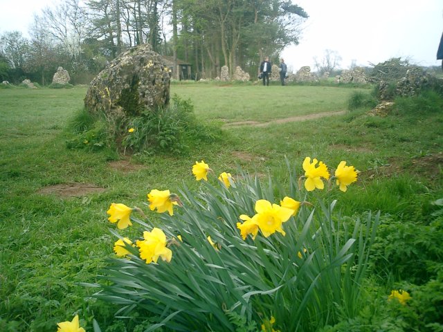
As fortune would have it, the other monuments in the complex had not been touched by the paint smearing vandals. The King stone looked impressive in the afternoon sun but what a shame that it was caged behind iron bars. The stone is said to be that of a king in days gone by, a witch promised him Britain if he could see the nearby town of Long Compton. He couldn't see it because his line of site was impaired by a nearby hill. The poor guy was turned to stone as his reward and his men became the rollrights. A bit harsh I thought, especially now that this area seems to be a favoured picnic spot amongst young couples. Mind you, who could blame them, the view down from the stone to the valley below is wonderful.
The other part of the complex are the Whispering Knights located in the field opposite from the Kings stone and at the same side of the road but further down from the Rollrights. These poor guys seemed to get ignored by the many tourists who came to look at the circle whilst we were there. I'm not sure that a lot of the people visiting actually knew that they were there quietly nestling at the far end of the field. I can't quite understand this apathy as it really isn't a long walk to them.
We arrived in Stow on the Wold only the check in and to go straight back out. I had spotted a couple of alleged monuments on the 'Cotswolds Tourist Map' recently purchased from the local information centre. This whole area is deep in old roman territory and there are plenty of links to that era, from villas to the road on which we travelled south the monuments spotted on our map, the Fosse Way.
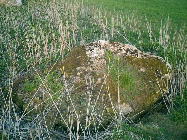
Our first destination of the ever darkening evening was to see something called the Hangmans stone! Very macabre we anticipated it being a most impressive monument, alas what we got couldn't have been further from the truth. If the truth is known the monument was so unimpressive I can't even be sure whether we found it or not. Although I am convinced that we did find two sarsens, of sorts, however these were most certinaly not in their original positions. They had been the victims of field clearance and now made up a wall which penned in a number of growing saplings.
We had a job to find these stones. The map directed us to the village of Northleach, we took the road to Oxpens Farm and it was just after the turn off for there that we parked. Having searched around the area for the Hangmans stone, it was concluded that the only sarsens of note that this could be were they stones making up this wall. I would very much like to be proved wrong some day by antiquarians with much better stone finding abilities than me but for now it appears that these make up Hangmans stone.
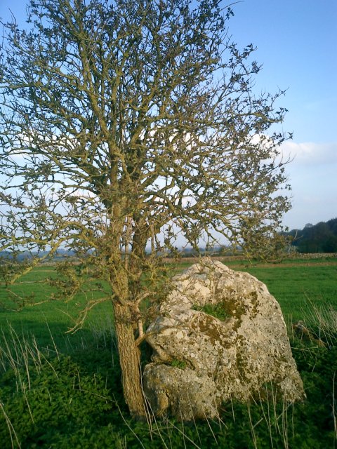
Following on from this disappointment we headed towards the next alleged monument, the Hoar Stone. This was situated off the A417 towards Cirencester, taking the turnoff towards Duntisbourne Leer. The 'stone' is situated to the left in the middle of a field before the first turnoff to your left once through the village. Of course its not just a stone but a long barrow, and it is noticeable. The capstone is still there along with another dominant stone which now has a tree growing next to it. After the debacle of the Hangmans stone, this was a very pleasing result!!!
We then headed to the village of Bisley, not a million miles away, but, because of the way the roads ran, it may have well been. As the crow flies the distance between the Giants Stone near to Bisley and the Hoar stone was not far at all but the fact that it took 40 minutes to get there testifys to the difficulty of navigating the roads in this part of the world.
The Giants stone is allegedly located on the road out of Bisley towards Battlescombe. This road ends and there the stone should be on the right. It was a case of déjà vu because despite a thorough sweep of the area I could not find it for love nor money. I did find however a number of inquisitive sheep and a road that should have ended but didn't which added to my confusion. Next time I shall arm myself with an OS map and use the visitors map for reference only.
We returned via the viewpoint at Barrow Wake near Gloucester and bedded down for the night, in, as it customary in youth hostels, a dormitory full of men!!!
I awoke of 5 to the sound of rumbling, I attempted to get back to sleep but could not. What was this noise? Could it be my stomach? No I had eaten before I retired! Could it be an earthquake? Don't be silly we don't get earthquakes here, not severe ones anyway! Could it be the guy in the bunk opposite snoring his head off and preventing me from a good nights kip? Of course it was!!!
Actually although I was bitter at the time, the gentleman and his nasal orchestra did me a favour by not allowing me back to sleep. For without this disruption I would not have gotten up, and if I had not have got up, I would not have set off in the early hours to the Uffington White Horse.
The roads were clear and dawn was beginning to break as we left the hostel. We wound our way through the many picture postcard villages of the area and ended up at the White Horse for 7 in the morning. Not another soul was around, it was slighty damp and dreary but this mattered not one jot as the peace was serene. With great forethought we had prepared a flask with the intention of enjoying a cup of tea at the top, there our plan was to drink it and soak up the wonderful views of the valley known as the Manger below.
Legend abounds this area, the favourite of mine being that the horse is actually a representation of the Dragon slain by St. George. The place of said slaying was upon the nearby Dragon Hill. This seemingly unnaturally shaped hill boasts a large chalk patch upon its summit on which nothing will grow. This patch is said to be the place where the Dragons blood fell and hence will remain forever barren.
Further up from the White Horse towards the Ridgeway is Uffington Castle, an iron age hill fort upon which evidence of great wooden structures were found, as well as an iron age coin. People residing in this place chose a good vantage point, it was possible to see for miles even on a damp overcast days such as this.
The next point of call when in this area has to be Waylands Smithy! We joined the Ridgeway having crossed over the castle ramparts and headed west to walk the one and a half miles towards it. The walk dragged a bit. The Ridgeway in this section is not particularly exciting and therefore seems longer than it is. At one point we thought we'd taken a wrong turn and had to ask a jogger for confirmation of where the Smithy was. Sure enough though it was there sitting within a copse in the middle of a field. The Smithy was also looking surprisingly well maintained for its age. I wondered aloud if this was because of its proximity to the White Horse.
Excavations in 1919 revealed the skeletons of 8 adults and 1 child within the two main chambers and further excavations in 1962 revealed 14 more. The place gets its name from the blacksmith who lived there. It was said that if you left your horse tethered along with some coins on the stone overnight, then the horse would be found shod come morning.
Waylands Smithy is of course not really a Smithy but a long barrow and is believed to date from around 3400BCE. From within its chambers we poured another cup of tea and decided upon which spot would be easiest to get to next…
Now Swindon is not the sort of town you would normally associate with the Neolithic, true its proximity to some of the great sites is enviable but Swindon is very much a sprawling 'new town'. It therefore came as a great surprise to see a stone circle marked on the OS map just south of the place between Coate and Coate Country Park at 183.824.
The circle is very easy to miss for there is nothing on the site to say what it is and the stones are unspectacular at best. We drove straight past and headed towards the huge ringroad at the end of the lane which was of course far too far. On our return we spotted the stones laying in an ark in the farmers field opposite the first barn we came to. Five stones were all that I could see but I dare say it would have been fairly sizeable. From the remaining stones you can indeed get a good idea of its size. A brief glance over towards the farm buildings revealed nothing that could have been the second half of the circle but condsidering the building work going on in that area this was not suprising.
Time was now stretching on and we decided to try and get a bite to eat. Our next destination was to be the hill fort at Barbury Castle, an area which is now a country park. Upon arriving our delight was assured by the presence of a café which sold full English breakfasts. We were not the only people there, the area seemed to be popular with dog walkers and families.
The area has been settled for many years probably due to its dominant position overlooked everything it surveys. Bronze age disc barrows have been discovered at the site as well as later Iron age burials. Legend has it also that the site was the scene of a great battle between the Saxons and the celts in around 550CE. A battle, which, may have gone a long way to the establishment of the kingdom of Wessex.
From the castle we set off towards Winterbourne Bassett where we had heard there was a stone circle. Again using the fieldnotes taken from this site (very helpful thank you) we found the place without any difficulty. Marking the site is an outlying stone at the junction of the road, opposite, over a style in the field the two nearest stones of the circle can be seen. Upon further inspection I found four more. Although the site has probably suffered damage in years past I was able to gain a sense of how it could have looked. There are three outlying stones which form a triangle around the four inner stones. The four inner stones are positioned in such a way that it would be feasible to assume that at some point there would have been a fifth which would have made up the circle.
Afterward we decided to head toward the white horse figure carved onto the nearby hackpen hill which overlooks this area. As we drove toward it at OS ref 118.757 in the field to our left we saw what appeared to be a standing stone. There was no reference to it anywhere so far as I could see, but it was there, approximately 50 yards from the road. I have posted it on this site to see what everyone else thinks. The horse in the background certinaly gave it a good backdrop although that is anything but Neolithic.
One place that had intrigued me since reading about it in the TMA was that of Marlborough Mount, alleged to be a close relative of Silbury Hill yet laying neglected in the grounds of a private school. The mound from which the town takes its name is indeed seemingly forgotten about by the locals. There is no plaque, the mound is overgrown and untidy and on top is a horrendous construction which I believe is a water tank.
The setting however within Marlborough college promises much. Although you wouldn't expect to walk into a school to see such a monument as soon as you do it becomes apparent that this is no ordinary school. It is the sort of school with rebellious rich kids sporting foppish hairstyles, blazers, oversize suits and shirt tails hanging out over their trousers. The sort of school which best resembles the typical English sterotype of the way all schools in this country are no matter how untrue.
The grounds are lovingly and painstakingly manicured, but the mound that was there before the school was even thought of, has been left to overgrow and the vast majority of the pupils there probably have no idea of its potential importance.
From the mount after wandering through the lovely town of Marlborough we headed towards the Devils Den, a dolmen of which I am convinced only part of remains. The rest of the structure seems to be lying in clearance at the edge of the field.
We parked upon the verge of the road next to the farm and walked the alleged one and a half miles towards the monument, our guidance on distance being taken from a very weathered signpost at the entrance of the track leading to the site.
Just beyond a quaint looking barn in a field beyond and to the left lies the dolmen. It looks impressive just as structures like these should look. Seeing the rest of the stones laying along the side of the field however make you despair. That they must have been once something to do with this monument seems obvious. I wonder how much grander it would have appeared with them in situ.
But the day was now beginning to become long. There are lots of things to see in this area and in the limited time that we had, we sure were packing them in. Soon it would be time to bed down in the sweet B & B we had booked in the tiny hamlet of Winterbourne Abbas.
Tomorrow would be just as full a day but first we had more pressing things to do like visit Avebury, the legendary Silbury Hill and a former timber temple on a place called Overton Hill, the Sanctuary.
The sanctuary was just that, in days gone by, a huge timber structure, the postholes of which have now been filled with horrendous concrete blocks. The Sanctuary looks down upon the valley below and must have played a significant part in the pre-history of this area. Of course it would have been more Sanctuary like had the A4 not been directly next to it and the lorries did not thunder past at such breakneck speeds.
Next door to the circle are the Seorfon Barrows immediately noticeable if approaching from Marlborough. The burial mounds sit proud upon the brow of the hill and appear to form the arched back of some long forgotten serpent. I counted four on the other side of the road from the Sanctuary and a much more overgrown one on the path leading down the Sanctuary side.
Now for the main event, my father despite cycling around the area in his youth had never visited the place. He had heard about it of course but without ever really seeing Avebury I can imagine that it is difficult to understand just how impressive this site is. As soon as you enter and see the town, whether it be along the Avenue of Stones or any other way, the sight is breathtaking and awe-inspiring.
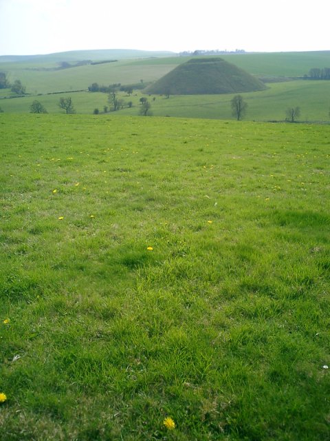
We chose to park in the NT car park and set off not towards the town, but towards Silbury Hill. There is a path that leads there from opposite the entrance to the car park. The path runs along the lovely River Kennett and the hill is only a short hike really. The river can be crossed at a sweet little bridge and the path turns and heads towards West Kennett and the Silbury Hill car park. Access to the hill is now forbidden in order to help preserve the monument. Truly this is an amazing structure and along with the Avebury stones has to go down as one of the wonders of England.
Back over the bridge the path leads up toward Waden Hill, Silburys more natural neighbour. At the time we clambered up the hill was lush with green and the flowers of Spring. Given the lovely blue sky nothing could have been more perfect at that moment. The view of Silbury in the background was exquisite and once on top the view of the surrounding area, divine.
We headed down from the hill into the Avenue of Stones and walked through until we came to the edge of the village. We entered and walked along the path at the top of the earthwork on the rim of the village, breathtaking. Some of the stones are now fenced off in order to protect them but the majority you can reach out and touch. The village itself is delightful some nice and interesting books and spiritual bits and pieces can be found in the local shops.
From the village our last stop of the day was to be West Kennett long barrow. We hopped in the car and drove the short distance there (our legs now far too tired to carry us far) and parked in the layby at the side of the road. As the time was now dusk, the only people we saw were walking back from the barrow. Once there we had the place to ourselves. The chambers are impressive, as is the façade and the barrow itself is lovingly maintained, the view from the top was wonderful too. During excavation of the barrow in 1956, the remains of 46 people were found within its chambers.
Having finished for the day we headed back to Marlborough and dined in the Bear pub apparently renowned for its fish and chips. We enjoyed them and a starter of leek soup before we were joined by the local town crier on an ale tasting mission. By all accounts as part of his responsibilities he has to taste the ale and issue a certificate accordingly. We wondered at the time if after he'd done he'd go to the local kebab house and sample one of those too.
The siting for our stay that evening could not have been better. Winterbourne Abbas allowed us to investigate the areas of interest around the Vale of Pewsey of which there were many.
Having polished off a lovely organic full English breakfast in the morning we headed to our first point of call which was Pewsey Church. We had heard that sarsen stones made up the base of the church at certain points and we were eager to take a look.
Sure enough as you walked up to the entrance of the church and went along the right hand wall there they were. Three stones making up keystones to the base of the church. As the church was on a hill I wondered aloud whether, if there ever was a stone circle in Pewsey, then this may have been the location. Local legend has it that one was destroyed so its not an unfeasible thought I daresay.
Further into the village beyond the co-op car park and nestling next to the bridge crossing the stream stand what could possibly be the remains of the monument. They form a border with the path at this point and to my mind must have been placed there by town planners. Clearance stones probably connected with these possibly with the stones at Pewsey church nestled unloved in the background. The stones themselves were nestled at the foot of the hill upon which the church now stands. Maybe this was the location of an original circle and the keystones were moved up to the church who knows!!
Heading out of the village we set off for a place known as Swanborough Tump. A great battle was fought here in the year 871 and people with the name Swanborough can link there ancestary back to this. I wasn't expecting to be able to see much. The fieldnotes had warned me of this but what I could see opposite was the brows of two conical imposing hills, Picked Hill and Woodborough hill. Picked Hill particularly was imposing its conical shape reminded me of Silbury and Marlborough Mount. Its neighbour Woodborough too had the same shape. I again wondered whether all these hills could have one point been linked.
Heading past the tump we decended upon the village of Woodborough. Here a holed stone lays at the side of the road with a plaque in front dedicating it to the memory of people who fought for peace and freedom in the fifty years since the end of world war 2. The map reference for the stone is 108.568.
History abounds this place and from Woodborough we headed to a place which this time was actually marked on the Ordance Survey. A place known as the hanging stone. We actually took a wrong turn and ended up at the nearby Hursts Farm. There we encountered the farmers wife and her children with their quad bikes. We asked for directions and although the farmers wife didn't know anything about the stone the kids certinaly did. They directed us to it and also told us a legend about how years ago a sheep thief got his cape stuck on the stone when trying to escape the clutches of an angry farmer. It got stuck so fast that the cape actually strangled the thief to death hence the name hanging stone
The stone was approximately a half mile down the track heading straight on past the barn. To the right a number of sarsens the victims of field clearance and at one point probably part of this monument nestled forgotten in a copse. Further up the Hanging stone protruded through the ploughed field. We headed on up thankful that the weather had dried out the land otherwise we would have gotten very muddy.
Returning to the car from the stone we headed to our next Christianised site, that of St. Marys Church, Alton Priors. It is confusing because there are too churches and one is signposted from the road 'St. Marys Saxon Church' go there if you like but this is not the one of Neolithic interest.
A further bonus other than the church and the pleasant setting about Alton Priors is the sarsen stone sitting directly in the middle of the village. We discovered from an elderly local that the stone had been originally placed in a nearby field and removed unfortunately he did not remember in which field it was discovered. Upon the stone is a carving of the horse which stands proud on the hill overlooking the village. The horse was carved by an American expert in crop circles who comes to the village every year to discuss the crop circle frenzy around these parts. The centre of his organisation actually meet in a pub nearby called the Barge Inn alas we didn't have time to go in.
Down from the sarsen is the church, situated in a lovely field absolutely choca-block full of barrows. The church grounds are fenced off from the field and you need to clamber over a style to get into them. It's a pretty church of that there is no doubt, in the grounds there is a lovely Yew tree which, it is claimed, is 1700 years old.
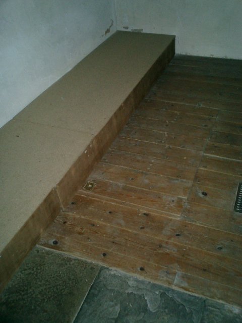
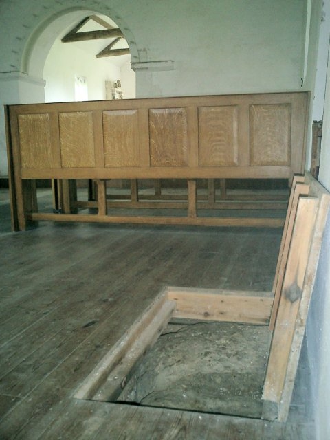
Inside the church, which is no longer in constant use, the first trap door in the floor can be seen. Lifting it up reveals the sarsen itself. Whoever laid this floor had good foresight in thinking that people may come here just to see that. There is another trapdoor nearer the front of the church but it cannot be lifted up as there is a makeshift step which has been built over it.
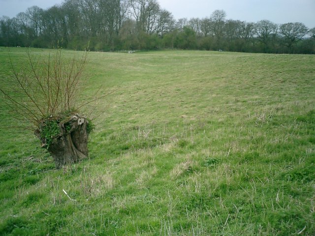
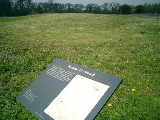
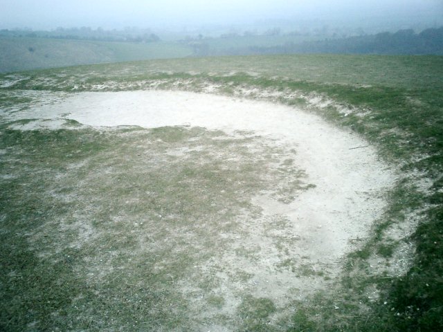
Next step was another highlight of the trip. Again having read about the place in TMA I was intrigued and wanted to go. The location? Hatfield Barrow near the village of Marden. A structure not unlike Silbury in its day and scandalously destroyed. Whats worse, the remains of said barrow where bulldozed to one side by the farmer in later years.
I expected to have trouble finding it as all the sources said that there was nothing left to see. However we did have an approximate location on a makeshift map and when we arrived at the point on the map, directly opposite in a field was an information plaque. The plaque told the unhappy tale of this once great monument and we had found it much easier than expected.
There were mounds and ridges to be seen alright but I found it difficult to determine the exact location of the barrow especially following the bulldozing. But, at least I had been, in the flat landscape it would have stood out like a beacon. I can well imagine this too being part of the great Avebury complex.
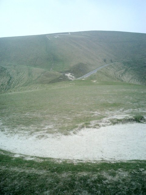
We set off back up the road towards Knap Hill and prepared ourselves for a bit of walking. The weather was pleasant and in this particular area there were many hills of importance that we needed to climb. Knap Hill was the closest so we parked the car at the foot of the hill and clambered up. At the top of all the hills in this area are earthworks we clambered past the ditches and headed for the top from which we had the most tremendous of views. Golden Ball Hill, Adams Grave, Picked Hill and I should think at one point we would have been able to see Hatfield Barrow.
Along from the summit we headed for Golden Ball Hill. Slightly higher this is special because evidence of really ancient civilisations have been found here in the form of flint floors. Nothing much remains of the excavations now and it was quite impossible to guess where the excavations where other than assume the various indentions in the ground where them. I'd have liked there to have been a plaque or information board on some sort. If this place is indeed where the first settlers came to then I'd consider that a more than important piece of history.
From the top the views where again magnificent although, perhaps on account of the odd bush and tree the wind was not as severe as when on Knap Hill. From the summit both Knap and Adams Grave from the angle looking like a humped back bridge.
Wandering down the side of Golden Ball Hill earthworks dominate there are lots of them. The early settlers perhaps choosing here because of the view and the fact that it was actually quite sheltered from the wind.
We headed onto Adams Grave, the site of the huge barrow which was discovered on top. Again the walk was relatively easy and the earthworks are substantial, this whole area must have been a place of major importance. At the summit of the barrow again the view was breathtaking. We rested for some time at the top, not through tiredness but through awe. We really were looking through the eyes of the ancients for they had been here and all around this place.
It was with a heavy heart that we descended Adams Grave, hopping into the car with the intention of finding somewhere to stop for a cuppa. Our plan was to find a stream fill our kettle with water and boil it using the primus stove we had brought for such an occasion.
The only stream that we could think of was that near to Silbury and that wasn't a stream at all but a river. We made the decision to head back but on the way noticed an extreme amount of sarsen stones in a field near the village of Lockeridge. This came as a surprise I had not counted on seeing something like this, I wondered what monument this could be.
A plaque at the entrance to the sarsen field revealed that the area was under the protection of the national trust and that the sarsens were the remnants of sandstone deposits formed on the chalk over 30 million years ago. This is the same sort of sarsen that had been used for building material for the past 5000 years. I wondered whether any of the many sarsens around the area could have been taken from this place. It clearly was an important area and in very good proximity to Avebury itself.
We drove on and came to rest in the NT car park in Avebury, water was collected from the river and we drove to Longstone Cove where the plan was to boil it and make tea.
Whilst we sipped I read that Longstone Cove used to be made up of three giant stones not just the two that are now present. The other being used for building material by a Victorian vandal. The two remaining ones don't look that big even from the path but once you approach they are tremendous.
Down the way from the stones is Beckhampton barrow. It seems that now it is much easier to get to than a few years ago. The footpath runs along the side of the farm and there is a gap in the fence to the field on the left which you can wander through. The barrow can be clearly seen in the distance dominating the field with its thick copse of trees growing on top. There is a path that leads alongside so we took it but left it later on to get a better look.
It was difficult to tell where the entrance had been but I later read that it had been destroyed some time before. The whole shape remains though, there are many barrows which don't look like anything but this still does.
Our final destination before heading for the next hostel such outside of Wantage was another long barrow, this time at East Kennett. We headed for the village and parked outside the church. There is a footpath which runs through the farm but which does not officially run past the barrow. We cut through the farm and took a left turn following the tracker trail up towards the barrow. Sitting imposingly on the hilltop. From the barrow we could see all around Silbury and its neighbour at West Kennett. I was disappointed that there were not even any fallen sarsens that I could see which may have made up a façade of some description.
I was content though, the barrow was an impressive one. Huge but overgrown, full of history and possibilities. I'd packed a lot into this tour from Marlborough to Marden we had walked in the footsteps of the ancients.
|
So the urge had finally caught up with me! A brief tour of the country had taken in a brief glimpse of Silbury Hill and the shortest stop on record for visit to Avebury. How impressive both these sites are and how full of history the area must be. I felt shame that I did not know much about this area despite my professed interest in Neolithic monuments. I have a copy of TMA at home and I had glanced at the pages concerning this area but had never had the drive to get up and visit it for any sustained amount of time. This was not a good situation and had to come to an end!
Returning home to Yorkshire after my brief UK tour I made plans to return within the next few days. Gourging myself on knowledge from TMA and more helpfully from fieldnotes made by members of this site, I drew up an itinerary and set off to the Marlborough Downs, well, almost…
I had convinced my father to come along, he had a couple of days off work and I was on holiday from mine. We booked a youth hostel in Stow on the Wold, an attractive village in the Cotswolds and not a million miles away from the Rollright Stones. What a good place to start. True they are not part of the Avebury complex but they are well known and they would provide the perfect first stop off point. Upon reaching said monument I was appalled by what I saw…
The stones had been daubed with yellow paint, each and every one, an April fools gag by all accounts. A notice on the board near to the stones said that the cost of removing the paint would run to a minimum of £30,000. Why so high? Well the paint has seriously damaged the lichen growing on the stones. The lichen, which is said to be 800 years old, is one of the oldest recorded colonies in Britain. A £1000 reward has been posted to anyone who has information leading to the capture of the mindless fools who did this and a local coven of white witches have cursed the perpetrators for their actions.
As fortune would have it, the other monuments in the complex had not been touched by the paint smearing vandals. The King stone looked impressive in the afternoon sun but what a shame that it was caged behind iron bars. The stone is said to be that of a king in days gone by, a witch promised him Britain if he could see the nearby town of Long Compton. He couldn't see it because his line of site was impaired by a nearby hill. The poor guy was turned to stone as his reward and his men became the rollrights. A bit harsh I thought, especially now that this area seems to be a favoured picnic spot amongst young couples. Mind you, who could blame them, the view down from the stone to the valley below is wonderful.
The other part of the complex are the Whispering Knights located in the field opposite from the Kings stone and at the same side of the road but further down from the Rollrights. These poor guys seemed to get ignored by the many tourists who came to look at the circle whilst we were there. I'm not sure that a lot of the people visiting actually knew that they were there quietly nestling at the far end of the field. I can't quite understand this apathy as it really isn't a long walk to them.
We arrived in Stow on the Wold only the check in and to go straight back out. I had spotted a couple of alleged monuments on the 'Cotswolds Tourist Map' recently purchased from the local information centre. This whole area is deep in old roman territory and there are plenty of links to that era, from villas to the road on which we travelled south the monuments spotted on our map, the Fosse Way.
Our first destination of the ever darkening evening was to see something called the Hangmans stone! Very macabre we anticipated it being a most impressive monument, alas what we got couldn't have been further from the truth. If the truth is known the monument was so unimpressive I can't even be sure whether we found it or not. Although I am convinced that we did find two sarsens, of sorts, however these were most certinaly not in their original positions. They had been the victims of field clearance and now made up a wall which penned in a number of growing saplings.
We had a job to find these stones. The map directed us to the village of Northleach, we took the road to Oxpens Farm and it was just after the turn off for there that we parked. Having searched around the area for the Hangmans stone, it was concluded that the only sarsens of note that this could be were they stones making up this wall. I would very much like to be proved wrong some day by antiquarians with much better stone finding abilities than me but for now it appears that these make up Hangmans stone.
Following on from this disappointment we headed towards the next alleged monument, the Hoar Stone. This was situated off the A417 towards Cirencester, taking the turnoff towards Duntisbourne Leer. The 'stone' is situated to the left in the middle of a field before the first turnoff to your left once through the village. Of course its not just a stone but a long barrow, and it is noticeable. The capstone is still there along with another dominant stone which now has a tree growing next to it. After the debacle of the Hangmans stone, this was a very pleasing result!!!
We then headed to the village of Bisley, not a million miles away, but, because of the way the roads ran, it may have well been. As the crow flies the distance between the Giants Stone near to Bisley and the Hoar stone was not far at all but the fact that it took 40 minutes to get there testifys to the difficulty of navigating the roads in this part of the world.
The Giants stone is allegedly located on the road out of Bisley towards Battlescombe. This road ends and there the stone should be on the right. It was a case of déjà vu because despite a thorough sweep of the area I could not find it for love nor money. I did find however a number of inquisitive sheep and a road that should have ended but didn't which added to my confusion. Next time I shall arm myself with an OS map and use the visitors map for reference only.
We returned via the viewpoint at Barrow Wake near Gloucester and bedded down for the night, in, as it customary in youth hostels, a dormitory full of men!!!
I awoke of 5 to the sound of rumbling, I attempted to get back to sleep but could not. What was this noise? Could it be my stomach? No I had eaten before I retired! Could it be an earthquake? Don't be silly we don't get earthquakes here, not severe ones anyway! Could it be the guy in the bunk opposite snoring his head off and preventing me from a good nights kip? Of course it was!!!
Actually although I was bitter at the time, the gentleman and his nasal orchestra did me a favour by not allowing me back to sleep. For without this disruption I would not have gotten up, and if I had not have got up, I would not have set off in the early hours to the Uffington White Horse.
The roads were clear and dawn was beginning to break as we left the hostel. We wound our way through the many picture postcard villages of the area and ended up at the White Horse for 7 in the morning. Not another soul was around, it was slighty damp and dreary but this mattered not one jot as the peace was serene. With great forethought we had prepared a flask with the intention of enjoying a cup of tea at the top, there our plan was to drink it and soak up the wonderful views of the valley known as the Manger below.
Legend abounds this area, the favourite of mine being that the horse is actually a representation of the Dragon slain by St. George. The place of said slaying was upon the nearby Dragon Hill. This seemingly unnaturally shaped hill boasts a large chalk patch upon its summit on which nothing will grow. This patch is said to be the place where the Dragons blood fell and hence will remain forever barren.
Further up from the White Horse towards the Ridgeway is Uffington Castle, an iron age hill fort upon which evidence of great wooden structures were found, as well as an iron age coin. People residing in this place chose a good vantage point, it was possible to see for miles even on a damp overcast days such as this.
The next point of call when in this area has to be Waylands Smithy! We joined the Ridgeway having crossed over the castle ramparts and headed west to walk the one and a half miles towards it. The walk dragged a bit. The Ridgeway in this section is not particularly exciting and therefore seems longer than it is. At one point we thought we'd taken a wrong turn and had to ask a jogger for confirmation of where the Smithy was. Sure enough though it was there sitting within a copse in the middle of a field. The Smithy was also looking surprisingly well maintained for its age. I wondered aloud if this was because of its proximity to the White Horse.
Excavations in 1919 revealed the skeletons of 8 adults and 1 child within the two main chambers and further excavations in 1962 revealed 14 more. The place gets its name from the blacksmith who lived there. It was said that if you left your horse tethered along with some coins on the stone overnight, then the horse would be found shod come morning.
Waylands Smithy is of course not really a Smithy but a long barrow and is believed to date from around 3400BCE. From within its chambers we poured another cup of tea and decided upon which spot would be easiest to get to next…
Now Swindon is not the sort of town you would normally associate with the Neolithic, true its proximity to some of the great sites is enviable but Swindon is very much a sprawling 'new town'. It therefore came as a great surprise to see a stone circle marked on the OS map just south of the place between Coate and Coate Country Park at 183.824.
The circle is very easy to miss for there is nothing on the site to say what it is and the stones are unspectacular at best. We drove straight past and headed towards the huge ringroad at the end of the lane which was of course far too far. On our return we spotted the stones laying in an ark in the farmers field opposite the first barn we came to. Five stones were all that I could see but I dare say it would have been fairly sizeable. From the remaining stones you can indeed get a good idea of its size. A brief glance over towards the farm buildings revealed nothing that could have been the second half of the circle but condsidering the building work going on in that area this was not suprising.
Time was now stretching on and we decided to try and get a bite to eat. Our next destination was to be the hill fort at Barbury Castle, an area which is now a country park. Upon arriving our delight was assured by the presence of a café which sold full English breakfasts. We were not the only people there, the area seemed to be popular with dog walkers and families.
The area has been settled for many years probably due to its dominant position overlooked everything it surveys. Bronze age disc barrows have been discovered at the site as well as later Iron age burials. Legend has it also that the site was the scene of a great battle between the Saxons and the celts in around 550CE. A battle, which, may have gone a long way to the establishment of the kingdom of Wessex.
From the castle we set off towards Winterbourne Bassett where we had heard there was a stone circle. Again using the fieldnotes taken from this site (very helpful thank you) we found the place without any difficulty. Marking the site is an outlying stone at the junction of the road, opposite, over a style in the field the two nearest stones of the circle can be seen. Upon further inspection I found four more. Although the site has probably suffered damage in years past I was able to gain a sense of how it could have looked. There are three outlying stones which form a triangle around the four inner stones. The four inner stones are positioned in such a way that it would be feasible to assume that at some point there would have been a fifth which would have made up the circle.
Afterward we decided to head toward the white horse figure carved onto the nearby hackpen hill which overlooks this area. As we drove toward it at OS ref 118.757 in the field to our left we saw what appeared to be a standing stone. There was no reference to it anywhere so far as I could see, but it was there, approximately 50 yards from the road. I have posted it on this site to see what everyone else thinks. The horse in the background certinaly gave it a good backdrop although that is anything but Neolithic.
One place that had intrigued me since reading about it in the TMA was that of Marlborough Mount, alleged to be a close relative of Silbury Hill yet laying neglected in the grounds of a private school. The mound from which the town takes its name is indeed seemingly forgotten about by the locals. There is no plaque, the mound is overgrown and untidy and on top is a horrendous construction which I believe is a water tank.
The setting however within Marlborough college promises much. Although you wouldn't expect to walk into a school to see such a monument as soon as you do it becomes apparent that this is no ordinary school. It is the sort of school with rebellious rich kids sporting foppish hairstyles, blazers, oversize suits and shirt tails hanging out over their trousers. The sort of school which best resembles the typical English sterotype of the way all schools in this country are no matter how untrue.
The grounds are lovingly and painstakingly manicured, but the mound that was there before the school was even thought of, has been left to overgrow and the vast majority of the pupils there probably have no idea of its potential importance.
From the mount after wandering through the lovely town of Marlborough we headed towards the Devils Den, a dolmen of which I am convinced only part of remains. The rest of the structure seems to be lying in clearance at the edge of the field.
We parked upon the verge of the road next to the farm and walked the alleged one and a half miles towards the monument, our guidance on distance being taken from a very weathered signpost at the entrance of the track leading to the site.
Just beyond a quaint looking barn in a field beyond and to the left lies the dolmen. It looks impressive just as structures like these should look. Seeing the rest of the stones laying along the side of the field however make you despair. That they must have been once something to do with this monument seems obvious. I wonder how much grander it would have appeared with them in situ.
But the day was now beginning to become long. There are lots of things to see in this area and in the limited time that we had, we sure were packing them in. Soon it would be time to bed down in the sweet B & B we had booked in the tiny hamlet of Winterbourne Abbas.
Tomorrow would be just as full a day but first we had more pressing things to do like visit Avebury, the legendary Silbury Hill and a former timber temple on a place called Overton Hill, the Sanctuary.
The sanctuary was just that, in days gone by, a huge timber structure, the postholes of which have now been filled with horrendous concrete blocks. The Sanctuary looks down upon the valley below and must have played a significant part in the pre-history of this area. Of course it would have been more Sanctuary like had the A4 not been directly next to it and the lorries did not thunder past at such breakneck speeds.
Next door to the circle are the Seorfon Barrows immediately noticeable if approaching from Marlborough. The burial mounds sit proud upon the brow of the hill and appear to form the arched back of some long forgotten serpent. I counted four on the other side of the road from the Sanctuary and a much more overgrown one on the path leading down the Sanctuary side.
Now for the main event, my father despite cycling around the area in his youth had never visited the place. He had heard about it of course but without ever really seeing Avebury I can imagine that it is difficult to understand just how impressive this site is. As soon as you enter and see the town, whether it be along the Avenue of Stones or any other way, the sight is breathtaking and awe-inspiring.
We chose to park in the NT car park and set off not towards the town, but towards Silbury Hill. There is a path that leads there from opposite the entrance to the car park. The path runs along the lovely River Kennett and the hill is only a short hike really. The river can be crossed at a sweet little bridge and the path turns and heads towards West Kennett and the Silbury Hill car park. Access to the hill is now forbidden in order to help preserve the monument. Truly this is an amazing structure and along with the Avebury stones has to go down as one of the wonders of England.
Back over the bridge the path leads up toward Waden Hill, Silburys more natural neighbour. At the time we clambered up the hill was lush with green and the flowers of Spring. Given the lovely blue sky nothing could have been more perfect at that moment. The view of Silbury in the background was exquisite and once on top the view of the surrounding area, divine.
We headed down from the hill into the Avenue of Stones and walked through until we came to the edge of the village. We entered and walked along the path at the top of the earthwork on the rim of the village, breathtaking. Some of the stones are now fenced off in order to protect them but the majority you can reach out and touch. The village itself is delightful some nice and interesting books and spiritual bits and pieces can be found in the local shops.
From the village our last stop of the day was to be West Kennett long barrow. We hopped in the car and drove the short distance there (our legs now far too tired to carry us far) and parked in the layby at the side of the road. As the time was now dusk, the only people we saw were walking back from the barrow. Once there we had the place to ourselves. The chambers are impressive, as is the façade and the barrow itself is lovingly maintained, the view from the top was wonderful too. During excavation of the barrow in 1956, the remains of 46 people were found within its chambers.
Having finished for the day we headed back to Marlborough and dined in the Bear pub apparently renowned for its fish and chips. We enjoyed them and a starter of leek soup before we were joined by the local town crier on an ale tasting mission. By all accounts as part of his responsibilities he has to taste the ale and issue a certificate accordingly. We wondered at the time if after he'd done he'd go to the local kebab house and sample one of those too.
The siting for our stay that evening could not have been better. Winterbourne Abbas allowed us to investigate the areas of interest around the Vale of Pewsey of which there were many.
Having polished off a lovely organic full English breakfast in the morning we headed to our first point of call which was Pewsey Church. We had heard that sarsen stones made up the base of the church at certain points and we were eager to take a look.
Sure enough as you walked up to the entrance of the church and went along the right hand wall there they were. Three stones making up keystones to the base of the church. As the church was on a hill I wondered aloud whether, if there ever was a stone circle in Pewsey, then this may have been the location. Local legend has it that one was destroyed so its not an unfeasible thought I daresay.
Further into the village beyond the co-op car park and nestling next to the bridge crossing the stream stand what could possibly be the remains of the monument. They form a border with the path at this point and to my mind must have been placed there by town planners. Clearance stones probably connected with these possibly with the stones at Pewsey church nestled unloved in the background. The stones themselves were nestled at the foot of the hill upon which the church now stands. Maybe this was the location of an original circle and the keystones were moved up to the church who knows!!
Heading out of the village we set off for a place known as Swanborough Tump. A great battle was fought here in the year 871 and people with the name Swanborough can link there ancestary back to this. I wasn't expecting to be able to see much. The fieldnotes had warned me of this but what I could see opposite was the brows of two conical imposing hills, Picked Hill and Woodborough hill. Picked Hill particularly was imposing its conical shape reminded me of Silbury and Marlborough Mount. Its neighbour Woodborough too had the same shape. I again wondered whether all these hills could have one point been linked.
Heading past the tump we decended upon the village of Woodborough. Here a holed stone lays at the side of the road with a plaque in front dedicating it to the memory of people who fought for peace and freedom in the fifty years since the end of world war 2. The map reference for the stone is 108.568.
History abounds this place and from Woodborough we headed to a place which this time was actually marked on the Ordance Survey. A place known as the hanging stone. We actually took a wrong turn and ended up at the nearby Hursts Farm. There we encountered the farmers wife and her children with their quad bikes. We asked for directions and although the farmers wife didn't know anything about the stone the kids certinaly did. They directed us to it and also told us a legend about how years ago a sheep thief got his cape stuck on the stone when trying to escape the clutches of an angry farmer. It got stuck so fast that the cape actually strangled the thief to death hence the name hanging stone
The stone was approximately a half mile down the track heading straight on past the barn. To the right a number of sarsens the victims of field clearance and at one point probably part of this monument nestled forgotten in a copse. Further up the Hanging stone protruded through the ploughed field. We headed on up thankful that the weather had dried out the land otherwise we would have gotten very muddy.
Returning to the car from the stone we headed to our next Christianised site, that of St. Marys Church, Alton Priors. It is confusing because there are too churches and one is signposted from the road 'St. Marys Saxon Church' go there if you like but this is not the one of Neolithic interest.
A further bonus other than the church and the pleasant setting about Alton Priors is the sarsen stone sitting directly in the middle of the village. We discovered from an elderly local that the stone had been originally placed in a nearby field and removed unfortunately he did not remember in which field it was discovered. Upon the stone is a carving of the horse which stands proud on the hill overlooking the village. The horse was carved by an American expert in crop circles who comes to the village every year to discuss the crop circle frenzy around these parts. The centre of his organisation actually meet in a pub nearby called the Barge Inn alas we didn't have time to go in.
Down from the sarsen is the church, situated in a lovely field absolutely choca-block full of barrows. The church grounds are fenced off from the field and you need to clamber over a style to get into them. It's a pretty church of that there is no doubt, in the grounds there is a lovely Yew tree which, it is claimed, is 1700 years old.
Inside the church, which is no longer in constant use, the first trap door in the floor can be seen. Lifting it up reveals the sarsen itself. Whoever laid this floor had good foresight in thinking that people may come here just to see that. There is another trapdoor nearer the front of the church but it cannot be lifted up as there is a makeshift step which has been built over it.
Next step was another highlight of the trip. Again having read about the place in TMA I was intrigued and wanted to go. The location? Hatfield Barrow near the village of Marden. A structure not unlike Silbury in its day and scandalously destroyed. Whats worse, the remains of said barrow where bulldozed to one side by the farmer in later years.
I expected to have trouble finding it as all the sources said that there was nothing left to see. However we did have an approximate location on a makeshift map and when we arrived at the point on the map, directly opposite in a field was an information plaque. The plaque told the unhappy tale of this once great monument and we had found it much easier than expected.
There were mounds and ridges to be seen alright but I found it difficult to determine the exact location of the barrow especially following the bulldozing. But, at least I had been, in the flat landscape it would have stood out like a beacon. I can well imagine this too being part of the great Avebury complex.
We set off back up the road towards Knap Hill and prepared ourselves for a bit of walking. The weather was pleasant and in this particular area there were many hills of importance that we needed to climb. Knap Hill was the closest so we parked the car at the foot of the hill and clambered up. At the top of all the hills in this area are earthworks we clambered past the ditches and headed for the top from which we had the most tremendous of views. Golden Ball Hill, Adams Grave, Picked Hill and I should think at one point we would have been able to see Hatfield Barrow.
Along from the summit we headed for Golden Ball Hill. Slightly higher this is special because evidence of really ancient civilisations have been found here in the form of flint floors. Nothing much remains of the excavations now and it was quite impossible to guess where the excavations where other than assume the various indentions in the ground where them. I'd have liked there to have been a plaque or information board on some sort. If this place is indeed where the first settlers came to then I'd consider that a more than important piece of history.
From the top the views where again magnificent although, perhaps on account of the odd bush and tree the wind was not as severe as when on Knap Hill. From the summit both Knap and Adams Grave from the angle looking like a humped back bridge.
Wandering down the side of Golden Ball Hill earthworks dominate there are lots of them. The early settlers perhaps choosing here because of the view and the fact that it was actually quite sheltered from the wind.
We headed onto Adams Grave, the site of the huge barrow which was discovered on top. Again the walk was relatively easy and the earthworks are substantial, this whole area must have been a place of major importance. At the summit of the barrow again the view was breathtaking. We rested for some time at the top, not through tiredness but through awe. We really were looking through the eyes of the ancients for they had been here and all around this place.
It was with a heavy heart that we descended Adams Grave, hopping into the car with the intention of finding somewhere to stop for a cuppa. Our plan was to find a stream fill our kettle with water and boil it using the primus stove we had brought for such an occasion.
The only stream that we could think of was that near to Silbury and that wasn't a stream at all but a river. We made the decision to head back but on the way noticed an extreme amount of sarsen stones in a field near the village of Lockeridge. This came as a surprise I had not counted on seeing something like this, I wondered what monument this could be.
A plaque at the entrance to the sarsen field revealed that the area was under the protection of the national trust and that the sarsens were the remnants of sandstone deposits formed on the chalk over 30 million years ago. This is the same sort of sarsen that had been used for building material for the past 5000 years. I wondered whether any of the many sarsens around the area could have been taken from this place. It clearly was an important area and in very good proximity to Avebury itself.
We drove on and came to rest in the NT car park in Avebury, water was collected from the river and we drove to Longstone Cove where the plan was to boil it and make tea.
Whilst we sipped I read that Longstone Cove used to be made up of three giant stones not just the two that are now present. The other being used for building material by a Victorian vandal. The two remaining ones don't look that big even from the path but once you approach they are tremendous.
Down the way from the stones is Beckhampton barrow. It seems that now it is much easier to get to than a few years ago. The footpath runs along the side of the farm and there is a gap in the fence to the field on the left which you can wander through. The barrow can be clearly seen in the distance dominating the field with its thick copse of trees growing on top. There is a path that leads alongside so we took it but left it later on to get a better look.
It was difficult to tell where the entrance had been but I later read that it had been destroyed some time before. The whole shape remains though, there are many barrows which don't look like anything but this still does.
Our final destination before heading for the next hostel such outside of Wantage was another long barrow, this time at East Kennett. We headed for the village and parked outside the church. There is a footpath which runs through the farm but which does not officially run past the barrow. We cut through the farm and took a left turn following the tracker trail up towards the barrow. Sitting imposingly on the hilltop. From the barrow we could see all around Silbury and its neighbour at West Kennett. I was disappointed that there were not even any fallen sarsens that I could see which may have made up a façade of some description.
I was content though, the barrow was an impressive one. Huge but overgrown, full of history and possibilities. I'd packed a lot into this tour from Marlborough to Marden we had walked in the footsteps of the ancients.
|

|
|