 Previous 5 Previous 5 | Showing 11-15 of 15 posts. Most recent first
The Cosmic Egg and the Ziggurat -Scratching the Surface in Sardinia Pt3.
Originally posted 4th September 2005ce
I accidentally deleted this weblog and those lovely Eds managed to recover it for me. Reposted 2nd February 2006ce
Thanks Eds.
Monte Accoddi
This site was on the top of my list of Sardinian sites to visit. Who could resist a site that has been described as 'one of the most puzzling and interesting monuments in Sardinia', 'the only Ziggurat in the Mediterranean' and 'an important monument to megalithic architecture unique to the western world'? A Ziggurat is defined as a "temple tower, either stepped in tiers or spiral, symbolizing the mountain peak where the gods dwelt and where the skies met with the earth." Ziggurats are thought to represent a cosmic axis, a bridge between heaven and earth.
To reach the site I once again had to drive across the top of the island. I managed to get through Porto Torres without losing my wing mirrors or enraging the locals and found myself heading towards Sassari. You know how it is when you're driving along the road and all of a sudden you pass the place you need to be? Well this is what happened to me. The site entrance is situated on the busy 131 dual carriageway, I had managed to find the site but I then spent 20 frustrating minutes trying to back-track on myself. I don't know how many Sardinian traffic laws I broke but after a period of frenzied driving, which took me into the outskirts of Sassari, I managed to get to finally get to the site.
There is a car park and a site reception/ticket office. Once you've purchased your ticket you walk along a long path to the site. I had driven for two and a half hours to reach Monte Accoddi; my level of anticipation was so high that I almost ran down the path to the site, definitely a case of 'mad dogs and Englishmen'. After passing through a set of gates you enter the site from the south and walk along the eastern side of the monument.
The man in the ticket office told me to report to the guide, so I headed down to the portacabins at the bottom of the site. When I arrived at the cabins the guide was showing an Italian couple around a small exhibition so I waited patiently and used the time to look at the surrounding landscape to see if I could spot any distinctive landmarks. The day I visited was extremely hot and the heat haze had reduced visibility. All I can really say about the surrounding landscape is that the monument is situated on a flat fertile plain with mountains in the far distance.
The guide finished with her Italian couple so I asked her if I could look around the site. Her English was quite poor but 100% better than my Italian. She managed to explain to me that I was welcome to walk around the site as I pleased but I couldn't walk up to the platform of the monument as there was work taking place. Nay problems!
The monument itself is stunning, although the site itself could do with a good tidying-up. Basically you have a rectangular platform of 36x30m aligned north-south and faced with a dry stone wall construction using large, un-worked, limestone rocks, this is then surmounted by a smaller, three stepped, platform faced with smaller, more closely packed stones also in a dry stone construction. There is a 30m long, trapeze-shaped, ramp that leads from the south to the first stage and then a set of 14 steps leads you to the top platform. The top platform is 9-10m higher than the surrounding land. The site faces north and I am told that on a good day you can see the coast and the Golfo Dell Ainara from the top.
My first impression of the monument when looking up from the base of the ramp was "bloody 'ell, it looks like a ziggurat", not that I'd ever seen one in the flesh.
My second impression was of the asymmetry of the structure, with the ramp leading up the right hand side. On closer examination I realised that the right hand side of the top platform had been destroyed.

When I first saw a picture of Monte Accoddi, I was stunned by the sight of a large, cup marked boulder. Having stood at the foot of the monument and taken in it's size I made a beeline for the boulder.

There are two boulders, one large, one small and both cup marked. The larger boulder. is cracked, two ideas immediately came to mind, an omphalos and the cosmic egg. I sort of discarded the omphalos idea due to the stones position in relation to the monument and the fact that there were two stones, I guess you can't really have two omphalos (what's the pleural of omphalos?) in the same place. The egg idea lingered. There are a number of creation myths around the world that feature the cosmic egg, the seed from which the world was born. Another idea that came to mind was that there were two stones here, one substantially larger than the other. The larger stone is a reddish colour the smaller one whitish grey. Could they represent the sun and the moon? I love days like this.

I eventually managed to tear myself away from the boulders to have a mooch around the rest of the site. A little further along the eastern side of the monument is an amazing large flat stone known as the sacrificial table. The stone has a number of perforations around it's margins which could only have been man- made. It is these perforations that have led people to suppose that they were used to tether the living sacrifices to the stone. I don't know whether any evidence of sacrifice has been found but the stone could certainly accommodate a fairly hefty victim, man or beast.
From the stone I carried on around the margins of the monument where there is ample evidence of other buildings in the form of low walls.
The rear of the monument is a good place to have a look at how the monument was constructed with most of the stonework still intact, there is also a small ramp.

However this is also the area that lets the site down badly. It is being used as a dump for construction materials and debris. Whilst I was looking at the small exhibition in the site cabins I noticed a picture and illustration of a carved stone that had been interpreted to be a crude carving of a female figure, possibly a goddess.
 http://images.fotopic.net/ybhaen.jpg"> http://images.fotopic.net/ybhaen.jpg">
I had presumed that this stone had been carted off to Sassari Museum for safe keeping. I was deeply shocked and saddened to find this stone lurking amongst a pile of large drainage pipes and site rubbish. The stone was cracked and chipped in two places and the cracks looked recent. I later mentioned this to the site guide but she just shrugged.
The western side also has evidence of structures surrounding the main monument and to balance the sacrificial stone, on the eastern side of the ramp, is a large standing stone. Whilst looking at the stone I was struck by the strange asymmetry of the monument and wondered if the standing stone, sacrificial table and 'egg' had some form of alignment or were just placed there with little or no thought of their symmetrical relationship to the ramp and the main monument. Perhaps this trio of stones predated the monument. The standing stone itself is beautiful, it is made of limestone and has a number of large holes caused by weathering, these holes have been occupied by snails who have secreted a sort of natural concrete which partially fills many of the smaller holes.

I conclude my circumnavigation of the site back at the base of the ramp. Unfortunately I wasn't allowed to walk up the ramp to the platform but to be honest with you I didn't mind. I didn't need to climb to the top of the platform to understand that this site was extremely special and unique. There are elements of the site that suggest that the early Sardinians may have been influenced by the cultures of the near and Middle East. If you are lucky enough to visit Sardinia I would recommend that place this site on the top of your list.
The discovery sort of the broken carved stone put a bit of a damper on my visit to Monte Accoddi. Monte Accoddi is a world class archaeological site, and from what I saw, it deserves to be treated with a lot more respect that it is currently receiving. Happily this is not the case with the other Sardinian sites I had visited. They had all been well cared for and many were manned by enthusiastic and helpful guides.
|
Scratching the Surface in Sardinia Pt2.
The Elephant and the Red Angel.
My second exploration to scratch the surface of Sardinian prehistory involved a visit to a pair of sites commonly known as Domus de Janus which I believe translates as 'tombs of the fairies' although I have seen this translated as 'tombs of the witches'. Either way they are rock cut tombs.
One site I had high on my list was Anghelu Ruju, a necropolis of rock cut tombs.
Anghelu Ruju is about 60 miles from where I was staying in Sardinia, the drive to the site involved following the long winding road along the north coast to Porto Torres and then turning south towards Alghero. If you find your self in Sardinia and travelling along the north coast road (200) I would advise you to by-pass Castelsardo, this will benefit you in two ways. Firstly, you'll avoid driving through a picturesque but congested town with narrow hilly streets lined with cars just waiting to tear off your wing mirrors. Secondly the by-pass road gives you easy access to a wonderful site called L'Elefante.
L'Elefante also known as Castelsardo dell'Elefante or Roccia dell'Elefante
L'Elefante is exactly what it says it is, an elephant or at least an elephant shaped rock. If you approach it from the north it is an upright elephant and from the south it is an elephant sitting down either way it is unmistakably an elephant. I had passed this rock a few days before and dismissed it as a tourist curiosity, one of hundreds of bizarrely-shaped rocks that litter the island. Two things changed my mind about this, one was the road sign which said Domus de Janus and the second was a brief reference in Margaret Guido's excellent 'Sardinia' book.
L'Elephante couldn't be easier to visit as it is on the kerbside next to a major road; there is also a handy lay-by opposite the rock. One thing I should warn you about is that you have to run the gauntlet of a group of old men selling tourist trinkets at the side of the road, there is even a man with a donkey, donkey rides on a main road?..hmmm No grazie. Two things struck me about the hawkers, one, they seemed to be mainly selling knives, two, none of them would have looked out of place in the Godfather part 2, wrong island I know but that's how they looked, all that was missing were the shotguns.
The rock is perched on the margins of the road on a hillside overlooking the coastal plain from Castelsardo to the north, the views are beautiful and include a http://images.fotopic.net/ybh9gj.jpg"> nice view of the Nuraghe su Tesoru
To tell you the truth I wasn't expecting too much from this site but what a shock I got. The rock itself reminded me of a large red cinder, there's that colour again!, but it wasn't until I got up close to it that I realised that there were a number of chambers carved into it, I was even more surprised when I climbed through one of the http://images.fotopic.net/ybh9gh.jpg"> carved portals into the chambers and was confronted by two great http://images.fotopic.net/ybh9g4.jpg"> crescents carved into the walls of the chambers. The carvings were beautifully executed and still quite crisp.
If you are travelling around the north of the island I would definitely recommend that you call in on L'Elefante. The nearby medieval seaside town of Castelsardo is very picturesque and a good place to stop and have a drink and something to eat.
The next stop on my itinary was Anghelu Ruju but to reach it I had to drive to Porto Torres and then head south to Alghero. Porto Torres is a nightmare, you are channelled into the town through gradually narrowing streets until you reach the port from there it's anyone guess, pick a road and follow it. Six times I passed through Porto Torres never travelling the same route twice. Once you've cleared Porto Torres it's fairly plain sailing. The drive across the fertile plain to Alghero is fairly pleasant but uneventful.
Necropoli Anghelu Ruju
The name means 'Red Angel'. This 'red' thing is starting to nag at me.
The site was discovered in 1903 by a workers quarrying the local sandstone. 37 tombs have so far been discovered' almost all of the literature uses the words 'so far'.
The site is well signposted and situated next to main road. There is a car park and an entry fee is required.
The tombs have been dated by the finds discovered within them to the Oziere culture of approximately 3300-2800BC. The tombs were later reused by different cultures including the Beaker culture.
All there is to see when you enter the site is a low grassy hill surrounded by rich farmland and close to a large river, the Riu Filberta. This area is known as Fertilia. The remains of the quarry are visible along with a few loose rocks and one small http://images.fotopic.net/ybhazj.jpg">standing stone. The locations of the tomb entrances are given away by little information boards above each tomb. The board tells you the tomb number, gives a plan of the tomb and provides you with a little information about the tomb.
I'm not sure if you are allowed to climb down into the tombs. I couldn't see a sign prohibiting it so I crawled through a number of them. Crawling through the chambers was a little scary, some of the chambers had props supporting the ceilings so I tended to avoid these, I also tried not to think about the dead snake my son had found the previous day. I was unable to stand up in any of the chambers; which to me would indicate that they were not used for ritual activity on a regular basis. The chambers did not seem to follow a uniform layout.
"In plan the tombs naturally vary, but not infrequently a large burial chamber with smaller chambers radiating from it is reached by a long passage sloping down from the entrance steps: the passage too may have chambers leading off it. Others are much simpler. The chamber themselves may be oval or rectangular in plan, and have round or flat ceilings". Sardinia. M.Guido
One common feature of the tombs and chambers was the rectangular door with the http://images.fotopic.net/ybhazi.jpg">carved recess; which was also a feature of L'Elefante and reminded me at the time of carved entrances I'd seen in Maltese temples. Many of the doors also had a carved lintel. In one of the tombs there were carved stone pillars which I presume were there as architectural feature rather than structural supports. In another tomb, whose roof had collapsed, was a http://images.fotopic.net/ybhaze.jpg">carved bed. The lintels, pillars and carved bed lead you to think that design of the tombs may have reflected features found in the houses of the Ozerei people who created the tombs.
There are two sets of carvings that make this site really special. One is a set of carvings depicting 5 http://images.fotopic.net/ybhazb.jpg">Bulls heads ,or protomi turine, situated above the entrance to a tomb with a 6th on an adjacent wall.
The second set of carvings is within tomb XXVII. This http://images.fotopic.net/ybxw1e.jpg">carving depicts a pair of crescents over a set of concentric circles enclosed within a rectangular box; there are two of these carvings facing each other on opposing walls. There is much speculation as to the meaning of these carvings, the depiction of bulls heads outside of one of the tombs strengthens the arguments that these carvings are stylised versions of the bulls head and are linked to a bull cult others suggest that they may represent high–prowed ships. Unfortunately my camera packed up as I was photographing this carving so the images I have are a little rough.
When the tombs were excavated they yielded many grave goods including metal axes, beads, marble idols and many other objects, the most interesting of which to me, was a flat axe and an awl that were found to have come from the British Isles, probably Ireland.
Anghelu Ruju is a beautiful site and well worth a visit.
Whilst driving south from the site towards Alghero I noticed a large standing stone in a field margin on a bend in the road. The road was too busy to stop and check it out but it's worth looking out for if you are in the area.
Conclusions
I haven't too much to say about the two Domus de Jana that I visited. Rock cut tombs are wonderful places, the addition of carving to the Sardinian tombs make them seem somehow more personal. Looking at the http://images.fotopic.net/ybhaz4.jpg">bulls heads reminded me of something I read a book by Christopher Tilley that contained the following quote by someone called Robb that seems to sum it all up "Fixing the moment of encounter to an eternal now".
|
Scratching the Surface in Sardinia Pt1.
Tombi dei Giganti, Gobsmacked in Gallura
My journey to Sardinia began about 4 months ago when my we first booked a family holiday to the island. It was then I began to hit the resources looking for information on the Mediterranean's second largest island. I managed to get hold of a copy of Margaret Guido's 1963 book 'Sardinia, Ancient Peoples and Places' and found a number of websites offering various degrees of information on the island and it's prehistory. What really fired my imagination were the wonderful photographs of the Tombi dei Giganti in Mr Cope's The Megalithic European. I had an awareness of Sardinian prehistory from the various books I have read but these books generally concentrated on the Nuraghe and the Well Temples with the occasional mention of Bronze statues. Mr Cope's book was different; he had pictures of beautiful megalithic tombs with a crescent shaped facades. I knew this was a place I had to visit.
My trip to Sardinia was essentially a family holiday with a few visits to ancient sites fitted in so it was therefore was never going to be to be anything more than a taster of the island but I didn't really care, I was going to Sardinia.
My first outing into the Sardinian countryside started in the usual fitzcoraldo way. I got lost! This turned out to be quite a fortuitous experience as it put me straight into the mountains on the road from Trinita d'Agultu to Tempio Pausania. Basically you wind your way up into the mountains and then all of a sudden you drop down into a fantastic surreal landscape. A valley of the giants, imagine a valley peppered with dozens of supersized versions of Brimham Rocks, groves of windswept trees growing at 45 degrees, hilltop villages perched beneath huge bizarrely weathered rocks. This was more than a landscape, a dreamscape would be a more apt title.
Pascaredda.
This was my first Sardinian site. It's location on the Tempio to Calganius road is pretty much where Julian Cope describes it in the Megalithic European, unfortunately, due to Ryanairs meagre baggage allowance, I didn't have the book with me and the site wasn't on my map so I came across it by accident. Fortunately for me the Sardinians are pretty good at signposting their ancient monuments.
To reach the site you have to walk down a country lane and along a path on the edge of a field, you then cross over a fairly dodgy looking wooden bridge and the site is just in front of you in a cork wood. That sounds fairly straight forward, as it is, but the walk is absolutely beautiful and a great introduction to the sounds and smells of the Sardinian countryside, it also grounds you in a landscape ringed by sharp, craggy mountains with the Monte Limbara peaks rising to over 1300 metres.
Pascaredda is beautiful, you approach the site from the rear so the first thing I noticed was how neatly the stone capped mound fitted into the surrounding valley. As I moved around the mound the horned façade and forecourt came into view. The rocks of the façade had a definite pink tinge to them which would be something I would also encounter at Li Longhi. The carved portal stone is large but not huge, the proportions and symmetry of the monument are perfect and the carving is beautifully executed. After sitting and taking in the fact that I was actually here, I began to mooch around the mound and passageway. The mound appears to be constructed of small cobbles and earth. One of the cap stones had been removed from the passage, so I was able to slip down into the passage with relative ease. The passage was orientated east-west and was constructed in a dry stone style. It was interesting to note that the passage was independent of the façade, by this I mean that the large carved portal stone had been placed over an existing portal and the passage may have originally been a self-contained unit. This could imply that the façade was added at a later date. The rear (west) end of the chamber had a bench-like structure constructed by placing a large slab horizontally across the back of the chamber. Another feature, which was to become areoccurring theme in the monuments I visited in Sardinia, was the use of water/wind eroded stones in the monuments.
Pascaredda was my first Tomba dei Giganti and I think it will always remain my favourite. It just all fits in so well, the walk to the site, the intact mound, the tomb, the lovely façade, the nearby stream, the mountains, Perfect!
The next site on my list was Coddu Vecchiu
Coddu Vecchiu
Coddu Vecchiu is signposted on the Tempio to Arzachena road. As with Pascaredda, if you approach this site from the west you will be travelling through a beautiful and bizarre landscape passing peaks with boulder strewn ridges and valleys with huge monoliths that appear to have been thrust upwards through the earth by the hand of some unseen orogenic deity. I wrote in my note book "these rocks must have names". Even the modern quarries chop away the hillsides to create the appearance of stepped pyramids.
Coddu Vecchiu is served by a car park. There is a small visitor's centre in the car park where you can purchase a ticket for the monument, buy an ice cream, a cold drink or use the toilet.
Tip No.1– Sardinians are obsessed with change, in the monetry sense, so keep plenty in your pocket. That said, I managed to score a free ice cream at Coddu Vecchiu because the very nice lady behind the counter did not want to lose her change, despite having lots in her till.
The site is just a short walk from the car park and approaches the site looking towards the forecourt. If you can manage to take your eyes off this beautiful site you should check out the lovely large, squat, weather-worn rock outcrops to the left of the path to the monument.
The Monument is stunning and sits in a low valley on an elevated hillside surrounded on one side by scrub land and the other by strictly regimented lines of grape vines running like contour corduroy across the hillside. It would be nice to think that this arrangement stretched back to the origins of the monument. As we know, many megalithic monuments were deliberately sited within liminal areas on the edge of farmland, one foot in the wild and one in the cultivated fields perhaps symbolising the continuity between past and the present. In his book 'The Bronze Age in Barbarian Europe' Jacques Briard describes the Sardinian central stelae as; "the sacred stone in front of the kingdom of the dead was visible from afar and reminded the living, at work in the nearby fields, of the frailty of human life".
It is the central stone or stelae which draws the eye here. This design of stelae is known as a bilithon, a two piece stone. Once again there is a pink tinge to the rock which is enhanced by a vein of pink crystal running downwards at approximately 45 degrees from the top left hand corner of the bottom stone. Later I was to visit the Neolithic cemetery of Il Muri where large amounts of ochre were found in the cists. This set me to wondering if this use of reddish/pink stone and the use of ochre were linked over the millennia between the erection of the monuments. Perhaps red was a colour associated with death. Marija Gimbutas has this to say about the use of ocre "Red was the colour of life, of blood, which was neccessary to secure regeneration".
My first impression of the monument was that this Tombi definitely had a different architect to Pascaredda. It's well worth having a detailed look at the stones of the façade. The central stelae have been beautifully carved. The carving borders the lower stone and extends around the outside edge of the upper stone. Care has also been taken to carve around the small portal at the base of the stone. The carving had also been applied to the back of the stelae, presumably after the two stones were united and erected.
The stone to the right of the stelae has a natural channel carved into it that runs from ground level to the side of the stelae, the final stone of the left hand horn of the façade has a natural cup in its face. I'm sure these features would have not gone unnoticed by such accomplished masons as the Tombi builders and once again we see the use of weather worn stone in the construction of a monument.
The monument we see today is a stripped-down version of the original. Many years ago when the monument was excavated the archaeologists didn't believe that the stone cairn that covered it was actually part of the structure so they removed it.
The passage of the monument is aligned east-west and unlike Pascaredda is constructed of large stone slabs on the interior (visible) passage and thick, dry stone walling on the exterior (unseen) walls. The passage also differs from Pascaredda in its layout. There is no 'bench on the back wall and the side slabs butt straight onto the central stelae. There is also a large slab on the floor of the chamber marking a small step down in the passage just before the stelae, creating a small anti chamber behind the small portal at the base of the stelae. Perhaps this was the place for offerings.
In summary, Coddu Vecchiu is a beautiful Tombi dei Giganti sitting in a lovely landscape. It is well signposted and judging from the day we went, and its close proximity to a main road, can be quite busy.
The next site on my list was Li Longhi, this site is no more than a 15 minute drive away from Coddu Vecchiu. The drive is along a long, narrow dusty road and is one of the places where you're pretty sure you've taken the wrong turning and just as you're thinking about turning back, you find yourself at the monument.
Li Longhi
Once again this is a sign posted site with a car park and a small booth from where you can buy tickets for the monument. On my visit, I had the good fortune to find a guide here who spoke very good English and had recently spent 3 months in Newbury.
Tip No.2 – If the service is available, pay the extra Euro for the guide, they are usually very knowledgeable and generally keen to speak English, they also carry folders containing illustrations, details of finds and general information about the sites.
Li Longhi is a fascinating site situated on a prominent hill. Like Pasceradda the tumulus remains intact and the monument has undergone some restoration. The path to the monument is only short and you approach it from the front. The first thing you notice is the stelae, it's huge and it's broken. The repair job on the stelae reminds me of my own attempts to repair things at home. They've just taken the huge lump that fell off and clagged it back on, it's pretty unsympathetic but it works and restores the stelae to it's original height. The stone to the right of the stelae is also a replacement.
The passage is a little confusing until you realise that this monument developed in 3 stages. The first stage of the monument was the construction of a dolmen, the remains of which form the rear of the passage. The dolmen was constructed, during the period of the Bonannaro Culture usingrough stone slabs placed on the original ground surface. The second stage of the monument was the construction of an allee couverte or passage; this was dug into the bedrock. The walls of the passage were constructed using a mixture of large slabs and dry stone walling, a mound/tumulus/cairn of stones was also constructed at this point. The final phase of the monument was the addition of the horned façade.
Within the passage, the dolmen was separated from the rest of the monument by a
blocking slab and a bench, as at Pascaredda.
There is only one capstone insitu on the passage, my guide informed me that the archaeologists have speculated as to whether the passage was actually capped with removable wooden planking to allow access. What intrigued me was what happened to the capstone of the dolmen. I wonder if it was reused in the construction of the passage or perhaps in the horned façade of the monument.
My guide also informed me that Roman and Greek writers had witnessed and recorded how the Tombi were still being used when they had visited Sardinia. There are written accounts describing people sitting on a bench-like structure attached to the horned façade of the monument whilst rituals took place within the area defined by the facade.
Li Longhi is well worth a visit, when combined with a visit to Cuddu Vecchiu and the Necropili di li Muri. It provides insight into the development of the wonderful Tombi dei Giganti in this part of the island.
Necropili de Li Muri
Li Muri is about a ten minute drive from Li Longhi. Drive past the site and park in the car park on the hill. Walk back up the hill and buy a ticket at the small hut. Once again I was able to use the guide who also spoke excellent English and had a deep love of this site.
This Neolithic necropolis should have a ring of familiarity about it to anyone who has read about or visited British prehistoric burial sites. The site is not large but it is full to the brim with archaeology. The site is neatly 'tucked in' amongst numerous rocky outcrops with views over the surrounding valleys.
Basically what you have here are five cist burials, four of the burials date to about 4500BP, the fifth cist dates to a later pre-Nuraghic culture. There are also a number of standing stones or Betyls, and small cist-like boxes that 'were used for offerings'.
The four Neolithic cists are surrounded by a number of small concentric circles and were originally covered by an earth mound or cairn with only the outer kerb showing. The cists were orientated north–south and when excavated yeilded a rich crop of distinctive grave goods including obsidian arrowheads, polished axes, maceheads, flint knives, pottery, soapstone necklaces and a steatite bowl which may be of Cretan origin.
The fifth, and later, cist is aligned roughly east-west and was also covered by a cairn.
My guide was extremely enthusiastic about the site and went to great lengths to explain many aspects of Sardinian prehistory including the trade in Obsidian throughout the Mediterranean. Sardinian obsidian was the best in Europe and Galluran obsidian was the best in Sardinia. She was also very keen on Irish archaeology having just spent seven months living in Galway.
One thing that struck me about the site was a large outcrop of weathered granite on the margins of the site. For me the rock almost seemed part of the site and on closer inspection I noticed a number of weathered depressions and natural bowls within it's structure. I tried to discuss this with the guide and how the people who built the monument could have easily chosen a rock-free site in the adjacent field. But she only smiled and said that we can only discuss the facts of the site. I did however detect a knowing look in her smile or maybe I was kidding myself, perhapsshe just pitied me for my wide eyed ramblings. She did inform me that the local rocks, some of which are weathered into the most bizarre shapes, contained rock shelters. Some of these shelters had been excavated and yielded early pottery.
The necropolis of Li Muri reminded me of home. There are definite parallels with sites on the North York Moors such as Obtrusch and round barrows and cairns in many other parts of our islands.
Conclusions
I suppose it's a bit arrogant to try and draw any meaningful conclusions after seeing just three Tombi dei Giganti and one Neolithic cemetery but I guess I should write down a few thoughts if only to start a debate and have them ripped to pieces when someone else looks at a few more of these wonderful monuments and comes up with some better ideas.
The three Tombi dei Giganti I visited had followed the same basic design, orientation east-west, a long passageway, no chambers and an elaborate forecourt but I also observed that there were differences in the choice of location within the landscape, construction methods, levels of carving and other subtlties of architecture between the three.
Much is made of the crescent design of the forecourt and the possibility that it is symbolically linked to a bull cult. We must remember that this type of forecourt is not only common in Sardinia. There are many horn or crescent shaped forecourts throughout our own islands and beyond. The court tombs of Ireland e.g. Ballymacdermot, the Clyde tombs of Scotland, the Cotswold Seven tombs, the horned cairns of Caithness e.g. Grey Cairns of Camster even the Street House site on the North York Moors. When I first saw Pascaredda from the front I was reminded of Cairnholy. Could I be so bold as to say it is a common design? and why shouldn't it be? Basically what this design provides is a place for the living to meet each other in the presence of the ancestors. What the Sardinians did was take this basic design and add some unique Sardinian flavour to it just as many other people have done in their own monuments. I have read that the forecourts of the Tombi with the false portal represent the transition from life to death. I would like to think that the stones of the forecourt also reflect the Galluran landscape, with it's boulder ridges and craggy peaks. To quote Richard Bradley "monuments can be landscapes and landscapes may be monuments".
What the basic design may show is that people throughout Europe and beyond may have been thinking in a similar way about the cycle of life and death and applying those ideas to their monuments. The same process continues today, we still erect elaborate large stone monuments to the great and the good, Prominent members of society usually get large grave markers whilst the less prominent get smaller markers. We still congregate at these monuments to remember and celebrate our ancestors, we still bury our dead in communal cemeteries and we still bring offerings to the grave, long after the person has died.
When I was training for my current job my mentor made me recite a daily mantra, "common things are common", I think the same rules may apply here.
One thing that did confuse me initially in Sardinia was the dating of everything. I would look at the Tombi and think Neolithic, see a Nuraghe and think Iron Age. I had trouble getting my head around the fact that the builders of the Nuraghe were also the builders of the Tombi dei Giganti. I guess this was due to the baggage I carry around. I was trying to relate everything back to my own experience. I found the process of coming to terms with the chronology of these and other sites challenging, disorientating and amusing.
On the other hand, we need some form of perspective even if it's too say that there is no connection betwen the megalithic monuments of Sardina and the islands of Britain. Especially if we want to try and gain some understanding of the role that we, on our little islands on the very edge of Europe, played in prehistory. We need to get out and look at these monuments.
We need to understand that our ancestors had a different perspective to our modern, some would say, blinkered world-view. Our ancestors did not view the sea as a barrier but as a highway, a major route of communication fostering the exchange of knowlege and beliefs, trade and the sharing of new technologies.
If we accept this then we can assume that our British and Irish ancestors may well have visited these places and that Sardinians may have visited our islands.
 |
This was my first Sardinian site. It's location on the Tempio to Calganius road is pretty much where Julian Cope describes it in the Megalithic European, unfortunately, due to Ryanairs meagre baggage allowance, I didn't have the book with me and the site wasn't on my map so I came across it by accident. Fortunately for me the Sardinians are pretty good at signposting their ancient monuments.
To reach the site you have to walk down a country lane and along a path on the edge of a field, you then cross over a fairly dodgy looking wooden bridge and the site is just in front of you in a cork wood. That sounds fairly straight forward, as it is, but the walk is absolutely beautiful and a great introduction to the sounds and smells of the Sardinian countryside, it also grounds you in a landscape ringed by sharp, craggy mountains with the Monte Limbara peaks rising to over 1300 metres.
Pascaredda is beautiful, you approach the site from the rear so the first thing I noticed was how neatly the stone capped mound fitted into the surrounding valley. As I moved around the mound the horned façade and forecourt came into view. The rocks of the façade had a definite pink tinge to them which would be something I would also encounter at Li Longhi. The carved portal stone is large but not huge, the proportions and symmetry of the monument are perfect and the carving is beautifully executed. After sitting and taking in the fact that I was actually here, I began to mooch around the mound and passageway. The mound appears to be constructed of small cobbles and earth. One of the cap stones had been removed from the passage, so I was able to slip down into the passage with relative ease. The passage was orientated east-west and was constructed in a dry stone style. It was interesting to note that the passage was independent of the façade, by this I mean that the large carved portal stone had been placed over an existing portal and the passage may have originally been a self-contained unit. This could imply that the façade was added at a later date. The rear (west) end of the chamber had a bench-like structure constructed by placing a large slab horizontally across the back of the chamber. Another feature, which was to become a occurring theme in the monuments I visited in Sardinia, was the use of water/wind eroded stones in the monuments.
Pascaredda was my first Tomba dei Giganti and I think it will always remain my favourite. It just all fits in so well, the walk to the site, the intact mound, the tomb, the lovely façade, the nearby stream, the mountains, Perfect! Li Muri is about a ten minute drive from Li Longhi. Drive past the site and park in the car park on the hill. Walk back up the hill and buy a ticket at the small hut. Once again I was able to use the guide who also spoke excellent English and had a deep love of this site.
This Neolithic necropolis should have a ring of familiarity about it to anyone who has read about or visited British prehistoric burial sites. The site is not large but it is full to the brim with archaeology. The site is neatly 'tucked in' amongst numerous rocky outcrops with views over the surrounding valleys.
Basically what you have here are five cist burials, four of the burials date to about 4500BP, the fifth cist dates to a later pre-Nuraghic culture. There are also a number of standing stones or Betyls, and small cist-like boxes that 'were used for offerings'.
The four Neolithic cists are surrounded by a number of small concentric circles and were originally covered by an earth mound or cairn with only the outer kerb showing. The cists were orientated north–south and when excavated yielded a rich crop of distinctive grave goods including obsidian arrowheads, polished axes, mace heads, flint knives, pottery, soapstone necklaces and a steatite bowl which may be of Cretan origin.
The fifth, and later, cist is aligned roughly east-west and was also covered by a cairn.
My guide was extremely enthusiastic about the site and went to great lengths to explain many aspects of Sardinian prehistory including the trade in Obsidian throughout the Mediterranean. Sardinian obsidian was the best in Europe and Galluran obsidian was the best in Sardinia. She was also very keen on Irish archaeology having just spent seven months living in Galway.
One thing that struck me about the site was a large outcrop of weathered granite on the margins of the site. For me the rock almost seemed part of the site and on closer inspection I noticed a number of weathered depressions and natural bowls within its structure. I tried to discuss this with the guide and how the people who built the monument could have easily chosen a rock-free site in the adjacent field. But she only smiled and said that we can only discuss the facts of the site. I did however detect a knowing look in her smile or maybe I was kidding myself, perhaps she just pitied me for my wide eyed ramblings. She did inform me that the local rocks, some of which are weathered into the most bizarre shapes, contained rock shelters. Some of these shelters had been excavated and yielded early pottery.
The necropolis of Li Muri reminded me of home. There are definite parallels with sites on the North York Moors such as Obtrusch and round barrows and cairns in many other parts of our islands. |
Tales of The Little Table -Two Freaks in a ditch.
The reports of a third henge, The Little Table, at Eamont Bridge had intrigued Stubob and me for quite a while, so we decided it had to be tracked down. We started at the Mayburgh Henge, where else?
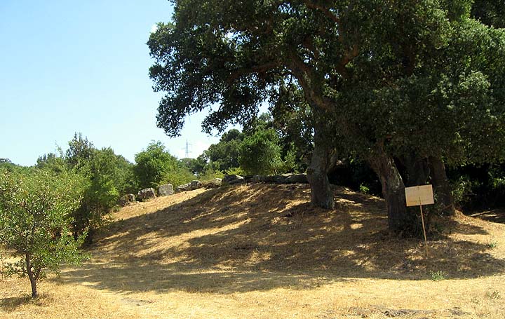
The farmer has fenced-off the field just outside the entrance. This means that you cannot walk directly over to King Arthur's Round Table but have to detour along the road past the Millennium Stone. A couple of years ago I was all in favour of the removal of the stone, but now my attitude to this new stone has mellowed. It acts to reassure me that despite two thousand years of Christianity, there is still an underlying desire, to erect substantial, rude stone monuments.
After a respectful mooch around Mayburgh and King Arthur's Round Table we headed for the site of The Little Table. To aid in our quest we were armed with the SMR summary and a copy of the Magic map.
We turned off the A6 and passed the Lowther gatehouse to be confronted by a thigh-high carpet of thick foliage on the side of the road where the ditch was supposed to be. Tip – wear don't wear short trousers as I did, this is nettle country.
Apparently the henge was destroyed by a combination of the construction of the Lowther gatehouse and road and the meanderings of the River Lowther. The SMR states "The monument is located on a comparatively flat alluvial terrace between an escarpment to the west and the steep slope of the River Lowther to the east". The Magic Map placed it just past the gatehouse on the lazy right-hand bend in the road.
We found the ditch sure enough but we weren't sure whether it was a regular roadside ditch or part of the henge, so to be sure we clambered all around the wood, up the track to the higher ground, along the road, basically we looked everywhere to make sure that we had the right feature. We then returned to the ditch. Stu drew the short straw and clambered through the nettle beds whilst I took the easier route along the margins of the road. We soon sussed-out that the ditch was a short arc that began and finished at the road, we had found our ditch. I paced the length of the ditch and it came out at about 33 paces. For further confirmation, this portion of the road is the only part of the road that is fenced. The fence begins and ends where the ditch lays, we presumed this was part of the protection of what's left of the monument.
So if you're visiting the site, look for the fence on the right hand side of the road, a few yards past the gatehouse. There is a track halfway along the fence, this track bisects the ditch and reveals what's left of the profile as can be seen in Stubob's photo http://www.themodernantiquarian.com/post/29777. Don't expect to see too much but be happy in the knowledge that at least something remains of the third henge.
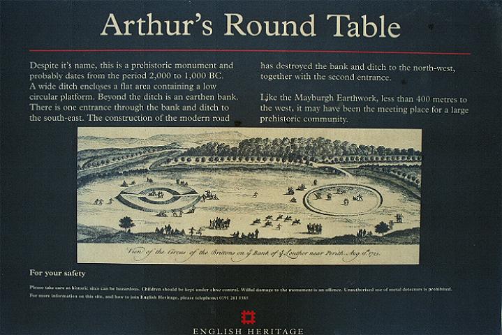
One point of interest is that when you look at Stukeley's picture of the Round and Little Tables, you'll notice that the Little Table is a continuous unbroken bank without an entrance, whereas the entrances are clearly marked on the Round Table. This may imply that the Little Table was of a different design to the Round Table.  |
According to Burl " Mayburgh seems an Irish enclosure, King Arthur's Round Table on from Yorkshire. The Little Table resembles neither. With it's atypical outer ditch it had few things in common with a conventional, externally banked henge but it was not unlike structures of previous centuries, the Neolithic causeway enclosures of Wessex and southern England. It may not be an entire coincidence that just such an ancestry has been proposed for the initial chalk and turf earthwork phase of Stonehenge". Another Cumbrian causeway enclosure was discovered a couple of years ago at Aughertree Fell
Or could it the Little Table be a homegrown Cumbrian henge? I'm not aware of any other Cumbrian henges. Robert Harris speculates in his book 'Walks in Ancient Lakeland' that Towtop Kirk is a henge but there seems to be some disagreement with this.
My personal theory (and I've got a million of 'em!) is that this place may have been significant to the local people long before the henges were built. Richard Bradley speaks of 'the particular potency of certain natural places'; the aboriginal people of Australia simply call it Djang. If a river is a potent natural place then surely a confluence of rivers could be doubly so. What is interesting is that there may be an association between some multiple monument complexes and a confluence of nearby rivers. We can see this not only at Eamont Bridge but also on the Ure-Swale plateau and along the Gypsey Race in Yorkshire and on the Milfield Plain in Northumberland
The Round and Little tables would have been on the banks of the River Lowther and Mayburgh on the banks of the Eamont. The fabric of the Mayburgh henge is composed of thousands of river-worn cobbles and the banks of the other two henges are built using the rich alluvial soil. In both cases the henges are composed of materials that may have been seen as being once part of the rivers.
The henges lie across the entrance to a spit of land that runs between the two rivers and terminates at the confluence of the Rivers Eamont and Lowther. Move a little further east and you come to the confluence of the Rivers Eamont and Eden.
Another thought is that Eamont Bridge may have been a river crossing point for thousands of years. Taking this idea one step further. The people of the Mesolithic could have first identified the site whilst following the migrating herds. Later it was the crossing point of one of the great north-south drove roads.
In 927 AD Eamont Bridge was the site chosen by King Athelstan to meet and gain the allegiance of the Kings of Scotland, Strathclyde and Gwent breaking their alliance with Gothfrith, the King of Dublin.
The River Eamont once defined part of the England /Scotland border and until recently was the county boundary between Cumberland and Westmoreland. To this day the junction of the Trans-Pennine A66 and the north-south A6 & M6 lies just north of the bridge.
An alternative, more mundane, explanation could be that gravel terraces have been shown to be ideal sites because they are composed of well-drained, rich alluvial soils, in other words, these places were chosen because they were 'a nice place to be'.
A combination of the low ground and the two rivers could have meant that this area could have flooded on a regular basis leaving a rich layer of fertile alluvium when the waters receded.
The strategic and defensive value of this place was not lost on the Romans. They chose a site a little further east to site the auxillary fort of Brocawm – 'place of the Badger', this was later followed by the fortified settlements of Brougham Hall and the nearby Yanwath hall .
Later that day Stu & I were out following-up a reference to a lost circle and a cup marked rock in the Sockbridge area. We met a nice ould fella on the track and got chatting. He told us about a local amateur Archaeologist and all round good egg called T.C. Bell, who had turned up lots of Roman sites in the area. Unprompted, he then mentioned the Eamont Henges. In his opinion the Mayburgh Henge was "Pukka" and "was definitely used by the druids" but King Arthur's Round Table was "a load of old crap because they dug it in the nineteenth century and found nowt". This is not quite correct, Bersu discovered the remains of a burnt corpse beneath a collapsed cairn of stone slabs in 1939, but I guess you can't please everyone.
|
The Shap Avenues or Caught by the Bullocks- Stu & Fitz's Big Adventure pt.1
"We should be hidden from their eyes,
being but holy shows
And bodies broken like a thorn
Whereon the bleak north blows"
from 'A Man Young and Old'
W.B. Yeates
"The largest stone circle near the English border—the Stonehenge or Avebury of the north of England—formerly stood near Shap. The stone avenues leading to it are said to have been nearly two miles in length. The engineer of the Carlisle and Lancaster railway carried his line right through the very centre of the ancient stone circle forming the head of the chief avenue, leaving a few of its huge stones standing out on the western side, where they may he still seen by the passing traveller about half a mile south of the Shap station. If the line had been laid only a few feet on either side, the wanton desecration and destruction of this fine archaic monument might have been readily saved. Railway engineers, however, and railway directors, care far more for mammon and money than for mounds and monoliths".
Professor J.Y. Simpson M.D.
December 1860
The village of Shap is located at the southern end of the Lowther Valley, 12km south of Penrith and 18km north of Kendal. Stan Beckensall writes that 'Shap' means a heap of stones ('Hepe in 1228). Other sources say that the 12th century name was 'Hepp' which means a heap yet another translates it as 'Hep', which is the same as hip as in the rosehip of the dog rose. I'd like to think that Stan's interpretation is the correct one.
The area around Shap has been a focus of activity since at least the late Mesolithic. Cherry found over 2000 artefacts in 4 major concentrations around Wickers Gill, (just over a kilometre south of Kemp Howe). He describes the general background as being of 'Mesolithic appearance with Neolithic traits' he also found barbed and tanged arrowheads and pottery indicative of 'the late Neolithic and early Bronze Age'.
Dating the avenue has proved difficult due the lack of dateable evidence. T. Clare suggested a late Neolithic date based upon his excavation of the Goggleby Stone and comparisons with other similar linear monuments such as The West Kennet Avenue.
The antiquarian, Leland, visited the area in the 16th century and failed to mention the stones. A short while later, Camden visited Shap and recorded the northern stones as 'large stones in the form of pyramids set almost in a direct line and at equal distances, for a mile together'.
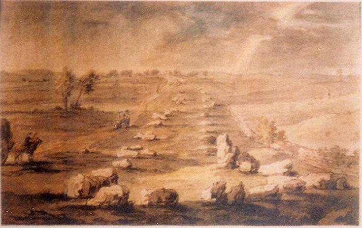
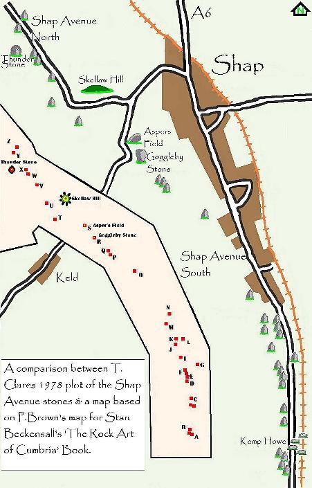
Stukeley visited the site in 1725 and interpreted the avenues as a 'megalithic serpent', unfortunately the plan drawn up by his surveyor, Routh, is now lost. The earliest diagram I can find of the avenues is a painting of the southern avenue. I came across the painting on the Shap Community website (http://ShapCumbria.co.uk). The painting is unaccredited but appears to be based on a sketch that Burl has in his book 'Carnac To Callanish' the sketch is credited to Lady Lowther and dated 1775.
Through the centuries the Shap avenues have attracted many of the more notable antiquarians and archaeologists. This has left us with a record charting the destruction of this once spectacular monument. In 1777 Nicholson and Burn noted the blasting and carrying away of stone for the foundations of buildings. By 1824 G. Hall wrote about the destruction of the stones by enclosure. When Lukis and Ferguson review the evidence in the late 1800's 'there was precious little remaining other than the early and apparently conflicting accounts'.
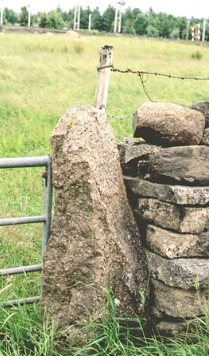
The antiquarian, Rev. J. Simpson was the Vicar of Shap in the mid 1800's; he described the avenue and gave an intriguing account, writing that from tradition there was a stone circle 400ft in diameter with a large stone at the centre. It's said that this huge centre stone was cut into 7 pairs of "Yat Stoops" or gateposts.
.
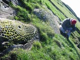
The Reverend Simpson was also something of a pioneer in the field of prehistoric rock art and was the first person to describe and draw the cup and ring marking on the Goggleby and Asper's field stones. Aubrey Burl describes these stones as "mistakenly claimed to be cup marked" an opinion which is not shared by Stan Beckensall who describes them thus " the symbols on the Goggleby Stone are a shallow wide cup mark with a smaller one beneath it on the vertical face of the stone. The Asper's Field stone, has a cup with a single ring on top".
In the mid 1970's, T. Clare reviewed all of the published accounts of the avenues and tried to make sense of the conflicting accounts of the Antiquarians. His fieldwork led him to conclude that the apparently conflicting accounts of the avenues were in fact complimentary. The main difficulty with all of the early interpretations of the avenues was what Routh described as the 'remarkable turn' in the avenues course. Clare hypothesised that there could be two possible explanations for this turn. The north and south avenues were two separate monuments or that the Skellaw Barrow preceded the avenue and had to be avoided. He then concluded that avoidance of the barrow was unlikely and so chose the option of two separate avenues. Looking at the stones themselves further strengthened this argument. He stated that all but one of the members of the north avenue appear to be tabular in form whilst the members of the southern group were more diverse in form. He suggested that Skellaw Hill could have been a terminal along with the Kemp Howe circle.
Aubrey Burl's favoured and as he puts it, un-dogmatic, interpretation of the avenues is 'To the north of the Kemp Howe there had been two single lines, the eastern beginning at the Goggleby Stone, and the other starting about 1000 feet (300m) to the WNW and stretching north-westwards for some 900yds (820m) passing alongside the Knipe Scar enclosed cremation cemetery with it's burnt human bones".
Stu and myself have waded through this material and decided that the only way to sort it out was to get ourselves there and give the place a good coat of looking at. After a few false starts we finally made it.
We decided to roughly follow T. Clare & P. Browns plans of the avenues and try and identify all the stones marked.
We decided to look mainly at stones made of un-quarried Shap granite. Shap granite is a magical rock, for the geologically minded amongst you, it is a biotitic granite with large crystals of pink, plagioclase feldspar, once seen never forgotten. It also seems to be the stone of choice for the stone circle builders of the eastern Lakeland fells.
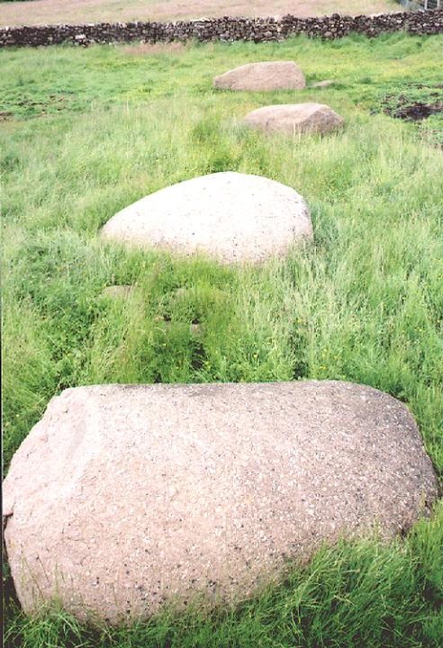
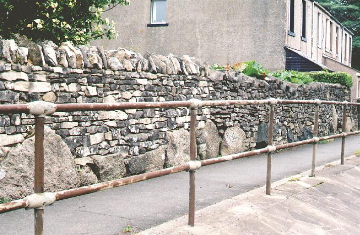
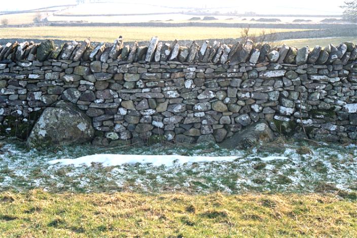
So down to the nitty-gritty. We parked up at the southern end of the village and started our search in the walls just south and on the opposite side of the road of Kemp Howe. Almost immediately we started finding large well-rounded boulders being used as footings for the walls. Stu reckons there were 6 there in total. To be honest with you I was preparing myself to not find a thing, so this was a wonderful start. We then crossed the road to Kemp Howe aka Karl Lofts aka the Liftings of the Husbandmen... yeh I know, I haven't a clue what it means either but in my Yorkshire dialect book, ' Kemps' means hair mixed with wool, clear as mud!
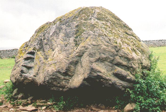
The lovely stones of Kemp Howe sit beside the railway track and resemble a group of hippos wallowing in a sea of green.
Julian Cope described Shap as "A whole community built at the expense of a mini-Avebury", this statement hits home as we sit in the ruins of this once-grand but now forlorn circle. The northern walls of this field reveal more stones in the footings.
We left the field and head north along the A6. The area close to and around the Force Bridge revealed more stones including a large stone nestled amongst the trees beside a field wall west of the Force Bridge.
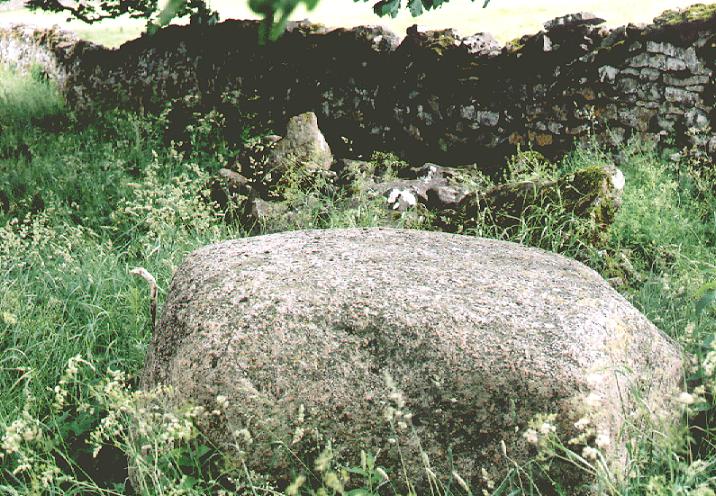
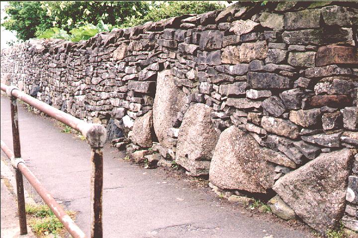
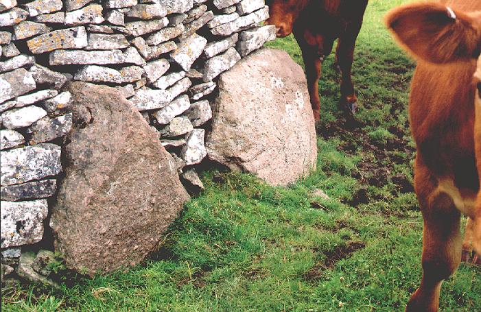
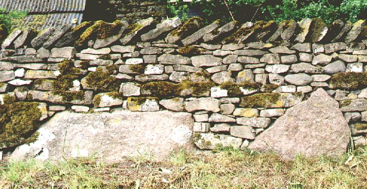
From here we had stones to the left and right of us. There was a large stone poking through the grass in Brakenber Field along with a number of stones in a field clearance, and then, suddenly we were faced with a whole wall full of stones. These stones had un-weathered faces but by looking at the sides of them you could see that these were not quarry stones but boulders that had been broken up.
One of the beauties of granite is that it doesn't weather; a face that was broken 1000 years ago can look as fresh as a modern face. As an example of this, if you ever go to Aberdeen, check out the buildings there. The whole city is built of granite and it's only the differing architectural styles that reveal the true ages of the buildings.
By now our heads were spinning, what we had found was greatly exceeding our expectations. Time for the pub. We called into the Greyhound Hotel to chill for a wee while and talk about what we were seeing.
I can recommend the Tirril Brewery's lovely Bewsher's bitter. You can't miss it; they use the sanctuary knocker from Durham Cathedral as a logo. There is also the same knocker, which I presume is a copy of the original, on the huge gates of Brougham Hall and on my toilet door at home, but maybe that's just too much information.
We needed to confirm that these were stones from the avenue. What started to convince us that these were indeed the stone was the fact that the local building stone is limestone. The granite was only being used a piece here and there. If it was coming from the quarry we would have expected to see worked stones or walls and buildings faced with this incredibly durable stone but this just wasn't the case.
On leaving the pub, the same pattern continued, occasional stones in walls, the odd isolated stone in a field e.g. the large rounded boulder in front of Green farm, but they were becoming less frequent. It was at this point that we decided to start heading out into the fields towards the Giants Foot Stone. As we followed the footpaths we started encountering the same pattern of stones in walls that we had seen along the A6. At this point the plan of the avenue shows that it starts to veer away from the road and our observations seemed to confirm this.
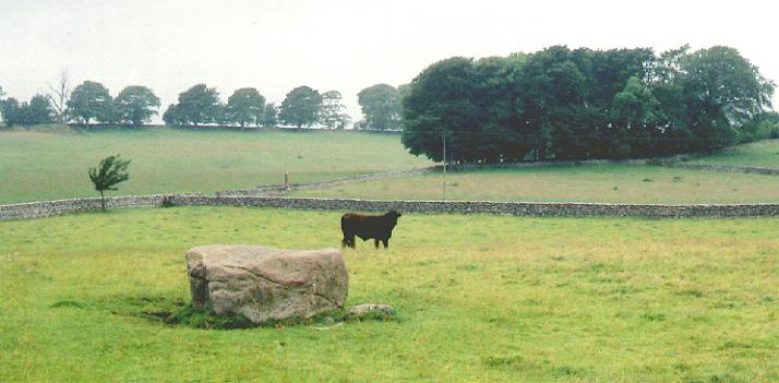
The Giants Foot is a beast of a stone, but its size was not the most significant factor, its shape was more important, it was tabular, an indication that something may have changed. So far the stones we had seen were rounded boulders. There are references in the various accounts of the pairing up of tabular and rounded rocks, perhaps to signify the male and female form. This was the first of this new type of stone, and what a cracker!
As we moved along, gradually making our away up the low rise checking out the various stones in the wall and dodging inquisitive bullocks, we began to move towards the Goggleby Stone with the very low, subtle rise of Skellaw Hill beyond.
Burl describes the Goggleby stone as looking like a bulbous triangular avocado standing on its head. Burl's Avocado is a beautiful stone. In his stone row book he relates a tale that ' In 1834 the Rev. Bathurst Deane scoffed at the 'ridiculous name of the "Guggleby" stone, given to it by a facetious farmer some years ago to exercise the ingenuity of antiquarians'. As, over a century before, Stukeley had referred to 'one particularly remarkable, called Guggleby Stone' Deane appears to have been misled'.
Stu and I discussed the possible origins of the name. One idea that came to mind was that of Gog, the ancient British God, who according to T.C. Lethbridge, is also known as Og, Hog (remembered at Hogmanay). He describes Gog as "Perhaps originally a bodiless deity corresponding to Brahma and the force at the back of all things. Later seems to have become identified with the sun and either the husband or son of Magog". Magog is the Earth Mother and Moon Goddess in her old phase. She is also known as Magg, Meg, Matrona, and Maha-devi etc. She may also be the Cailleach and is sometimes represented by a standing stone. Stu pointed out to me, that in Paul Newman's book, The Lost Gods of Albion, Newman writes that "Gog is a version of Ogmios, a Herculean divinity equated with the glare and dazzle of the sun - hence the word 'goggle'".
The Goggleby Stone is a marvel in itself, but Stu and I were keen to get to Asper's Field and get to grips with the cup and ring. We checked out the fields and looked for the easiest way to access the stone using the various gates. I'm afraid we didn't gain permission from the farmer because we didn't have a clue who to ask and as there was no livestock in the grassy field, we thought no one would mind.
Before the next stage of the journey, a word of warning. If you are planning to use the footpath from the Goggleby Stone to Skellaw Hill I would advise you to wear a pair of wellies, waders would be better. This path in parts is a quagmire and a real test of determination but if you do make your way along it you'll see a couple of lovely, great big stones embedded into the wall.
Skellaw Hill is generally a bit of a disappointment. Unfortunately 'The Hill of Skulls' has long since lost its 'sepulchre' status and was reduced to a small mound following the enclosure of the common in 1815. If you didn't know it was there... But fear not, this was an important part of the northern avenues and an integral part of the whole monument.
There's one issue on which we disagreed with previous surveyors of the avenue. Everyone seems to agree that the avenues avoided Skellaw Hill, but if you look in the wall just below the hill, you will find a large embedded stone that is perfect alignment with Asper's Field and the Goggleby Stone.
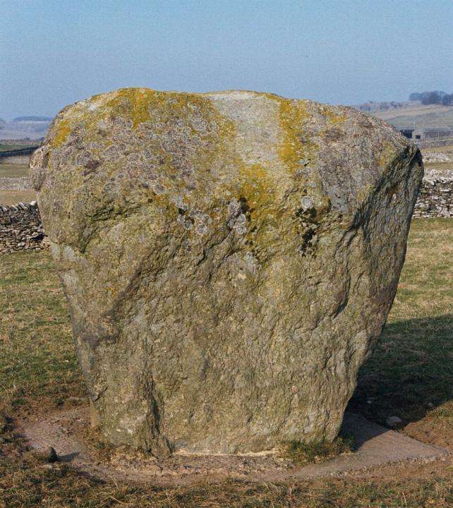
From here it is fairly plain sailing, we followed the road heading towards the Thunder Stone checking out the field walls and finding a number of good-sized stones poking out of the walls and grass. At the entrance to High Buildings Farm you can see the Mighty Thunder Stone in the field ahead. We walked up to farm and the friendly farmer allowed us to mooch through his field to the stone. This rock is the size of a car. The Goggleby stone weighed in at 12 tons so what would this weigh? "No wonder folk thought that these stones fell from the sky," remarks Stu. Put yourself in the days before folk knew about glacial transportation. You've got this bloody great stone in the middle of a field. How did it get there? A Thunder Stone indeed.
In the opposite corner of the field, close to the road is another good-sized stone but nothing on the scale of the mighty Thunder Stone.
In the field beyond we came across the area described by Clare as "disturbed ground amongst which the remains of old enclosures (associated with quarrying?) can be discerned. This area would equate with the four ovals or circles of Routh and the square plots of stones nearly covered with earth, of Hodgson which are considered to be the northern terminus".
As we walked back into Shap village from the north another piece of the jigsaw fell into place. The houses and walls of the northern two thirds of the village are almost totally free of granite. The walls are topped with beautiful gnarly limestone but no boulders, no footings. At the point where the avenue leaves the village, the use of granite stops.
The implication here is that all of the granite we encountered in the southern end of the village has been gathered from the fields. Burl writes that there were 500 stones in the avenue, I'm not sure where he gets this figure from but given the length of the avenues, it seems reasonable. If this figure is true then we have seen evidence of about 1/10th of these stones. The rest, we must assume are now part of the fabric of the village, foundations for walls and houses, drainage channels and road stone.
So what can we say about Shap? Yes the avenues would have been magnificent, but more than this, Shap appears to be the significant part of a prehistoric Cumbrian monumental landscape. This is a landscape that exists in a corridor between the western margins of the Pennines and the eastern margins of the Cumbrian fells. This landscape seems to be associated with the three interconnected rivers, which run through it, The Rivers Eden, Eamont, and Lowther.
If we start at the ruined stone circle and stone row of Grey Yauds and then move along the Eden to the ruined complexes at Broomrigg, the monuments of Old Parks,Glassonby, Long Meg and Little Meg. We then come to the junction of the Eden and the Eamont, if we follow the Eamont for two miles we come to the junction of the Lowther and the crossing point at Eamont Bridge with the triple henges of Mayburgh, King Arthur's Round Table and The Little Table. Follow the Lowther south past the standing stones of Clifton, the Long barrow of Low Moor, the Moor Divock complex which includes another series of stone rows, the circles and enlosure of Knipe Moor and the nearby circles of Shapbeck Plantation, Wilson Scar, and Gunnerkeld.
These monuments are all north of Shap and roughly follow the river systems. In the hills surrounding Shap itself we have the prehistoric stone circles and cairn circles of Castlehowe Scar, Iron Hill and Oddendale.
An interesting aside to all the followers of Julian Cope's research. The Dr. J.Y Simpson refers to Oddendale as "Odindale" and the nearby barrow of Seal Howe as "Sill Howe".
The source of the River Lowther lies just south of Shap in the area where I began this article, Wickers Gill, a Mesolithic site.
So what was happening here?
Judging from the amount of monuments, there seems to be a huge amount of ritually related activity taking place in the late Neolithic and early Bronze Age.
Were people coming into this area from other parts of the British Isles?
I believe they were. I base this upon my researches, visits to the area, looking at the different styles of monuments and tracing possible routes of communication between Cumbria and the rest of the British Islands.
Why were prehistoric peoples coming to Cumbria?
Its location in the centre of the British Isles is ideal, especially if you are navigating the western seaboards or crossing from Ireland to continental Europe. There is also a lot of evidence which points to the movement of stone axes out from Cumbria. Cumbrian stone axes have been be found throughout Britain and Ireland. A lot of research has been undertaken into the production and distribution of stone axes, I don't really want to explore that here but if you want to look into this subject further then Terry Manby's paper, 'The distribution of rough-out "Cumbrian" stone axes', is a good starting point (see references).
I was recently asked, why are so many of these monuments dated to the Bronze Age, a time when the production of stone axes was in decline?
I believe that the ancient Cumbrians were prospectors, craftsmen and traders. They originally explored and exploited the fells for rock that was suitable for making tools such as axes, but as the demand for stone tools fell into decline, the native Cumbrians embraced the new metal technologies and built upon the trade links that were already established with the rest of the Islands of Britain and beyond. Veins of copper, lead and silver that can be found in various locations throughout the fells would probably have been known to many people. There is evidence of prehistoric copper extraction at Coniston. This may have been a natural progression. The quarrymen may have become surface miners and the knappers may have become metal workers. One hint of this may be Stukeleys report of a 'bronze celt' (probably an axe) found ritually buried in the entrance to Mayburgh Henge 10km north of Shap.
Of course none of this is certain but it's the best I can come up with given the evidence I have.
Finally I would like to say that I agree with Mr Cope's statement that Shap is a "Mini-Avebury". It is still a magnificent Cumbrian monument set in a spectacular landscape. More significantly for me, it is a place that is free of the new-age frippery that you encounter at so many of our ancient British monuments.
Long may it stay that way.
Fitzcoraldo
July 2004
Updated October 2004
The SMR lists stones at the following grid references
NY55171592, NY55151574, NY55551528, NY55551526, NY55841520, NY55921509, NY56051496, NY56031477, NY56611436, NY56591425, NY56741411, NY56751410, NY56761409, NY56741409.
To add these Stu took the following references on his trusty GPS. This doesn't cover all of the stones that we found but it is a good starting point.
NY5673613194 to NY5673713308. The stones opposite Kemp Howe
NY5656813841. The Force Bridge stone
NY5659414220. The Green Farm stone
NY5656814378 to NY5650314574. The central stones in the wall side.
NY5629314819. The bullock field stones
NY5564115433. Two stones on the roadside below Skellaw
NY5555315278 & NY5555713264. The two stones north of Asper's Field next to the quagmire
NY5527915783. Stones close to the Shap Abbey junction.
NY5527915783. Stones in a field clearance.
NY5527015828. Wall stones
NY5521215932. Two uprooted stones.
References
Prehistoric Rock Art in Cumbria
Stan Beckensall
Tempus Publishing 2002
From Carnac to Callanish. The Prehistoric Stone Rows and Avenues of Britain, Ireland and Brittany.
Aubrey Burl
Yale University Press 1993
The Stone Circles of Britain, Ireland and Brittany.
Aubrey Burl
Yale University Press 2000
Field Walking in Cumbria
James Cherry
Current Archaeology 115. June 1989
Recent Work on the Shap "Avenue"
T. Clare
Transactions of the Cumberland & Westmorland Antiquarian & Archaeological Society Vol LXXVII 1978
Archaeological Sites of the Lake District
T. Clare
Moorland Publishing Co Ltd 1981
The Modern Antiquarian
Julian Cope
Thorsons 1998
Gogmagog. The Buried Gods
T.C. Lethbridge
Book Club Associates 1975
The distribution of rough-out "Cumbrian" stone axes
T. Manby
Transactions of the Cumberland & Westmorland Antiquarian & Archaeological Society Vol LXV 1965
Lost Gods of Albion. The Chalk Hill-Figures of Britain
Paul Newman
Sutton Publishing 1997
The Shap Community Website
http://ShapCumbria.co.uk
Stone Circles Near Shap, Westmorland
Proceedings of the Society of Antiquities of Scotland Vol 4 1860-62
Rev. James Simpson
On the Sculpturings of Cups and Concentric rings
Proceedings of the Society of Antiquities of Scotland Vol 6 1864-66
Rev. James Simpson
Address on Archaeology
Proceedings of the Society of Antiquities of Scotland 1860
Prof J.Y. Simpson
Stanfords Geological Atlas of Great Britain
Edward Stamford Ltd 1964
The Cumbria Directory
http://www.thecumbriadirectory.com/
W.B. Yeates
Selected Poetry
Pan Books.
|
Previous 5 | Showing 11-15 of 15 posts. Most recent first |
https://teessidepsychogeography.wordpress.com/
|
