|
|

|
|
Iron HillCairn circle
|
||||||||||||||||||||||||
|
|
|
Images (click to view fullsize) |
|
Photographs: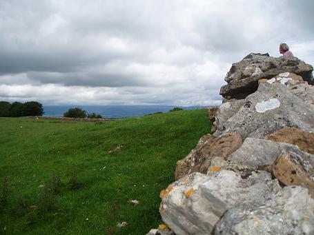
 Maps / Plans / Diagrams:
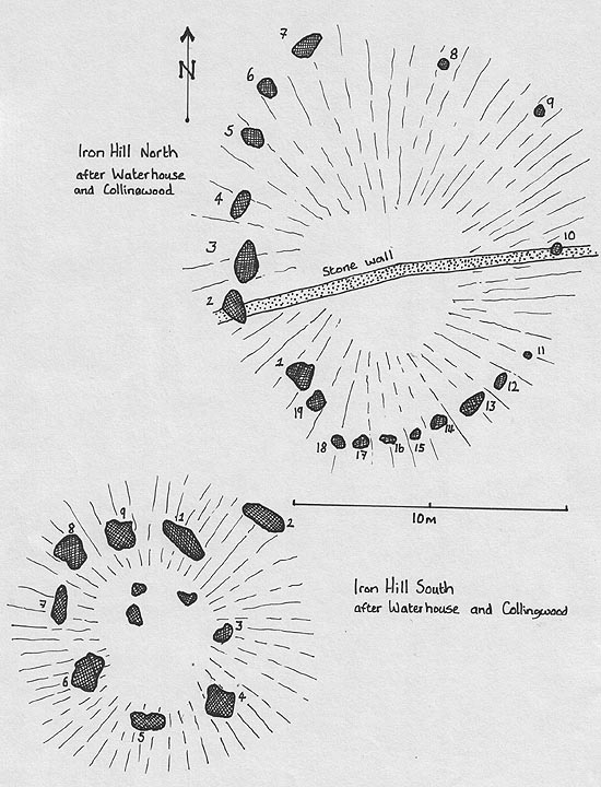
|
Fieldnotes |
|
|
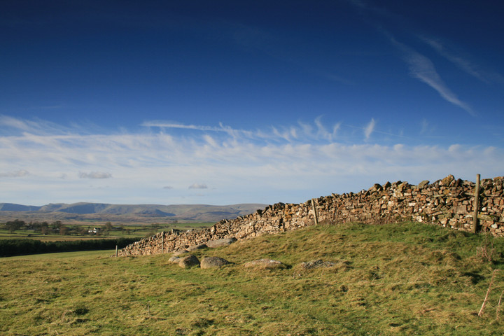
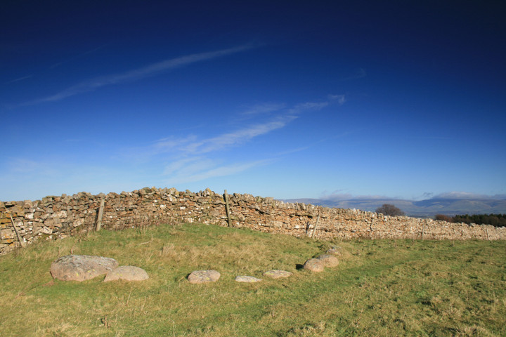
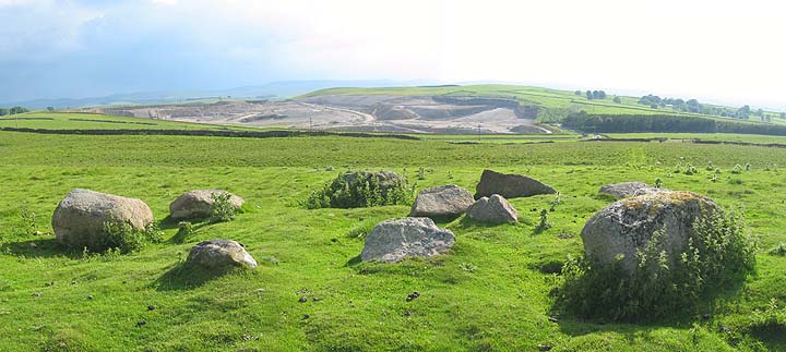
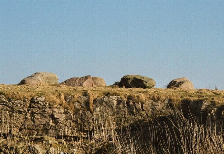
Sunday 29 June 2003 From Castlehowe Scar stone circle, we continued south to the end of the plantation on the left. It’s worth noting that the lane does a sharp left and then turns right to continue south to avoid the revolting newish Hardendale quarry. (Older maps show it as going straight on.) For Iron Hill we simply parked at the second of these corners and walked up the overgrown lane that goes straight on at the corner. As you reach the brow of the hill after a couple of hundred yards, tops, the bizarre ‘Iron Hill north’ cairn ‘chopped in half’ by the wall appears on your left. To the right is Iron Hill south. Can’t add much to Fitzcoraldo’s description, except to echo that it’s worth a visit if you’re around. The views must have been beautiful pre-quarry & still are if you manage to look in a direction that excludes the damn thing. Still, won’t be there forever I guess. This post appears as part of the weblog entry Such a nice Shap!
|
2nd July 2003ce Edited 15th July 2003ce |
|
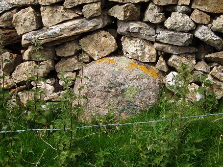
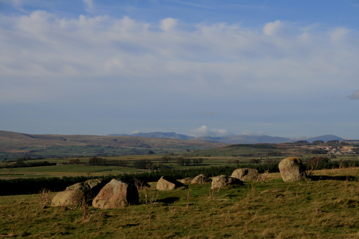
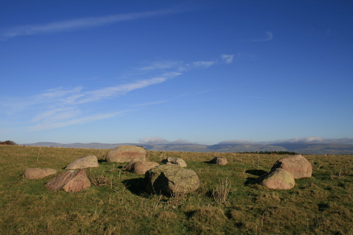
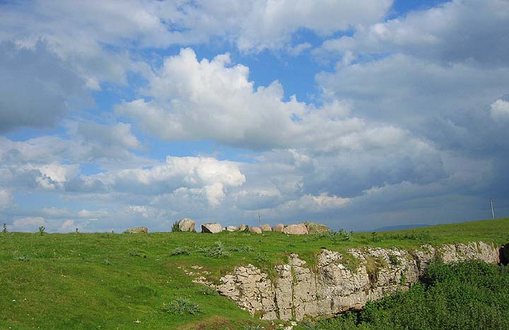
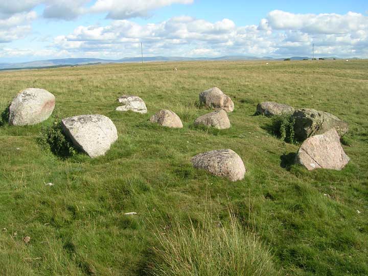
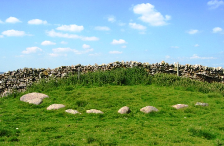
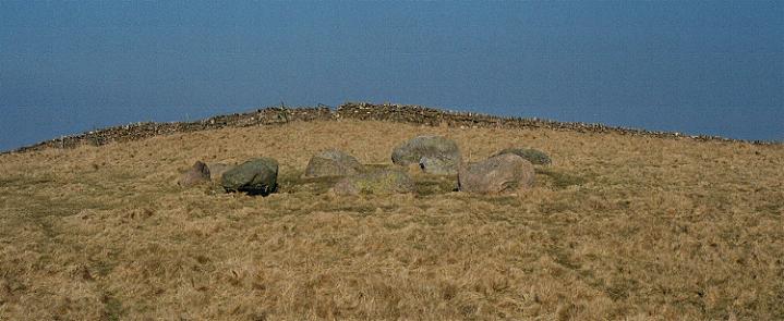
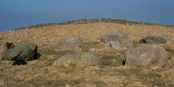
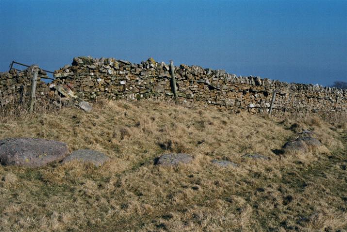
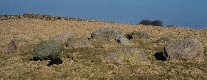
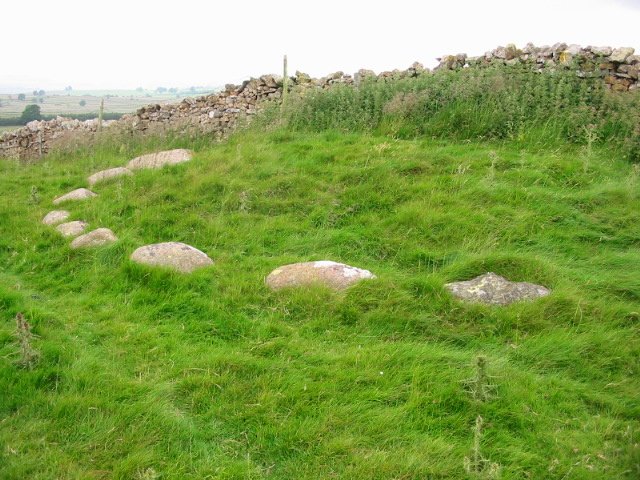
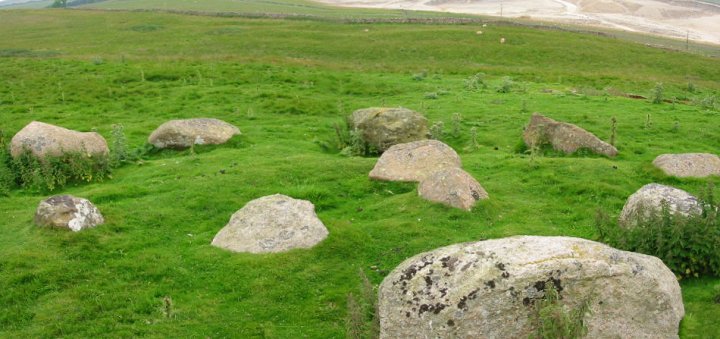
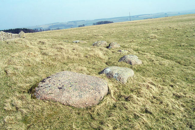
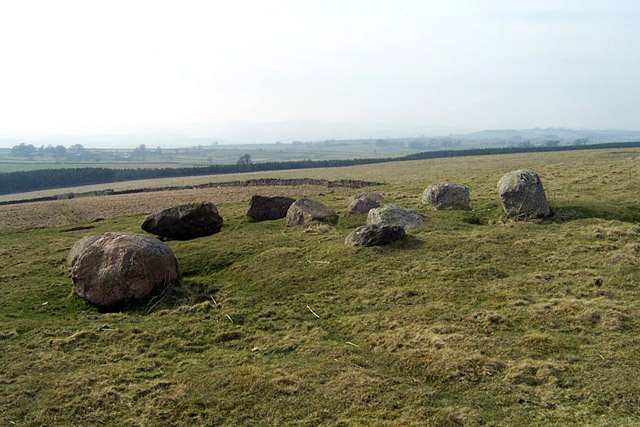
I've been trying to get to this site for some time and have eventually got there. I must say I wasn't disappointed. You can see the stones profiled on the horizon as you come up the road from the cattle grid. The footpath up the hill is walled on both sides and seems like an extension of the road. The first site you come to is the cairn which is bisected by a stone wall. The cairn is approximately 10 metres in diameter and only has stones on the southern side (10 of 'em). It makes you wonder about the farmers attitudes to these sites. Why did the farmer of the northerly side remove the stones and the farmer on the southerly side leave them in situ? Fifty metres south of the cairn along the low limestone scar is the second circle. This is a lovely intimate circle with twelve stones, nine of which are lovely Shap granite and the rest limestone (I think). The view from the circle is over the massive Hardendale quarry. A truely rural/industrial landscape. Fifty Metres east of the first cairn is a single large stone that stands at the entrance to another walled corridor between fields. Weird boundaries they have up here! |
 Posted by fitzcoraldo
21st February 2003ce |
|
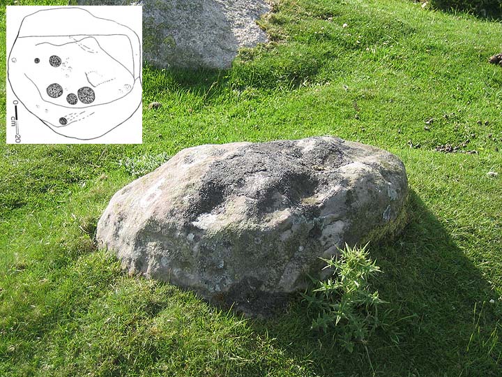
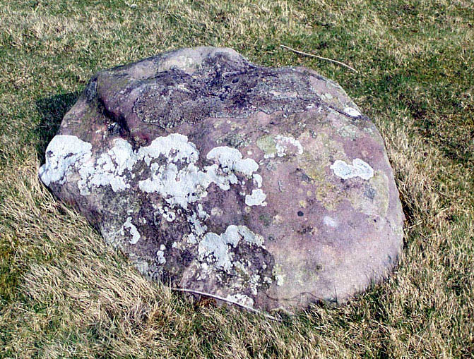
The half circle of Iron Hill North has one stone of limestone amongst the Shap granite, this also occurs at other sites nearby such as Gunnerkeld and Gamelands. There is a sandstone boulder in Iron Hill South that has 4 or 5 cupmarks on the top. |
21st January 2003ce |
| Well worth the visit to the Iron HIll cairn circle and it's companion cairn just a few feet away, intersected by a dry stone wall. The circle is difficult to understand, at first, but does eventually make sense. Taking photographs was very hard! |
 Posted by IronMan
2nd April 2002ce Edited 21st March 2003ce |
Miscellaneous |
|
|
On Harberwain Rigg is a remarkable mound occupying a very elevated position; its diameter is fourteen yards, and surrounded by eighteen large boulders. It was carelessly opened a few years ago, and in the south-west side was found a human skeleton of gigantic proportions; but whether he had been in a cist of how laid was not noticed. Along with the bones were found portions of the horns of the red deer. The mound is called Iren Hill, doubtless a corruption. Half way between it and the stone circle was found in a cleft of the rock a bronze dagger blade, thirteen inches in length and four inches broad at the hilt. It is of very good orkmanship. Whether it is coeval with the mound is doubtful; but it is a good specimen of the weapon which supplanted those of the stone age, and in the hand of the Briton opposed the advance of the Roman legions. From The Vale of the Lyvenett T.S. Bland |
Posted by fitzcoraldo 24th June 2007ce Edited 24th June 2007ce |
Links |
|
Megalithic WalksImages and description of the site. |
Posted by IronMan 26th February 2002ce Edited 30th July 2003ce |