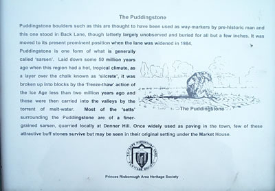
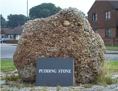
|
|
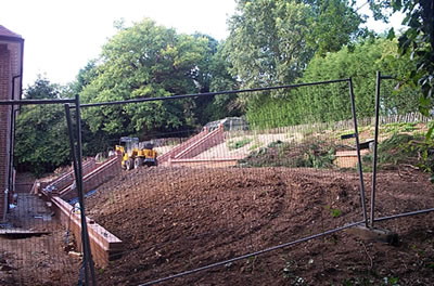
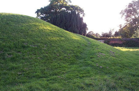
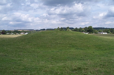
There's supposed to be a "Fairy Ring" up here ... though judging by the state of the place, any fairies will have been long scared by people sat around campfires getting pissed ...
|
has a reconstructed Iron Age house, amongst other things ...
|

 
|

|
email from Bucks Archaelogical Service:
-------------------------
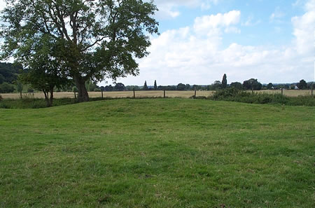
The barrow at Slough Farm only survives as a cropmark and as a very slight "bump". It is scheduled however, and we would strongly support reversion to grassland under Countryside Stewardship, if the farmer were ever to consider it.
|
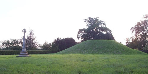
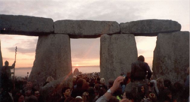
Save Silbury Peaceful Protest
http://www.cruithni.org/issues/silbury/savesilbury.html
September 8th, 2001:
Venue Avebury main car-park with walk to Silbury Hill.
A mass walk to bring attention to the sorry state of the hill and to demand that govt money is provided to repair the damage. By this date the current surveys should be completed and an idea of just how much work and money is needed should be ready.
Help to keep the pressure up and to get media attention by joining the walk, meet up in the main car- park around 1-1.30pm ready to set off to Silbury Hill car park at 2pm.
Bring a picnic, bring children, bring your friends, bring banners. This is to be a peaceful demonstration so the more peaceful types the better!
The last march went off very well with a friendly police presence and some of the kids getting lifts in the back of the lead police car. If by any chance an announcement is made that the funds will be made available then the day will transform into a celebration instead.
If any of you who live in cities and don't have cars would like to offer to arrange coaches get in touch. Likewise anyone with car space.
Birmingham/Midlands pagans are already trying to arrange coach hire and places. Make a day out of it, book a coach for your moot, enjoy a day out in Ancient Avebury and do something to show support for Silbury Hill.
Anyone wanting to offer to be a steward for the day please get in touch by mailing [email protected], stewards are needed to try to talk people out of climbing the hill and to ensure safety on the walk (fluorescent jackets provided).
|
Joseph Tubbs, 1844 - carved this poem on "Poem Tree" up the Clumps ...
As up the hill with labr'ing steps we tread
Where the twin Clumps their sheltering branches spread
The summit gain'd, at ease reclining lay
and all around the wide spread scene survey
Point out each object and instructive tell
The various changes that the land befel.
Where the low bank the country wide surrounds
That ancient earthwork form'd old Murcia's bounds.
In misty distance see the barrow heave,
There lies forgotten lonely Culchelm's grave.
Around this hill the ruthless Danes intrenched,
and these fair plains with gory slaughter drench'd,
While at our feet where stands that stately tower
In days gone by uprose the Roman power
And yonder, there where Thames smooth waters glide
In later days appeared monastic pride.
Within that field where lies the grazing herd
Huge walls were found, some coffins disinter'd
Such is the course of time, the wreck which fate
And awful doom award the earthly great."
|
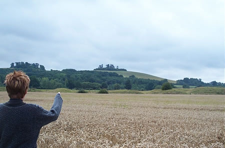
went roaming about for this on Friday (28/8/2001), but couldn't see anything, only arable farmland.
hot and sweaty, and stumbling over footpaths across fields being harvested ... dust in the air.
|
Apparently, if you run barefoot up and down, then across the arms, you will be invigorated and be able to continue your journey.
Or dead of exhaustion - it's *very* steep up there on the Ridge ...
|
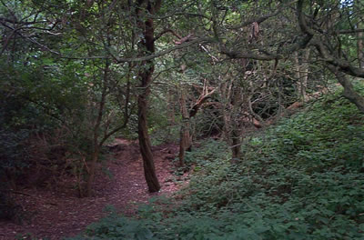
Went up here for sunset last night (24/aug/2001). Absolutely breathtaking, not least because the awesome gradient of the hill.
The Ridgeway runs along the bottom of the hill, but the real action takes place further up, if you dare ascend (or park at the top). Densely thick woodland, paths twist and turn off in every direction, some leading to burial mounds, some to large bushes of stinging things. Forget getting a signal on your phone or gps, you're on your own up here.
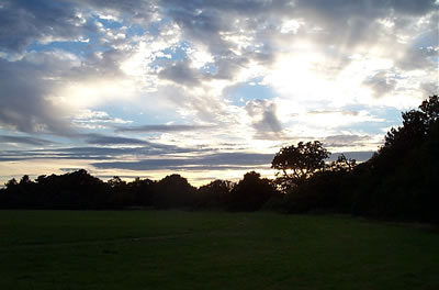
Just before sunset, I burst out into a clearing. This view stretches on for miles, bathed in a golden light. The sun sank, I sweated like a pig, flying ants swarmed and I was in the middle of thick woodland on an incredibly steep hill. The Gps reckoned the actual cross was about 300m away to the NE, but there was no way I was going to make that and back before sunset.
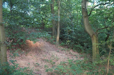
Tumbled down the hill down what looked like a path, but probably wasn't --- found some strange things facing out towards the sunset that looked like burial mounds lodged into the hillside (but probably weren't) - like the ones in Malta, back into even more woods, steeper hill,clinging onto the battered fence-cum-bannister, out onto more twisting turn paths ... a path dug into the earth like it was a trench ready for a cable ... this path has been walked for *thousands* of years
creepy creepy ... paths go up and down, dunno which way to go, the compass says go this way, but it's all dense wood, can't go that way, don't want to go up again, my heart can't stand it
hit a path that goes down, thank you, where am I ... GPS technology marvellous with a clear sky, no use in woods. Bloke with a dog, at least I'm still in 2001 ...
road ahead --- open air, check the gps to find where I am ... wallop, it's the *exact* same way as I came in ... cars 2 minutes away
woah
never made the cross, knackered, smelly. Get yourself up there ... it's all rather strange. I think you'll like it ...
RG
|
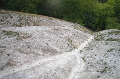
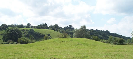
It's great when you find somewhere by accident. I was out with the Gibbonnettes, barrow hunting.
I knew that there was a couple of barrows at the top of a hill outside Princes Risbrough, and it was just about the only place open (this was during F&M time)
We parked up, and had a good scramble around the hill and in the woods ... noticing what appeared to be a bit of quarrying on the hill, but not paying too much attention to it ..
We skirted around the bottom of the hill, and looped back up. There's a lovely walk in the woods, and it opens out to a *stunning* view towards Oxford. With a barrow at the top of the hill.
Perhaps eager to avoid the barrow for as long as humanely possible, the Gibbonnettes roved down the front of the hill towards a big wooden log fence, saying "hey, what's this?"
Still preoccupied with the rather sorry state of the barrow on top, I didn't pay a lot of attention to them (shame upon me), but they persisted, so I had a look ...
the whole side of the hill was cut away into huge cross. This thing is *massive*. Huge. Enormous ...
I just couldn't comprehend it ... I've read books, driven past Princes Risbrough more than once, know people who've walked the Chilterns, but never, ever heard of this, or anything about it.
Fantastic place, go and have a look
RG
|
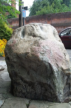
We stopped by here just before dusk. Driving down from Crickhowell, it's in the gate area of an abandoned army base on your left hand side.
There's a big sign saying "MOD Property: No Tresspassing, No Photography".
Walk past this, and it's on the left hand side of the driveway, about 15 meters down. It's not really visible from the road, as it looks a bit like a tree stump from a distance.
Get a bit closer, and a magnificent shard of rock is bursting out of the ground, straining at the earth and your perceptions of normality.
|
What the Romans started, Powys County Council roads department finished
There's lots of little wooden stakes patterned around, like at Woodhenge.
|
 
|
Without going on the Bluestone trip too much (Bedd Arthur overlooks Carn Meini, the alleged Stonehenge bluestone etc etc), it's interesting that Bedd Arthur is a horseshoe shape, as in the inner Stonehenge ring.
But it's possible this site isn't that old...there's no date on it, and Burl doesn't list it in my copy of his guide.
Nice place to stop by though, if you're passing.
RG
|
From Clwyd-Powys Archaeological Trust - http://www.cpat.org.uk/cpat/past/meso/meso.htm
Excavations were undertaken between 1977-78 on the Neolithic chambered tomb just outside Crickhowell in advance of improvements to the A40. The buried soil beneath the cairn produced evidence of Mesolithic activity in the period between about 5900-5600 BC represented by characteristic flint points or microliths. This activity appears to have been superseded in about 3750 BC by a small settlement represented by a number of pits and traces of a timber structure, probably a house. Cereal grains recovered from the buried soil provide evidence of early agriculture.
The Neolithic tomb which overlay the earlier settlement appears to have continued in use for a period of about 500 years, between about 3750-3200 BC. The monument took the form of a long trapezoidal mound, about 45 metres in length, which contained four stone chambers entered from the sides of the mound (one of which is visible in the photograph right), with a ceremonial forecourt at the eastern end. This type of tomb is well known from other sites in the Cotswolds and the Breconshire Black Mountains, together with a number of outliers in North Wales. Evidence from other sites suggests that the chambers were used for communal burial possibly by different family groups.
Excavations were funded by the Welsh Office.
|
|
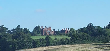
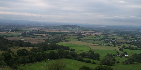
The big hill in the background is Winter Hill, where "Wind in the Willows" is set ... hurrah!
|
        
|
   
|
 
|

|
 
|
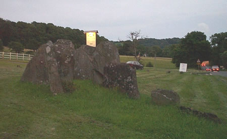
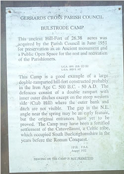
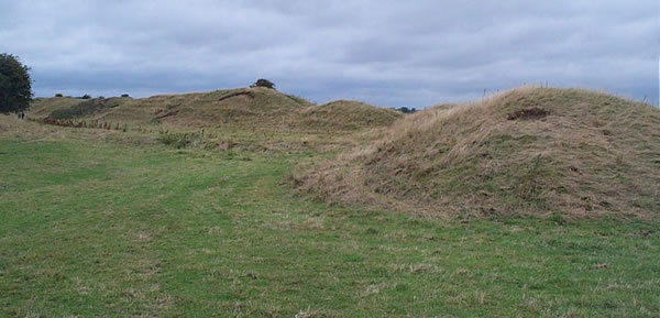
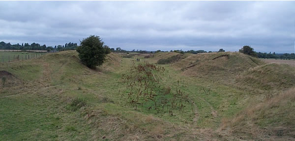
Details of the lost prehistoric fort that may have influenced the siting of the later barrow.
|
|