|
|

|
|
Bedd ArthurStone Row / Alignment
|
|
|
|
Images (click to view fullsize) |
|
Photographs: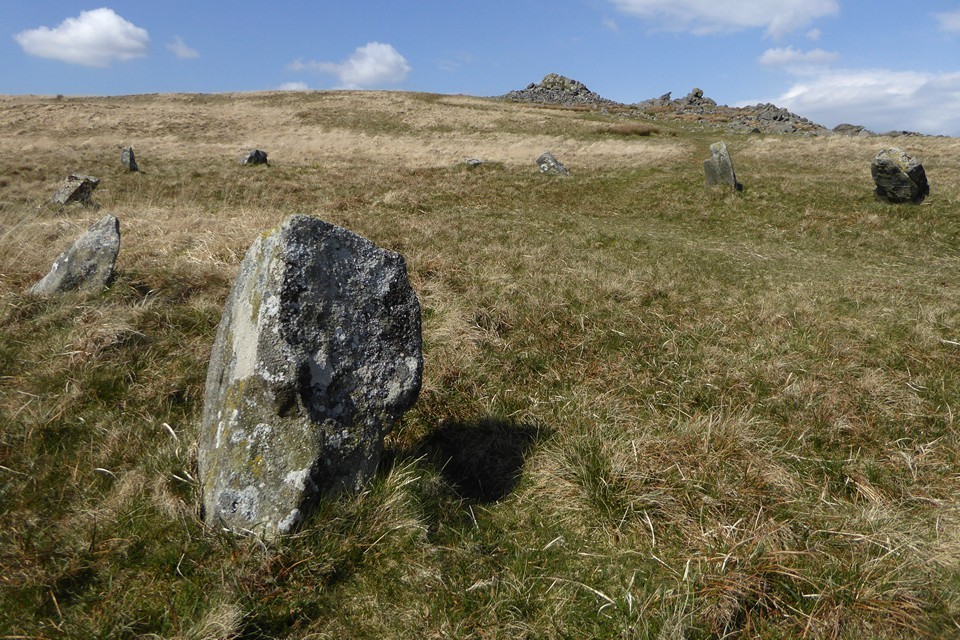


 Maps / Plans / Diagrams:
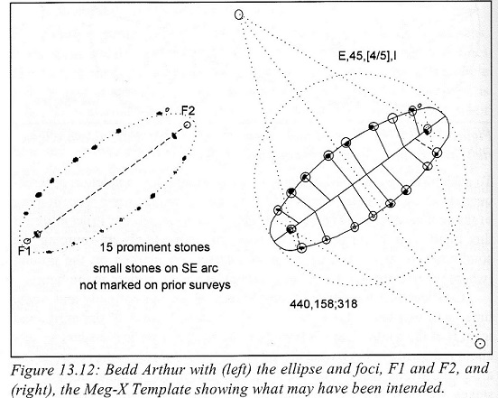
|
Fieldnotes |
|
|
After a trip to Pembroke, I thought I’d take another look at Beddarthur on the way home. It was mid-afternoon and I decided I’d see if it’s possible to take the direct route north from the parking area opposite the gate to Pentrithel. You’ll note from the OS map that the obvious trail to the stones is a dog-leg that skirts the huge hill (Talfynydd) in front of you. At the parking area, instead of going northwest along the Pony Trail, I hugged the fence at the east for a short distance and took a well-defined northward-bearing track that leads to a rock outcrop (presumably at 130314). To avoid some horses, I’d actually taken a path on the slope above the track that led to the top (but it’s not at all high). Here, there’s a distinct hollow (where I imagine the water runs off the hill) and a line of rocks in view to the north on the very top of the slope, where the main trail runs a good few hundred metres away (I could see people walking along it). I cut off northwards along the top of the hollow, following the contour but tending towards the crest of the hill (safe in the knowledge that the main trail was above me) and eventually met the track at the stones below Carnbica. Two-thirds of the walk is on rough moorland, but it was a doddle walking back. I just wouldn’t try it in the mist or in the dark. As it was, I reached the track below the rock outcrop just before dusk. |
Posted by meg-y 13th September 2018ce |
|
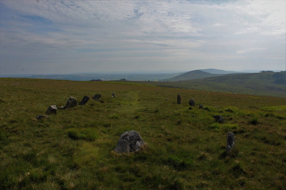
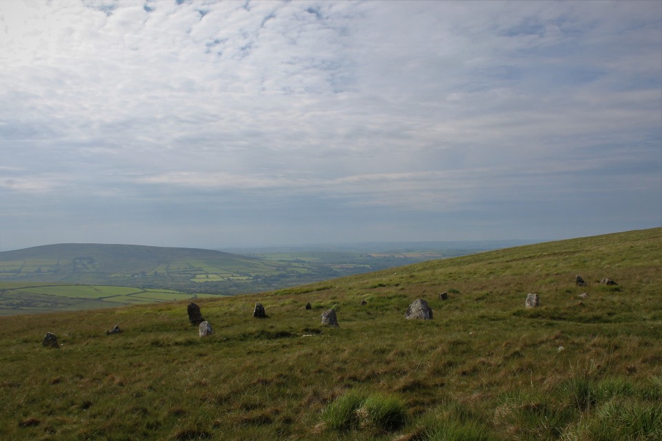
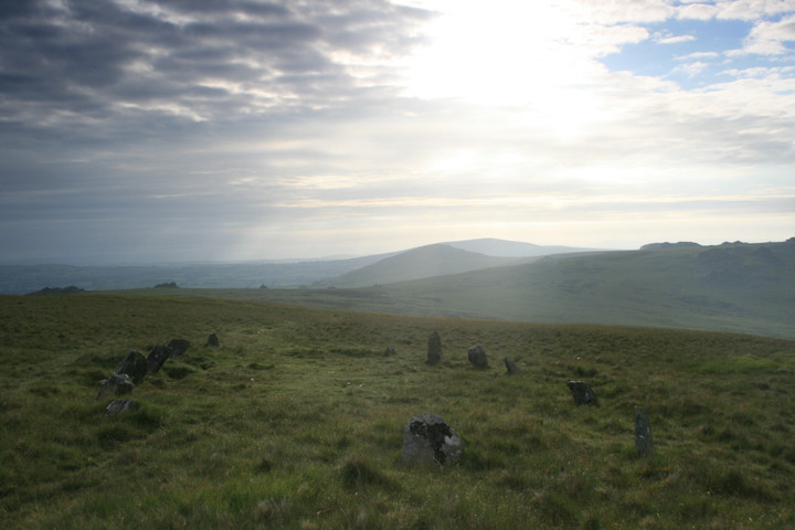
My daughter and I left the car at the entrance to Pantithel farm (there's plenty of room), and headed north on the footpath. The path slowly but steadily goes up to the main path across the Presellis, when the paths T junction turn right, east, head for Carn Bica and the stones are visible and down hill from here. Judging from the other notes on here it seems the place is a bit questionable, what is it exactly? The place felt ancient to me, if that means anything, at least in keeping with other places I'd seen. It was the day of the summer solstice that I'd chosen for a visit and we'd been on the road since 1am, but it wasn't time enough to get here and we missed the sunrise by at least an hour. But the early visit did reveal a possible alignment, though the sun was already quite high, in my minds eye I could track the sun going back down and stopping at the end of the stone rectangle. A perfect sunrise on the summer solstice when viewed along its axis, might have the suns globe acting for a minute as the missing stone . Or maybe the suns magic energy was somehow caught in the net made by the stones. I hope that makes sense, it does to me. |
 Posted by postman
2nd August 2009ce Edited 3rd April 2014ce |
|
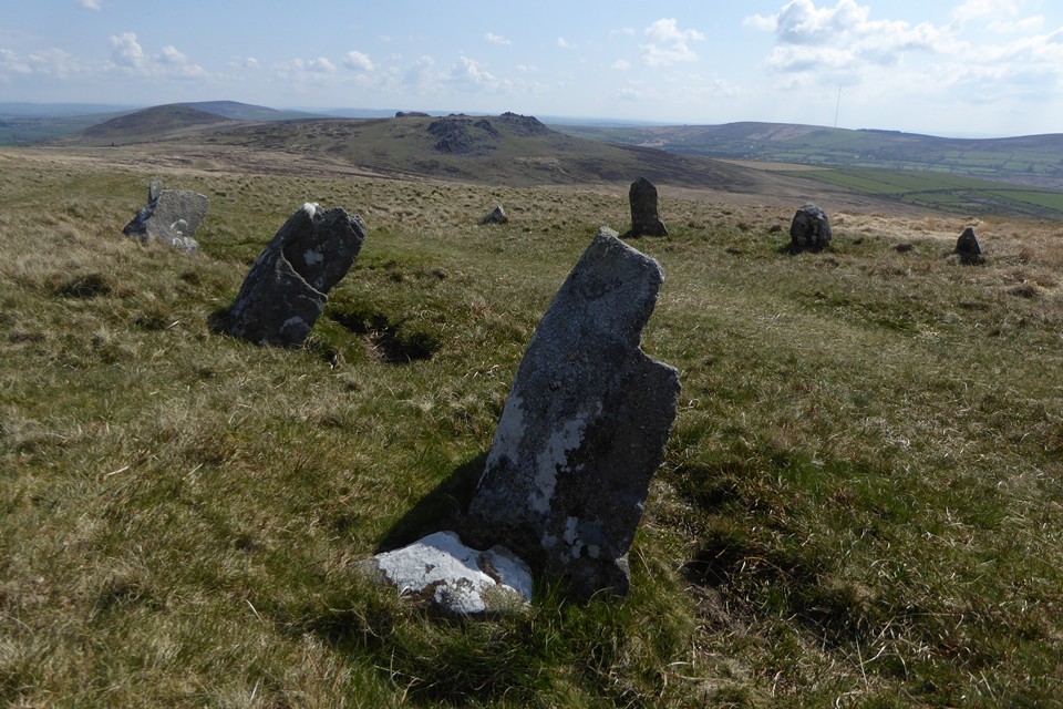
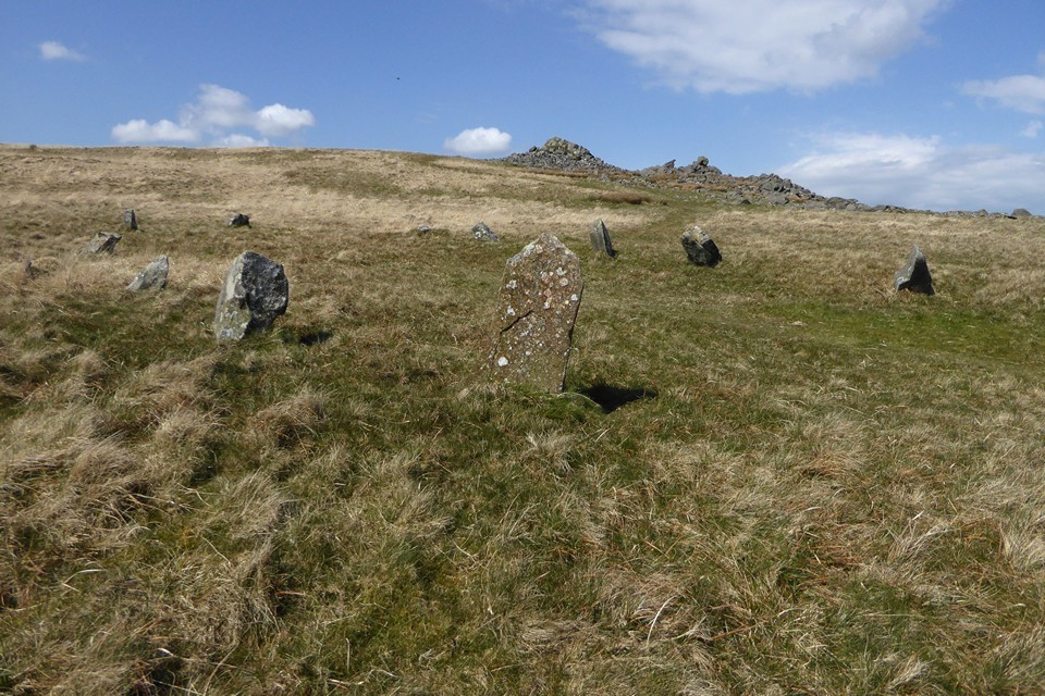
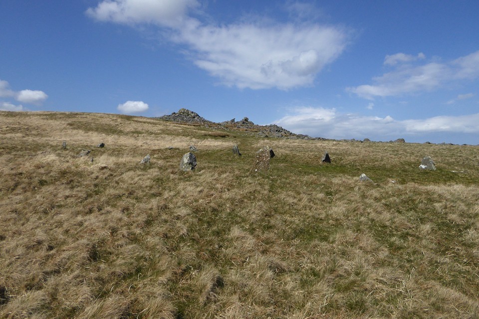
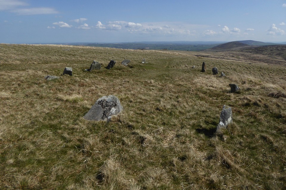
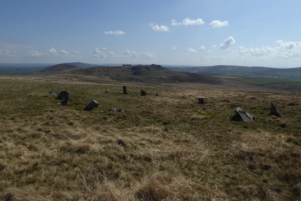
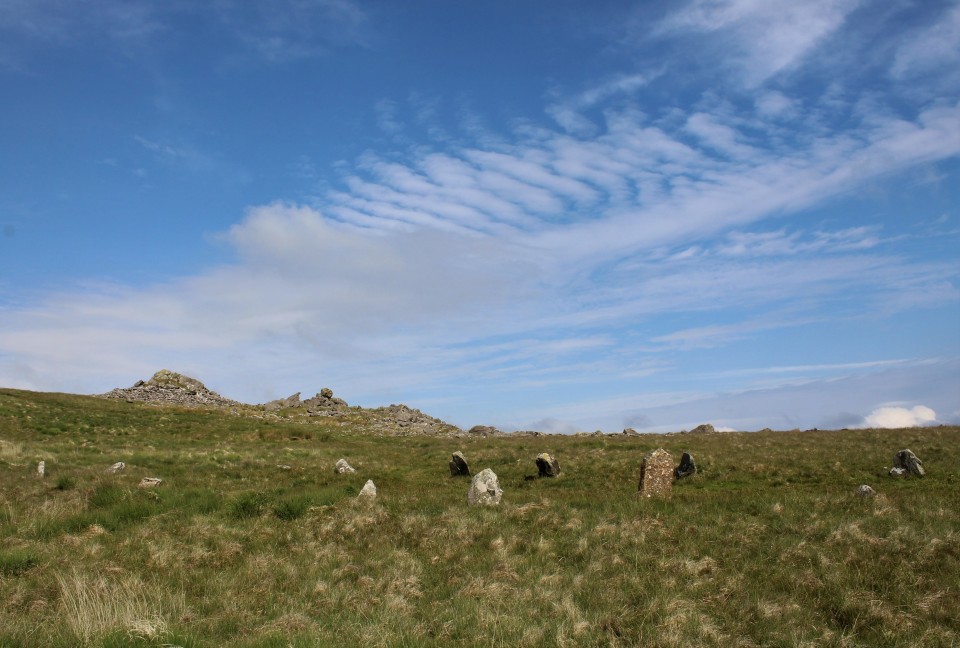
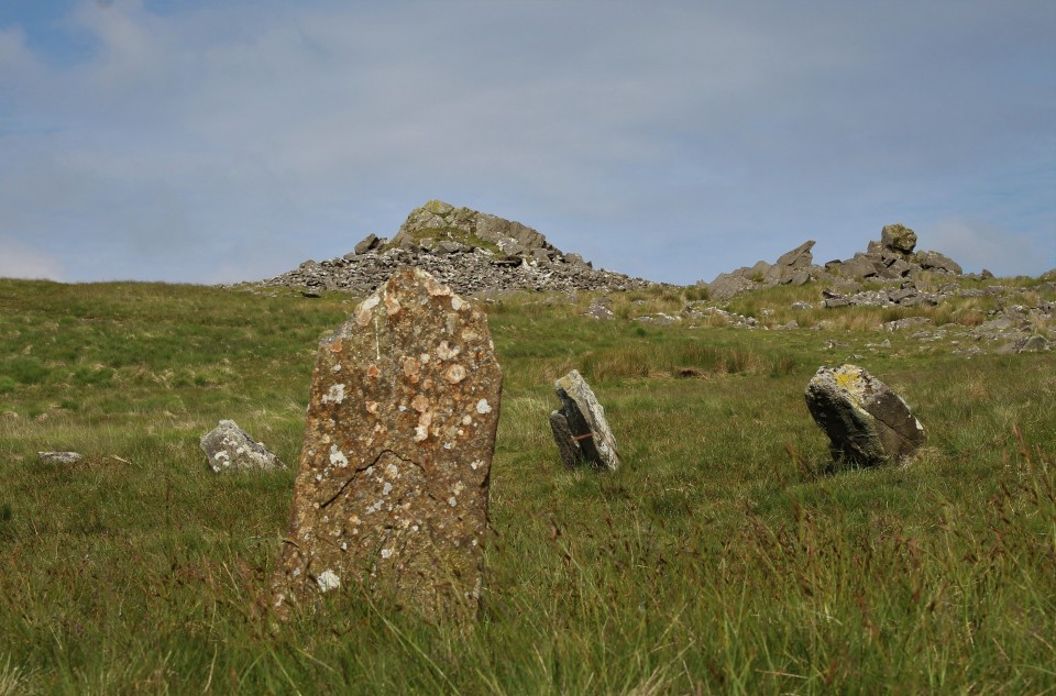
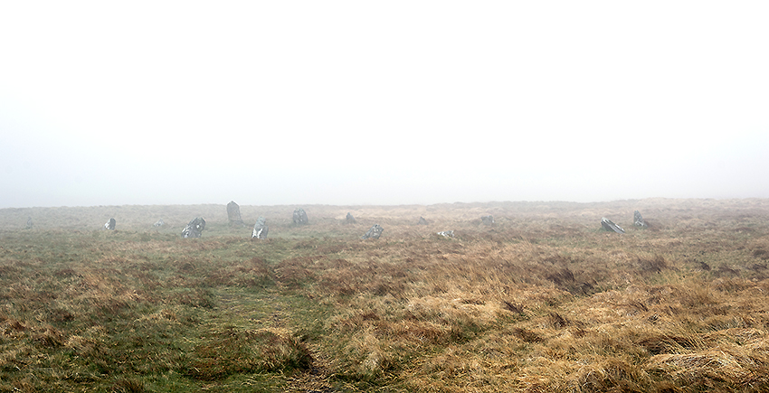
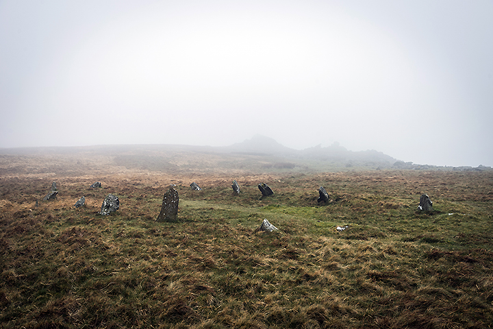
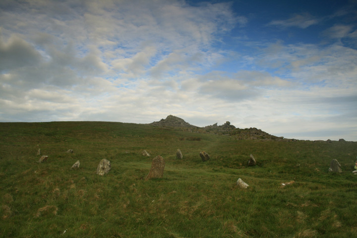
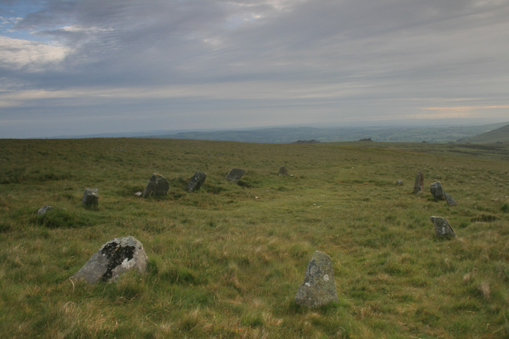
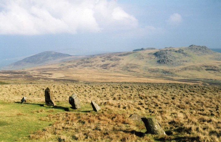
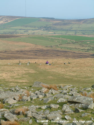
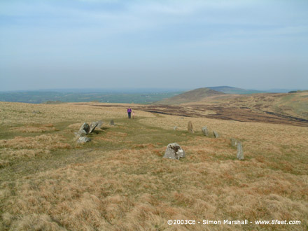
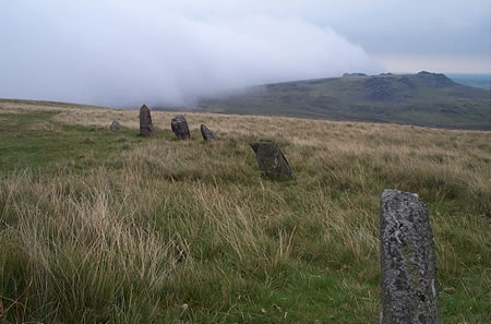
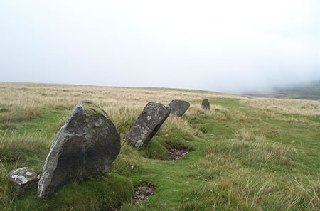
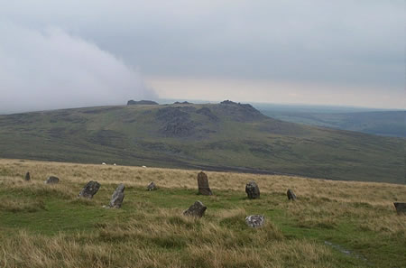
Visited 15th April 2003: Bedd Arthur was as far west as we walked along the Preseli ridge. I was really proud of William for walking all the way without being carried at any stage along the journey, so this posting is dedicated to him. What a strange site Bedd Arthur is. My gut feeling is that it's prehistoric, but how you categorise it I've no idea. Some people regard it as an ellipse of stones, and others as a rectangle (depending on how you join the dots in your head). Apparently it's regarded as a hengiform monument, because there are traces of a bank around it (not that I could see them). As for it's situation, the site overlooks Carn Meini and the Stone River, which can't be coincidence. The place has quite a special feel to it, possibly because it's so isolated. By the time we got there it was nearly evening (much later than intended) and there was simply no one about. Apart from William's noise it was tranquil. I wish we hadn't been so tired by the time we got there. With the prospect of the walk back (at three and a half year old speed) hanging over us we didn't stay as long as I would have liked. I've posted a view from Bedd Arthur towards Carn Meini on the Carn Menyn Chambered Cairn part of the site. |
 Posted by Kammer
14th May 2003ce Edited 27th October 2003ce |
|
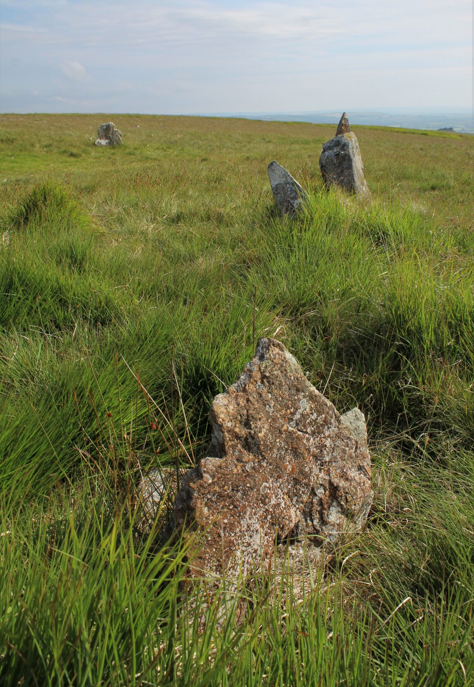
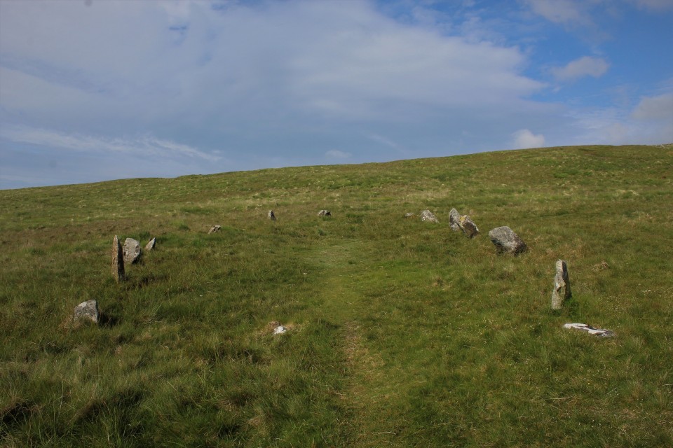
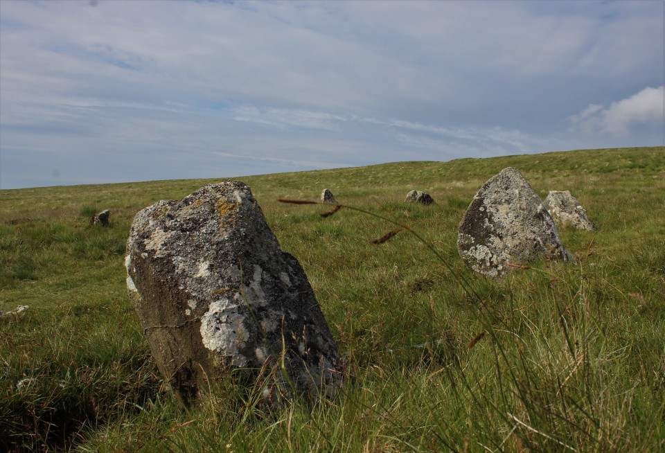
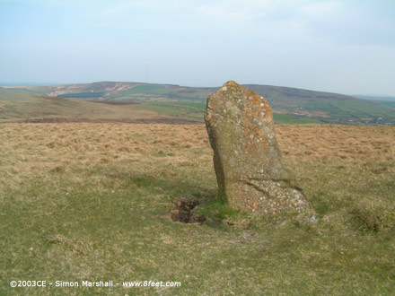
No-ones really sure about this site ... is it a "true" site, or is it a later addition? It stands by Carn Bica, on the path along the top of the Preseli ridge (by the famous "crossroads" that have caused so much speculation). The stones are about 2 ft high, and all tend to lean inwards. The site isn't listed in Burl, but is definitely there, and in one of the most spectacular locations. You'll need to walk for at least 30mins/hour to get there from any road, but it's worth it. |
Posted by RiotGibbon 20th December 2001ce |
Folklore |
|
|
Said to have been thrown from Dyffryn Circle - presumably by Arthur himself, in his giant guise. (Grinsell- folklore of prehistoric sites in Britain) |
 Posted by Rhiannon
18th June 2004ce |
| Alleged to be one of the resting places of King Arthur. They take the Mabiginon seriously around here ... |
Posted by RiotGibbon 20th December 2001ce |
Miscellaneous |
|
|
Without going on the Bluestone trip too much (Bedd Arthur overlooks Carn Meini, the alleged Stonehenge bluestone etc etc), it's interesting that Bedd Arthur is a horseshoe shape, as in the inner Stonehenge ring. But it's possible this site isn't that old...there's no date on it, and Burl doesn't list it in my copy of his guide. Nice place to stop by though, if you're passing. RG |
Posted by RiotGibbon 23rd August 2001ce Edited 10th March 2003ce |