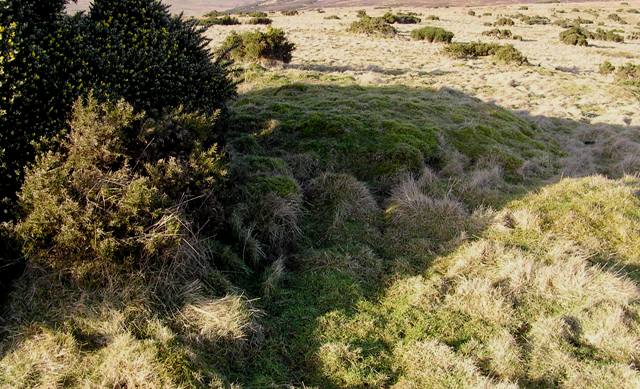
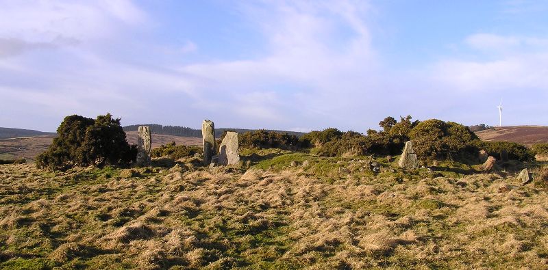
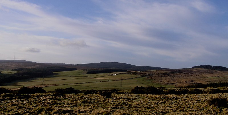
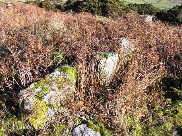
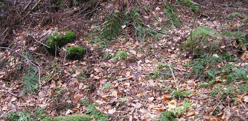
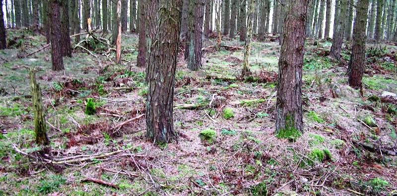
Glenton North is about a mile north from it's southern neighbour. Luckily a lot of the heather and trees have been taken down or burnt making walking conditions, apart from the boggy start, much easier. Sadly a lot of small cairns and probably a hut circle or two have been trashed beyond recognition. I went into the wood at the top of Glenton Hill (calling it forest might be an exaggeration) and like Tara didn't see very much. However keeping heading north and on the downslope a cairn overlooking the very small village of Rickarton will be found.
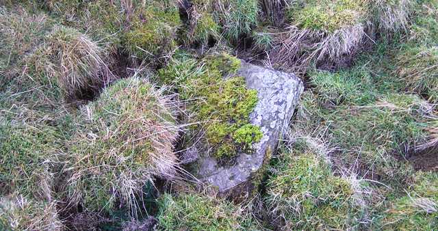
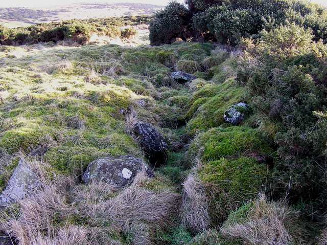
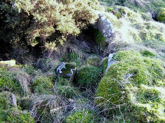
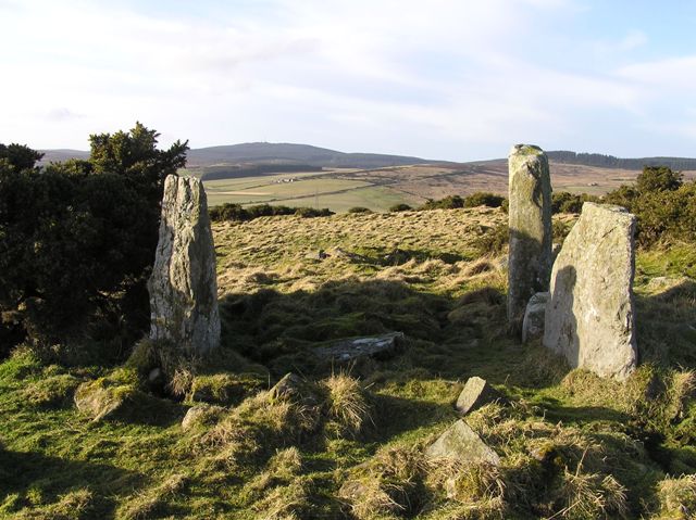
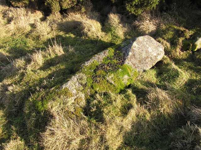
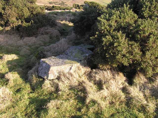
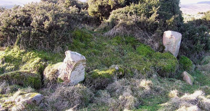
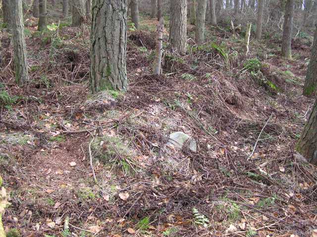
It has also survived a bit better than its southern neighbour with possibly two kerbs still in place and the remains in of cist in it's houked centre. It stands at over 6m wide and is about 0.6m high. To the north is the wonderful view of Cairn Mon Earn.
A nice way to spend a sunny afternoon near Stonehaven.
Visited 3/1/2018.
|
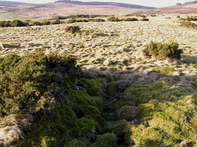
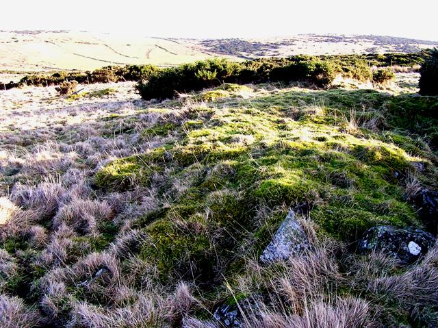
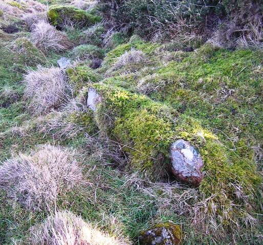
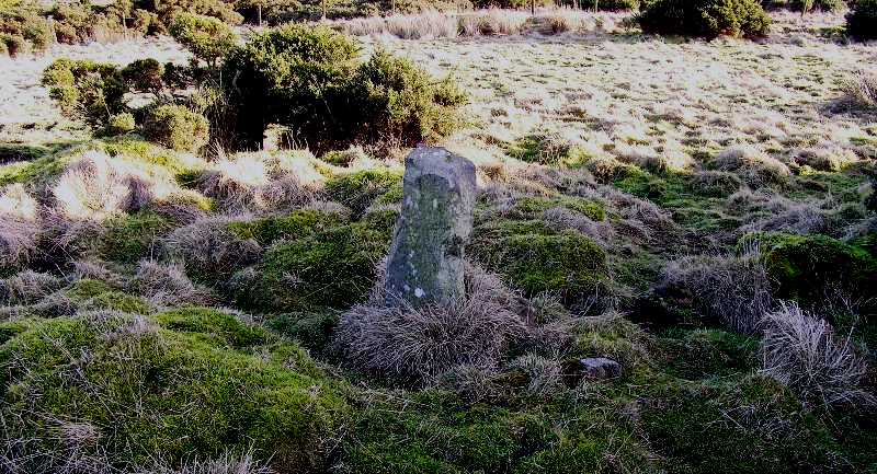
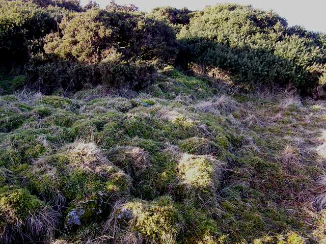
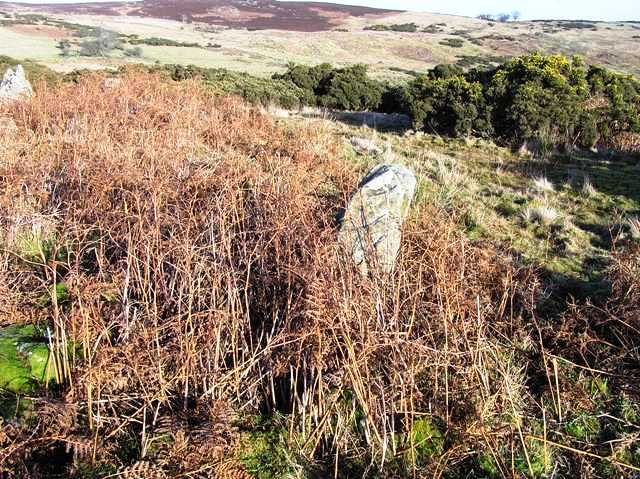
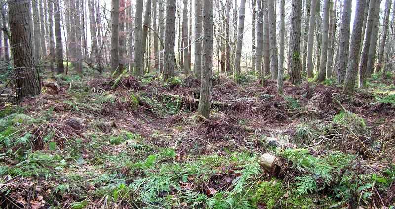
Sadly there are not much visible remains of the Glenton South cairn. All that can now be seen is a green circular patch amongst the gorse sitting at over 6m wide and 0.5m tall. Underneath the grass cairn material can be felt. What it does have are tremendous views over to Findlayston and Raedykes, homes to several cairns. A lot of the nearby smaller cairns have been gobbled up by the large amounts of gorse.
Heading west from the Cowton Bridge on the Slug Road aka the A957 Banchory Road. Take the first road heading south, almost doubling back, to North Glenton farm. I asked permission to park, which was granted, at the farm. From here I jumped the fence into a field and headed south and uphill. The cairn is located on the edge of a bog amongst jabby stuff just over the next fence/gate.
Visited 3/1/2018.
|
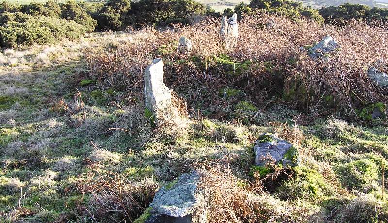
From Creag Bheag we headed back down into the valley and climbed up the other side. Nearby there is a deer fence gate. Go through this until a steep descent (which is full of various animal holes). There is a small bridge crossing the Caoachan a Mhananaich burn. Cross this and climb up the other side. On top there is another track which heads north east then, after a large turn, heads west. By this time the cairn can be seen below.
It is unusually positioned being surrounded on three sides by three slopes. The only clear view is east towards the Cairngorms and River Spey. Being over 12m wide and 1m tall I think this cairn must have been considerably larger. Large stones which might have possibly stood lay prone on the other side of the track. Kerbs survive on the east side but sadly a massive amount of houking has taken place. Still the site remains circular, defiantly looking east.
Just below is the A86 which leads to Kingussie and eventually the road home. An excellent second day in an excellent area.
Visited 30/12/2017.
|
      
|
From Caochan A' Mhanaich head north east past the huge natural mound. This might look an easy walk on the map but with loads of small streams, bogs, ruined dykes and the occasional fence keeping an eye on your feet is a good idea.
Eventually a new deer fence with a fairly new track behind is reached. Climb over this and go over the road to look down into a small valley. Just to the north there is a small hillock in front of the, by now, very impressive Creag Bheag from which the site earns it name. Indeed the small hill looks like a guard standing on duty.
Go down into the valley, cross the bog (and a couple of hidden streams) and climb the wee hill. The cairn is on the southern most point.
At 8m wide and almost 0.6m high the cairn stands watch over the Pitmain Burn. The slab mentioned by Canmore, now almost entirely covered in turf, might be the remains of a cist cover. Other cairn material poke their heads through the heather and turf covered site. It is a site of fantastic beauty despite the ever increasing darkness and dampness. These simply add to the atmosphere.
Still the hills aren't the safest place to be with darkness fast approaching so away we marched/stumbled to the last site of a wonderful day.
Visited 30/12/2017.
|
With Creag Bheag standing majestically to the north we continued from Newtonmore along the A86 until we reached the farm track to the ruined farm of Ballachroan. From here follow the dry stane dyke north west until it ends. Go through the gate and keep heading north west. By this time a large natural mound will be seen. Jump the burn, go through the bog and climb a wee hill. If still heading north west the cairn will be clearly seen in the short heather.
The site sits at just over 8m wide and is about 0.8m tall. Some displaced kerbs remain almost in place. Making it easier to the spot, turf covers the cairn. Even as the weather became dreicher (more damp and rainy) the scenery is magnificent. Creag Bheag looks down on top of us, the River Spey/Cairngorms are to the east and to the south the Banchor valley, one of my favourite areas.
With that it was over to look at the natural mound and on to continue splashing through the various bogs. Great fun!
Visited 30/12/2017.
|
    
|
From Biallidbeg we walked the couple of miles north east following A86 back to Newtonmore. Sites to the west of Biallidbeg will be explored later this year but today was all about walking around the Newtonmore area.
Cross Calder Bridge and immediately head south to the clump of trees which houses the cairn. Next to this is the home of the famous Newtonmore Shinty Club, scene of some stunning sporting achievements and some other types of achievements by spectators - not today.
The cairn is situated just above the corner were the Rivers Calder and Spey meet with some glorious mountainous scenery. It stands at well over 13 m wide and is well over 1m in height. Tree roots look like giant spiders climbing over cairn material and kerbs.
Beautiful place, I just wonder why I've never spotted it before!
Visited 30/12/2017.
|
Dun Ban
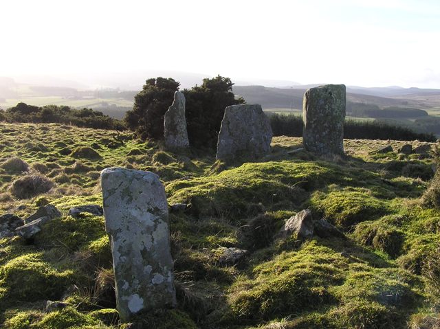
We have one definite prehistoric site in Knoydart - Dun Ban at Done (NG701036). The name Doune itself comes from the Gaelic word dun meaning fort, of which there are hundreds of examples throughout Scotland. Some, like Dundee, Dunkeld, Dumbarton or Dumfries, became important centre. Others, such as Doune, represent settlements that never grew beyond a cluster of families. Without excavation we have no means of dating this site, though it is likely to be Iron Age in origin and falling between the period 500BC to 500AD. It measures 74m by 49m and, like the forts in Arisaig, has a heavily vitrified wall. It occupies a strategic site on the coastline facing Sleat (Skye).
Knoydart A History by Denis Rixson
|
After a good nights refreshment in Kincraig I awoke bright and hazy ready for a good hike. Wee B was in good form so we were taken south and dropped off at Biallidbeg Farmstead on the A86.
We jumped the gate and headed up the small slope then headed north east. This is an area covered in cairns and hut circles, the biggest cairn was our aim. It stands at well over 10m wide and is almost 1m high. The remains of a long robbed cist can be seen in the centre of the cairn. An impressive tree also seems to trying to protect and keep the site warm.
A stunning start to the day with impressive views to the Cairngorms and Strathspey. Also a return visit to this place is needed. Roll on the warmer weather.
Visited 30/12/2017.
|
       
|

|
Just before heading into Kincraig for some light refreshment and rest there was time to visit the chamber cairn near the village. From Loch An Eilein car park we took the road back to the B970, a very twisty road indeed through Feshie Bridge until the first minor road heading west. This follows the northern shore of Loch Insh to Kincraig. Head through the village to the B9152 turning north. Take the first subway underneath the A9 and park near the group of small farm buildings, the cairn is a short distance behind. There is plenty room to park.
All that remains of this once massive cairn is the chamber, split into two and the scant outline of its former surroundings. This had been over 17m at some point. Some kerbs still remain.
Canmore's description 'This heavily robbed chambered cairn is situated at the upper limit of improved pasture roughly midway between the newly constructed blacksmith’s shed and a small coniferous plantation, some 425m to the ENE of Kincraig House. The cairn lies on relatively flat ground and appears to have been terraced on the S, with the ground rising gently to the N and W and a tongue of natural outcrop extending out to the SE. Oval on plan, it measures 17m from ENE to WSW by 14.8m transversely, and is defined by three kerb stones on the SW, S and SSE, and another that appears to have fallen outwards on the ENE. On the N and NW the outer edge of the cairn has been reduced to a low stony bank. Loose stones lie across the interior and several large angular blocks are still visible on the SE. The chamber, orientated ENE to WSW, measures 3.2m by 0.9m internally and is divided into two compartments by a low septal slab. The innermost compartment survives as two upright stones on its S side and a back-slab, the latter the tallest of the chamber standing 0.68m in height. Two displaced stones immediately behind these may be capstones or corbels from the roof of the chamber that have slipped backwards. The second compartment comprises a pair of upright stones and another adjacent to that on the N set just outside though not overlapping. A further 0.7m to the E there is another earthfast stone which may also belong to the chamber but now appears to be displaced.'
Just before leaving I looked south towards Newtonmore and Kingussie. The next day would see a lot of miles walked.
Visited 29/12/2017.
|
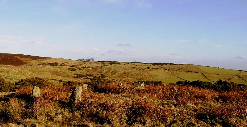
Just to the south east of Creag A Chait over some treacherous underfoot conditions is another large cairn. The site at Creagan Ruighe Dhughaill is in a small glen which blocks the view of Loch Gamhna. Views of Loch An Eilein can just about be glimpsed through the trees.
Some large blocks are near this cairn making it relatively easy to find. A small ditch can just about be seen surrounding the site. It is an odd shape for this area being rectangular, 11m by 7m sitting at 1m high amongst some trees. Just like the nearby Chait the scenery of the mountains is spectacular.
After a good look round it was back to the shores of Loch An Eilein via the southern shore of Loch Gamhna, sadly the crannog was covered in water so, happily, another trip needed. The path back to the car park on the southern shore is varied to say the least. Sometimes good, sometimes terrible and sometimes invisible.
Still its a good way to explore which is what we spent the day doing for a few hours before heading to the cairn at Kincraig.
Visited 29/12/2017.
|

|
On a cold misty but dry morning we started walking from the car park at Loch An Eilein Gate. To reach here take the B9152 from Coylum Bridge/Inverdruie (great name) and head south. Take the first minor road heading south east that ends at the car park.
Follow the track south to the beautiful shores of Loch an Eilein, which was mirror calm, with its medieval castle still standing proudly. Keep going until a junction in the track near Loch An Eilein's south west shore. We headed or attempted to head straight south. This short cut ended up being the longest route as we climbed over Kennapole Hill, which provided stunning views of the snow covered surrounding mountains. Eventually after a few bumps and scrapes we found the site. A difficult place to reach.
The large cairn, being over 20m wide, is covered in heather but glimpses of turf reveal cairn material. Several large stones also surround the site well hidden amongst the vegetation. Only when standing well back can the height of the cairn be seen, it is well over 2m in height. To the east is Loch Gamhna obscured by a small hill. To the north the southern shores of Loch An Eilein and the snow covered Ord Ban.
A beautiful place!
Visited 29/12/2017.
|
        
|
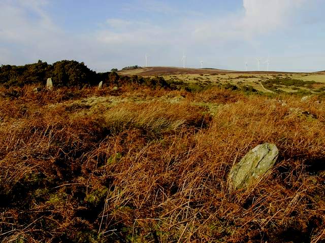
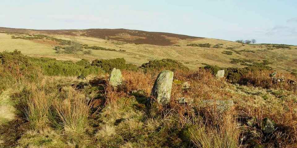
Totally agree with G, G and Vicster. This is a fantastic site with fantastic views. Sadly, on this visit, bits of farm waste was dotted about the site. I tidied up what I could by throwing it over the fence into a field with more rubbish in it.
Directions.
Take the B9152 from Coylum Bridge and head south. When the Alvie Gate Lodge is reached head west under the first subway. If coming north from Kincraig its the second subway. Follow the signposts to Easter Delfour, which will lead straight to the site.
Handy thing these subways!
23/12/2017.
|
From the Milton cairn head uphill, this is very steep in places, in a southish direction. We forced our way through bogs, trees, scattered rocks, holes and streams. Somehow major injury was avoided and we finally found the cairn. Near the top there is the remains of a small loch, the cairn is on the south west side on a slight uphill.
Nothing much remains just a small mound around 6m wide being no more 0.5m high. The cist stone can be felt underfoot as can other stones. Sadly almost impossible to photograph. The views on the other hand are tremendous looking down on the Spey Valley. Cairns to the east have gone thanks to forestry.
On our way down, meaning straight down, we took an interesting route almost copying the Dun Dearduil uphill route. We headed west looking for a track which we eventually found. Once back into the trees the climb down is very steep, on a couple of a occasions I used my backside to get down some of the way. Some deer passing nearby obviously had a good laugh at my antics. At the bottom is the Milton burn which this time was waded and jumped. From there it is a fairly gentle climb to the track. We had every intention of heading to a nearby dun but the weather was closing in, therefore Delfour entered the agenda.
Love this area, the dun will be found when the snow goes.
23/12/2017.
|
   
|

|
Still doing the music, following that team and getting lost in the hills! (Some Simple Minds, Glasvegas, Athlete, George Harrison, Empire Of The Sun, Riverside, Porcupine Tree, Nazareth, The Avalanches, Public Service Broadcasting on the headphones, good boots and sticks, away I go!)
Turriff, Aberdeenshire
https://www.thedeleriumtrees.com/
|
|