The Modern Antiquarian
Log in
|
Register
Home
Latest Posts
Forums
Maps
Help
Browse Sites
News
Blog
Contributors
The Books
Select
-
Belgium
Denmark
Eire
France
Germany
Greece
Italy
The Netherlands
Norway
Portugal
Republic of Malta
Spain
Sweden
Switzerland
United Kingdom
England
Northern England
Lancashire
Anglezarke Moor Group
Rushy Brow
Mesolithic site
Rushy Brow (Mesolithic site) on The Modern Antiquarian, the UK & Ireland's most popular megalithic community website. 1 image, 1 fieldnote, plus information on many more ancient sites nearby and across the UK & Ireland.
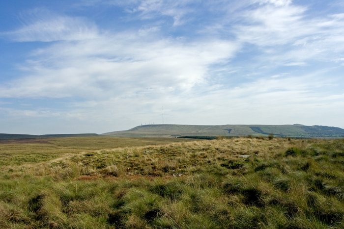
Image © John Miller
Nearest Town:
Adlington (5km SSW)
OS Ref (GB):
SD633177 /
Sheet: 109
Latitude:
53° 39' 15.23" N
Longitude:
2° 33' 19.25" W
Added by
LivingRocks
Images (1)
Fieldnotes (1)
0 discussions
Start a topic
Show |
Hide
Web searches for Rushy Brow
Flickr
Google
Google Images
MAGIC
The Megalithic Portal
Bing
Stone Pages
Streetmap.co.uk
Wikipedia
Show map
(inline Google Map)
- Sites within 20 km -
-
Anglezarke Misc 7 (0.29km SW) (1 post)
Anglezarke Misc 1 (0.42km WNW) (4 posts)
Pikestones Cairn (0.42km SW) (11 posts)
Devil's Ditch (0.51km ENE) (3 posts)
Round Loaf (0.7km NE) (23 posts)
Anglezarke Moor Standing Stone (0.82km WNW) (7 posts)
Pikestones (0.85km SW) (55 posts)
Jepson's Gate Cairn (0.98km WSW) (7 posts)
Anglezarke Misc 11 (1.06km ESE) (1 post)
Stronstrey Bank Cairns (1.13km W) (2 posts)
Black Hill Upper 1 (1.16km ENE) (3 posts)
Anglezarke Misc 6 (1.21km WSW) (1 post)
Standing Stones Hill (1.33km E) (6 posts)
Stronstrey Bank Stone (1.4km W) (10 posts)
Black Coppice Chambered Cairn (1.49km WNW) (20 posts)
Anglezarke Misc 4 (1.55km WNW) (9 posts)
Anglezarke Misc 5 (1.62km WNW) (4 posts)
Anglezarke Misc 3 (1.62km WNW) (2 posts)
Anglezarke Misc 10 (1.97km NE) (3 posts)
Anglezarke Misc 9 (2.24km NNE) (8 posts)
Noon Hill (3.04km SE) (15 posts)
Winter Hill Cairn (3.48km ESE) (11 posts)
Winter Hill (3.62km ESE) (14 posts)
Slipper Lowe (4.03km NE) (9 posts)
Anderton (4.4km SSW) (7 posts)
Hanging Stone (4.61km ENE) (11 posts)
The Two Lads (4.83km SE) (8 posts)
Holdens Farm Barrows (5.52km ESE) (2 posts)
Astley Hall Farm Bronze Age Burial Site (5.91km W) (3 posts)
White Brow (6.08km SE) (12 posts)
Charters Moss (6.29km E) (5 posts)
Moortop Barrows (6.51km ESE) (6 posts)
Ashleigh Barrow (7km ENE) (6 posts)
Cheetham Close (8.49km E) (38 posts)
Cheetham Barrow (8.59km E) (4 posts)
Hawksclough (8.61km WNW) (6 posts)
Pleasington Cemetery (9.62km N) (2 posts)
All Hallows Well (11.38km NNE) (1 post)
Carve Hill (12.21km E) (4 posts)
Revidge (12.35km NNE) (8 posts)
Mawdesley Blue Stone (13.04km WSW) (1 post)
Boar's Den (13.17km WSW) (10 posts)
Thirteen Stones Hill (14.8km ENE) (8 posts)
Castlesteads (17.01km E) (9 posts)
Whitelow (17.21km E) (10 posts)
Little Hameldon (19.79km NE) (12 posts)
- Add -
-
Add news
Add an image
Add fieldnotes
Add folklore
Add miscellaneous
Add a link
Add a nearby facility
Add an alternative name/spelling
Images
(click to view fullsize)
Add an image
Fieldnotes
Add fieldnotes
Close to Pike Stones and the Jepsons Gate Cairn, evidence of Mesolithic lithic scatter and occupation were discovered by excavation in the 1990's. The report can be found in The Proceedings of the Prehistoric Society 62/1996.
Comments (0)
|
Add a comment
|
Permalink
Posted by
LivingRocks
13th September 2006ce
Edited 21st October 2007ce