|
|

|
|
Boddington Hill CampHillfort
|
||||||||||||||||||||||||
|
|
|
Images (click to view fullsize) |
|
Photographs: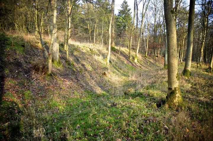
 Artistic / Interpretive:
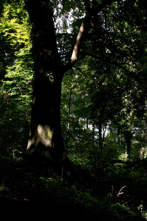
|
Fieldnotes |
|
| The last time I was in this part of the world was 30 years ago as a young trainee at RAF Halton. Often we would go on runs through these woods. Not once did I realise there was a hillfort there, to be honest though after running up that hill it was probably the last thing on our minds. Nice to return and see the fort though. I followed the fitness trail which takes all the way around the outside of the site. Some great views as well. |
17th January 2012ce |
|
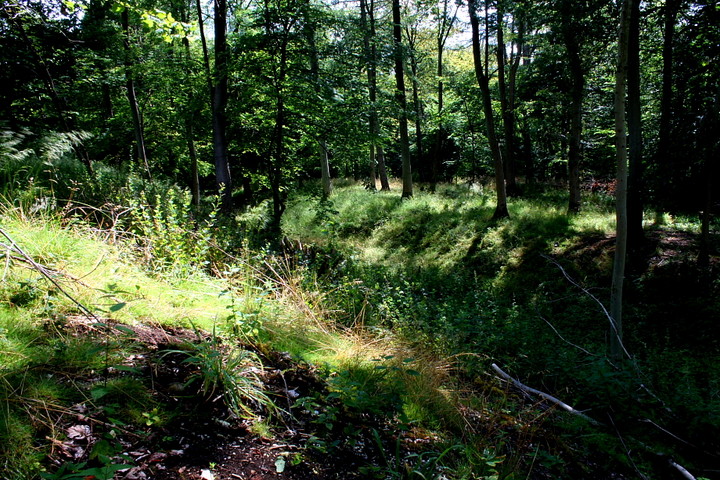
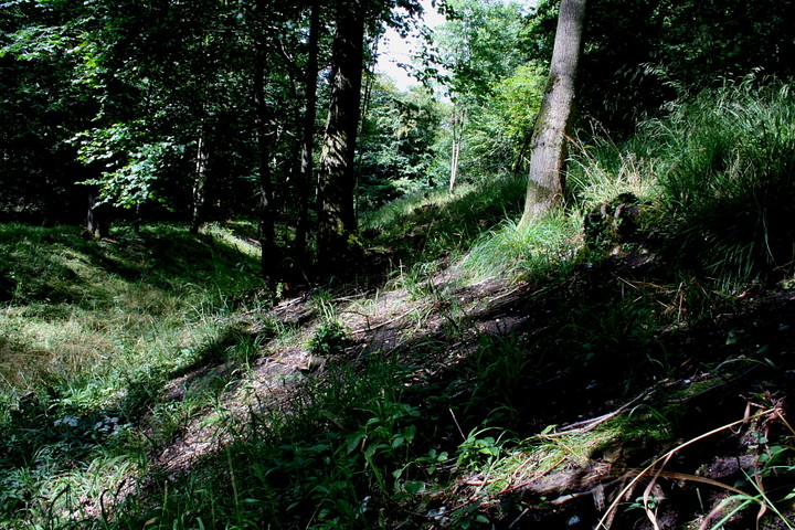
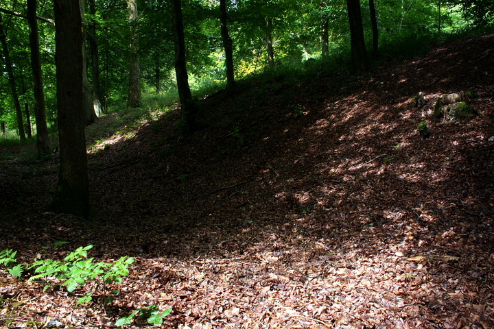
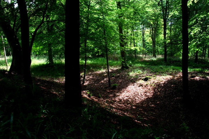
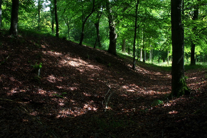
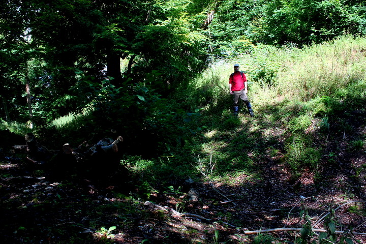
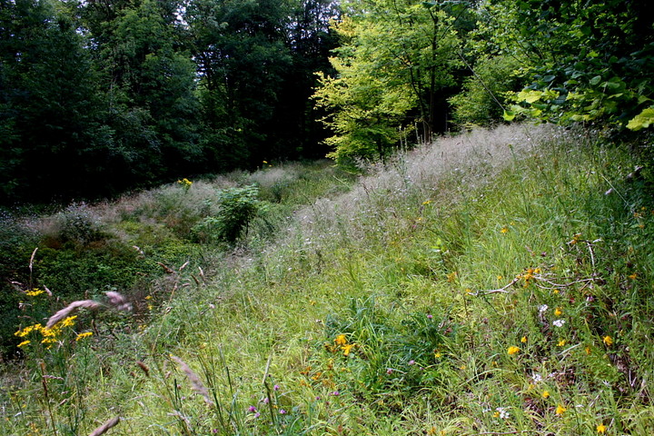
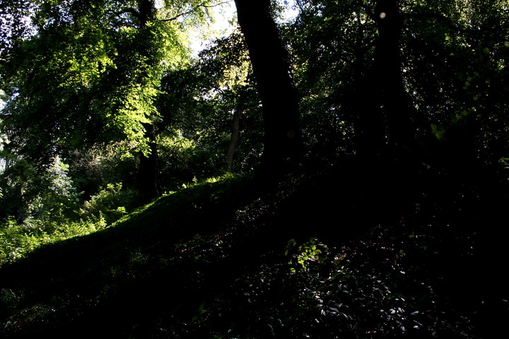
Boddington.... the name conjures up a couple of images in the Gladman mind, both rather striking. The gorgeous Melanie Sykes with a (lovely, if somewhat suggestive) mouth full of froth in those TV ads.... and Halton RAF camp, where the Mam C lived for a while in the 80's with her thankfully long-since-ex-husband (incidentally there is a sign warning motorists of 'troops and children crossing'. I kid you not). Of the two, the first is perhaps the most relevant to this rather splendid promontory fort, implying that one shouldn't judge a book by its cover, so to speak. Approaching Halton upon the B4009, I take the minor road signposted 'Wendover Woods'. So far, so good. Passing the golf course there is a sign for a 'pay and display' car park on the right. Needless to say I neglect to check the map (a disturbingly common occurence when visiting these semi-urban lowland sites - guess I should have learned by now) and consequently decide to park roadside and walk in... don't get me wrong, I simply hate car parks at ancient sites... destroys the vibe. Anyway, just over a mile later I finally arrive at the gigantic - and overwhelmingly twee - car park, having been passed en-route by a myriad cars and decide... retrospectively... that it would probably have been better to 'bite the bullet' and join the procession. Yeah, there's a cafe, adventure playground, barbecue area... even a free pamphlet - with map - explaining how Boddington Camp has been utilised as a 'Fitness Trail'. My, I can hardly wait. No, that's a lie. Let's get this over with. ASAP. I head south-west along the promontory and halt in dismay at the sight of a wooden weight lifting contraption beside what appears to be a stretch of Iron Age rampart... Yeah, it's worse than I feared. Or am I just hopelessly out of touch? Hmm, the thought has occured. I check the map (finally!) and locate the rampart proper to the north-east of the site. It is heavily overgrown with vegetation, but much more substantial than I supposed. I force my way along the summit of the bank, sunlight streaming through the thick overhead canopy, and suddenly the vibe is all encompassing. Boddington Camp is seriously reclaimed by Nature. With a bit of help from the Forestry people, I guess. And that, I think, is what has saved it from it's banal surroundings, like a Mayan temple isolated within the rain forest... For me the defining arc of the defences is to the south-west, the inner bank and ditch very pronounced here and (relatively) easy to access. The south and south-eastern flanks are also impressive, albeit overcome with tall - very tall - summer grasses. The odd group of rambling punters wander noisily by, but none seem to give a monkey's about this Iron Age gem rising aloof and silent above them. Assuming they even know it's here. The views described in the previous posts are, to all intents and purposes, non existent now due to the foliage. But the sheer scale - the length of the enclosure, the height of the surviving banks - has taken me completely by surprise at Boddington. As they say, you can't judge a book by its cover. Joggers may 'jog' around the perimeter, 'mountain bikers' may hurtle past doing their crazy thang and ramblers may simply ramble. But it would appear Boddington Camp itself is left to its own devices. Long may it continue, I say. |
 Posted by GLADMAN
30th August 2011ce Edited 30th August 2011ce |
|
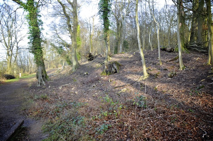
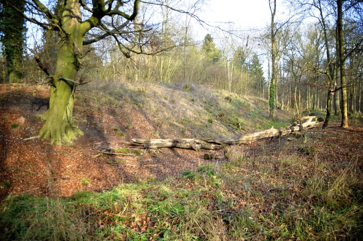
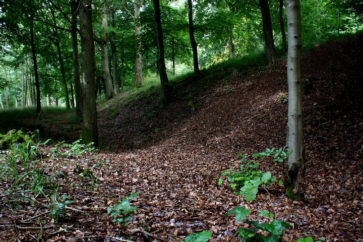
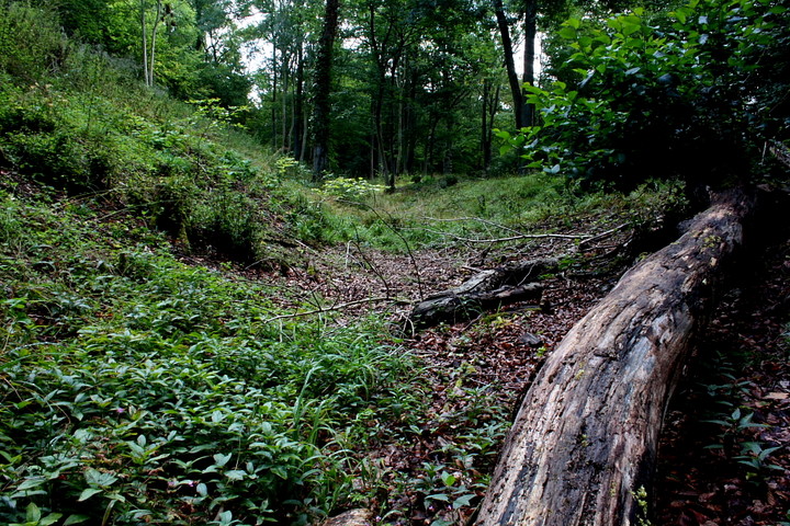
Field Visit by Clive O'Sullivan. As I live very close to Boddington hill and have visited the site many times. I can comment on the site for any body wishing to visit the prehistoric hill fort. The whole site is currently owned by the forest commision and is a picnic site with activities for the public. There is parking close to the site for a fee. The forest commision close the site off at 9pm each night. The Map reference; SP 883080 1 mile east of Wendover The Oval prehistoric fort is situated on a promontary. So can be classified as a promontary fort. The earthworks enclose an area of 17 acres.(7 ha).The earthwork is complete except at the northwest. The east side being preserved in the best condition, still standing 13 feet above the bottom of the ditch in some places. Of the remains of the defences; an inner scarp is still detectable as well as a ditch and bank along the east side. The west side has no remaining ditch but still a bank. The Main gate is presumed to have been at the northwest and has been completely destroyed by a farm that existed there since 1768 (known as Calloway farm) Rubble and tiles are still in evidence of the demolished farm at the NW. Within the defences are several features; These include two dells. The dell at the N is waterlogged most of the year. The second dell which is more to the south is dry. An old disused concrete reservior exists approximately in the centre of the earthwork. The whole site is mostly over grown with brambles and trees. The site was breifly excavated at the south east in 1964 to reveal pottery and some post holes. A profile of the bank and ditch was revealed. The bank was formerly held back by posts with a rubble revetment. In front of the bank was a 'V' ditch. The excavations can still be traced as a scar exists in the bank. The depression across the foot path is from the same excavations. As the site is very long it is possible a second gate existed at the south east. A notice board says the oval fort was in use from 600 bc till about 400 BC. ref; -guide to prehistoric England (Nicholas Thomas 1976) -SMR wendover -from imfomation notice board Clive O'Sullivan 10/nov/2003 |
Posted by moating sully 16th November 2003ce |
|
A tidy little hill-fort, with spectacular views across the western chilterns and all the way to Oxford and beyond --- I didn't pick out Wittenham Clumps/Dorchester-on-Thames complex from here the day we visited, but they should be visible. At the top of a massive hill, just south of Aylesbury, this forms part of the Icknield Way family of settlements, from Ivinghoe Beacon to the north, and joining up with the Ridgeway further south. Cholesbury is a 20 minute walk The banks are pretty eroded, and obsucured by thick vegetation, but it's still a highly popular spot for picnickers. Go there. |
Posted by RiotGibbon 20th December 2001ce |
Miscellaneous |
|
|
Excavations at Boddington hill fort 1964 The excavations at Boddington hill fort were carried out with the aim to try and fix the location of the main entrance and to date the site, before tree roots make it difficult to do as trees have been planted at the site. The trenches were dug at the south of the site. A section was cut across the bank and carried through to the ditch. An area was exposed at the rear of the bank within the same trench. A further two trenches were cut across the angle at the presumed gate. The excavations were carried out by: -Flight officer J.A.W. Burdon BA (director) -Flight Lieutenant and Mrs J Jeffers -Flight Lieutenant Dir. B. Eng -Chief technician Thomas Finds made during the excavation were pottery which is indicated as 'Iron age A' which was sealed beneath the rubble of the rampart. The rampart itself had a stone revetment to probably contain the rubble inside the rampart but no post holes or stone were found to show how the face was contained. The ditch was clearly defined and dropped almost perpendicular 10 feet to the base. An area of 20 feet was clear then there is a ditch in the shape of a 'V' which is approximatly 6 feet deep with angles of 45-50 degrees. Three Post holes were found: Post hole A: was 15 inches in diameter with packing stones which extended it diameter to 24 inches also contained 37 pieces of pottery some with fingertip decoration. This post hole may have been a gate post. Post hole B: A stake hole 6 inches in diameter was found under the rampart and predating it. Post hole C: Was recorded as of doubtful origin which was 12 inches wide and 10 inces deep. Only one rampart had been erected in this area as clearly defined by soil layers and another was made up of ditch spoil but had been eroded. A clearly defined occupation layer was found which yielded; pottery, animal bones, flints and a layer of carbon deposit. The pottery previously mentioned is 'Iron age 'A' which is attributed to 600-400 BC and is of a coarse texture with flint grit. The animal bones were in pieces and recognised as cattle and pig. None were burnt so may have been the remains of numerous boiled meals. I would stick my neck out here and say that there is a south gate at this fort as it's such a long fort. There's a break in the rampart so it pretty obvious a gate probably existed. The excavation site from 1964 is quite easy to work out as the excavation team did not fully restore the rampart back how it looked. Brambles and stinging nettles almost blanket the exact dimensions of where the excavation took place. Also a big chunk of the bank is missing. The depression across the path is still visible. You can see the plants give it us lots of clues to what happened many years ago. |
Posted by moating sully 16th November 2003ce |