|
|

|
|
Norbury Camp (Farmington)Hillfort
|
|
|
|
Images (click to view fullsize) |
|
|
Fieldnotes |
|
|
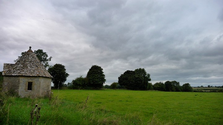
Visited 17.7.10. The road leading to Farmington goes straight through the Hillfort. As you approach from the west there is a house to your right and a stone on the left which is engraved Farmington MM. This is where the western 'defences' are. All that can be seen is a slightly raised mound leading off into the field. At the eastern end of the 'defences' can be seen a low raised bank where the field boundary hedge now is. There is in truth very little to see and is hardly worth making a special visit for. |
Posted by CARL 20th July 2010ce |
|
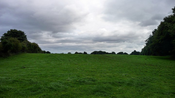
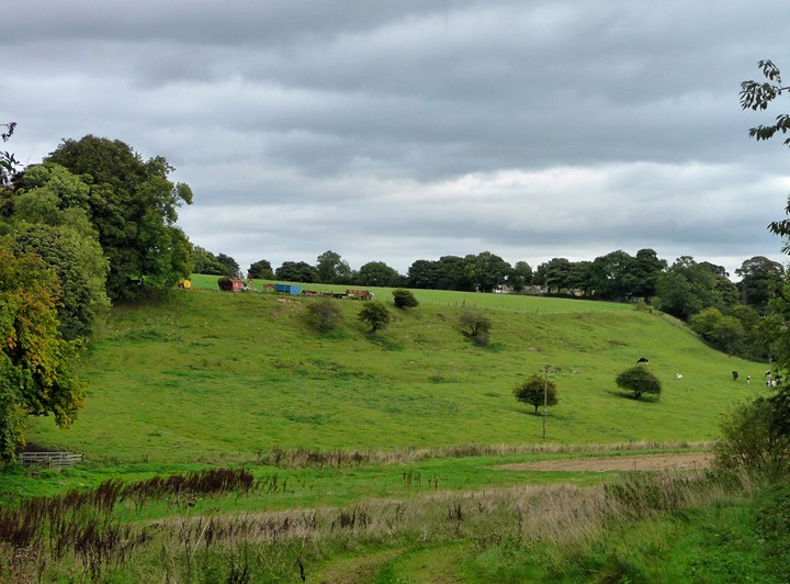
Visited 5.9.2009, walking up from Northleach along the Monarch's Way. The first sight of the "fort" comes over a gate, where the by-road takes a kink to the NE just south of Bunker's Hill. From here, the defensive line of the southern side of the site is visible - it appears to be defended purely by a scarp slope, with no obvious rampart or earthwork. It's a very large site, and as none of the ramparts (E and W sides) or slopes (S and N sides) would appear to be particularly formidable, I can only guess that it was more of a settlement site than a true defensible hillfort. The internal area alone would make any kind of sustained defence almost impossible unless you had a very large garrison to man all of the palisades (assuming there were palisades). At the western end, inside the rampart, can be seen the ghost of Farmington long barrow and the farm inside the fort produces ice cream. The western rampart is the most "impressive" but is still very low and has no natural slope to assist. Leaving the fort to the east, the eastern rampart follows the line of a hedge and again if you didn't know to look for it you wouldn't even notice it in all probability. |
 Posted by thesweetcheat
4th October 2009ce Edited 4th October 2009ce |
Miscellaneous |
|
|
Details of site on Pastscape (SP 127155) Norbury Camp (NR). Norbury Camp, univallate hillfort, unexcavated, encloses 80 acres on a promontory between re-entrant valleys. The west and east sides of the fort are defined by banks set along the extremities of a slight eminence; the north and south sides are defined by the edges of the promontory, accentuated in part at least by scarping. On the north a low bank set on a terrace beneath the scarp edge, and extending for about 220 ft along the inner side of a track, may be the northern mound mentioned by Witts. The ploughed west bank, 50 ft wide, rises 1 1/2 ft above the interior and contains limestone blocks up to 3 ft long. The ditch shows only as a crop-mark. The eastbank, about 16 ft wide and 2ft high, ends 200 ft south of the steeply scarped NE corner. No ditch is visible. Original entrances, used by modern roads, may be represented by a gap near the centre of the east bank and a hollow-way in the south scarp. (Visited 19 9 69). (2-4) Generally as described by RCHM. The scarping along the south side extends for about 270.0m from the SW corner. The terrace below the scarp on the north side may originally have been a natural feature modified by land-scarping, probably when trees were planted on the regular, scarped slopes above and below it. The west bank is under plough, but remains 1.3m high externally and 0.3m high internally. The eastern bank averages 1.0m high and 8.0m wide, and is crowned by the remains of a field wall. The internal slope has been mutilated or destroyed by ploughing. The bank south of the road has been almost destroyed by modern development. The eastern bank is incorrectly positioned on the 2" Drawing of 1815. There is a considerable slope east of the sharply scarped NE corner, and there could never have been a continuation as shown on the 2" Drawing. Published survey (25") revised on Antiquity Model. (5) Excavations within the hillfort took place in advance of farm building. In addition to Iron Age features, a Roman pit, ditch and gully were excavated; these probably relate to previously known occupation immediately to the north (SP 11 NW 15). The pit contained an incomplete inhumation suggesting mutilation. (6) Information as in Authy.2 now published. (7) SP 1278 1545. Excavations in the north-west corner of Hospital field in 1977, (see Authy. 6) demonstrated late Iron Age occupation within the hillfort enclosure in the form of 3 probable 4-post structures. An undated semi-crouched inhumation burial is possibly associated with this occupation. No specific dating evidence was recovered for the Iron Age occupation, nor was a positive association demonstrated between the wxcavated structures and the hillfort enclosure. The Iron Age pottery is undiagnostic and could related to any phase of the local pre-Belgic Iron Age. [Published excavation report]. (8) SP 127 155. Norbury, Northleach. Listed in gazetteer as a univallate hillfort covering 3.2ha. (9) A rapid examination of air photography (10a) suggests that the ploughed down west end of the hillfort may have been multivallate. (10) A multivallate Iron Age hillfort enclosing 80 acres is situated on the western side of the village of Farmington. Excavation and geophysical survey has revealed Iron Age and Romano British occupation (UID 329947). The hillfort also contains a probable Neolithic long barrow (UID 329938). These features were mapped from aerial photographs as part of the South Cotswolds NMP project; and are protected as Scheduled Ancient Monument 209 (county number). The roughly rectangular Iron Age hillfort is centred at SP 1273 1554, and covers an area approximately 890m east to west and 520m north to south. Certain features described by the previous authorities are visible as earthworks or cropmarks on aerial photographs. The innermost bank of the western rampart is visible as a slight earthwork on the latest available aerial photographs of 2006; its' outer ditch and a further three outer banks and two ditches visible as cropmarks on aerial photographs of 1969. Short lengths of the northern and southern ramparts are visible as extant scarp edges, along with the clearly defined north-eastern corner of the hillfort. The remainder of the enclosing banks, ditches and scarps are hidden from aerial view by trees, field boundaries and modern housing. The Neolithic long barrow in the south-western corner of the hillfort, and the Romano British settlement in the north-eastern corner have also been mapped from aerial photographs and are recorded as UIDs 329938 and 329947 respectively (11-14). |
 Posted by Chance
10th June 2014ce |