|
|

|
|
GarnwndaBurial Chamber
|
|
|
|
Images (click to view fullsize) |
|
|
Fieldnotes |
|
|
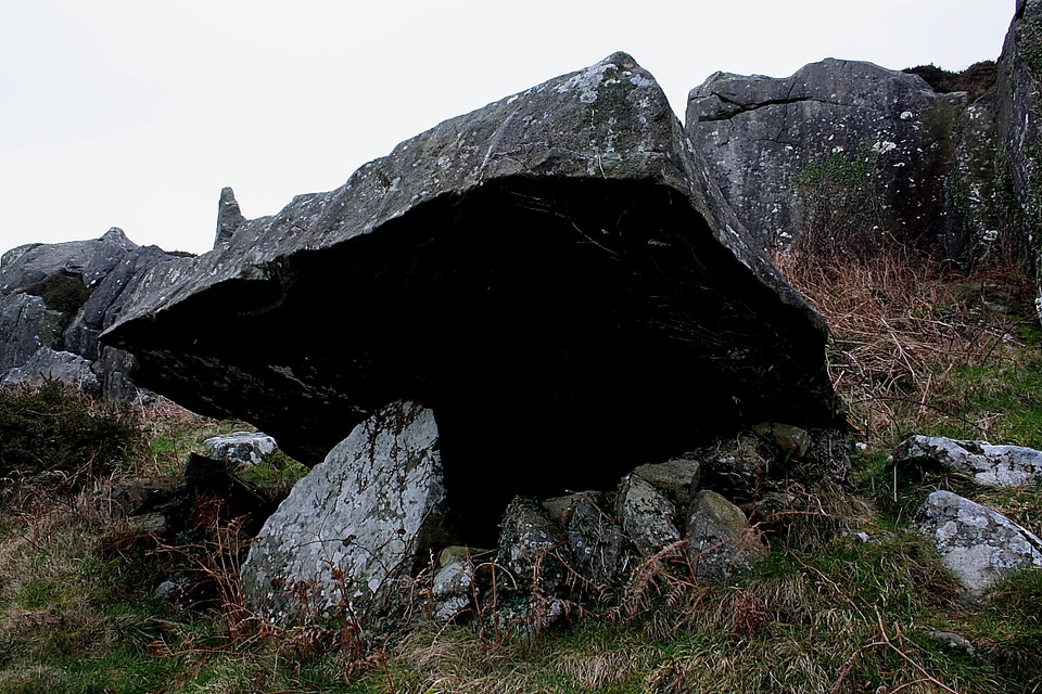
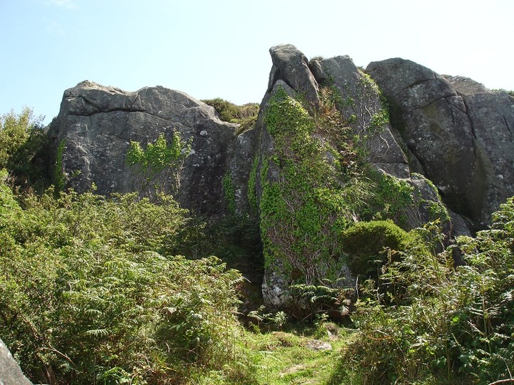
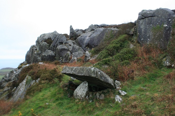
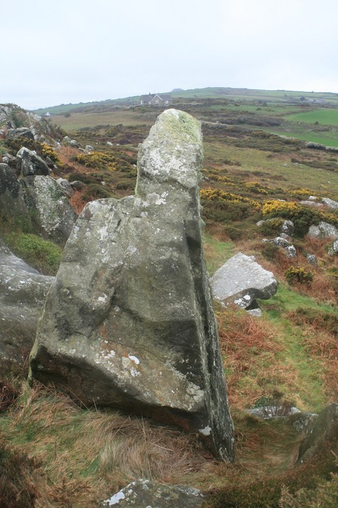
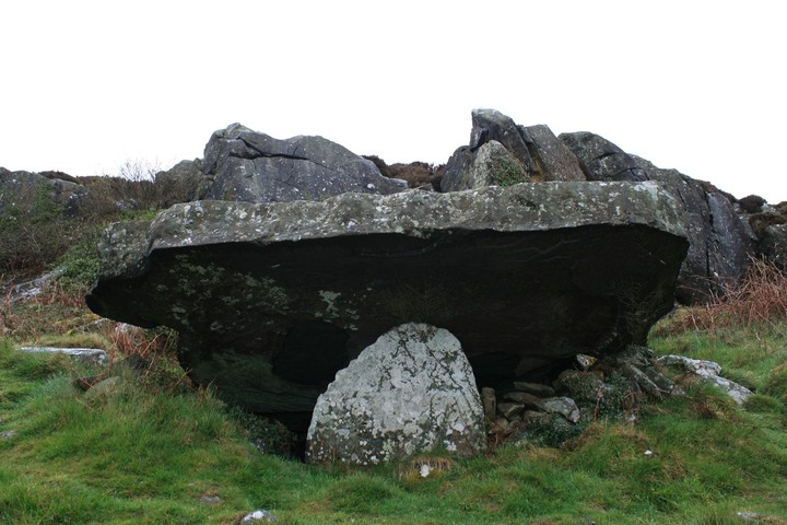
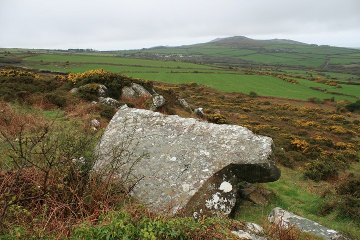
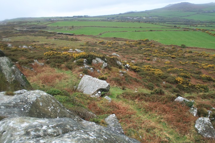
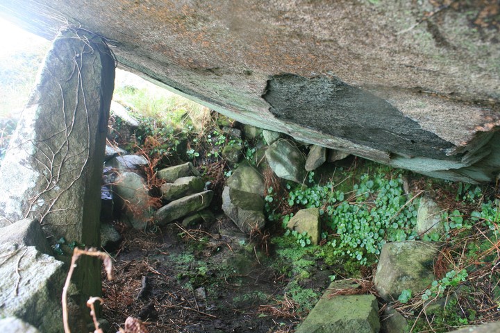
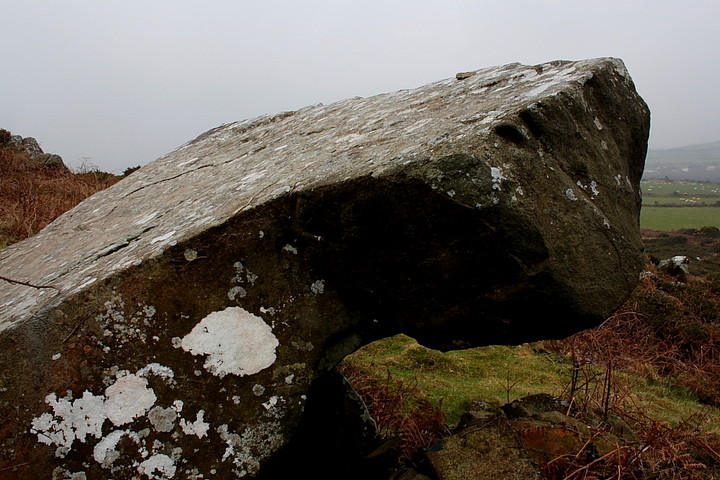
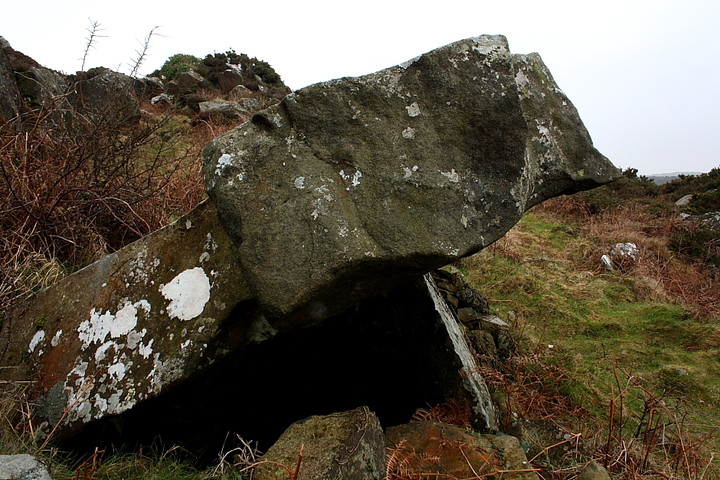
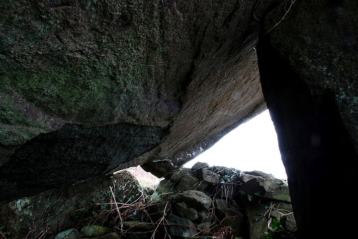
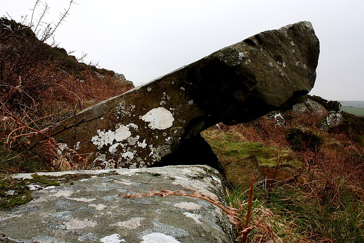
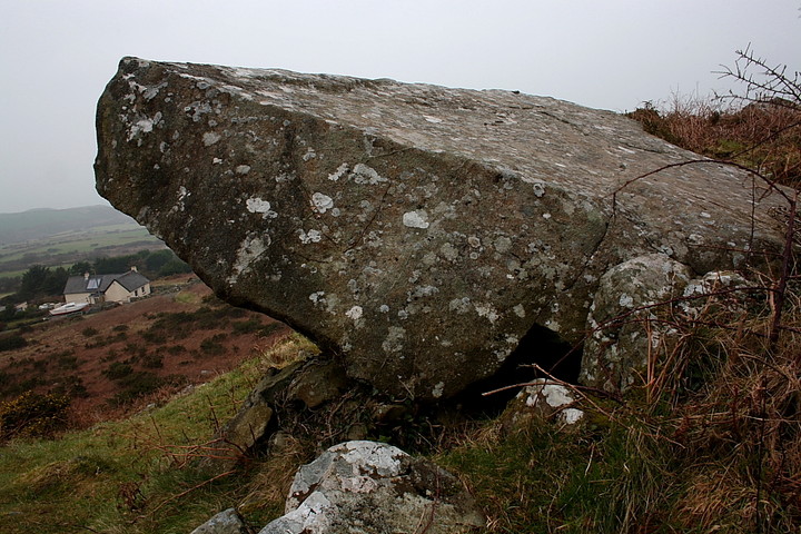
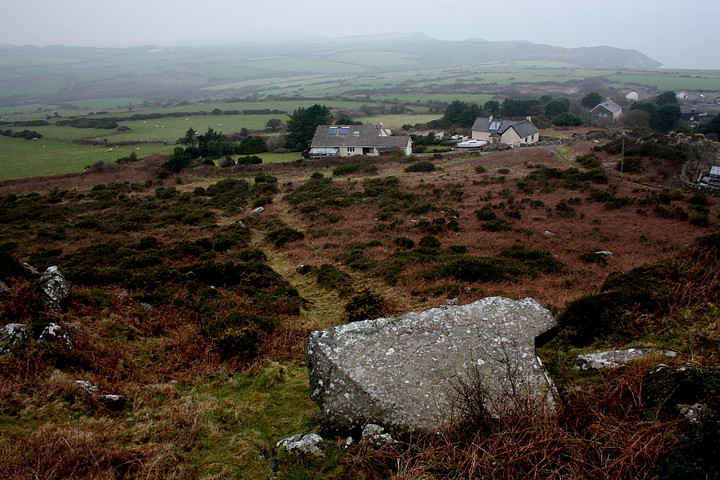
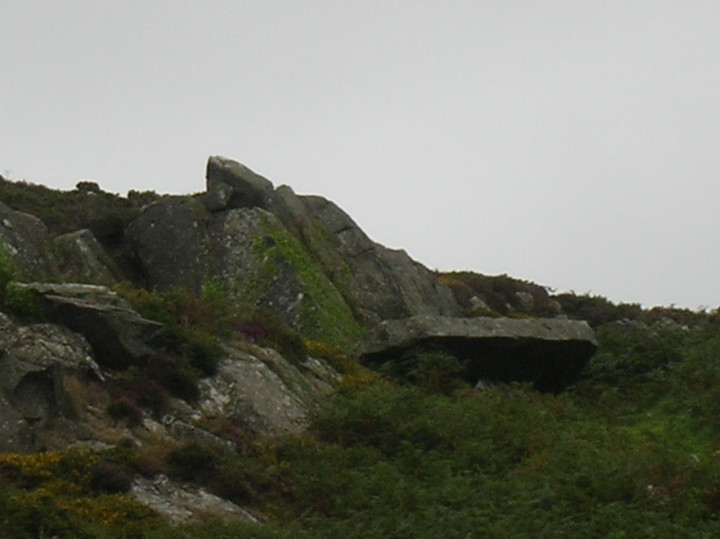
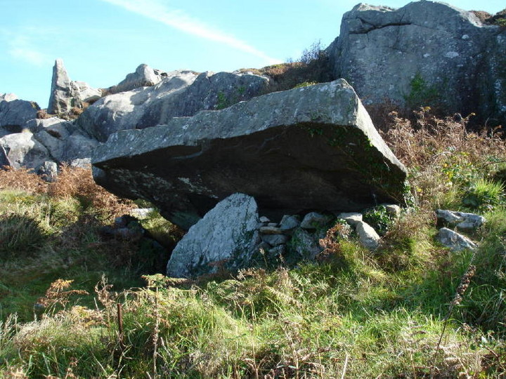
This was the only one out of the four I hadn't been to, Garn Wen trio....yes, Pen Rhiw wedge tomb....yes, even Carn Gilfach proved not difficult to find, but it took this my third visit to the area to find time enough for Garnwnda and it's shy outlying menhir. It was well worth the wait. Finding this last one wasn't hard, once the proper place was found to leave the car, I left it next to the phone box more or less directly south of the chamber and the rocks it hides amongst. Once more upon the bikes it's fifty yards back down the road, turn north/right up the footpath that looks like it's going through someones back yard. The path is muddy, but it would be after all it chucked it down most of the way here, standing on tip toes looking over the wall to your right you can see the standing stone of Parc Hen. At the end of the muddy path a gate is reached, once on the other side the footpath diverges into a starburst of desire lines, the one that is in line with the footpath just traversed is the one you want, after a hundred yards look up to the rocks, a tall pointy rock on the highest part has the burial chamber under it. That said I didn't go that way I went straight to the top and just scrambled around until I came across the chamber. When ever I find something for the first time it is impossible not to emit some sort of jubilatory sound, this one was a cross between Yaaay, and woohoo, a Yaaywhoo. The four chambers strung along the headland from Carn Gilfach to Garn Wen are within two hundred yards at most of the same latitude, hard to do if your trying, extremely difficult to do by accident. But the thing that struck me about another similarity between this one and Carn Gilach is that they are both very very close to the rock outcrop and both have a standing stone less than two hundred yards away. I love the mystery, that tantalising hint of something close to an explanation to what was going through the minds of these ancient ancestors, there has to be answer, and here it is close to the surface, luckily I didnt visit Garn Fawr hillfort or it's littler siblings so a return visit is assured. Was the capstone moved to it's current position ? or was it always there and they just jacked up one side and then propped it up on a single stone, either way the single stone looks wholly inadequate for the job, all that weight pressing down on just one small stone, carefully we entered the chamber. Cosy, if you like creepy crawlies, I don't mind most of them, except the slimey ones, in the summer when it's been dry for ages I could imagine staying here all night, yeah all night long. Come to Pen Caer headland and see these four chambers, but clear your mind first and put in some effort. This post appears as part of the weblog entry Trefdraeth to Wdig or Newport to Goodwick
|
 Posted by postman
13th April 2012ce Edited 15th April 2012ce |
|
I used to view these 'earthfast', 'sub-megalithic' burial chambers as not worth the effort of visiting. That I was wrong is, I think, self evident; not least since even the remnants of a largely destroyed monument still serve to focus attention upon the landscape it once formed a part of. Yeah, for me location will always be the primary attribute of a prehistoric site... so it depends upon where the tombs are.... It goes without saying that the Garnwnda chamber is exquisitely placed, overlooking, as it does, the justifiably famed northern Pembrokeshire coastline. That much can be surmised by anyone who can - ahem - read a map, after all. What isn't so obvious, however, is the size and sheer aesthetic beauty of the capstone supported upon its single orthostat. Hey, this mighty stone doesn't need any additional, supporting acts... not when it puts in an oscar winning performance of such magnitude just by remaining upon this hillside. No need for any pretensions here. It's an impressive, substantial tomb appearing to emanate from the very crag upon which it was built. In a way, I guess, it did. Nevertheless it is the location which elevates Garnwnda to the status of a megalithic 'must see' for me. Despite the overcast weather, the fine hillfort of Garn Fawr crowning a somewhat murky skyline to the approx west, this tomb speaks volumes.... much of which it would perhaps not be prudent to try and put into words. Even assuming I've understood, of course. Suffice to say it feels 'right' to be here, you know? It is not a 'pretty' spot, the gorse and brambles not at all out of place in a landscape which might well be labelled brutal. But nature is brutal by nature (ha!). And Garnwnda seems to me to reflect what its builders thought about their relationship with the earth. Perhaps such a relationship was too intense for a 21st Century mindset to begin to comprehend millennia after the fact? However I think we - from the vantage point of a 'modern world' which has no doubt reduced our capability for sensory perception - underestimate these people at our peril. There may well be much to learn at places such as Garnwnda which is not only relevant, but possibly essential to the future of our species? Here's to insight, then. In whatever form it may take. |
 Posted by GLADMAN
22nd March 2011ce Edited 22nd March 2011ce |
| Although I did better than Carl (my namesake, actually) and managed to find Garnwnda, the scramble up towards it was too brutal-looking today. Merrick's directions are pretty comprehensive, except to add that if coming from the church, head uphill and look out for the outcrop on the right. The capstone looks strikingly out of place, being a flat, rectangle seemingly thrown into the side of the cliff. |
Posted by ruskus 25th August 2010ce |
|
'Visited' 30.6.10. Failed to find this one I am afraid to report. Despite walking around and around, climbing up and down, getting stung by nettles and twice getting zapped by an electric animal fence I failed. I can only assume I couldn't see the burial chamber due to the height of the gorse / brambles? I am sure I was in the right place. Perhaps it is one to visit in the winter months? |
Posted by CARL 8th July 2010ce |
|
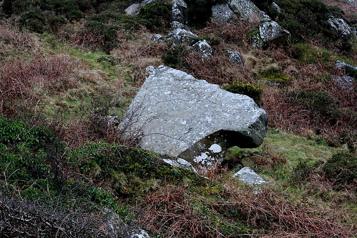
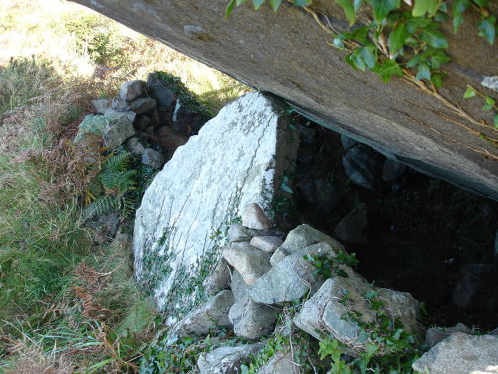
Not much to add in the way of fieldnotes, except to say that Merrick's bluestone is probably the spotted dolerite type. Above the tomb is ankle-breaking rock and heather, the view is of course magnificent. I walked up from the lane, along the path past a small derelict schoolhouse. Glyn Daniel who gave the name 'earthfast' to this localised crop of tombs, goes on to say that they come from the sub-megalithic group which existed in western France, Wales and Ireland; he plays around with terms such as primary, demi-dolmen, or half-dolmen. They do seem original 'cave' tombs, giving them a somewhat primitive feel. But like Carn Llidi tombs they hide themselves from view in a jumble of rocks and are often difficult to find. Not far from here are are the Garn Wen tombs, there are three in a row (SM 948 390) sadly you won't be able to find them for they are covered safely in a thick vegetation of nettles and brambles. Safely, because they back on to council housing, and the area in front of the cromlechs is used for a motorcycle track and tipping. At Garn Wynda I had jammed the car key in the door lock but deciding not to panic had managed to work out how to unjam and vowed there and then NEVER to lock the car. Arriving at the council estate I asked the road sweeper, how to get onto the coast path, giving me instructions he warned me not to leave anything in the car and to lock securely (did not). But coming back to the car three children who had been watching me intently, yelled back to their mother, 'Mum she's back in her car' So if you really want to find these three take a sickle. ;) |
 Posted by moss
6th October 2007ce Edited 6th October 2007ce |
|
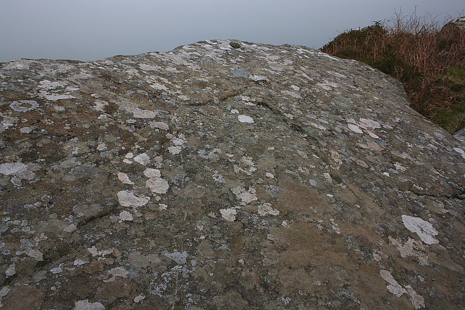
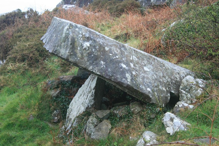
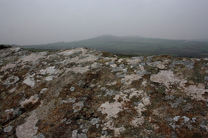
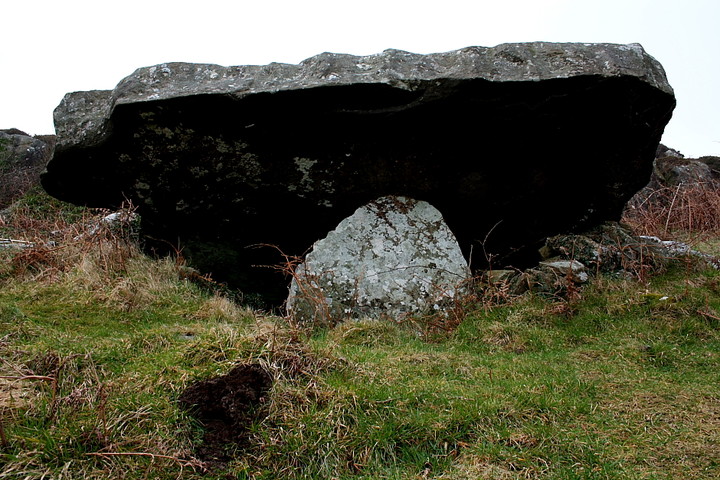
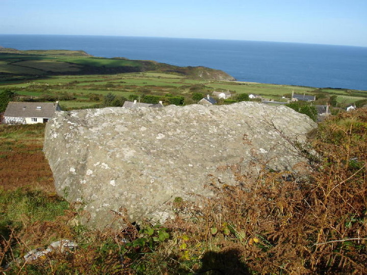
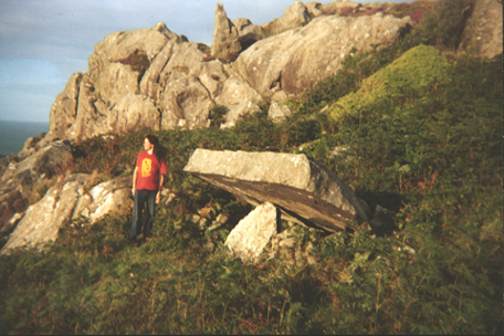
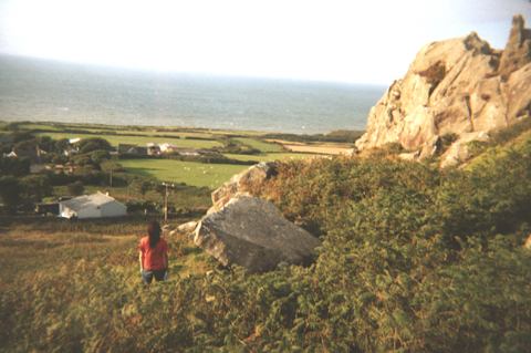
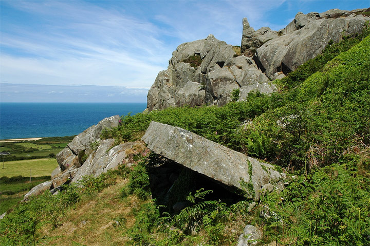
This is an absolutely staggering place. It's not just the fact that the rain's abated and we're in the first glorious sunshine of our tour, there is something a lot more, a solid, strident magnificence to this place and its view. Our theory that the burial chambers with names on the OS map (Gwal-y-Filiast, Pentre Ifan, etc) are generally in better nick than the ones merely marked 'Burial Chamber' is once again confirmed here. Our other theory of the Pen Caer cromlechs being Calanais-style orientated on rock outcrops is rammed home hard – this cromlech is literally sticking out of the outcrop! Looking up the hill from the south there's a weird flat slab of capstone jutting out. Get up here and it's resting on a single upright, 12ft long bluestone at a 45 degree angle, facing out at a rugged horizon around Garn Fawr. There was some encroachemnt from ivy and bracken., which we removed. It's an 'earth-fast' cromlech, one side of the capstone resting on the ground. It can clearly never have had a covering mound as it's so hard against the outcrop. Children & Nash (1997) say these cromlechs came later than the others. In The Modern Antiquarian, Cope refutes the idea given by some (such as Chris Barber) that those others were never covered, and suggests a later cult of uncovering the mounded tombs. Could the earth-fast builders, with their belief in cromlechs of stone open to the sky, be that later cult? Climb the extra few feet to the top of the outcrop for the most amazing panorama. To the west the outcrops of Garn Fawr, Garn Fechan, Garn Gilfach and Garn Folch form a serrated skyline; scoop clockwise past the Pen Caer lighthouse; Carreg Wastad Point where the French invaded in 1797; the sea coming in to the village of Llanwnda (whose churchyard apparently has an ancient holy well); round to look east with the foreground showing the outcrop by the Penrhiw cromlech, the background being the view from those cromlechs of Bae Abergwaun/ Fishguard Bay and the mountains of Mynydd Dinas and Mynydd Preseli. Turn further to see Carn Gelli outcrop, which presides over the Ffynnon Druidion burial chamber, then the sacred mounds along Penmaen Dewi/ St David's Head and two islands in the open sea. It's an utterly amazing view, a total must-visit of a place irrespective of the great megalithic value. The sun is out now, the sea a rich grey-blue and I wouldn't be anywhere else. A few people have had problems finding it, so here's directions: Just before you descend into Llanwnda you see the outcrop above you on the left. Then there's a turning marked Garn Gron and Garn Fach on the left, and a wooden public footpath sign. Take this and keep going till you run out of road at the last house, Garn Fach. The footpath runs in front of you to the left of the house. Look up to your left and there's an obvious flat slab just below the summit. This is it! Take the footpath 30 metres or so, then there's one that goes straight up to the cromlech. If you're coming by car, go beyond the Garn Gron turning to the village, park by the church and walk back up. Incidentally, the footpath loops right round the outcrop, and in a field off the south side is Parc Hen standing stone. visited 20 Aug 04 |
Posted by Merrick 7th September 2004ce Edited 10th September 2004ce |
| Strange site in a nice location. Mind the grassy slope up to the tomb - could be lethal in the wet. |
Posted by Grendel 26th June 2002ce |
Folklore |
|
|
Garnwnda (Carn Gwnda) is named after Saint Gwyndaf Hen (Gwyndaf the Aged), who presumably used it as a nice quiet spot for a bit of hermitage and religious introspection. He lacked some of the sympathy for nature that some of the other Celtic saints had. He was returning from Fishguard one day and was just crossing one of the (many) streams in the area, when a fish leapt up and frightened his horse. Poor Gwnydaf was thrown to the ground and broke his leg. He cursed the brook so no fish would ever live in it again. (mentioned in volume 3 of Baring-Gould's 'Lives of the British Saints' 1913). |
 Posted by Rhiannon
20th July 2006ce Edited 20th July 2006ce |
Miscellaneous |
|
| The photo in Barber & Williams' The Ancient Stones of Wales (1989) labelled 'Carn Wnda' is wrong, it's of a different cromlech altogether. |
Posted by Merrick 7th September 2004ce |
| At the given NGR is NPRN 309041 a clearance cairn, of which the steep angle of the remaining stone shows it to have been a sheepfold. The correct NGR for the tomb in the photo is SM93313923 and is yet another Carreg Samson, distinguished as Carn Wnda. The capstone is approx. 3.3m x 3.1m and covers a rock-cut pit. |
9th July 2004ce |
| Garnwnda burial chamber(s) lie above the village where the French tried to invade in 1797 (honestly). The capstone is apparently only supported by one upright. |
Posted by Rhiannon 21st June 2002ce |
Links |
|
Archaeologia CambrensisCromlech at Llanwnda, Pembrokeshire |
Posted by moss 27th July 2012ce Edited 27th July 2012ce |