Fantastic monument on the peak of this hill.
Image credit: ryaner
Fantastic monument on the peak of this hill.

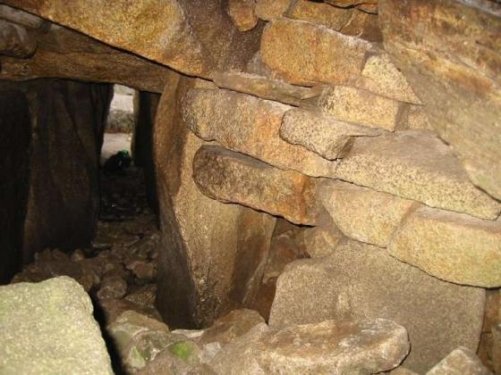
The bank of the barrow is stone-lined.
This wonderful barrow is at the top of a hill north of Slieveroe, west-north-west of Blessington. The tiny boreen that gives access to the field is almost impossible to park on. Below the hill and to the west, there is a space with enough room for one car, but it’s very tight so I wasn’t comfortable hanging around in case a farmer with his tractor happened by.
About 250 metres south into the field and up, the line of an old field boundary becomes visible. Directly behind this is the ring-barrow (the SMR classification). There is a raised area at the centre, but given that there is also an entrance through the bank and fosse at the east, you could be forgiven for thinking this is a ceremonial henge rather than a burial site.
The views from up here are stunning, even with the dank, low cloud – Sorrel Hill, Black Hill, Moanbane and Silsean to the south-east over the reservoir all look magnificent. North-east is the plains of Kildare. I hadn’t the time that the place deserves, but was very taken by this monument.
From archaeology.ie:
Description: Prominently located (OD c. 296m) at the NE end of a narrow-topped, moderately steep-sided NE-SW ridge, overlooking Glen Ding valley to the NE and with panoramic views in all directions except SW. A sub-circular area (diam. 14.4m E-W; 13.4m N-S) is defined by a shallow fosse (D 0.2-0.4m: base Wth 0.8m at N – 3.5m at E) and by a low, heavily poached outer earthen bank (int. H 0.2-0.6m; Wth 2.5m at S – 4.1m at W; ext. H 0.3-0.5m) which has a spine of dense stony material, and possible small inner revetting stones at S (ext. diam. 29m E-W; 27.5m N-S). An entrance gap (Wth 3.3m) at ESE is flanked on its S side by a single revetting stone on the inner face of the bank.
Compiled by: Gearóid Conroy
Date of upload: 23 July 2012
Date of last visit: 02 November 2000