|
|

|
|
Round Hill TumpRound Barrow(s)
|
||||||||||||||||||||||||
|
|
|
News |
|
Archaeological Open DaySat 17 July 10.00 - 16.00 Upper Row Farm, Laverton, Near Bath Join us for a day of activities for all the family. Join the Roman children's army have a go at excavation and see a roundhouse. Bath and Camerton Archaeological Society (BACAS) 07977 176402 [email protected] continues... |
 Posted by Chance
5th July 2010ce |
Images (click to view fullsize) |
|
|
Fieldnotes |
|
|
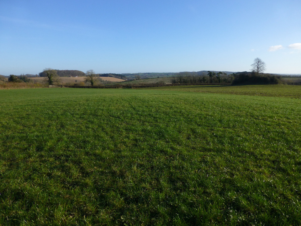
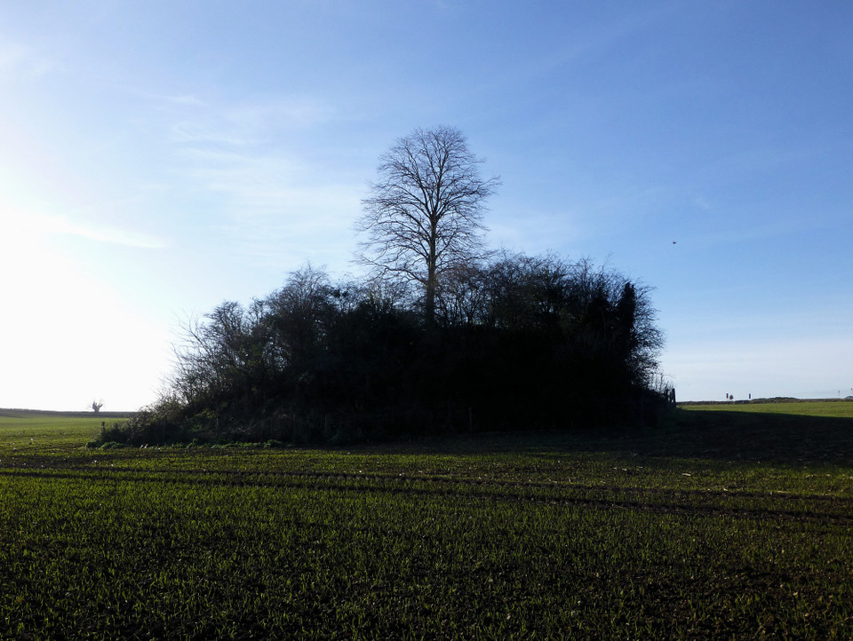
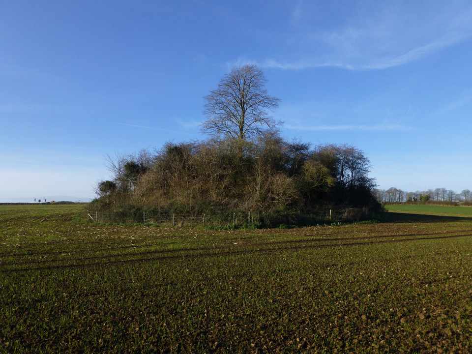
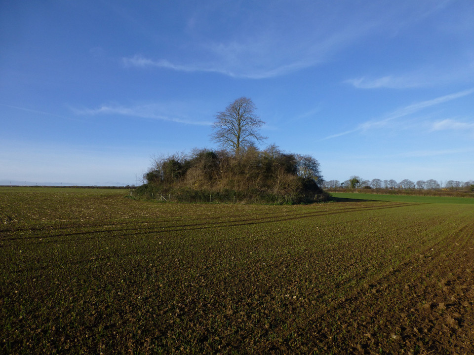
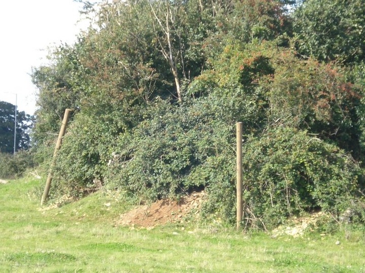
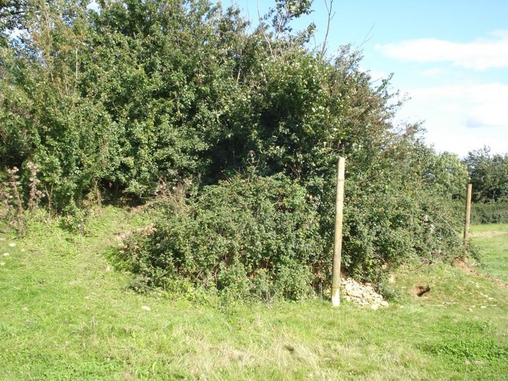
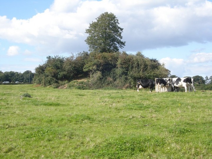
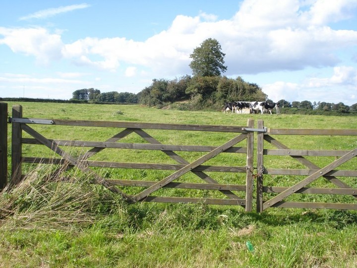
Visited 30.3.13 Directions: To the north of Radstock, next to a minor road off the busy A367. Access is via a stile next to a wooden field gate. The start of a day of ‘Barrow hunting’ and what a good one to start with! The Barrow is an impressive sight approximately 4m high x 30m across It is covered in trees with a particularly tall tree right in the centre. The Barrow has a barbed wire topped wooden fence all around it. Access to the Barrow is easy and given its size is well worth a visit when in the area. |
Posted by CARL 2nd April 2013ce |
|
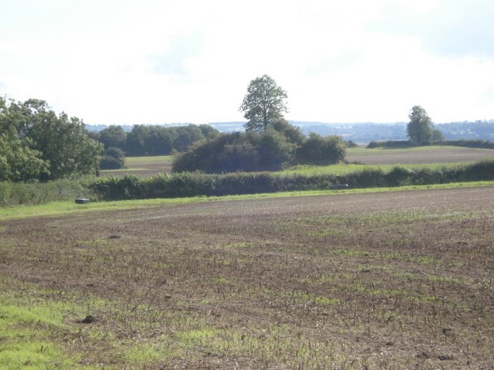
Field Notes Round Hill Tump - ST 6900 5617 - Aug 2008 Ordnance Survey Explorer Map 142 - Scale 1:25000 Shepton Mallet & Mendip Hills East inc. Frome & Midsomer Norton. ISBN 978-0-319-46154-9 After looking at both references to this site on TMA database, I feel this one is the most appropiate in terms of name and grid reference, although Rhiannon's Camerton Round Barrow site No.5698, is older. Like a lot of ancient sites, it has become the boundary marker because it was here before anything else. As to the name, I'm going for Round Hill Tump, as it lies in a field called the "Tump Ground". Rhiannon's name of "Camerton Round Barrow" is a little confusing. The village of Camerton lies 2 miles north of the site, on the other side of the Roman Road, the Fosse Way (the modern A367). The area was partially excavated by W.J. Wedlake and a report was published in 1958 entitled 'Excavations at Camerton 1926-56'. The nearest village is Clandon. The whole hill is called Round Hill and the course of the Fosse Way makes straight for the top of it. My route to the site was along the bottom of the valley from Stoney Littleton Long Barrow and the Sustrans cyclepath href="http://www.bathnes.gov.uk/BathNES/transportandstreets/walkingandcycling/cycling/NCN24.htm">The Colliers Way - National Cycle Network Route 24. From the middle of Radstock, I took the Bath Old Road, behind the museum and up the side of Round Hill. The road is very steep to begin with but once past the sports field, it levels off a bit. The "Tump" is easily spotted from the road and a gate was conveniently placed for access. As to the mound itself, it is unusual. It certainly isn't your average bowl or bell type of round barrow and it didn't seem to have any form of ditch or bank (although there probably was one formed to create the structure. Maybe it was such a bowl barrow to begin with and it was added to at a later date. Colt Hoare also noted such strange barrows and called them "Conical Barrows". The only other one I have encountered like this is known as Mount Wood and lies on the Marlborough Downs near Yatesbury. I think the TMA Eds will probably re-list it as a disputed antiquity after reading this, although I do hope they find the time to merge it with Rhiannon's Camerton Round Barrow, site No.5698. |
Posted by Chance 15th October 2008ce Edited 16th October 2008ce |
Folklore |
|
|
From Somerset Brrows by L.V.Grinsell. This is said to contain the remains of a saxon chief killed in battle, or of soldiers killed in a battle. An oak or elm, which grew on this barrow until 1937, is said to have bled when cut with a knife. Wedlake, W.J. (1958) and Tongue, R.L. (1965). |
 Posted by formicaant
6th January 2008ce |
|
In the Reverend John Collinson's 'History and Antiquities of the County of Somerset' (from the 1780s) he spoke of "an immense tumulus at the extremity of the parish [of Wellow]". I initially assumed he was talking about Stoney Littleton but actually he was writing about the hamlet of Woodborough - where this barrow lies. It was "said to be the burial place of Saxon chieftains slain in a bloody battle." Camerton was the Roman town that it became part of - although the site is open fields now. The round barrow has interestingly survived through everything. If you know a local name please tell me! It is still an impressive 6m high, crowned with trees and easily visible from the road. There are the remains of another round barrow in the field apparently, and archaeological work has found traces from the Neolithic too. The field in which the barrows lie is called 'Tump Ground'. A large oak formerly stood on top of the larger barrow (the Roundhill) but was removed in the 1930s. Local people claimed that if you attempted to cut or damage the tree, blood would run from the wound. Wedlake (in 'Excavations at Camerton 1926-56' 1958) also writes that "Local legend still has it that the mound contains the remains of soldiers killed in a battle when a town which extended from Wellow to Paulton was attacked." (This idea of the town seems quite weird, but could it be recognition of the lost Roman settlement in the area?) The Reverend Skinner excavated the mound in September 1815 (it was a busy time for him, see the Priddy Nine Barrows). He used an interesting and unusual technique, hiring local coalminers to drive a tunnel in from the side (rather like at Silbury, I suppose). When they got to the middle they found someone had sunk a shaft from top to bottom in the past anyway. |
 Posted by Rhiannon
17th August 2005ce Edited 5th December 2014ce |
Miscellaneous |
|
|
This barrow was opened by the rev J.Skinner in 1815. He employed two colliers from 22nd until 30th September. They tunnelled into the centre but "the interment was gone; there was no cist, only a hole in the soil". There was a burnt layer on the original turf-line which revealed a structure of stones with a revetment wall on the north side, and a quarry on the south side from which some of the material from the barrow was derived. This opening revealed a human thighbone and a broken whetstone. Skinner thought the barrow had previously been opened in the 18th.c. and robbed of its contents. An adjacent barrow also yielded an antler pick, ox bones and two flint scrapers. from Somerset barrows by L.V.Grinsell. |
Posted by formicaant 6th January 2008ce Edited 6th January 2008ce |
| To add to Rhiannon's post. Anne Ross mentions a stone head that was found in the foundations of a 3rd C AD roman house. This local limestone head is probably much earlier, and could be a" foundation offering" in the building of the house. She describes it as celtic but looking very "neolithic" in other respects. The head culture round here is fairly common, the beautiful Celtic head of Bath springs to mind. But she also mentions A "phallic" head from Eype some 45 miles away... |
 Posted by moss
18th August 2005ce Edited 5th December 2014ce |