|
|

|
sals’s TMA Blog |
|
Second Sardinian Adventure - Day 1
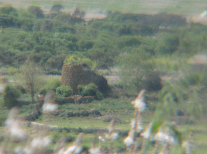
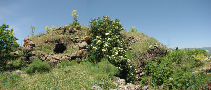
| Time for our next Mediterranean trip .... having enjoyed last year's visit to Sardinia so much, and with a cheap airline starting a new route from our local airport, we'd booked the first possible flight and packed the unused research notes ..... Arriving into Olbia in the early afternoon, we picked up a hire car and headed south and west on the main road, managing not to fall into our usual habit of arguing about directions, and by tea time had finally found a cashpoint that didn't reject our cards, and checked into our beach front apartment ready to spend a few days exploring a new area - the towns of Macomer and Abbasanta and their surroundings. Advantages of it being low season: apartment upgrade, very quiet and peaceful Disadvantage: the village was almost closed! The local bar rustled us up a meal (choice: pizza or pasta!) and a beer, and we watched the sun set over a stunning beach sharing a bottle of wine, and planned our first day. We'd spotted several impressive looking nuraghe on the way to the apartment, including Nuraghe Santa Barbara — Fieldnotes11.05.08ceVisible from, and signposted from, the fast SS131 that runs vertically down the island. However only accessible when going north - the road bends quite sharply around Macomer and then heads west and uphill - watch out for the sign to the right. We always seemed to be on the wrong side of the road, or heading home late after a full day, so never did stop to investigate. Margaret Guido, in "Sardinia: Ancient Peoples and Places" describes the site as "an early tower, with niches, guard-chamber and staircase has a four-towered addition each of whose towers contains a tholos chamber". It's one of her recommended places to visit. but our first actual stop was a little nearer our base south of Bosa. Nuraghe Sèrras — Fieldnotes11.05.08ceStanding prominently on a hill overlooking the main road (obviously new, as it didn't exist on our map) from Macomer to the resort of Bosa, south of the village of Sindia. We parked up and fought our way through the hip high grass, thistles and brambles, over stone walls, and ended up in a field still a way away, with no obvious access route, so had to be content with viewing from a distance. There were quite a few (sheep, I suspect) skulls and other bones in the field, and we spent quite a time watching the wildlife, including a dung beetle with a sphere much larger than it was, both of us contemplating picking up a souvenir or two for a certain friend ..... Nuraghe Sèrras — Images11.05.08ce
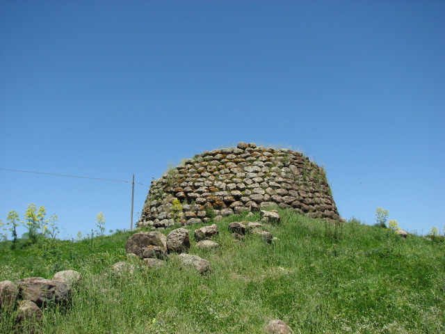
 Beetle photo courtesy of Beardy. Beardy got out his binoculars and scanned the horizon spotting several more nuraghi - not surprising as the density in the area is more than 0.6 per square km (Lilliu) - and I dug out my new telephoto lens to zoom in on: Nuraghe Nela — Images11.05.08ce
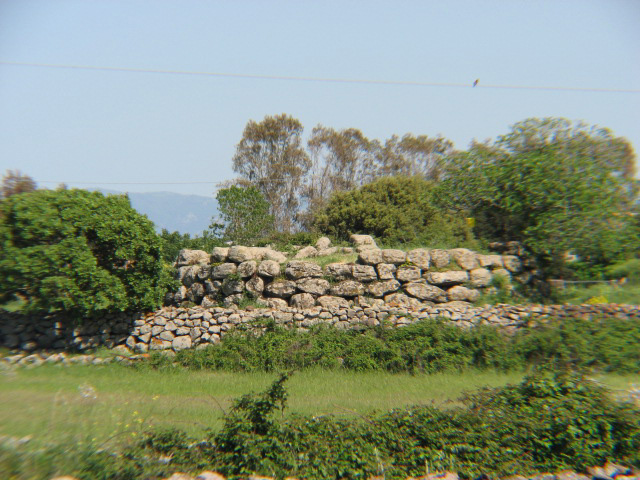
Back towards Macomer, and we pulled in again to get a few photos of Nuraghe Succoronis - there is a path leading from the main road but it was chained and padlocked, even though it theoretically was open on a Sunday. Nuraghe Succoronis — Images11.05.08ce
After numerous level crossings, we reached the T head and chose to go right towards Macomer rather than back to the main road, pulling in to hopefully visit Nuraghe Ruju and Domus de Janus Filigosa - both, according to my notes, managed by a cooperative, and due to be open. Or not! Nuraghe Ruju — Images11.05.08ce
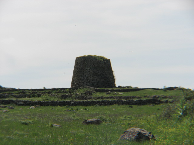
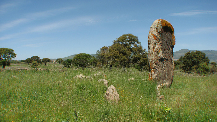
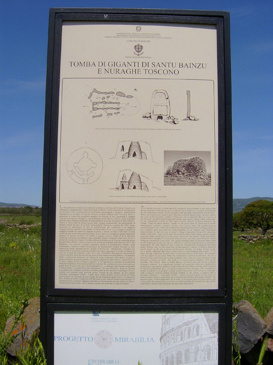
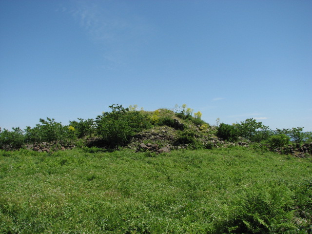
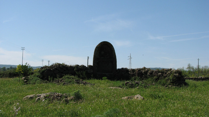
Accompanied by couple of small friendly ankle-licking dogs who'd been chilling out beside the grim-looking hospital, I was all ready to jump the low wall as the sign said it was supposed to be open (I'd learnt the days of the week in Italian specially, after being scuppered by lack of such knowledge in Spanish on a trip to Mallorca) but Beardy insisted that we shouldn't, and should instead head to find the first, for this holiday, of the site type that fascinates us both, the tomba di gigante. We crossed over the SS131 south of Macomer, and headed towards Borore - but instead of turning into the town, continued along the main road towards Dualchi until we reached the left turn at Nuraghe Toscono, and parked in the shade of the trees infront of the old church. Leaving the nuraghe for the moment, we followed the road on, to the gate with an info board about both sites. Santu Bainzu — Images11.05.08ce
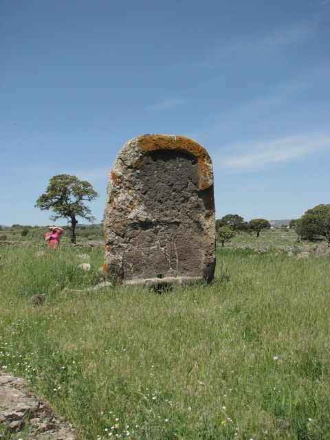
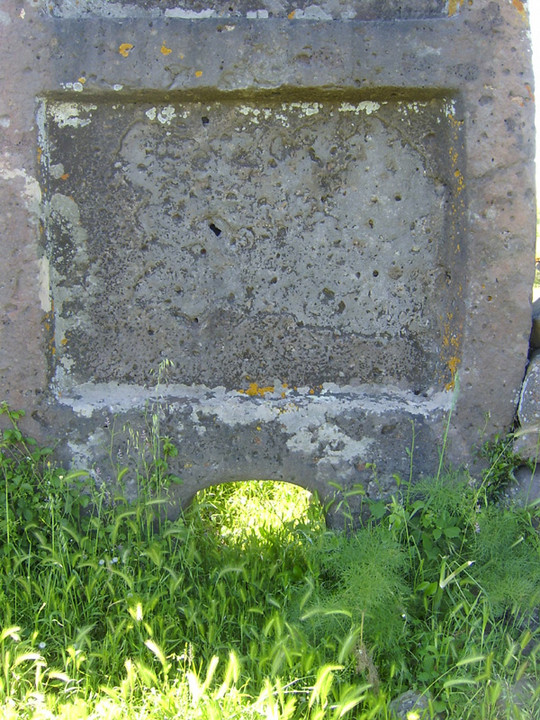
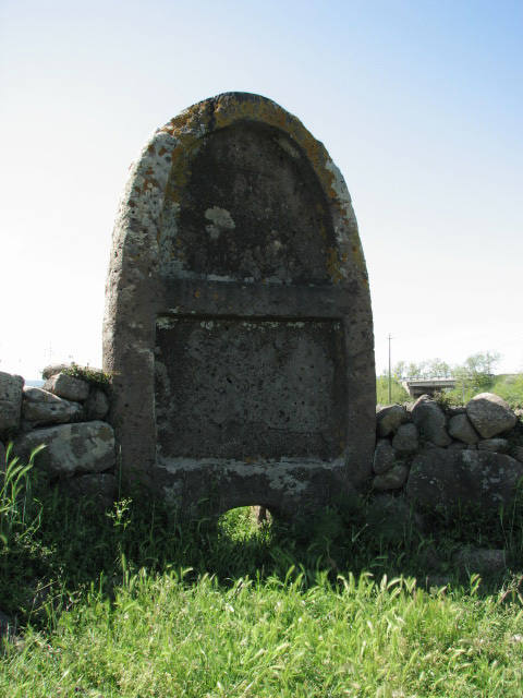
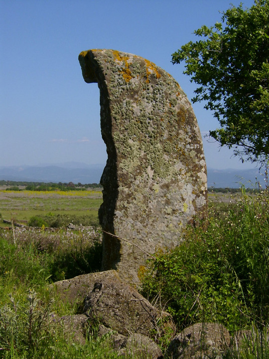
Santu Bainzu — Fieldnotes12.05.08ceThe tomba of Santu Bainzu has an impressive stele, or central stone, standing 3.2 metres tall and just over 2m wide. It's relief carved, as we'd seen at Coddu Vecchju and Li Lolghi, but this time with the addition of a large cupmark above the portal (the portal being approx 30cm tall by 50cm wide). Not much remains of the esedra, and the low lying stones were partically hidden in the long grass and wild flowers. The funerary space can be clearly identified at the rear of the stele; of the cist, about 6m x 1m remains, though the origial construction is thought to have been almost 14m long. If you zoom in on the info board, you'll see that this area had a village too, based around the nuraghe. We didn't notice any particular features of this as we backtracked to the tower. Nuraghe Toscono — Images12.05.08ce
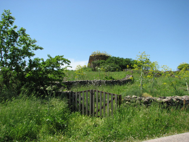
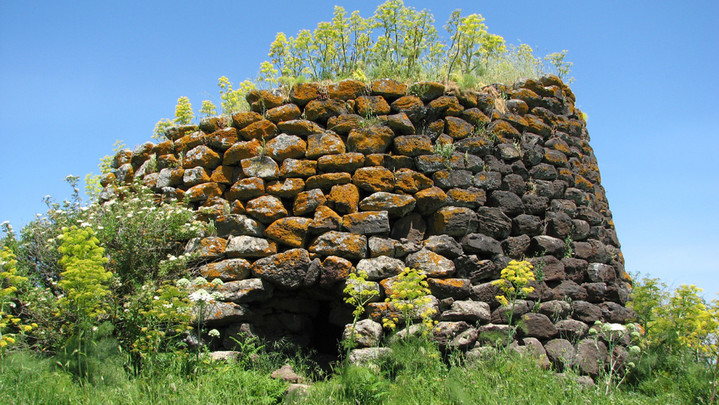
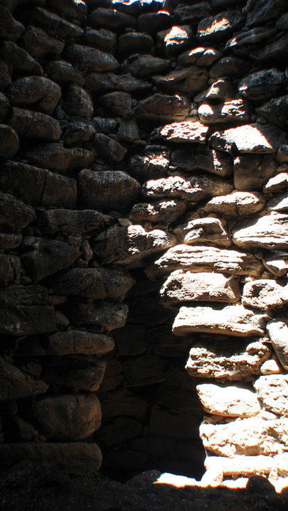
Nuraghe Toscono — Fieldnotes12.05.08ceAbout half way between the church and the road junction is a gate giving easy access to the nuraghe, through a field of tall grasses and flowers, with the occasional thistle. The entrance to this simple monotower nuraghe faces the road - I climbed up and in, noticing a collapsed roof (or possibly the original entrance on further reading) to the left. To the right, and much lower down, there was another shaft of light but with a black void between it and me. Cursing the lack of foresight to pack a torch, I felt my way carefully down the uneven 'staircase' to an anti-chamber which opened onto the main chamber with 3 side chambers and a collapsed tholos roof. I'd spent rather too much time playing with Google Earth and this area was included on one of my many screen dumps, so we planned a circuituitous route round and back to Borore .... starting to think about stopping there for a late breakfast as we'd so far failed to find an open shop, it being a Sunday. The next stop was another nuraghe: Nuraghe Porcarzos — Images12.05.08ce
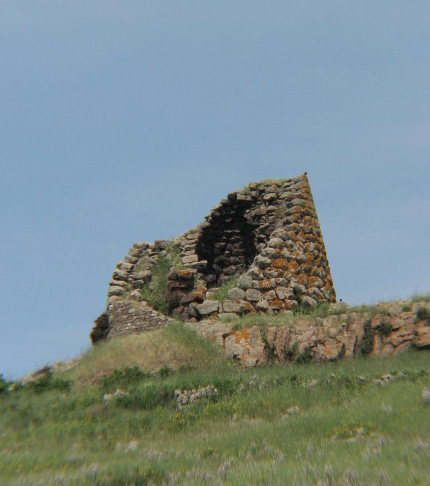
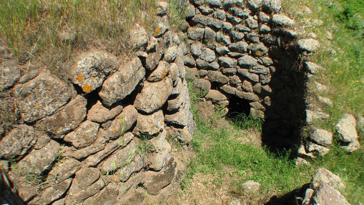
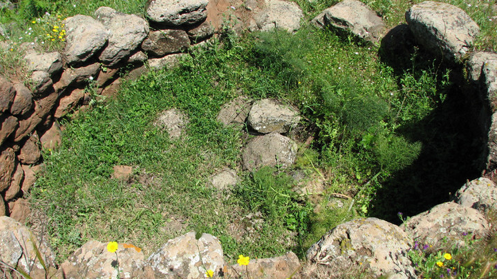
Nuraghe Porcarzos — Fieldnotes13.05.08ceApproaching this nuraghe from the road, there's a path with drystone walls on both sides - and the view doesn't inspire. But as I approached, I could make out some impressive walls and a path round what we worked out is the back of the nuraghe. Round the front, it becomes clearer - a long walled approach and then access to the main chamber from the first floor level only, with two side towers both with collapsed tholos roofs. The actual entrance was propped with scaffolding poles so we decided to err on the side of caution and not enter, instead climbing up to the highest point - using a flight of steps above the left hand side collapse - and peering down into the chambers. The nuraghe has 4 side towers, sited asymetrically, though we were unable to access the rear two. Despite another scaff pole being visible through the floor of the right side tower, I climbed down - it's at second floor level - to admire the flights of stairs up the the roof, and a double set leading back down to the forecourt of the main chamber. The field we had to cross before Nuraghe Porcarzos had plenty of what we soon realised was the most common plant we'd bump into - literally ....  Ouch! and some interesting wildlife  From here, the next planned visit was to 2 dolmens just to the north. I had a grid reference, but was unsure of its accuracy ..... we pulled up at roughly the right place and wandered down a track, until the boggy ground and a loose bull in the field made us turn back - and I spotted a likely looking sign on the road further ahead. Serbine domus de janus - pointing across a walled field with no obvious entry or crossing route, and no obvious site to aim for. Talking of aiming for - notice the condition of the sign.  We decided to leave investigating the area to someone else! One more nuraghe was on the map (there are so many more unsignposted!) before the town: Nuraghe Bighinzones — Images14.05.08ce
Nuraghe Bighinzones — Fieldnotes14.05.08ceJust to the east of Borore, on the road which takes you to Santu Bainzu and Nuraghe Toscono is Nuraghe Bighinzones. It's a quadrilobate structure, similar to Nuraghe Porcarzos but with symmetrically arranged side towers ... not that you can tell, as it's buried to beyond the height of the side towers and only the central one is visible. Climbing to the top, you can look down through the collapsed tholos roof to the interior of the tower, and some of the entrances to the side chambers can be seen. We parked up carefully opposite a bar in Borore, in search of a drink and snack. No food available, so sat outside in the sunshine with a bottle of pop each and watched locals arrive to watch the football being shown inside and pretty much abandon their cars part way across the road. An elderly gentleman appeared from the next door building and started chatting - and kept chatting to us even after we'd used our stock phrase "Scusi, io non parlo Italiano. Io sono Inglese." Then back to the main road, to the turn to Sedillo where the next two sites were clearly visible. Nuraghe Imbertighe — Images14.05.08ce
Nuraghe Imbertighe — Fieldnotes14.05.08ceIn a farmyard only metres east of Imbertighe tomba. Imbertighe — Images14.05.08ce
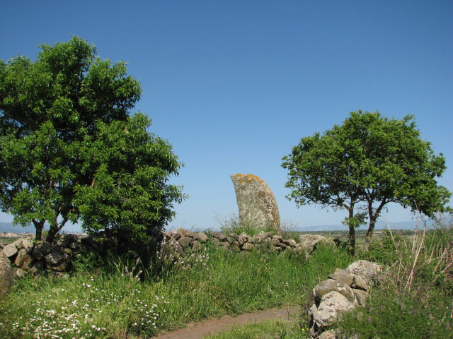
Imbertighe — Fieldnotes14.05.08ceImbertighe tomba di gigante has an impressive curved esedra made of small blocks, and a relief carved stele standing 3.6m high. The body of the tomb was originally 11.5m long, but there's very little to see of it on site. The info board says it's been destroyed; my research notes say it's still buried. For the first time all day, there were other visitors to the site! Two Italian speaking women joined us in the field and posed for photos in front of the stele for each other. Though feeling weary - and hungry! - we decided to make one more visit, to a tomba less than 1.5km away as the crow flies. Perdalonga e Figu — Images14.05.08ce
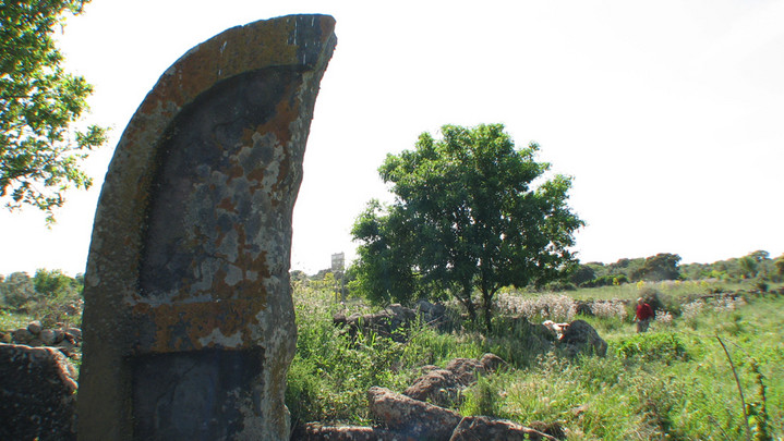
Perdalonga e Figu — Fieldnotes14.05.08ceFrom Borore, head towards the SS131. At the big junction and flyover, take the first left, signposted to Flor Mirko (nursery / garden centre) and head south on the old main road. The tomba is signposted from this road and its turn is directly opposite Flor Mirko - as you turn, there's a farmyard infront, and the track you want goes to the left. We drove cautiously on for about 300m, and then spotted the stele in the corner of a field on a S bend ahead. There's a track to pull into / turn round in just before the first corner, and a similar space opposite the second. And what a stele! Broken vertically. Has it been intact, it would probably be among the largest on the island. It's 3.8m high, and the remaining part is 1.9m wide - originally about 4m wide. The tomba is right up against the field/road boundary, and the left hand side of the esedra is almost non-existant because of this. The body of the tomba runs parallel to the boundary and there are 9 of the original 12 side stones still in place, half buried in the long grass, forming a corridor 8.8m x 1.2m. As we visited, the local farmer appeared to clear the field of sheep and gave us a friendly wave. Then it was time to head back to base, finally having breakfast on the beach at Bosa Marina at 5pm. We vowed find an open shop and pack a picnic for the next day trip! |
11th May 2008ce Edited 14th May 2008ce
sals's TMA Blog
Latest TMA Blog Posts
|

Comments (0) |
|
| You must be logged in to add a comment | |