|
|

|
sals’s TMA Blog |
|
Sardinia - Sassari circuit plus (it's the final part!)
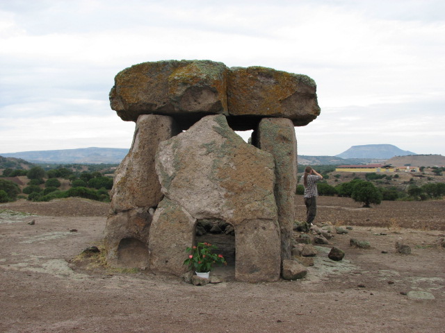
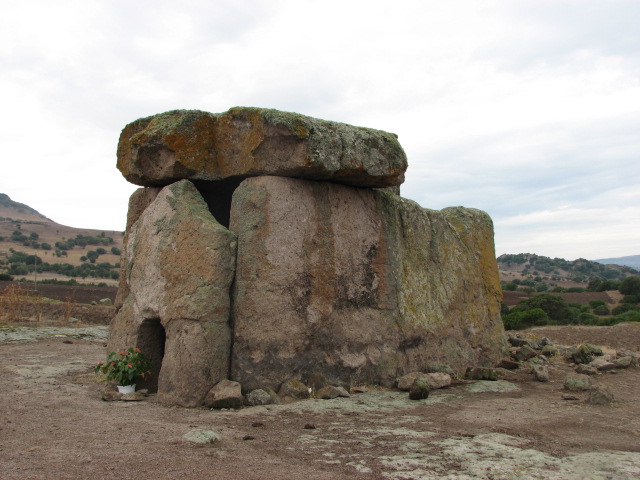
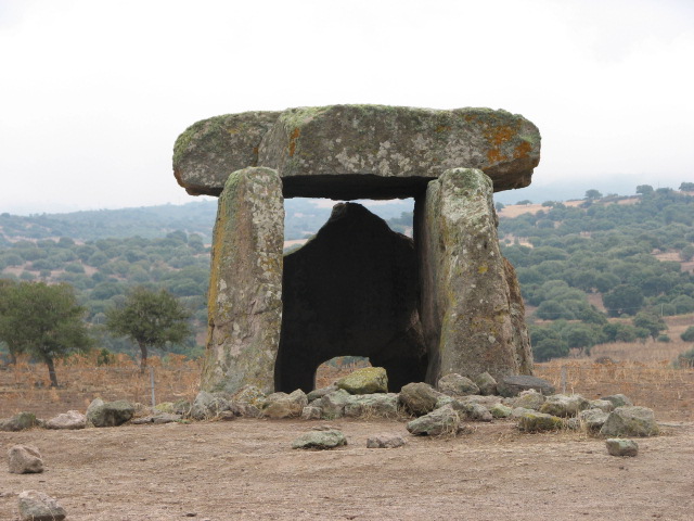
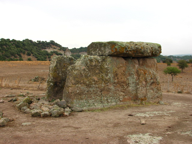
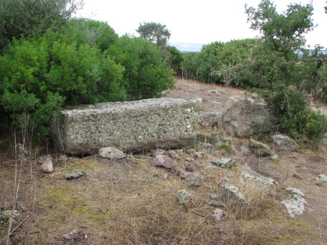
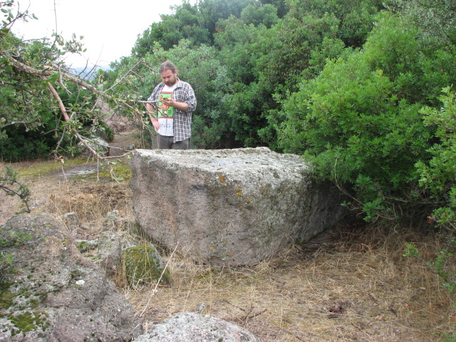
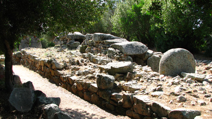
After a lazy Sunday on the beach and in the warm turquoise Mediterranean, a drizzling Monday morning dawned, and we managed to get up early enough for a full day out. After the fast road freakout, we decided to steer clear of the SS131 as much as possible and headed west from Olbia on the 199 instead - a reasonably good road but with some strange junctions - through an amazing volcanic landscape. We were aiming for the town of Mores - and just before that, our first stop of the day - to see the largest dolmen on the island.Sa Coveccada — Fieldnotes13.10.07ce1.4 km east of Mores, on the 128bis, turn south onto the SP47. After 6.3 km turn right, and then after another 3.15km turn right again past the farm to the dolmen. All turns are signposted! Just before the final junction, we were held up for a while by, but then inched forward through, a flock of sheep and barking dogs, actually herding a few stragglers with the car when we turned to the farm. The first gate is 730 metres further on - we drove through and parked, walking the last couple of hundred metres. It's huge! My notes say 2.7 metres tall, 5 metres long, and the capstone used to be 6 metres by 3 metres by 60 cm, weighing in at 27 tonnes. The rear wall is missing; the front has a small portal as though belonging to the stele of a tomba di gigante, and inside there's a niche carved into the side wall. Whoever had visited the dolmens such as Ladas around the village or Luras had been here, or maybe it's a local custom, but yet again a potted plant had been left recently. Free and open access - but watch out for livestock on the approach road! Sa Coveccada — Images13.10.07ce
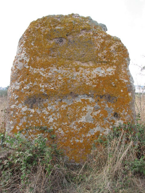
The information board by the gate mentioned a menhir, so we wandered down the path - and realised we'd gone too far so headed onto the rocky outcrop on the right for a better view, and then stumbled on to where we wanted to be. Sa Covecadda — Fieldnotes13.10.07ceFrom the dolmen, follow the wide path away from the farm. There's a single tree, and then a clump of trees to the right - just before the clump, veer to the right (up a slope heading NNWish), and on the right after 50 metres, the menhir can be found fallen behind some bushes. Sa Covecadda — Images13.10.07ce
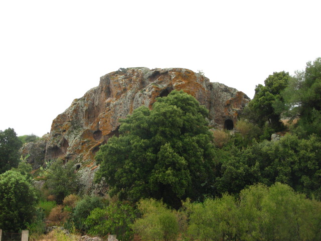
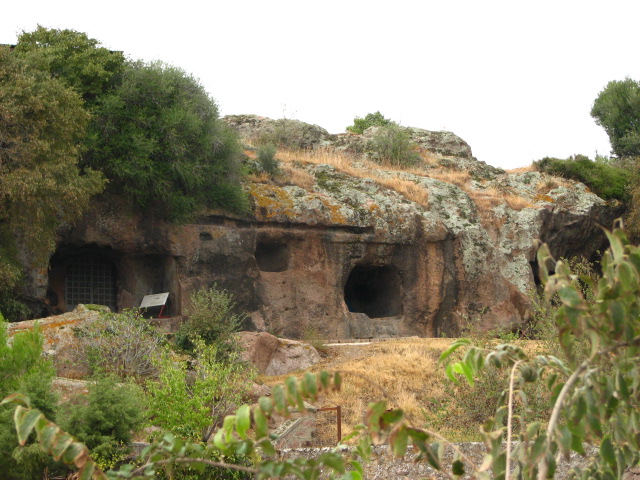
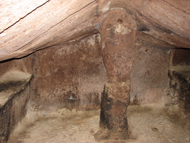
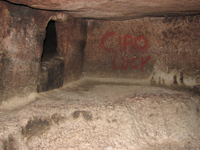
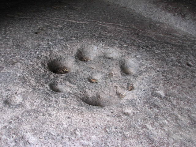
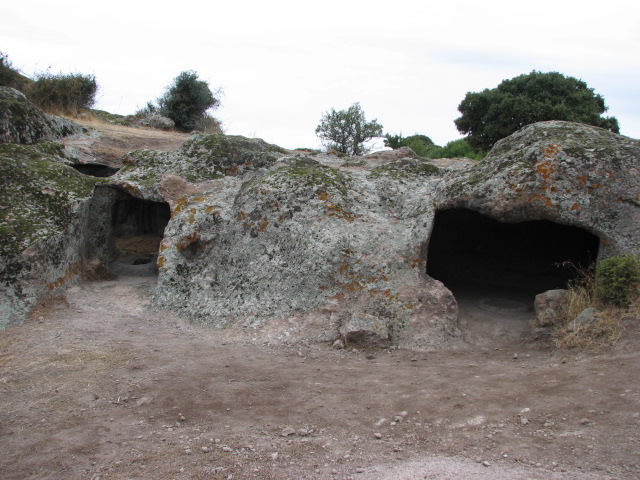
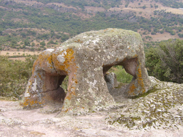
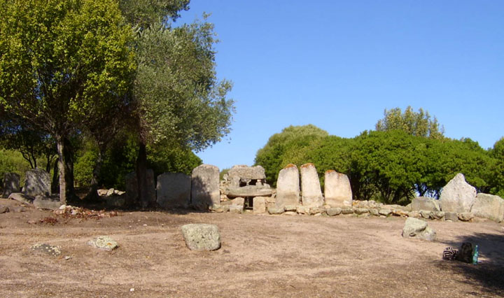
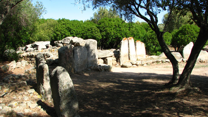
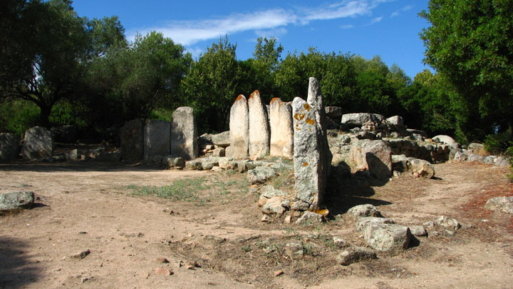
With the drizzle easing off and the sky starting to blue up nicely, we got back in the car. Turning out of the farm track, there was another car turning in and we got a cheery wave. The "perpetual percussion soundtrack of sheep's bells" (TME) was in evidence, and surely enough, a hundred metres or so along, we found ourselves facing the flock again, with the dogs even more keen to bark at us and not move the animals at all. We were sat pondering how long it would take to get past, when the car we'd seen a few minutes before pulled up behind us, and the guy got out, still grinning from ear to ear, and proceeded to usher the flock out of the way and wave us through and on our way. "Multo grazie signore!" We headed west, through Mores itself with a small diversion following signs to nuraghe and not finding them, and then further west to the other branch of the 131 (from Sassari to Cagliari) where we turned south intending to check out varies sites around Torralba - and missed the turn so kept going a bit further, and turned off at Bonorva (even though Macomer was only a tempting 18km beyond that) to visit our first domus de janus. Sant' Andrea Priu — Fieldnotes13.10.07ceFrom Bonorva, follow the signs towards Bono (also signposted for the site) on the SP126 and then the SP43. About 6.5km from Bonorva take the right fork and proceed carefully - we hit the bottom of the hire car on a ridge and pothole combo and though fortunately nothing fell off, and no leakage occurred, it made some very nasty noises for the rest of the holiday and didn't do much for my nerves! - for another 2.5km. Park on the road by the big tree opposite the site. Open 10:00 - 13:00 and 15:00 - 19:00 (all day in July and August, I think), entrance 3½ euros per person including guided tour of the main tomb - in Italian! From the ticket hut, follow the path up the slope and double back on yourself past the steps and tombs to the "tomb of the head" which is locked when the site is closed. This tomb is deep and made up of several different rooms: the vestibule area has cists cut in the floor on the left and cupels the other side of a central rainwater channel. The two rooms behind each have two pillars and numerous side chambers, and on the ceiling you can see the original red paint, and later murals as the tomb was used through Roman times, and then used as a church, and was still in use in the Middle Ages. There are numerous friezes from its Christian period on the walls. There's also a light well, and the floor in the central chamber has been carved to collect the rainwater that this also lets in, probably used for baptisms. You are free to wander around the rest of the site - to the right is tomb VIII with its carved roof, meant to resemble the rafters of a hut, and right from there in tomb IX someone's added graffiti "Ciao Lucy" in red paint. The steps to the right lead to a small gate, and then a rock cut path to the hilltop, where you find more tombs / dwellings cut into the rock, and the rock cut dolmen, described as being known locally as "the Elephant" in TME, but also listed as a Taurus in my research. Sant' Andrea Priu — Images13.10.07ce
Sant' Andrea Priu — Images13.10.07ce
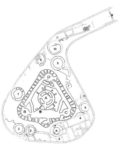
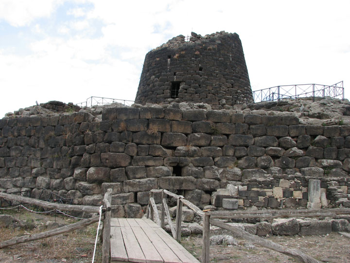
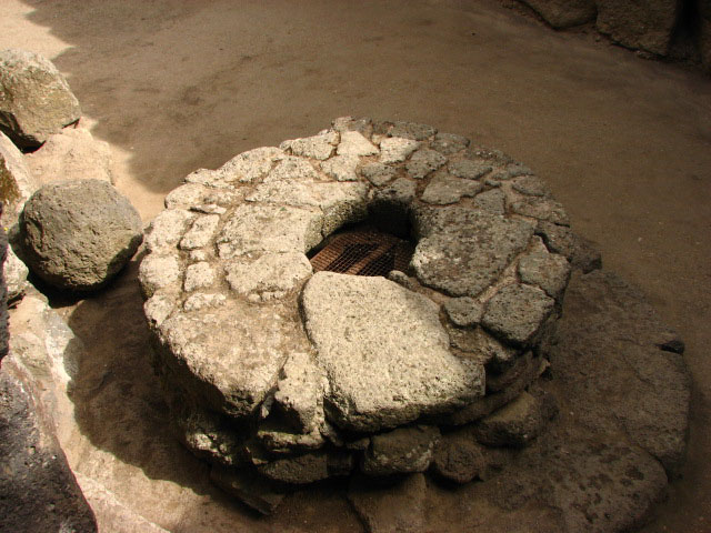
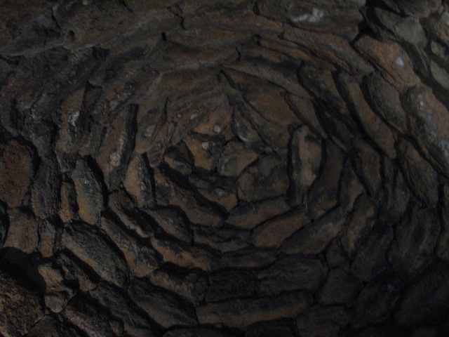
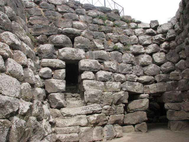
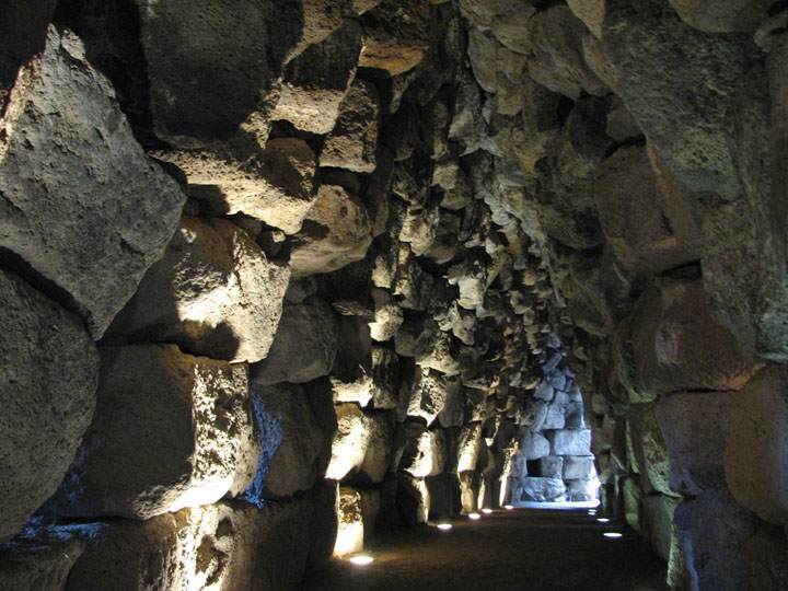
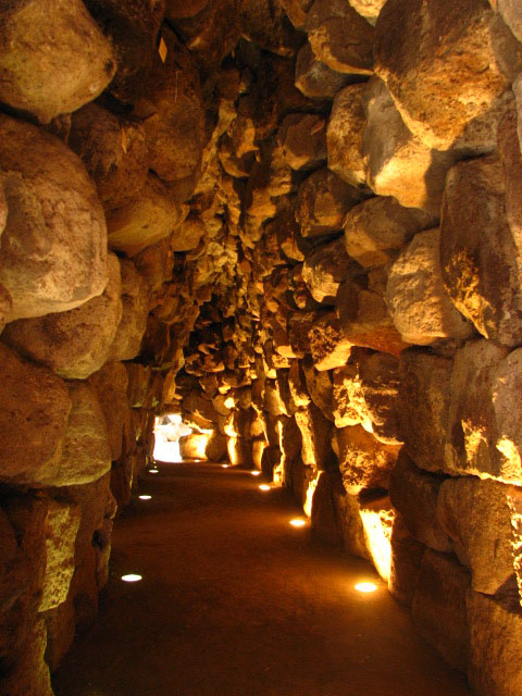
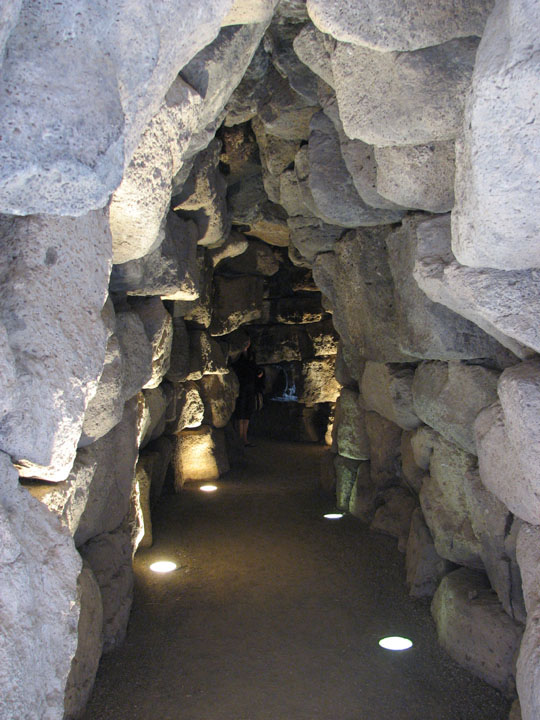
Retracing our steps towards Bonorva, we decided to continue with new site types, and hence turned up the steep hill after only about 4km to the village of Rebeccu in search of the Fonte Nuragica Su Lumarzu - signposted from the main road. I didn't have a grid reference, and our instructions were vague, and we couldn't see any of the promised arrow markings, so headed uphill just in case - and then back down again. By this point, it was lunchtime and the builders who'd been working on the village church had disappeared, so we gave up and headed towards Torralba and one of the sites that had stood out in my research: Santu Antine — Fieldnotes13.10.07ceIf you only visit one nurahge, make it this one! Just take a look at its aerial view from Google ... Signposted from Sant' Andrea Priu and south of Torralba, on the SP121, in the valley of the nuraghes - they are everywhere! We'd taken some binoculars and spotted the nuraghes of Fraigas, Oes, Bonzalzas, Mura Coloras and Cabu Abbas with little difficulty - all under 1.5km away. Fig 29 in Margaret Guido's book shows the distribution of nuraghe across the island - and here it's over 0.6 per square km. Crazy! There's a fair bit of parking in the layby, a simple cafe, ticket booth (entrance fee 3 euros, ticket also valid for the Valle dei Nuraghi museum in Torralba) with information leaflets and an extra hut selling local produce of all kinds. The site has been managed by La Pintadera Cooperative since 1992, when the town council assigned Santu Antine to them. We stopped for a toastie and a drink, while talking to an older couple trying to persuade a small scared white kitten to drink the cup of milk they'd bought for it, and then went past the reconstructed round hut at the gate and to the southerly entrance. There's a settlement surrounding the nuraghe and it's possible to make out maybe 10 huts, with some later Roman building too. The nuraghe itself is built on a triangular plan out of basalt blocks. As you go in, there's a guard post or sentry box to the left - this area now houses the visitors' book - and then the courtyard. It might make more sense if you have a look at the plan .... but .... The furthest left is the entrance to the west tower (B), then a passage which joins the passage which runs from the west to the north tower (D). There's a flight of stairs up to the second level with a well just in front of it, then an entrance to the central tower. The pattern repeats itself with another staircase, a passage to the passage that runs from D to C, and entrance to the east tower (C). We checked out the ground level first of all, amazed at the illuminated corridors, and saw the second well in the north tower, which also has a secondary - now barred - entrance to the nuraghe. Then we took the left hand stairs which lead to a walkway round the perimeter wall and then back down the right hand stairs. The central tower or keep used to be about 25 metres tall, but is only about 17.5 now. Entering this from the east-west courtyard, there's a corridor that rings the chamber to the right and a staircase to the left. The ground floor chamber has an impressive tholos and is 5.25m wide and almost 8m tall. Following the winding staircase up to the second level, there's another tholos chamber on top of the first one and this room has several storage niches visible and a low bench seat along its walls. Up again to the third level - this room is now open to the air, hence the reduced height of the tower - with superb views over the surrounding settlement and across the valley and the numerous other nuraghe in the vicinity. The light had changed in the ground floor corridors by the time we came back down again, from the initial warm orange to a beautiful cool blue grey. A stunning place! Santu Antine — Images08.10.07ce
Santu Antine — Images11.10.07ce
Santu Antine — Images11.10.07ce
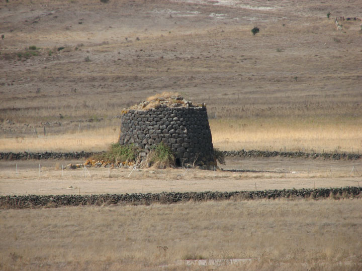
On the way back towards the car, I asked in pidgin Italian and sign language about a tomba di gigante (Su Igante) I had marked on my map, less than 1km from the nuraghe, and as we'd not spotted it, we were not surprised to be told it was underground - though how much remains we never got to. I knew there was another tomba in the vicinity however, and had approximate directions but wasn't sure which of two roads to take - the lady from the ticket booth scanned the guides and maps on the rack, and pulled one out and then took it into the cafe to spread out over the freezer so I could see where to go - she was quite happy to just use it to give us directions, but when we saw how much information it had, we knew we had to buy it. 2 euros very well spent! Despite the continuing disturbing noises coming from under the car, we headed away from Torralba and turned left just before the railway line and stopped briefly for a slightly closer look (ie not from Santu Antine with binoculars!) at Nuraghe Fraigas and then Longu and Culzu beyond that. Longu — Images14.10.07ce
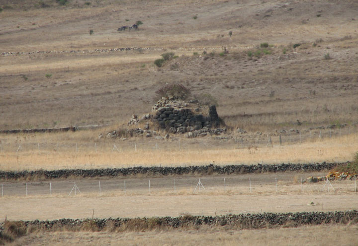
Culzu — Images14.10.07ce
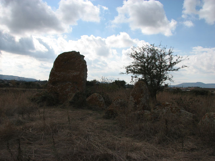
At the T head, we went south east over the railway line - not fancying a dodgy walk up the tracks to Nuraghe Ruju - in search of the group of sites I'd enquired about earlier, and found the first one really easily. Sa Pedra Longa — Fieldnotes14.10.07ceAn unloved tomba not far from Santu Antine. It's not signposted, but is easily visible from the road running south east from the easterly railway crossing near Torralba. After the crossing, you go over the river on a bend, and when you see a track to the left, stop - the tomba is in the field just after the turning. We climbed over a wire fence to get access. The stele, though weathered, is impressive. About 3m high, with relief carving and that pink tinge to the stone we'd seen at several other tombas. The area is quite overgrown, and it's hard to work out much of the burial chamber. Sa Pedra Longa — Images14.10.07ce
By now, it was getting late in the afternoon, and despite having some research on a few nearby sites most of which were marked on our new map, we decided to leave those for a future visit and see how noisy a drive it would be home. Another day of rest (I refused to drive anywhere!) followed, and then on the Wednesday it was time to check out and head back to the airport - but with one little detour on the way. Time to visit the site I'd actually planned as a potential first stop - but we'd missed the turn on day 1 when we opted to go and check in rather than try to find an alternative route. Su Monte 'e s'Ape — Fieldnotes14.10.07ceFrom Olbia airport, head west and watch out for the sign to Loiri - even though you want to go south and logic says that's left, it's a right turn. Second time lucky, we got on the right road - the SP24 - and turned off at the sports pitch mentioned in TME - the tomba is signposted from here. We parked in the area probably designed for those visiting Pedres castle, on the hill overlooking the site, having seen the state of the bumpy, sandy track, and walked the last 200 metres. There was a red Renault parked just by the gate in the low wall, and it turned out that it belonged to the site guardian - a lovely man! You can buy a ticket for 5 sites round Olbia for 7,50 - the others being: Pozzo Sacro "Sa Testa" Acquedotto e Cisterna "Sa Rughittola" Nuraghe "Riu Mulimu" Fattoria Romana di "S'imbalconadu" but we only had time for this one, so paid 2,50 euros each. They may not get many visitors - the tickets had their prices overstickered for last year, if not the year before's charges. This is one of the largest tombas in Sardinia, 28 metres long. As at Li Lolghi and Coddu Vecchiu, it's thought to be a reworking of an allée couverte. The esedra is huge; the stele has been broken off and removed, leaving a stump of stone with a ridge down it on the left of the entrance, giving a good view down the funeral corridor. Su Monte 'e s'Ape — Images30.09.07ce
We shared a few jokes with the guy working there - he'd spent 2 weeks in London a few years back and we all laughed at the phrases we could create in each other's languages - and found out from him that it isn't possible to visit the nearby Nuraghe Casteddu and Pozzo Sacro Trambuccone - good job really, it was almost check-in time! A 5 minute journey to the airport, and after 980km around Sardinia, we'd covered a very small amount of the sites I'd researched and/or located. So plenty to visit next time then! If anyone is planning a trip to Sardinia, please drop me an email as I have a fair bit of dodgily translated info on most places north of Oristano. Best work on the south of the island at some point too, I guess. |
13th October 2007ce Edited 16th October 2007ce
sals's TMA Blog
Latest TMA Blog Posts
|
Comments (0) |
|
| You must be logged in to add a comment | |