|
|

|
|
Showing 1-50 of 155,810 posts. Most recent first | Next 50 
Drummanmoan Loan (Cairn(s)) — Images (click to view fullsize) |
         
|
Posted by markj99 8th May 2024ce |
Drummanmoan Loan (Cairn(s)) — Fieldnotes |
|
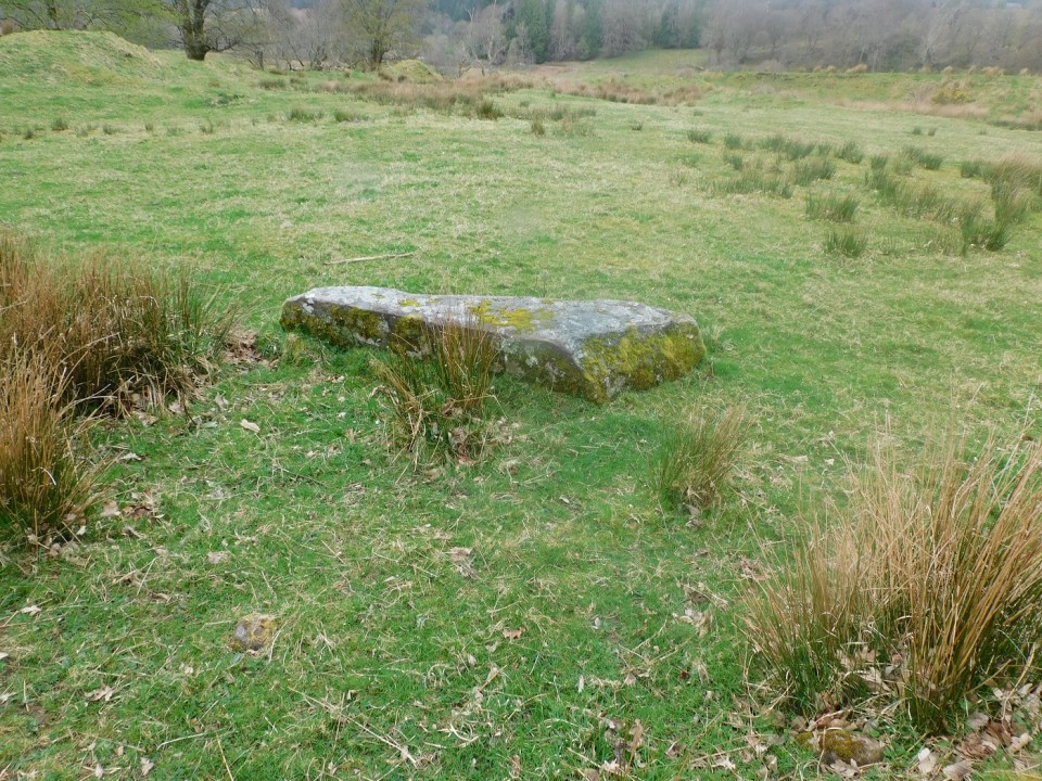
Visited 03.05.24 Drummanmoan Loan Cairn is located in open moorland c. 3 miles N of Penwhirn Reservoir in Dumfries and Galloway. This lonely green mound is hidden from view by marsh grass except on the N arc. The subcircular cairn measures c. 25 feet across and 2 feet high. A low scattering of stones on the W arc may be the remains of a collapsed modern cairn, described in Canmore ID 61902. The centre of the mound is occupied by a circular hollow of marsh grass. If you like a yomp over bleak moorland, this is your bag. Park up at NX 1275 7270 on the Lagafater Lodge dead-end single track road. Follow the W bank of the Laganabeastie Burn N for c. 0.5 mile to reach an enclosure above the burn. Head NW along rough ATV tracks. The cairn is obscured by a ring of marsh grass on approach making GPS navigation essential. Return by the reverse route. My route can be viewed on Drummanmoan Loan Cairn. Having travelled so far from civilisation, it would be a mistake not to visit Laganabeastie Cairns, which are located in pasture c. 200 yards E of the Stone Bridge. |
Posted by markj99 8th May 2024ce |
Brouch An Drummin (Standing Stone / Menhir) — Images |
|
7th May 2024ce |
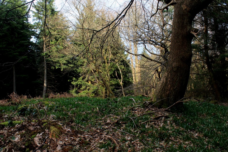
West Wood (Barrow / Cairn Cemetery) — Miscellaneous |
|
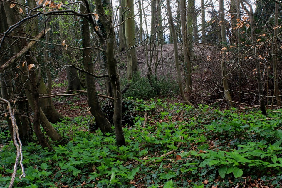
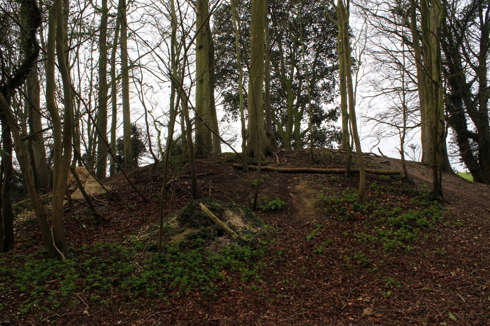
Mr Cane was clearly on a bit of a downer following his visit here some years back now... however, since the vegetation was fortunately less overwhelming during my early Spring sojourn, I found myself in a position to disagree. Yeah, I liked it here, despite the woods proving a lot more popular with folk than I had anticipated. Indeed, the eastern of the southern pair (of those monuments marked upon the map, that is - there are, apparently, a further three within the environs of West Wood not troubling the cartographers for whatever reason) is a particularly fine specimen of a bowl barrow, complete with encircling ditch. Its neighbour to the west, although not of a comparable stature, is pretty substantial, too... the northernmost example, completing the OS annotated trio, slightly less so. Access is straighforward from the B2068 - a Roman Road, aka 'Stone Street' - although the downside to that demonstrable obsession with 'straightness' is the traffic fair motors past; hence, there is some traffic noise to deny a perfect ambience. Note also that it is unwise to attempt to take a direct line (through the break in the trees) from the eastern of the southern pair of monuments to the western... if you value your legs, that is. Industrial-strength brambles all the way. Incidentally, note that the round barrow at nearby Tumulus Farm (TR 13481 42341) is apparently of Roman origin. Sigh.... |
 Posted by GLADMAN
6th May 2024ce |
West Wood (Barrow / Cairn Cemetery) — Images |
|
Posted by GLADMAN 6th May 2024ce |
Poltalloch Cist 2 — Images |
|
6th May 2024ce |
Kilchoan of Poltalloch (Cairn(s)) — Images |
         
|
5th May 2024ce |
Dun A' Bhuilg (Hillfort) — Fieldnotes |
|
The second last leg of the a circular walk took me back to the road, heading east from Ardnaw Cairn, to walk southwards down the hill past Kilmory Chapel. Walk past the house surrounded in trees and the hillfort will be easily spied. It is an easy climb, east, to get to fort, best approached from the north-east. The east defences are a cliff, part of the north east defences are similar - the entrance to fort is also in the north east - it's not very steep, a gentle slope. Massive walling, in places over 3m wide, at some stage surrounded the oval shaped site, 26m by 18m. As per usual in these parts a marker cairn was built on top of the southern wall. Tremendous views into Kilmory Bay, over to Jura / Islay and north to the sea lochs. Visited 08/04/2024. |
4th May 2024ce |
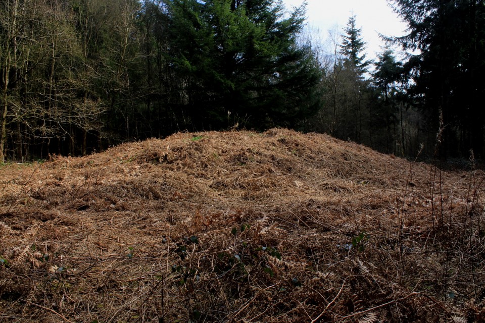
Rubury Butts, Three Barrows Down (Barrow / Cairn Cemetery) — Miscellaneous |
|
This site caught my eye while scanning the map for something to 'bolster up' a planned trip to not-too-distant West Wood... and turned out to be a first-class, primary visit, including possibly the finest surviving round barrows in Kent? Unfortunately, however, there is a downer in that The Three Barrows are located immediately adjacent to the (cue drumroll)...'North Downs Way', thus inevitably suffering from the attentions of plodding hikers 'doing the way'/French tourists and, far more seriously, moronic trail bikers. Indeed, the 'leader' of one such group of 'broom-broom-halfwits' steadfastly refused to meet my gaze after I countered his 'good morning' with a cold, silent stare - hell, the fool damn well knew riding his farcical contraption here - to the detriment of everyone else - is out of order! Shame on him and his kind. Having said the above, however, Rubury Butts is still a great place to hang out for a while... since the very substantial northwestern monument is seriously overgrown, the summit a hidden haven of wondrousness. Historic England summarises thus: "The three bowl barrows known as Rubury Butts at Three Barrow Down, Womenswold, Kent lie at the convergence of the three parishes of Womenswold, Nonington and Shepherdswell in a lightly wooded copse adjacent to the North Downs Way. They were noted by the C18 antiquarian Bryan Faussett in his Inventorium Sepulchrale published in 1860 who believed that their name derived from ‘’Romes berig Butts’, meaning ‘ the butts at the Roman burial place’. Faussett undertook excavations of Anglo-Saxon burial sites at Golgotha, Shepherdswell and Barfrestone approximately 2km to the east and it is thought possible that these later monuments may have been positioned intentionally within the sight of the three earlier barrows. It is certainly the case that a resurgence of interest in barrow construction took place in the Iron Age, Romano-British, Anglo-Saxon and Viking periods when burials were made in ancient mounds or new mounds were constructed. Nationally barrows are known to have acted as Parish markers as in this case..... It is likely that the Rubury Butts bowl barrow cemetery is Bronze Age in origin.... The barrows are aligned in a row on a north-west to south-east axis approximately 5m apart. The northernmost barrow is 26m across and stands to 3.5m [c11.5ft - G] in height. The middle barrow is 14m wide and 1m high and the third, adjacent to the track, is ovoid in shape, approximately 21m wide and 1.9m [c6ft - G] high, eroded to the south-east by the track. None of the mounds have obvious ditches." |
Posted by GLADMAN 4th May 2024ce Edited 5th May 2024ce |
Rubury Butts, Three Barrows Down (Barrow / Cairn Cemetery) — Images |
|
Posted by GLADMAN 4th May 2024ce |
Showing 1-50 of 155,810 posts. Most recent first | Next 50