
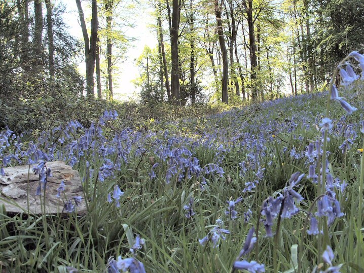
E Barrow, Spring
Image credit: Jimit April 07
E Barrow, Spring

E Barrow info board.
Banjo Enclosure Ditch

Banjo Enclosure “Neck”

Banjo Enclosure Info Board.
This really was the best time to visit these sites, a perfect 20 degree sunny spring day. The bluebells in their first flush of flower and the beeches just coming into leaf. Later in the season, with the tree canopy developed and the understory in full growth, the sites are more obscured and dark.
To add a few comments to Nat’s... The pub has been demolished and if you take the anti-clockwise path from the car park the Banjo Enclosure is first (almost impossible to photo but see FlashEarth link.) then the E barrow (with trees removed), follow the path to the conifers and turn right parallel to the (very noisy!) M3 to the N barrow.
Jim.

Lighting seems to be crucial in photographing this enigmatic stone. The curious waving lines show up well here.

The view S from the sadly ruined SE chamber. What a sight this barrow must have been when newly constructed. Visible for ever with the (presumed) portal stones standing proud. The sculptural quality of the downs here is also amazing with steep ridged combes nearby. Taking MAGIC’s figures of 70M long by 7M high by 20M wide we come to a very very aprox figure of nearly 10,000CuM of chalk moved. I wonder how this compares with similar barrows?
Jim
P.S. Quick calculation of Knap Barrow, the longest in Hants...4,000CuM and Grans Barrow nearby 5,000CuM.

WKLB in its landscape. Curious that from a few yards further on it disappears and is not seen from the path until you are nearly upon it.
Jim.

The “Polisher Stone” within its setting within the Avenue. As a help to those who wish to find it. There is a tiny layby, the"other side” of the yellow lines opposite.
Jim.

The “Polisher Stone” in the Avenue. The polished bit, centre bottom, is glassy smooth but in a position to be almost impossible to use. Was the stone originally in a horizontal position for this purpose before being raised vertically?
Jim.

Goodness knows what this is supposed to be. Looks as if someone has had a half hearted attempt to remove it. Difficult as it is scratched on.

I ask you, noughts and crosses! Less offensive than other graffiti elsewhere but mindless vandalism nevertheless.

Phill Harding of Time Team fame giving a masterclass in flint knapping with some of the replica tools he has made.
Sheffield Uni dig.

Sheffield Uni dig.
N excavation.
Circular arrangement of postholes, up from bucket.
This seems to be another round structure with signs of feasting.
(Info from guides)

Sheffield Uni dig.
N excavation.
Postholes and ditch. Notice L hole with ladder.

Sheffield Uni dig.
Centre excavation.
Postholes to R of hearth (L of measuring tape).

Sheffield Uni dig.
Centre excavation.
A circular structure with ditch. A burning site at centre with animal bones including pig to right of man with white hat. Hearth to L and up from buckets and postholes visible to right of man in black hat.

Sheffield Uni dig.
Large circular ditch at centre excavation.
Jim.

Sheffield Uni dig.
N. excavation nearest camera, centre excavation in middle distance and outer bank of Durrington walls in background.
Jim

Sheffield University Dig.
General view of site. A ramp to a stone hole at bottom left. The “V” shaped ridge is left for future investigators.
(Info from guides)
Jim.

Sheffield University Dig.
One of the huge post holes showing the errection ramp to the right.
(Info from guides)
Jim.

Sheffield University Dig.
The immense holes dug for the wooden uprights in the outer circles, shown by the green marker in the background. Aprox 1M deep by 1.5M wide. The shallower hole in the middle is believed to be for a large stone which was missed by the original Cunnington excavation. the shallower scrape to the L centre has been provisionally dated to the Mesolithic period.
(Info from guides)
Jim.
Remove the road and all is peace and tranquility.

Grrrr! How long has this been here? Seen on the L hand upright 27 Aug 06. To me it looks like a swastica which has been altered to be less offensive. There have been so many posts about this sort of vandalism in the past and yet it still goes on.

Maes Knoll in it’s landscape.
From Stanton Drew Great Circle, about 3K south.
A group of 4 (?) Long Barrows close to Danebury, which they pre-date.
flashearth.com/?lat=51.137338&lon=-1.537666&z=15.1&r=0&src=2
Using the above, the northerly couple can be seen clearly. There is said to be another at SU323387 (Tumulus on OS) to the E in the corner of the right hand field above the farm sheds. The LB/Bowl Barrow can be seen by the Y junction to the E of Danebury as a black clump of trees by the road.
It’s interesting that the N group are orientated ESE and the others ENE.

The more easterly of the two barrows here is 54M long, rectangular and orientated ESE.
SU320383

The more westerly of the two LB’s (on the right) is described as being 64M long and tapering with an orientation ESE.
SU319383

The inaccessable interior of the “Bowl Barrow”

Called a Long Barrow on Explorer (SU335376) but MAGIC calls it an elongated bowl barrow.
Orientation ENE.

Rather sadly flattened but still protected after a fashion.East end truncated by the road. Danebury in the background. OS Explorer..
SU334381
Aerial view from FlashEarth....
flashearth.com/?lat=51.046591&lon=-1.309853&z=16.2&r=0&src=1

Is this how we would like to see Stonehenge, un encumbered from the trappings of the 21stC? A cheat of course as I had to wait for some time for a traffic free A344 and the roar from the A303 was just behind me. Curious as to how modest the stones appear from this angle. (Taken from the track to the SW)

Weird collection of starlings on the stones. They all flew off to roost moments later.

There are two or three long barrows recorded for this area. I was looking for the one mentioned in “Hampshire Treasures” at location SU479362 but there is no record of it on Magic or the OS maps.
It would have been at a place called “Bayley’s Clump” about 1km to the East. When I looked into this small copse the nettles and undergrowth was chest high so a winter visit is on the cards.
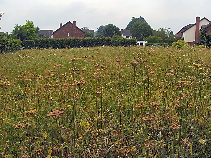
Not the most inspiring of sites in its suburban setting but at least some has been preserved apart from the bit trashed by the road.


Notice board at the entrance with interpretation of the other barrows in the area including another LB.
Where is it? Although see my notes.

The rather fine stepping stones over the Kennet provided by the farmer from old field clearance rocks.

Doesn’t get any better does it? Why spoil this pretty and atmospheric site with 21C tat? One wonders at the mentality of the people who do this....grrrr.

The hill in its landscape. Taken from the Cathedral tower. Winchester College in the middle ground.

Difficult not to do image duplication but the carvings can be seen more readily in some lights than others,

Couldn’t resist posting this pic of a beautiful hare which had been bounding about on the ditch and bank seemingly oblivious to the tourists only a few metres away.
I looked away to re-adjust my camera and when I looked back it had gone and was not seen again.

The beautiful slimness of the solitary trilithon upright, stone 56 (?). It contrasts remarkably with all the rest of the stones in its quality of finish and its almost pristine appearance. Does anyone know of any single stone which shows better the Neolithic peoples complete mastery of their craft?

Up close, one is in awe of the tremendous monumentality of this structure. Other circles might have more or heavier stones but it is the sheer height that astounds.

A curious angle where the stones reminded me of a natural rocky outcrop.

The Moon, not long after its most northerly rising in the 18.5 yr Metonic Cycle.