The Sarsen Stones built into the SE corner (only) of the early mediaeval chapel. The guide book states that “...they were taken from the pagan circle...“.

The Sarsen Stones built into the SE corner (only) of the early mediaeval chapel. The guide book states that “...they were taken from the pagan circle...“.

Looking E across the “passage”

Looking NE.

The odd “cist”(?) slightly N of centre.

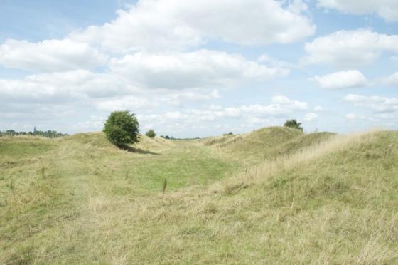
Looking S. Apart from some stones which obviously define the road, there are several “outliers” seemingly randomly erected in the valley.

The curious “passage” heading N. Constructed with distinctive pudding stones, a form of conglomerate.

Looking W.

Looking SW.
Having at last re-visited this site (see notes below) I am very confused. Its position in the park is very beautiful and tranquil, only the occasional car passing. The circle itself is mainly composed of the generic Sarsens but a curious extension to the N is made from conglomerate including the tallest stone at the termination.
There is a small double concentric prone circle somewhat N of centre of the main circle. Some of the stones are upright, some leaning and some prone. In the valley, apart from some used as road markers, there are several erect stones seemingly randomly placed.
How much of it is authentic? My own thoughts are that the circle itself “feels” right but the odd N extension looks as though an antiquarian has though to make a faux passage grave and while he was at it put a ruined cist in the circle for good measure!
The etymology for “Stonor” is, not surprisingly, “stone hill”.
This pretty circle needs more people to visit it, someone with more experience than me would be a start!
“.......As for this site (PRN 2064), we have recorded it as a folly on the SMR. A primary source is the Country Life article, May 7, 1981. Apparently the chapel was built over the original site of the circle; the circle was first reconstructed in C17. Re-erected in 1981 “as near as possible in its original formation.” There are additional sources within the SMR which you are welcome to consult during opening hours by appointment.”
County Sites and Monuments Record Officer
Central Library, Westgate
Oxford OX1 1DJ
01865 810825
Does this site now class as a modern folly, a very curious C17 re-working of a Neolithic site or a semi-faithful reconstruction of a destroyed monument?
I can only leave it to the Eds to decide whether this should remain on TMA. My own feeling is that it should remain if only to show the curious cheek by jowl jostling of different beliefs.
One wonders whether they would allow a Druid ceremony to be held there...........?
“The stone circle is of comparatively recent construction, but of stones found in the vicinity which correspond in type to a cornerstone underpinning the medieval chapel here. By implication these stones were part of a much older pre-Christian circle which was located where the Chapel now is. As you know it was frequently the habit in medieval time to “claim” a pagan circle for Christianity by including a stone in the foundations for the new christian chapel.“.....“Stones have been re-located here in the last 30 years or so, I believe”
With many thanks to John Weaver, Administrator of the Stonor Estate for these observations.
The Estate re-opens in the Spring so any investigations as to stone type and source must wait till then.
Curious that this site is not better known as it is at a very public location. Stonor Park is visited by thousands but on the web site no mention is made of this Neolithic(?) monument. The circle is right next door to the Catholic Chapel and does one sense a touch of embarrassment?
I visited this site a huge number of years ago(I used to knock around with one of the younger sons of the family) so the memory is a bit dim but I remember an earthwork and several standing stones. There is a small image available on the Google search but it’s not much help.
I tried trawling through Oxfordshire CC’s Web but couldn’t find much, perhaps someone knows the right site to go to for more information.
Some pics would surely bring this circle back to the prominence it deserves.
Details of stones on Pastscape
Stone circle situated in Stonor Park, near Stonor House. It has been moved from its original site.
1. [SU 7433 8916] “A Folly here which the owner believed may have been made from a Stone Circle. (1)
SU 7432 8913 (A) A stone circle composed of sarsens and pudding stones which, from the evidence of a photograph of c. 1873,
formerly stood at SU 7428 8917 (B). The owner, Maj. S. Stonor believes, however, that this is not the original site. (2)
This Web site suggests that the stones are a reconstruction, curiouser and curiouser!


