


Is this any way to treat a national icon and a World Heritage Site?
A pre-Christmas rush on a dreich day, Winter Solstice Eve 2007.
A few sad notes about the roundhouse erected in July 06.... Vandals have pushed out two sections of the painted wattle and daub walls and have pulled out chunks of the thatch.
It would be interesting to know where they got the inspiration/source for the carvings and painting from. Decorated bowls perhaps?
Jim.


The National Trust sign at the western end.

Stonehenge Riverside Project.
The southern ditch. The excavators were speculating that the small holes in the bottom held stakes, possibly a sort of fence.

Stonehenge Riverside Project.
One of two odd ramp-like features found in the southern ditch.

Stonehenge Riverside Project.
An unexpected discovery at the north ditch (Just visible behind guy in check shirt). A linear ditch (?) which approaches but does not breach the Cursus ditch.

Stonehenge Riverside Project.
The western terminal ditch. A curious curve as the Cursus is to the left.

Stonehenge Riverside Project.
Complex markings by the stone. The excavators have been surprised at the finds at this site as they include three pottery urns and a child burial with a dog’s skull at its head.

Stonehenge Riverside Project.
The dark linear feature approaching from the top is believed to be an IA boundary ditch and the fact that it kinks around the stone seems to suggest that the stone pre-dated it. The original socket for the stone is just out of sight behind it.

Stonehenge Riverside Project.
A curious feature in the single ditch barrow, a filling of yellow sand. Post holes of the previous structure to the left.

Stonehenge Riverside Project.
Post hole features in ploughed-out barrow to L and between barrows. Compare Aug 07 pictures.

Stonehenge Riverside Project.
Double ring ditch. Archaeologist and author Josh Pollard in red shirt. Compare Aug 07 pictures.

Stonehenge Riverside Project.
Double ditch feature with inhumation sites. Compare Aug 07 pictures.

Stonehenge Riverside Project.
Partly excavated articulated skeleton of a medium sized dog in the ring ditch of a ploughed-out barrow, S of Woodhenge. Femur to right, spine just out of sight in foreground of pit.

Stonehenge Riverside Project.
Early excavation of the S ditch leading to the W terminus and the later barrow.
Jim.

Stonehenge Riverside Project.
Early excavation of the S Ditch. It is interesting that this first stretch of the S ditch and bank seems to be aligned on Beacon Hill, shortly after this trench they veer northwards to follow parallel to the others. (clearly visible on OS maps) Change of mind...different gangs? What struck me was the beautiful quality of the ditch infill. a fine, dark loam that any gardener would covet.
Jim.

Stonehenge Riverside Project.
Early excavation of the N ditch.
Jim.

Stonehenge Riverside Project.
Early excavations outside the W termination of the Cursus. I was told that the slight bank to the right of the trench is a 20c reconstruction of the original bank, destroyed when a pig farm was built there!
(all errors are mine!)
Jim.

Stonehenge Riverside Project.
Early excavations at the Cuckoo Stone.
It is suggested that.....The rectangular mark centre, is a Roman mini metalworking area and will not be excavated.....The small square above it is a modern test pit......The dark area to the right of the stone may be the ramp used to raise it....the parallel lines are plough marks.
Other obvious traces are a mystery.
(All errors are mine!)
Jim.

Stonehenge Riverside Project.
Early excavations showing the ditch of the ploughed out BA barrow and the post holes of an earlier structure.
(All errors are mine!)
Jim.

Stonehenge Riverside Project.
The curious double-ditched structure. The interesting things to note are the roundish marks around the perimeter. A friend who excavated at Cranborne Chase said they found similar, but single ditched, structures there.
(All errors are mine!)
Jim.

Stonehenge Riverside Project.
Early stage in the excavations of the ploughed out BA barrows just to the South. In the background, a barrow with a 4(6?) post structure to the side. Foreground, an unusual double ditched structure.
(All errors are mine!)
Jim.

Stonehenge in its landscape.
A curious view obtained from the Cursus Barrows using a telephoto lens.
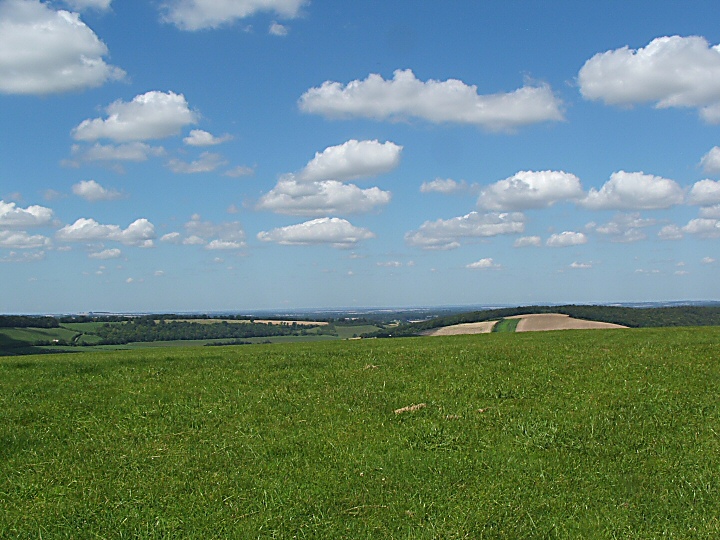

Looking W to Southampton and The New Forest.

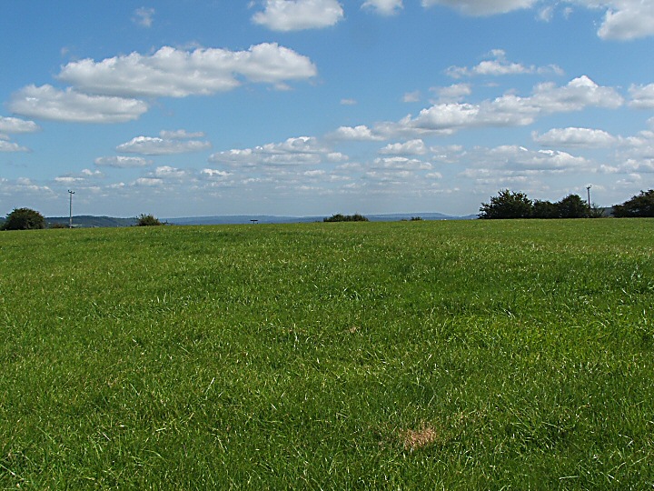
Although this poor Long Barrow has been almost completely ploughed out, it is well worth visiting because of its spectacular setting. Situated on one of the highest parts in Hampshire (234M.), the views encompass nearly the whole of the county and the N. of the I.O.W.
Deep combes to the E. and Butser Hill,Old Winchester Hill to the W, Southampton Fawley and the Solent to the SW and the N. Hampshire Downs and Beacon Hill to the N.
It is shocking that this ancient relic has no protection. So far as I could see, ploughing may well be going on (The site was under grass silage), and within a lifetime could destroy all traces of the barrow.
Why not impose a small exclusion zone as has been done elsewhere?
(MAGIC says it survives well. Hmmm!)
In all my pictures the barrow is the vague hump in the extreme foreground!
Access
Rough but adequate track to the W. of the disused MOD site leads to radio masts and parking by the barn. Short walk on level but rutted foot path (South Downs Way) and the barrow is just, barely, visible in the second field on the left.
When the Saxon/Norman church was demolished in 1876, it was found that the old tower had been built on a circle of 12 Sarsen stones. They were described as “A Druidical Temple” at the time and the builders blamed the difficulty of working around them as one of the reasons for the cost/time overrun of the new church. This was designed by the famous Victorian architect Sir Alfred Waterhouse (Nat Hist Mus, Manchester Town Hall etc.) and he put the new tower on the site of the old and used the old circle again for the foundations. Nothing to see above ground sadly but another nice example of one religion imposing itself on another.
(Two prone Sarsens by footbridge over the River Itchen and fine ancient clipped Yew to the north)

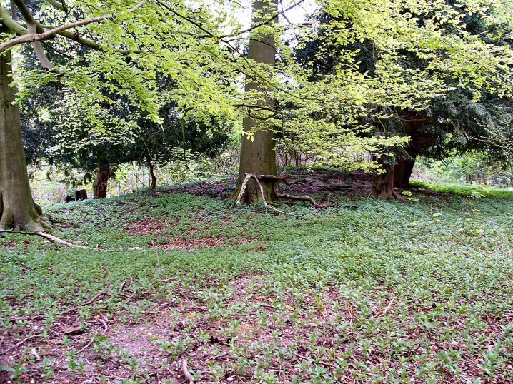
What does one say about a site like this? Another of Hampshire’s “lost” Long Barrows. Unvisited, unloved and almost inaccessible later in the growing season because of the waist high stinging nettles. Partly trashed in the past by a small quarry at the NW end and a track over the centre and rabbit/badger burrows at the SE end. Photographic recording of sites like this is important, boring though the images may be, as ancient barrows like this can so easily be lost.
As a case in point, my old (1976) 1: 25,000 OS Map (SU42/52) shows clearly a fenced Long Barrow a couple of hundred meters to the SE.
Later maps and a site visit show no traces. What has happened to it in the past 30 years?
Access Private woodland but footpaths close by.


N Barrow, Spring.

N Barrow, Spring.

N Barrow, Spring.
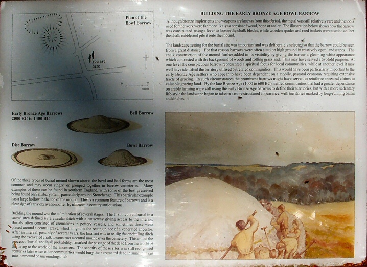
N Barrow info board.

E Barrow, Spring