Rhiannon

Rhiannon

All posts expand_more 3,401-3,450 of 4,457 posts

Miscellaneous

Clach Ossian
Natural Rock Feature

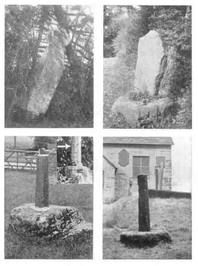
Wordsworth wrote a poem about Ossian’s grave. So maybe it was this one he knew – or maybe the Clach Ossian down the road. Who knows. If you read the poem, Wordsworth isn’t sure whether Ossian’s here or not either – it’s the atmosphere of the glen that’s important. So maybe it doesn’t matter.

Glen Almein, or The Narrow Glen.

In this still place, remote from men,
Sleeps Ossian, in the Narrow Glen;
In this still place, where murmurs on
But one meek streamlet, only one:
He sang of battles, and the breath
Of stormy war, and violent death;
And should, methinks, when all was past,
Have rightfully been laid at last
Where rocks were rudely heaped, and rent
As by a spirit turbulent;
Where sights were rough, and sounds were wild,
And everything unreconciled;
In some complaining, dim retreat,
For fear and melancholy meet;
But this is calm; there cannot be
A more entire tranquillity.
Does then the Bard sleep here indeed?
Or is it but a groundless creed?
What matters it? I blame them not
Whose Fancy in this lonely Spot
Was moved; and in such way expressed
Their notion of its perfect rest.
A convent, even a hermit’s cell,
Would break the silence of this Dell:
It is not quiet, is not ease;
But something deeper far than these:
The separation that is here
Is of the grave; and of austere
Yet happy feelings of the dead:
And, therefore, was it rightly said
That Ossian, last of all his race!
Lies buried in this lonely place.

Miscellaneous

White Caterthun
Hillfort

There is a stone with an impressive 80 cup marks on the west side of the fort. Another (with a paltry one cup mark) was found in one of the ditches, and was relocated to St Andrews University archaeological museum.

One of those curious knobbly carved stone balls (this one with four bumps) was also found here, and is now apparently in Brechin Museum, again according to the information on Canmore.

Folklore

Court Stane
Standing Stone / Menhir

The 1845 ‘New Statistical Account’ recorded the belief that this stone was set up to commemorate the death of Duncan II. He was unkindly but alliteratively murdered here at Mondynes by Mormaer Malpei of the Mearns in 1094. It also states “’Duncan’s shade’ or ‘field’ lies nearby.”

A later account of 1914 by J C Watt said (unbelievingly) that the stone was the judgement seat of the Barony of Mondynes.

It is apparently 6ft 9ins tall but leans to the NW, and stands “in a prominent position.. commanding a wide view.”

Aerial photographs from 2001 may show an enclosure around the stone, about 25m in diameter, with the stone inside the south edge.

(basic info gleaned from record on Canmore)

Miscellaneous

Witch Hillock
Round Barrow(s)

Information from the Canmore record:

The hillock was opened c1856 under the direction of the Earl of Kintore, who lived (I assume) at the nearby Big House of Inglismaldie. He didn’t actually get his hands dirty – a Mr J Glenny, his gardener, did the digging. He said that they found several cists containing bones with “a clay urn containing what appeared to be calcined bones.”

A 1971 visitor spotted some stones and put forward the following interesting idea:
“About 30m NE are three earthfast boulders, 4.0m apart, forming an arc. They are unusual, being an an area generally devoid of large stones. Their purpose is obscure, but they could be the survivors of a stone circle 7 to 8m in diameter.”

When did the mound get its name? Was it assumed a witch was buried there? Or were witches said (or known?) to gather there? Or was it just the Earl of Kintore who fancied something romantic in his garden. The ‘Name Book’ of 1863 says Witch Hillock is “a remarkable looking object...enclosed with ornamental wire fencing”. Lovely. It’s probably not quite such an fancy feature any more.

Folklore

Stone of Morphie
Standing Stone / Menhir

The Stone of Morphy.---This is an obelisk situated on the lands of the same name, in the western division of the parish. With reference to it, the writer of the former Account [ie the first Statistical Account] says, that it is difficult to determine whether it had been erected to preserve the memory of some gallant warrior of the name of Graham, to which Noble family the lands of Morphy originally belonged, or whether it may be a remnant of a Druidical temple; while, at the same time, he appears not to have been aware of the existence of a tradition, which says, that it was erected in memory of a son of Camus, or some other important personage in his army, who was killed here in an engagement with the Scots, after the defeat and death of the Danish leader at Panbride. The Danes, on that event, immediately retreated northward, and, according to the tradition, encountered the Scots near the Stone of Morphy; and that a battle had there taken place, is probable, from the immense number of stone-coffins, containing human bones, which have been found, particularly in and near a field called “the sick man’s shade,” close by the stone. The farm adjoining that on which the pillar stands, bears the name of Comeston, or, as it is written in old records, Camuston..

p282 in The New Statistical Account of Scotland, vol 11, 1845. Online at Google Books.

According to Canmore,
“it was knocked down shortly before 1856. Digging prior to re-erection revealed part of a human skeleton, buried in black unctuous earth.”

Folklore

Conjure Cairn
Cairn(s)

Canmore says:

‘...the name appears to have arisen from an old belief that the place was haunted by a ghost, and at this cairn St Knauchland conjured or subdued it. It is likewise known by the name of Devils Cairn.‘
Name Book 1867.

This grassy bump sits atop of Bo Hill. Beneath was alleged to be the kirk and holy well of St Knauchland (the most recent record on Canmore is most sceptical of both claims). It’s possible that ‘Knauchland’ is from St Nachlan, a saint renowned for his ability to grow crops when everyone else’s were failing.

You might also want to look out for the remains of ‘Kemp’s Cairn’, also close by. In 1745, a large cist was found at NJ 564514. It was said to be covered by a large stone. The farmer who was quizzed in the 1960s pointed out this reputed capstone, now built into a wall at NJ 5642 5141. “The stone is flat and measures 1.5m x 0.8m x 0.2m, being roughly rectangular.”

(this is not ‘strictly’ in Aberdeenshire, but in a tongue of Moray that sticks into it, so is surrounded by Aberdeenshire sites.)

Folklore

The Cove
Standing Stones

Stukeley wrote in 1743: “In an orchard near the church is a cove consisting of three stones.. this they call the parson, the bride and bridegroom.”

Aubrey, who visited in 1664 knew the stones as the Bride, the Parson’s Stone and the Cooke’s Stone. (Presumably the groom had sneaked off into the pub?)

Miscellaneous

Uffington White Horse
Hill Figure

From the first chapter of ‘Tom Brown’s Schooldays’ by Thomas Hughes (1857)

Right down below the White Horse is a curious deep and broad gully called “the Manger,” into one side of which the hills fall with a series of the most lovely sweeping curves, known as “the Giant’s Stairs.” They are not a bit like stairs, but I never saw anything like them anywhere else, with their short green turf, and tender bluebells, and gossamer and thistle-down gleaming in the sun and the sheep-paths running along their sides like ruled lines.

Online at Project Gutenburg
gutenberg.org/dirs/etext98/tbssd10.txt

Miscellaneous

Blowing Stone
Standing Stone / Menhir

From Chapter 1 of Tom Brown’s Schooldays, by Thomas Hughes (1857).

“What is the name of your hill, landlord?”

“Blawing STWUN Hill, sir, to be sure.”

[READER. “Stuym?”
AUTHOR: “Stone, stupid--the Blowing Stone.“]

“And of your house? I can’t make out the sign.”

“Blawing Stwun, sir,” says the landlord, pouring out his old ale from a Toby Philpot jug, with a melodious crash, into the long-necked glass.

“What queer names!” say we, sighing at the end of our draught, and holding out the glass to be replenished.

“Bean’t queer at all, as I can see, sir,” says mine host, handing back our glass, “seeing as this here is the Blawing Stwun, his self,” putting his hand on a square lump of stone, some three feet and a half high, perforated with two or three queer holes, like petrified antediluvian rat-holes, which lies there close under the oak, under our very nose. We are more than ever puzzled, and drink our second glass of ale, wondering what will come next.

“Like to hear un, sir?” says mine host, setting down Toby Philpot on the tray, and resting both hands on the “Stwun.” We are ready for anything; and he, without waiting for a reply, applies his mouth to one of the ratholes.
Something must come of it, if he doesn’t burst.

Good heavens! I hope he has no apoplectic tendencies. Yes, here it comes, sure enough, a gruesome sound between a moan and a roar, and spreads itself away over the valley, and up the hillside, and into the woods at the back of the house, a ghost-like, awful voice.

“Um do say, sir,” says mine host, rising purple-faced, while the moan is still coming out of the Stwun, “as they used in old times to warn the country-side by blawing the Stwun when the enemy was a-comin’, and as how folks could make un heered then for seven mile round; leastways, so I’ve heered Lawyer Smith say, and he knows a smart sight about them old times.”

We can hardly swallow Lawyer Smith’s seven miles; but could the blowing of the stone have been a summons, a sort of sending the
fiery cross round the neighbourhood in the old times? What old times? Who knows? We pay for our beer, and are thankful.

Online at Project Gutenberg
gutenberg.org/dirs/etext98/tbssd10.txt

Miscellaneous

Avebury & the Marlborough Downs
Region

From the Diary of Richard Symonds, on Fyfield, 1644.

a place so full of grey pibble stone of great bignes as is not usually seene; they breake them and build their houses of them and walls, laying mosse betweene, the inhabitants calling them Saracens’ stones, and in this parish [deposit] a mile and a halfe in length, they lie so thick as you may go upon them all the way. They call that place the Grey-weathers, because afar off they look like a flock of Sheepe.

Yes he really did say ‘Sheepe’. But I do like the image of him hopping from one stone to another, the whole length of the stones.

quoted in ‘Sarsens’ by H C Brentnall in v51 (1945/6) of Wiltshire Archaeology magazine.

Link

Stony Littleton
Long Barrow
Bath and North East Somerset Council

The 1982 Department of the Environment Guide Book for Stoney Littleton, with many interesting facts, and including the excellent inscription unexcellently cemented to the tomb:

THIS TUMULUS, -DECLARED BY COMPETENT JUDGES TO BE THE MOST PERFECT SPECIMEN OF CELTIC ANTIQUITY STILL EXISTING IN GREAT BRITAIN HAVING BEEN MUCH INJURED BY THE LAPSE OF TIME, – OR THE CARELESSNESS OF FORMER PROPRIETORS, WAS RESTORED IN 1858 BY MR T. R. JOLIFFE, THE LORD OF THE HUNDRED; THE DESIGN OF THE ORIGINAL STRUCTURE BEING PRESERVED, AS FAR AS POSSIBLE, WITH SCRUPULOUS – EXACTNESS.

[link broken]

Miscellaneous

Crofton
Causewayed Enclosure

Crofton’s probably better known today for its beam engines and pumping station on the Kennet and Avon canal. But in the Neolithic it was a place with quite different significance. In 1976 the traces of causewayed-enclosure-style interrupted ditches were spotted on an aerial photograph. They completely encompass the village! It’s possible you might be able to see something of them in the S/W stretches? The type of snail shells excavated tell us that at the time it was built the area was a clearing in woodland. The flints found confirm its Neolithic origins.

Apparently it has the largest? area of any known causewayed enclosure (600m across), and is also unusual in that unlike other causewayed enclosures – say, Knap Hill – it was built in a valley. Not only this, the River Dunn (now canalised) actually rose ‘in the vicinity’ of the enclosure, then flowing northeast into the Kennet at Hungerford. [This can’t help but remind me of the proximity of the stream at Marden, but that’s a henge and probably quite a different matter].

Another interesting point is that a Roman – or should that be, pre-Roman – road goes straight through the enclosure’s centre. Another road crosses through at right angles (Avebury style). And following the southeasterly road a short distance brings us directly to a round barrow – surely confirmation of the roads pre-roman credentials?

I’m sure there will be little if anything to see at Crofton. But I hope people won’t mind me mentioning it. It’s really at the eastern end of the Pewsey Vale, which of course contains many other important prehistoric sites.

(see ‘Excavation at Crofton Causewayed Enclosure’ by Sue Lobb, in WAM v88 1995)

WAM 70-71 1975/6 notes that five long barrows lie within 6km of the enclosure, these on the higher ground to the S and SE, flanking the Vale of Pewsey.

Miscellaneous

Blacker’s Hill
Hillfort

Blacker’s Hill is a promontory fort, protected by still impressive earthworks on the north and west, but otherwise defended by steep (and steepened) slopes. There are three entrances, but it’s not clear how many of these are original – the fields have been changed about over the years and there’s been some quarrying too. Perhaps there was just one to the NE. Springs and a stream run along the south of the fort, and there are various barrows nearby to the north. The site’s been excavated and ‘geophysed’ – you can read about it and the nearby barrows
here at the Somerset Historic Environment Record. A 1950s excavation found traces of smelted iron in one of the ditches, and the geophysics detected several enclosures, linear boundaries, roundhouses and pits: different phases of the fort’s use. Sounds like a busy community – something to think about if you choose to visit.

Folklore

Blacker’s Hill
Hillfort

Within the Camp, near the brow of the hill are ‘Fairy Sleets’, these, as the Rev. HH Winwood explained, are ‘slits’, narrow and shallow trenches formed when ore has been found by cutting through the rock to follow it out.

I found this in the 1904-08 volume of the Somersetshire Arch Soc Proc (Bath Branch). Perhaps someone knows more about to what it refers?

Miscellaneous

Maesbury Castle
Hillfort

To confirm your suspicions, Juamei:

..the members ascended the hill, crossed the vallum and ditch of the camp and from the top saw before them one of the finest views anywhere to be seen on the Mendips. On the south the whole plain of central Somerset, backed by the Quantock Hills; Glastonbury Tor in the foreground. Breandown and the Severn on the North, the Chalk Downs and Stourton Towers on the East. Crossing the centre of the camp to the opposite side an equally fine view of the country over which they had travelled in the morning, from the Lansdown hills to the Mendips before them; the late storm having cleared the atmosphere, rendered the distant hills well defined.

From an excursion in the Somersetshire Arch. Soc. Proc. (Bath Branch) 1907.

Folklore

The Great Circle, North East Circle & Avenues
Stone Circle

Much in former times has been written on their miraculous origin, and still superstition has not entirely died out, for a native told Prof. Lloyd Morgan that if he hit the stones with his hammer he would smell the brimstone.

Lloyd Morgan was professor of psychology at Bristol University. He ‘spoke to the natives’ on a field trip c1887.

From the Somerset Arch. Soc. Proc. (Bath Branch) for 1906.

Folklore

Devil’s Quoit
Dolmen / Quoit / Cromlech

In the parish of Columb Major stands Castell-an-Dinas. Near this castle, by the highway, stands the Coyt, a stony tumulus so called, of which sort there are many in Wales and Wiltshire, as is mentioned is the ‘Additions to Camden’s Britannia,’ in these places, commonly called the Devils Coyts. It consists of four long stones of great bigness, perpendicularly pitched in the earth contiguous with each other, leaving only a small vacancy downwards, but meeting together at the top; over all which is laid a fiat stone of prodigious bulk and magnitude, bending towards the east in way of adoration (as Mr Llwyd concludes of all those Coyts elsewhere), as the person therein under it interred did when in the land of the living; but how or by what art this prodigious flat stone should be placed on the top of the others, amazeth the wisest mathematicians, engineers, or architects to tell or conjecture. Coit, in Belgic-British, is a cave, vault, or co[r?]n-house, of which coyt might possibly be a corruption.” --Gilbert’s Parochial History.

also from Hunt’s book (as below)

Folklore

Madron Holy Well
Sacred Well

Plenty of testaments to the well’s healing properties can be found in Hunt’s ‘Popular Romances of the West of England’ (1886), online at the sacred-texts archive, here:
sacred-texts.com/neu/eng/prwe/prwe148.htm

You can also find out when you will be married:

In Madron Well--and, I have no doubt, in many others--may be found frequently the pins which have been dropped by maidens desirous of knowing “when they were to be married.” I once witnessed the whole ceremony performed by a group of beautiful girls, who had walked on a May morning from Penzance. Two pieces of straw, about an inch long each, were crossed and the pin run through them. This cross was then dropped into the water, and the rising bubbles carefully counted, as they marked the number of years which would pass ere the arrlval of the happy day.

Folklore

Nine Maidens (Troon)
Stone Circle

Hunt called the circle ‘the Nine Maids or Virgin Sisters’ and also calls them nine ‘Moor Stones’. He has a dry sense of humour: “From one person only I heard the old story of the stones having been metamorphosed maidens. Other groups of stone might be named, as Rosemedery, Tregaseal, Boskednan, Botallack, Tredinek, and Crowlas, in the west, to which the same story extends, and many others in the eastern parts of the county; but it cannot be necessary.”

(’Hals’, as mentioned by Stubob below, is W Hal’s ‘Compleat History of Cornwal, general and parochial’ (1702).)

Folklore

Trencrom Hill
Hillfort

Another story about the Spriggans from Trencrom Hill can also be found amid Hunt’s book:
sacred-texts.com/neu/eng/prwe/prwe045.htm
and hinges on the slightly weird idea that the pixies would be counting their riches at a human’s house. The old woman who owned the house stole their money and moved to St Ives. Well that was her excuse for her sudden improvement in wealth at least. However, you can’t mess with the pixies: her comeupance was that one touched her clothes, and she had awful pains.

Folklore

St Euny’s Well
Sacred Well

Spriggans from nearby Bartinney Downs substitute a child with one of their own? Or just plain child abuse. Make your mind up with the song at sacred-texts.com/neu/eng/prwe/prwe033.htm
Hunt’s ‘Popular Romances of the West of England’ (1886).

Here’s an extract that mentions the ritual at the well which Janey attempts to get rid of the changeling.

On the three first Wednesdays in flow’ry May
She plunged it deep at the dawn of day--
Pass’d it slowly three times against the sun,
Went three times round,--and when all was clone,
The imp of a child roar’d aloud for fun.
No tongue can tell
The trouble it gave her
To dip the shaver,
And work the spell.

Folklore

Rosewall Hill
Cairn(s)

Probably the source of Holy McGrail’s folklore, this is from Hunt’s 1886 ‘Popular Romances of the West of England’.

At Ransom Mine the “Knockers” were always very active in their subterranean operations. In every part of the mine their “knockings” were heard, but most especially were they busy in one particular “end.” There was a general impression that great wealth must exist at this part of the “lode.” Yet, notwithstanding the inducements of very high “tribute” were held out to the miners, no pair of men could be found brave enough to venture on the ground of the “Bockles.” An old man and his son, called Trenwith, who lived near Bosprenis, went out one midsummer eve, about midnight, and watched until they saw the “Smae People” bringing up the shining ore. It is said they were possessed of some secret by which they could communicate with the fairy people. Be this as it may, they told the little miners that they would save them all the trouble of breaking down the ore, that they would bring “to grass” for them, one-tenth of the “richest stuff,” and leave it properly dressed, if they would quietly give them up this end. An agreement of some kind was come to. The old man and his son took the “pitch,” and in a short time realised much wealth. The old man never failed to keep to his bargain, and leave the tenth of the ore for his friends. He died. The son was avaricious and selfish. He sought to cheat the Knockers, but he ruined himself by so doing. The “lode” failed; nothing answered with him; disappointed, he took to drink, squandered all the money his father had made, and died a beggar.

(Rosewall Hill mines were also known as Ransom United Mine)
mindat.org/loc-1261.html

Folklore

Trendrine Hill
Round Barrow(s)

Mr Hunt collected this for his ‘Popular Romances of the West of England’ (originally published 1865). He says: “the following, communicated to me on the 8th of August, is too good to be lost. I therefore give it in my correspondent’s own words:”

“I heard last week of three fairies having been seen in Zennor very recently. A man who lived at the foot of Trendreen hill, in the valley of Treridge, I think, was cutting furze on the hill. Near the middle of the day he saw one of the small people, not more than a foot long, stretched at full length and fast asleep, on a bank of griglans (heath)*, surrounded by high brakes of furze. The man took off his furze cuff, and slipped the little man into it, without his waking up; went down to the house; took the little fellow out of the cuff on the hearthstone, when he awakened, and seemed quite pleased and at home, beginning to play with the children, who were well pleased with the small body, and called him Bobby Griglans.

“The old people were very careful not to let Bob out of the house, or be seen by the neighbours, as he promised to show the man where the crocks of gold were buried on the hill. A few days after he was brought from the hill, all the neighbours came with their horses (according to custom) to bring home the winter’s reek of furze, which had to he brought down the hill in trusses on the backs of the horses. That Bob might be safe and out of sight, he and the children were shut up in the barn. Whilst the furzecarriers were in to dinner, the prisoners contrived to get out, to have a ‘courant’ round the furze-reek, when they saw a little man and woman, not much larger than Bob, searching into every hole and corner among the trusses that were dropped round the unfinished reek. The little woman was wringing her hands and crying, ‘O my dear and tender Skillywidden, wherever canst ah (thou) be gone to? shall I ever east eyes on thee again?’ ‘Go ‘e back,’ says Bob to the children; ‘my father and mother are come here too.’ He then cried out, ‘Here I am, mammy !’ By the time the words were out of his mouth, the little man and woman, with their precious Skillywidden, were nowhere to be seen, snd there has been no sight nor sign of them since. The children got a sound thrashing for letting Skillywidden escape.”

*Quite recently I heard, in St Agnes, heath-flowers called “the blowth of the griglans ?

Online at the sacred texts archive at
sacred-texts.com/neu/eng/prwe/index.htm

Perhaps the fairies lived in one of the cairns?

I see on the map ‘Skillywadden’ is the name of a nearby house (a barn where you can stay) – it’s on the 1880s map too.

Swanscombe Sculpture to be Unveiled

A sculpture inspired by a paleolithic hand axe will be unveiled at Swanscombe Heritage Park on June 29. The ceremony links in with the 70th anniversary of the internationally significant discovery of skull fragments at the site.

It also marks the culmination of two years of work to rid the site of dumped cars, fly-tipping and illegal motorcyclists.

The axe sculpture and clearance work forms part of the A Walk into History project which is being managed by charity Groundwork on behalf of the Swanscombe Action Group.

The project was set-up with a £370,000 grant from the Office of the Deputy Prime Minister via Kent County Council.

Groundwork’s landscape architect David Robinson said: “We hope this exciting sculpture will not only provide an interesting landmark for visitors but also raise the public’s perception of the archaeological importance of the park.”

‘Info taken from
This is Local London

A picture of the designer with his design at
https://www.groundwork.org.uk/kent/news/SHP%20design.htm

Miscellaneous

Boleigh Fogou
Fogou

There is apparently a carving at the entrance of the fogou – you can see it on the CAER site here:
caer.co.uk/index_files/CAER/carving.htm
It was noticed by Dr EB Ford, who excavated the site in 1957. The Caer logo is based on the carving – interpreted as a person holding a staff and a snake. It looks rather ambiguous in the photo though – but perhaps you’ve seen it yourself?

Folklore

Boleigh Fogou
Fogou

Jo May (the former owner of the fogou) mentions some legends connected with the site.

Firstly, ” in AD937 the fields surrounding the site witnessed the slaughter of the last of the Cornish Celts led by Howel in their final battle against King Athelstan and his invading Saxon army. The fogou is known as the ‘Boleigh Fogou’ and Boleigh means ‘place of slaughter’. Legend has it that after the battle the stream by the fort ran red with blood.”

He also has a tale connected with the Civil War: that in 1646 some Royalist soldiers who were fleeing the Parliamentary troops were kindly concealed in the dank fogou for several days by a member of the Levellis family. May points to two apparent blocked vents in the roof as a relic of this episode.

May also suggests that the fogou was used as a hiding place for smugglers’ and wreckers’ booty.

The place became known as the Grambler Grove, it was “..well wooded and the upper part thickly covered with hazel, thorn and elder, with a tangled undergrowth of briars, brambles and furze. Few persons liked to pass this place, because strange noises were heard and fires often seen within it by night, when no one would venture near the place.”
(Jo May, who seems to be quoting Blight’s ‘Churches and Antiquities of West Cornwall’ (1885) in ‘Fogou’ (1996), a sample of which is online at
gothicimage.co.uk/books/fogou1.html

Miscellaneous

Boleigh Fogou
Fogou

From W Hal’s ‘Compleat History of Cornwal, general and parochial’ (1702), quoted by Jo May in his ‘Fogou’ (1996).

[you see] the downfalls of a castle or treble entrenchment in the midst of which is a hole leading to a vault underground. How far it extends no man living now can tell, by reasons of the damps or thick vapours that are in it, for as soon as you go an arrow flight in it or less your candles will go out or extinguish themselves for want of air.

Folklore

Netherwitton
Cairn(s)

There are four round cairns near Netherwitton, three between the River Font and a nearby tributary. Some contained a stone cist. I can’t help thinking that the following story is set specifically in Netherwitton because of the presence of these mounds.

THE FAIRY NURSELING

A cottager and his wife residing at Nether Witton were one day visited by a fary and his spouse with their young child, which they wished to leave in their charge. The cottager agreed to take care of the child for a certain period when it had to be taken thence. The fary gave the man a box of ointment with which to anoint the child’s eyes; but he had not on any account to touch himself with it, or some misfortune would befal him. For a long time he and. his wife were ‘very careful to avoid the dangerous unction; but one day when his wife was out curiosity over-came his prudence, and he anointed his eyes without any noticeable effect; but after a while, when walking through Long Horsley Fair, he met the male fary and accosted him. He started back in amazement at the recognition; but instantly guessing the truth, blew on the eyes of the cottager, and instantly blinded him. The child was never more seen.

The book also contains this anecdote:

many years ago a girl who lived near Nether Witton, as she was returning from milking with her pail on her head, saw the fairies playing in the fields, and though she pointed them out to her companions they could not see them. The reason it seemed was her weise or pad for bearing the pail on her head was composed of four-leaved clover, which gives the power of seeing fairies.

From ‘The Fairy Mythology’ by Thomas Keightley [1870], online at the sacred-texts archive.
sacred-texts.com/neu/celt/tfm/index.htm

Folklore

The Puckstone
Standing Stone / Menhir

Unsurprisingly, the Puckstone’s alternative name is the Fairy Stone. Heaths can be weird places.

The stone is marked on the 1:25000 map – perhaps juamei missed it because he wasn’t in quite the right spot? It’s north of the Agglestone, right by a track. It’s the same type of rock as the ‘holy’ stone, but apparently with a scarier reputation.

(mentioned at the swuklink site
swuklink.com/BAAAGBSE.php)

Folklore

St. Agnes Beacon
Cairn(s)

From “Deep Down, a Tale of the Cornish Mines”
by R.M. Ballantyne (1869), a slight variation on the stories below:

One of these giants was a very notable fellow. He was named ‘Wrath,’ and is said to have been in the habit of quenching his thirst at the Holy Well under St. Agnes’s Beacon, where the marks of his hands, made in the solid granite while he stooped to drink, may still be seen. This rascal, who was well named, is said to have compelled poor St. Agnes, in revenge for her refusing to listen to his addresses, to carry in her apron to the top of Beacon Hill the pile of stones which lies there.

Online at:
athelstane.co.uk/ballanty/deepdown/mines19.htm

Miscellaneous

Crosswood
Cup and Ring Marks / Rock Art

from the RCAHMS website:

A Mr K Bowman and a Mr K Waldron have noted four cup-marked stones in a field clearance heap to the S of Crosswood Reservoir. One stone has double spirals, and a cup-mark with emanating chips and pecked edges. A further cup and ring-marked stone was found on top of the clearance heap. The local shepherd indicated that the stones had been put there some 15 years ago when the field was ploughed.
Information from letter from K Waldron, 1990.

Towards the W end of a patch of recently cleared ground, there is a pile of field-gathered boulders. Four of the boulders are decorated with motifs which include spirals, rings and cup-marks. The stones were gathered together in about the mid-1970’s.
Visited by RCAHMS (JBS) 9 November 1990.

Folklore

Wergins Stone
Standing Stone / Menhir

This stone is nearly 5ft high and stands (according to the Herefordshire SMR) in a pentagonal base – maybe a cross base. But they do say it’s prehistoric. Bar the cross base.

Gough’s 1806 ‘Camden’ mentions two stones, perhaps the remains of a cromlech. The meadow where they were was called ‘Wergins’, hence the name. An alternative title – the Devil’s Stone – comes from a strange incident in the 17th century:

Between Sutton and Hereford, is a common meadow call’d the Wergins, where were plac’d two large stones for a watermark; one erected upright, and the other laid a-thwart. In the late Civil Wars, about the Year 1652, they were remov’d to about twelve score paces distance, and no body knew how; which gave occasion to a common opinion, That they were carried thither by the Devil. When they were set in their places again, one of them requir’d nine yoke of oxen to draw it.

from Daniel Defoe’s 1720s ‘Tour Through the Whole Island of Great Britain’ (excerpt online at ‘A Vision of Britain Through Time’ visionofbritain.org.uk/Travellers/contents_page.jsp?t_id=Defoe_2&cpub_ID=0

The stone is right by the road, according to the OS map, so barring any hedges you might be able to see it from the comfort of your car.

Folklore

Aird a’ Mhorain
Cup Marked Stone

Graeme C’s ‘Yorkshire Rock Art’ site has this quotation:

WELL OF THE CUPS, North Uist. PSAS vol 16 p 400. – Near the old churchyard on the Ardivoran peninsula, there is a holy well called the Well of the Cups. The spring of water flows from beneath a rock which has a cross carved on it, there are also several cup marks along the top of the rock and on other stones nearby. An old inhabitant remembered hearing that people used to make an Easter pilgrimage to the holy well, taking hard boiled pashe eggs with them to place in the cup marks around the well.

alkelda.f9.co.uk/lore1.htm

According to the Scottish Monuments Record on Canmap, the well was variously known as the well ‘of the priest’, ‘of the cross’ and ‘of the cups’. Above it is a massive rock and just above the high water line, a 14” Latin cross has been inscribed.

Nine yards to the SE are 24 cupmarks arranged along the twin narrow and parallel ridges of a boulder embedded in the beach. Other cupmarks are said to exist, both above the well and on various stones at the NE side of the same promontory, but perhaps some of these are natural hollows.

lmid1.rcahms.gov.uk/pls/portal/newcanmore.details_gis?inumlink=10335

Folklore

Arisaig House
Cup Marked Stone

Graeme C’s ‘Yorkshire Rock Art’ site has the following quotation:

CUP MARKED STONE near Arisaig, PSAS vol 16 p397 – In the ground of Arisaig House there is a large block of stone with over eighty cup marks on its upper surface. A local belief connected with the stone is that an apprentice blacksmith could gain additional skill and strength in the craft by washing his hand in the water collected in the largest cupmark/basin on the stone, this act was to be performed at sunrise on the first of May.

alkelda.f9.co.uk/lore1.htm

Folklore

Arpafeelie
Bullaun Stone

Amongst the remains of the easternmost of six stone-walled round huts here there is a stone, in which is cut an 8” deep/diameter cup. The information in the National Monuments of Scotland record says it is locally supposed to have curative properties and is/was known as the “Wailing Stone”.

Folklore

Saint Columba’s Font
Holed Stone

This block of hard mica-schist has a 6” diameter hole, 11” deep. Traditionally known as ‘St Columba’s Font’, it was used for baptisms “within living memory” according to a 1970 source, and for medicinal purposes. On the banks of Loch Ness, it is apparently set within a 3m diameter circle of large irregularly shaped boulders. It is put forward in the Scottish National Monuments Record that it isn’t actually a half-finished millstone, in case you were wondering. It is a strangely deep hole compared to its diameter though?

Saint Columba himself apparently once saw off the Loch Ness Monster, according to his biographer Saint Adamnan (c597AD). One imagines the heathen picts were so impressed that they would have been queuing up for baptism in the aforementioned font.

On another occasion also, when the blessed man was living for some days in the province of the Picts, he was obliged to cross the river Nesa (the Ness); and when he reached the bank of the river, he saw some of the inhabitants burying an unfortunate man, who, according to the account of those who were burying him, was a short time before seized, as he was swimming, and bitten most severely by a monster that lived in the water; his wretched body was, though too late, taken out with a hook, by those who came to his assistance in a boat. The blessed man, on hearing this, was so far from being dismayed, that he directed one of his companions to swim over and row across the coble that was moored at the farther bank. And Lugne Mocumin hearing the command of the excellent man, obeyed without the least delay, taking off all his clothes, except his tunic, and leaping into the water. But the monster, which, so far from being satiated, was only roused for more prey, was lying at the bottom of the stream, and when it felt the water disturbed above by the man swimming, suddenly rushed out, and, giving an awful roar, darted after him, with its mouth wide open, as the man swam in the middle of the stream. Then the blessed man observing this, raised his holy hand, while all the rest, brethren as well as strangers, were stupefied with terror, and, invoking the name of God, formed the saving sign of the cross in the air, and commanded the ferocious monster, saying, “Thou shalt go no further, nor touch the man; go back with all speed.” Then at the voice of the saint, the monster was terrified, and fled more quickly than if it had been pulled back with ropes, though it had just got so near to Lugne, as he swam, that there was not more than the length of a spear-staff between the man and the beast. Then the brethren seeing that the monster had gone back, and that their comrade Lugne returned to them in the boat safe and sound, were struck with admiration, and gave glory to God in the blessed man. And even the barbarous heathens, who were present, were forced by the greatness of this miracle, which they themselves had seen, to magnify the God of the Christians.

online at fordham.edu/halsall/basis/columba-e.html

Graeme C’s ‘Yorkshire Rock Art’ site additionally mentions that the stone was “held to be beneficial in connection with child birth.” The cavity was said also “to be always full of water and if it was emptied out it would fill up of its own accord”.
alkelda.f9.co.uk/lore1.htm_

Repair Project Nears Completion

A year-long project to restore and preserve an Iron Age hill fort on the Painswick Beacon is nearing completion. The £80,000 initiative involved repairs to the ancient ramparts at Kimsbury Camp and new measures to reduce erosion caused by walkers and history-lovers.

Built sometime between 400 and 100BC, the fort is considered to be nationally important by archaeologists and the limestone grassland is a haven for rare orchids and butterflies.

“The work is extremely important,” said county archaeologist Jan Wills. “Painswick is so well-visited by walkers, the local community and people who come to see the fantastic views that the pressure of visitors’ feet has literally worn away the ramparts. The state of the site has been a concern for some time but it is only when the funding comes together that you have the chance to do something about it.”

The work was led by county archaeologists and was largely funded by national bodies like the Heritage Lottery fund, who contributed £50,000, English Heritage and English Nature.

Local bodies, chiefly the Painswick Beacon Conservation Group, was heavily involved in getting the project started. Group secretary Cedric Nielsen said: “It was almost at the point where if someone gave it a good push it would all fall down. This means people will be able to see the view and enjoy the fort but hopefully we are managing the erosion and making a better job of it.”

The work, which will include information boards about the site’s history and wildlife, is expected to be completed in a month’s time.

From the This is Stroud web site (also less comprehensive coverage of this item on the BBC News web site).

Folklore

Balvarran
Cup Marked Stone

It is commonly said that all the heirs of Balvarran were christened
at the stone, a new cup or basin being made for each infant, but that
General Reid was not so christened: at his baptism in the house a silver
bowl was used, with the disastrous result that there were no more male
heirs and the family died out.

From the article by John Dixon at
ads.ahds.ac.uk/catalogue/adsdata/PSAS_2002/pdf/vol_055/55_095_099.pdf
in the 1920/21 volume of the Proceedings of the Society of Antiquaries of Scotland.

Folklore

Clach Na Buidseach
Cup and Ring Marks / Rock Art

From Graeme C’s ‘Yorkshire Rock Art’ site:

The Witchcraft Stone – Clach na Buidseach – Strathtay, Perthshire PSAS 1920-21 p38 – This is the name given to a large cup marked boulder built into a dry stone wall on Tullypowrie farm. No tradition was noted regarding how the stone came by this name, although local opinion was that the stone was a cresset to hold lamps for monks attending midnight services.

alkelda.f9.co.uk/lore1.htm

Debate on future of Castle Hill

People in Huddersfield are being asked whether a pub should remain on Castle Hill – there has been one for nearly two centuries, but a recent unapproved addition to the building there led to it being demolished.

Kirklees Council deputy leader Clr John Smithson said: “I promised back in November 2004 that there would be public consultation once the structure was demolished. I am very pleased that this will now include a comprehensive conservation plan as required by the Heritage Lottery Fund.”

English Heritage will be involved as the land is a nationally-important archaeological site and a Scheduled Ancient Monument. Issues under review will include: access, car parking, visitor facilities, use of Victoria Tower, the condition and erosion of the earthworks.

Summarised from icHuddersfield

Folklore

Beacon Hill
Hillfort

“The top of Beacon Hill is the finest view-point in the county. The outlook embraces Lincoln Cliff, the Carr lands as far as the Ouse, and the country west of the Magnesian Limestone escarpment. Here are earthworks believed to date back to Roman or British times. Prince Rupert encamped here before going to the relief of Newark in 1644.”
nottshistory.org.uk/swinnerton1910/chapter26.htm
from ‘Nottinghamshire’ – HH Swinnerton (1910)

The spectacular view out may have looked rather different in the past when the lower lands were undrained – and from down there, the elevated beacon looked even more impressive?

The road up the hill is associated with a classic ‘road ghost’ – recounted at the Road Ghosts website
tudor34.freeserve.co.uk/CasesUKaccounts6.htm

“We were travelling From Misterton to Gringley (Notts). Just before the last corner leading up to Beacon Hill, in the headlights we saw a white figure about 3ft into the road. It was that of a young lady, beckoning us to come towards her with her left hand. My father slowed down. As he did she was smiling.

“At this point we noted that her flowing white gown was somewhat 8 to 10 inches from the floor with no feet visible. As my father accelerated past she retreated (floated) backwards at an angle in front of us with an angry scowling face, through a closed iron farm gate and quickened pace until almost a blur, across the field until she vanished into the hillside. Lengthy discussions followed on the way home with my father refusing to believe what he had seen.

“Over the past years since then, both my mother and father have seen the same apparition twice, years apart, but around the same autumn period in the same place. Discussions have ensued after each occurrence, my father now reservedly admits he has seen something; my mother, well, she would not mind seeing her again.

“Some years after our experience, a bus crashed at that same spot, he was coming down the hill and said he had swerved to miss a ‘woman in white’. No one else was found around the crash.”