East cairn, SW side, with Knock Fell with its hillfort atop, in distance. Yup, I know photos are poor, it was late evening, but folk should get the gist.
Image credit: Mike Purslow
East cairn, SW side, with Knock Fell with its hillfort atop, in distance. Yup, I know photos are poor, it was late evening, but folk should get the gist.

East cairn, south side. Cairn appears intact, and is a good 8’+ high.

East cairn, NW side, seen from the road

West cairn, north side, seen from road

The reflection of the SE side of the crannog in the loch, the setting Sun shining through the trees that enfold, conceal but demarcate it (ATTN EDS pse remove my other ‘artistic’ image, mistakenly uploaded : ) )


The view looking NNW from the top, which is an early Bronze Age cairn built on top of the late Neolithic remainder. The pale green field top right contains unexcavated features ID’ by aerial photography inc a wooden posthole avenue. Beyond the field – the L-R hedgeline is the railway to Stranraer – is the site of the wooden henge and 300’ m dia tri-concentric wooden cursus excavated in 1999-2002. Droughduil itself was excavated in ‘02, and was shown to be a probable contemporary viewing platform for the 2500 BC cursus.


N side. Path to the top visible. Fence posts at the bottom give an idea of its size.. yes, it IS that big. And 4500+ yrs old.


Kenmuir Graves seen from the ramparts of Dove Cave Head fort on the other side of Little Float Bay. Access is via an easy climb -I’ve seen pics of elderly ramblers doing it – from the bothy near the shore.

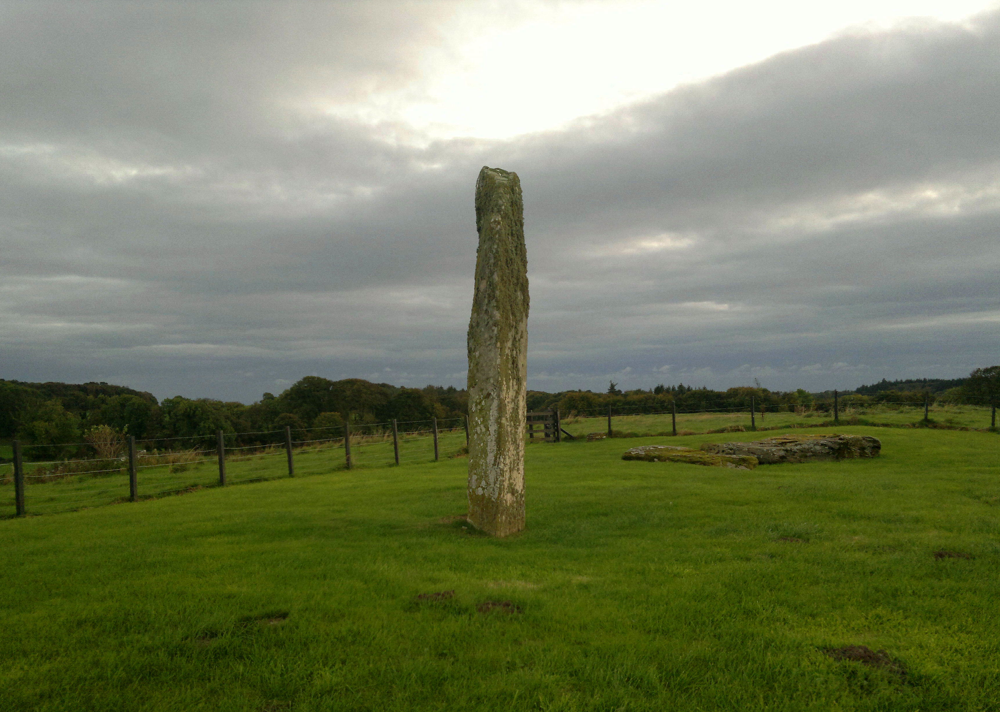
Drumtroddan Standing Stones, 5pm, 13th October 2016


Yes, tweaked rather, but, on some autumn evenings there w i l l be a blazing sunset behind those stones. Try to experience that here, as well as Torhouskie. To get the best photographs of this place lie down.

2016: Dunman, the Hall of the Gables, still unattainable... a fence and a cliff requiring new route, plus cattle and health...but is there a finer positioned Iron Age fort in all Scotland? Just look at it. Totally, utterly magnificent.

The W side...plenty of undisturbed courses under that turf, probably

Another N view...note the smallness of the stones used in the entrance, surely a factor in collapse. Stairhaven car park in distance, complete with WC. (hello t/rusty Fiesta xxx)

Looking N up coast to Stairhaven, and, in L distance, the sand dunes at the head of Luce Bay, which contain many Neolithic axe factories with, iirc, Langdale connections..the weather constantly reveals.

Looking W – uppermost extant top step of intramural stairwell R lower


Looking south.... Mull of Galloway on horizon R, with walling of intermural stairway in foreground

The start of a clockwise circular walk round...entrance at R

What greets you on completion of your ascent: the entrance on the NW side

Closeup of approach route: easy scramble up round L side of large blackened boulder in centre, then up ex-broch debris to site


The approach along the beach from Stairhaven..the stone chute from clifftop path to L ends in a mass of brambles etc. Sorry, beach at low tide IS only way. Step on the creamy brown boulders – barnacles give excellent grip. Incidentally the stone chute is whats left from a village clearance, heaved over the edge. Google the Master of Stair for other historical landowner activity....


Note how the stone is significantly broader on the ‘field’ side of the wall

2016... someone planted rambler roses either side of the stone, must look very pretty when in full bloom June/July, but need tending to avoid obscuring what they’re supposed to frame (Paul’s Scarlet Rambler, dontcha know..regards, TMA/HH gardening correspondent : ) )

The cairn, such as remains of it, is in the brambles to the left of the rocky outcrop at L of beach. A good place to chill, especially at low tide. Fine view of Ailsa Craig.


Well, after all these years s o m e o n e had to bother to photograph the poor thing, neglected in favour of the neighbouring glamourpusses... I hope the person whose resting place it is would approve and will sleep better.