
Dunbeg fort surrounded by barbed wire and No Entry signs because of serious damage caused by storms.
Image credit: tjj
Dunbeg fort surrounded by barbed wire and No Entry signs because of serious damage caused by storms.

With advancing sea mist.............


And again a bit further from the entrance, but southward. No, I didn’t see this space except on the photos. More at users.skynet.be/bert_saskia/travel/ireland/
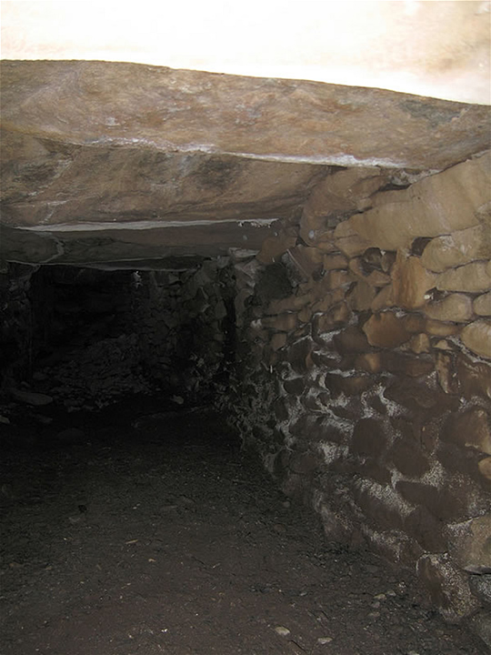
The souterrain a bit further away from the outer wall entrance, north again. More at users.skynet.be/bert_saskia/travel/ireland/

Again towards the north. How to get there? Impossible; simply stick the camera in the cracks... as shown :-) More at users.skynet.be/bert_saskia/travel/ireland/

Souterrain again at the same spot, but towards the north. More at users.skynet.be/bert_saskia/travel/ireland/

This is the pretty huge souterrain structure under the flagstones leading to the entrance; towards the south (spider eggs!). I luuurve souterrains, which is probably what made me take up speleology recently. More at users.skynet.be/bert_saskia/travel/ireland/

The outer wall on the inside. Nice stone work I’d say! More at users.skynet.be/bert_saskia/travel/ireland/

Looking out from the niche in the outer wall – where it is brilliant to meditate! – towards the big beehive structure. More at users.skynet.be/bert_saskia/travel/ireland/

Flagstones leading to te main entrance (see other pictures for the souterrain underneath!). More at users.skynet.be/bert_saskia/travel/ireland/

Magnificant Dunbeg setting, with Dingle Bay and the hills of Iveragh in the background. More at users.skynet.be/bert_saskia/travel/ireland/


the souterrain capstones

Walls and Clochaun
More serious problems at Dunbeg.
Full story:
thejournal.ie/kerry-fort-ancient-3781702-Jan2018/
Visited 18th May 2014
Dunbeg Fort is closed to visitors at present because of the serious damage caused by the winter storms. Visitors are allowed to walk down to it but no access to the site – it is clear to try and enter would be dangerous. The woman in the audio-visual centre told us that engineers had recently undertaken a structural survey and there is hope that some of the damage can be repaired with limited access allowed later in the summer.
The following information is taken from the audio-visual leaflet.
“Dunbeg Fort is a small but impressive example of a promontory fort but its location makes it even more dramatic. Built on a sheer cliff, its archaeological excavation was undertaken in the late 1970s. There are two major phases of occupation recorded. The first phase was around the 8th and 9th centuries AD. Clusters of stake holes to the north and south of the fort indicated the presence of wooden tripods for supporting pots and skins over the fire. Analysis of the occupation debris suggests a diet mainly of pigs, sheep and goats with some cows.
The second phase of occupation lay above the first phase and was around the 10th and 11th centuries AD. It was concentrated on two hearths in the centre of the Beehive (clochan). The bones of sheep, pig, deer, birds and fish were also recorded. But the excavation results did not reveal what the site was used for; it may have been defensive, or used for ritual or even status purposes, or it may simply have just been lived in.”
Some lovely examples of clochans/beehive huts nearby on the hillside.
This site is just off the road on the Slea Head drive. When we visited in September 2009 there was a charge of €2.50 to see it. You also get a photocopied information sheet
Its a nice site but not worth that kind of cover charge.
The audio-visual experience is extra, we didnt go for this however.


