Skip to content
Julian Cope
presents
The Modern
Antiquarian
Latest
Posts
Sites
Map
Blog
Forum
search
Search
⚠️
Sign in
more_horiz
Eire
County Cork
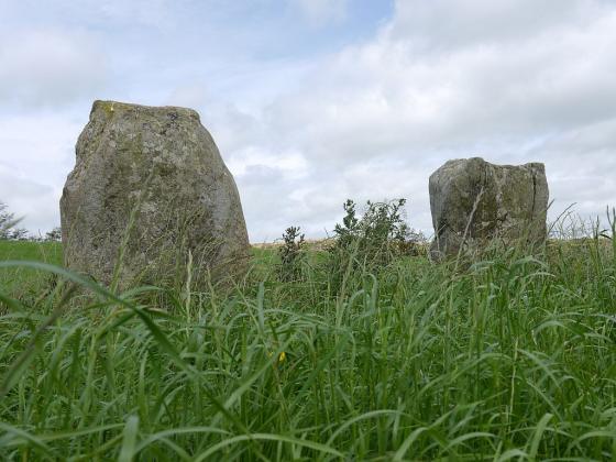
Shronacarton
Standing Stone / Menhir
W149476
expand_more
Also known as:
Clodagh
Nearest town:
Drimoleague (3km SW)
OS reference:
W149476
OS sheets:
85, 89
Latitude:
51° 40' 28.46 N
Longitude:
9° 13' 49.28 W
Added to TMA by
Meic
Images (6)
Add
content
Images
19th February 2012
Image credit: Michael Mitchell
Meic
Feb 19, 2012
19th February 2012
Image credit: Michael Mitchell
Meic
Feb 19, 2012
19th February 2012
Image credit: Michael Mitchell
Meic
Feb 19, 2012
19th February 2012
Image credit: Michael Mitchell
Meic
Feb 19, 2012
19th February 2012
Image credit: Michael Mitchell
Meic
Feb 19, 2012
19th February 2012
Image credit: Michael Mitchell
Meic
Feb 19, 2012
Sites within 20km of
Shronacarton
Clodagh
Stone Circle
•
2.32km N
photo
18
description
1
Clodagh Row
Stone Row / Alignment
•
2.55km N
photo
10
description
2
Baurnahulla
Dolmen / Quoit / Cromlech
•
2.83km SSW
photo
2
description
1
Garranes North
Standing Stone / Menhir
•
3.32km WNW
photo
5
description
1
Cullenagh
Stone Circle
•
4.3km N
photo
10
description
1
Cullenagh
Stone Row / Alignment
•
5.11km N
photo
9
Goulacullin
Standing Stone / Menhir
•
6.37km NW
photo
3
description
1
Reavouler
Standing Stone / Menhir
•
6.46km ESE
photo
13
description
1
Toughraheen
Standing Stone / Menhir
•
6.93km W
photo
1
Lissangle
Standing Stone / Menhir
•
7.59km SSW
photo
5
Farnanes
Standing Stone / Menhir
•
7.66km N
photo
8
description
1
Garryglass
Stone Circle
•
7.73km E
photo
2
forum
2
description
1
Garrygalss
Stone Circle
•
7.75km E
Gortnascreeny
Standing Stones
•
8.3km WSW
photo
4
description
1
Derrynacaheragh
Standing Stone / Menhir
•
8.93km NNE
photo
1
description
1
Gortnacowly
Stone Circle
•
9.04km WNW
photo
13
forum
1
description
2
Killinga
Cup Marked Stone
•
9.08km ESE
photo
5
description
1
Dromore School
Standing Stone / Menhir
•
9.16km WSW
photo
2
description
1
Barnagowlane West
Wedge Tomb
•
9.27km WNW
photo
8
description
1
Derrynasafagh
Standing Stone / Menhir
•
9.33km NE
photo
2
description
1
Cousane
Standing Stone / Menhir
•
9.4km NW
photo
3
description
1
Dunmanway North
Standing Stone / Menhir
•
9.62km NE
photo
5
Inchireagh
Stone Circle
•
9.69km NNE
photo
10
description
1
Cousane
Stone Circle
•
9.86km NW
photo
9
description
1
Maughanaclea NE
Stone Circle
•
9.87km NW
photo
8
description
1
Glanbannoo Upper
Standing Stone / Menhir
•
9.91km W
photo
5
description
2
Glanbannoo Upper
Standing Stone / Menhir
•
10.09km W
photo
2
description
1
Cloonygorman
Standing Stone / Menhir
•
10.12km W
photo
3
Gurteenaduige
Stone Row / Alignment
•
10.17km ESE
photo
7
description
1
Inchybegga
Stone Circle
•
10.2km WSW
photo
1
description
1
Bawnishall
Standing Stone / Menhir
•
10.25km SSW
photo
2
description
1
Ardrah
Stone Row / Alignment
•
10.32km WNW
photo
18
description
2
Maughanaclea Centre
Stone Circle
•
10.55km WNW
photo
7
Trawlebane 1
Standing Stone / Menhir
•
10.66km WSW
photo
6
description
1
Trawlebane
Stone Circle
•
10.66km W
photo
13
description
2
Ballyroe
Dolmen / Quoit / Cromlech
•
11.17km ESE
photo
7
description
1
Ballyhalwick
Stone Row / Alignment
•
11.2km ENE
photo
3
Carrigagrenane SW
Stone Circle
•
11.35km E
photo
7
description
2
Tullig Stone
Standing Stone / Menhir
•
11.41km ESE
photo
2
description
1
Derryarkane
Stone Circle
•
11.42km W
Cullomane East
Standing Stone / Menhir
•
11.47km WSW
photo
3
description
1
Maulatanvally
Standing Stones
•
11.54km E
photo
6
description
2
Cullomane
Stone Circle
•
11.55km WSW
photo
8
description
2
Cullomane East
Rath
•
11.57km WSW
photo
3
Cahermuckee
Stone Row / Alignment
•
11.6km WNW
photo
4
description
1
Carrigagrenane NE
Stone Circle
•
11.64km E
photo
6
description
1
Cullomane East
Burial Chamber
•
11.68km WSW
photo
6
description
1
Cullomane East
Cairn(s)
•
11.68km WSW
photo
5
description
1
Cullomane East
Standing Stone / Menhir
•
11.68km WSW
photo
3
Nedinagh West
Standing Stones
•
11.74km ENE
photo
3
Trawlebane 2
Standing Stone / Menhir
•
11.75km WSW
photo
5
Lettergorman (North)
Stone Circle
•
11.76km E
photo
23
description
2
Maulatanavally
Stone Circle
•
11.88km E
photo
24
forum
1
description
2
Coolnagarrane
Standing Stone / Menhir
•
12.09km S
photo
1
description
1
Knockawaddra W
Stone Row / Alignment
•
12.19km E
photo
16
description
1
Kealkil
Stone Circle
•
12.24km WNW
photo
39
forum
1
description
5
link
1
Knockawaddra E
Stone Row / Alignment
•
12.38km E
photo
14
description
1
Breeny More
Stone Circle
•
12.44km WNW
photo
26
description
4
Baurgorm
Stone Circle
•
12.57km WSW
photo
11
Dromourneen
Standing Stone / Menhir
•
12.62km WSW
photo
1
description
1
Glanbrack
Stone Circle
•
12.64km E
photo
15
Cappanaboul
Stone Circle
•
12.75km W
photo
7
Milleennagun
Wedge Tomb
•
12.75km ENE
photo
11
description
1
Milleennagun
Standing Stone / Menhir
•
12.85km ENE
photo
3
Shandrum Beg
Standing Stone / Menhir
•
12.99km W
photo
5
Cloghboola
Standing Stone / Menhir
•
13.04km SSW
photo
5
Cullomane West
Stone Row / Alignment
•
13.26km WSW
photo
9
description
1
Reanascreena
Stone Circle
•
13.3km E
photo
32
forum
3
description
5
Abbeystrowry
Standing Stone / Menhir
•
13.33km SSW
photo
5
Baurgorm SW
Stone Circle
•
13.41km WSW
link
1
Skeagh
Cairn(s)
•
13.48km SW
photo
3
Knocknaveagh
Burial Chamber
•
13.65km WSW
photo
4
Cappaboy Beg
Standing Stone / Menhir
•
13.68km NW
photo
2
Cappaboy Beg
Ring Cairn
•
13.7km NW
photo
2
Cappaboy Beg
Standing Stone / Menhir
•
13.7km NW
photo
3
Cappaboy Beg
Stone Row / Alignment
•
13.72km NW
photo
4
Cappaboy Beg SE
Stone Circle
•
13.79km NW
photo
6
description
1
Caherogullane
Standing Stone / Menhir
•
13.8km WSW
photo
5
Coolmountain
Stone Circle
•
13.86km NNE
photo
6
description
1
Derreengreanagh
Standing Stones
•
14.15km WSW
photo
10
description
1
Sarue
Stone Row / Alignment
•
14.34km E
photo
6
forum
1
description
1
Inchinattin
Standing Stone / Menhir
•
14.5km E
photo
1
description
1
Farrannahineeny
Stone Row / Alignment
•
14.6km NNE
photo
15
forum
1
description
1
Lyre
Standing Stone / Menhir
•
14.61km SW
photo
6
Cappaghmore
Standing Stone / Menhir
•
14.62km SW
photo
6
Scartbaun
Standing Stone / Menhir
•
14.67km WSW
photo
4
description
1
Inchincurka
Wedge Tomb
•
14.7km NE
photo
14
description
1
Scartbaun
Stone Row / Alignment
•
14.76km WSW
link
1
Killacoosane
Standing Stone / Menhir
•
14.99km ESE
photo
6
Foherlagh
Stone Row / Alignment
•
15.01km SW
photo
8
Dooneens
Standing Stone / Menhir
•
15.06km NNW
photo
4
Knocks N
Stone Circle
•
15.1km E
photo
19
forum
1
description
1
Maughsilly
Stone Row / Alignment
•
15.11km WNW
link
1
Knocks
Standing Stone / Menhir
•
15.14km E
photo
1
description
1
Maughanasilly
Stone Row / Alignment
•
15.16km WNW
photo
20
description
3
Cappaboy Beg NW
Stone Circle
•
15.25km NW
photo
4
description
2
Lissaclarig West
Stone Row / Alignment
•
15.38km SW
photo
7
Parkana
Standing Stones
•
15.52km WSW
photo
3
Toom
Stone Row / Alignment
•
15.58km ENE
photo
4
Behagullane
Stone Row / Alignment
•
15.58km NE
photo
1
Knocks S
Stone Circle
•
15.59km E
photo
16
description
2
Freahanes
Rath
•
15.62km E
photo
7
Knocks
Stone Row / Alignment
•
15.67km E
photo
12
description
1
Coolnaconarty
Standing Stones
•
15.69km E
photo
8
description
1
Illane
Stone Circle
•
15.7km WNW
photo
7
Keilnascarta NW
Stone Row / Alignment
•
15.72km WSW
photo
5
description
1
Keilnascarta
Stone Row / Alignment
•
15.74km WSW
photo
4
description
1
Keilnascarta SE
Stone Row / Alignment
•
15.76km WSW
photo
4
description
1
Drombeg
Stone Circle
•
15.77km ESE
photo
47
forum
1
description
8
link
2
Ballybane (The Rock of the Rings)
Cup and Ring Marks / Rock Art
•
15.79km SW
photo
4
Dooneens
Standing Stones
•
15.87km NNW
photo
8
description
1
Ballybane West NW
Cup and Ring Marks / Rock Art
•
15.93km SW
photo
5
Murrahin North
Standing Stone / Menhir
•
16.09km SW
photo
8
Maulinward
Ring Cairn
•
16.19km WSW
photo
5
description
1
Maulinward
Stone Row / Alignment
•
16.19km WSW
photo
5
description
1
Caherkirky
Dolmen / Quoit / Cromlech
•
16.24km ENE
photo
8
description
3
Gurranes
Stone Row / Alignment
•
16.29km SSE
photo
22
forum
1
description
3
Lettergorman (South)
Stone Circle
•
16.29km ESE
photo
36
description
3
Murrahin North
Stone Row / Alignment
•
16.3km SW
photo
12
description
1
Knockdrum
Stone Fort / Dun
•
16.74km SSE
photo
10
description
2
Carrigillihy
Standing Stones
•
16.86km SE
photo
6
Carrigillihy
Cup Marked Stone
•
16.86km SE
photo
8
description
1
Hollyhill
Standing Stone / Menhir
•
17km SW
photo
5
Curraheen
Standing Stone / Menhir
•
17.14km ESE
photo
3
Tinneel
Standing Stones
•
17.24km E
photo
7
description
1
Knockatlowig
Stone Row / Alignment
•
17.45km E
photo
8
description
2
Ballycommane
Stone Row / Alignment
•
17.69km WSW
photo
3
Ballycommane
Dolmen / Quoit / Cromlech
•
17.69km WSW
photo
2
Derrynafinchin
Stone Circle
•
17.8km WNW
photo
14
description
2
Kinneigh
Stone Row / Alignment
•
17.87km ENE
photo
5
Beach
Standing Stone / Menhir
•
17.93km WSW
photo
1
Derrynafinchin
Standing Stones
•
17.97km WNW
photo
1
Western Pap
Passage Grave
•
18.04km NNW
photo
7
description
2
Mill Little
Stone Circle
•
18.21km W
photo
26
description
2
Rosscarbery
Standing Stone / Menhir
•
18.53km ESE
photo
3
description
1
Burgatia
Dolmen / Quoit / Cromlech
•
18.7km ESE
photo
4
description
1
Inishbeg
Burial Chamber
•
18.71km SSW
photo
4
description
1
Derryduff
Standing Stone / Menhir
•
18.73km E
photo
4
Dromclogh
Standing Stone / Menhir
•
18.83km WSW
photo
5
Ahaghilla
Stone Circle
•
18.86km E
photo
11
description
2
Kinneigh
Standing Stone / Menhir
•
18.87km ENE
photo
4
Currahy
Standing Stone / Menhir
•
19.02km N
photo
4
Gortafludig
Wedge Tomb
•
19.12km NNW
Bohonagh
Stone Circle
•
19.16km E
photo
36
forum
1
description
7
link
1
Ahaglaslin
Portal Tomb
•
19.37km ESE
photo
2
forum
1
description
1
Turnaspidogy
Stone Row / Alignment
•
19.39km N
photo
6
description
2
Lisheen Lower
Dolmen / Quoit / Cromlech
•
19.69km SW
photo
4
Knockanereagh
Stone Row / Alignment
•
19.72km NE
photo
8
Barnabah
Cup Marked Stone
•
19.9km SSW
photo
2
Borlin Valley Standing Stone
Standing Stone / Menhir
•
19.97km NW
photo
5
description
2
search
I’m looking for…
location_on
photo
ondemand_video
forum
description
link