
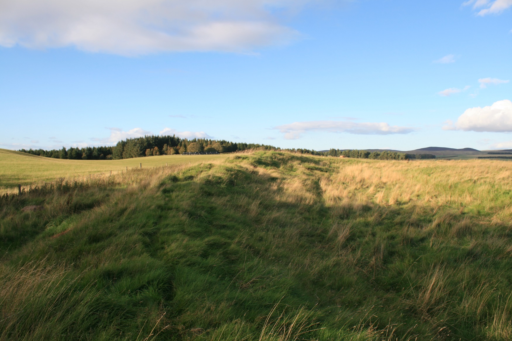
On approach to the 4th henge of the day.
Image credit: Chris Bickerton
On approach to the 4th henge of the day.


The scrappy bobbly south end of the henge.

Looking through the east facing henge, should’ve come here for the equinox.

Looking over the east facing entrance.


What I took to be livestock damage to this fine henge. But there you are... there are obvious parallels with another henge further south, should you care to make them. No Guardian reports here, however.


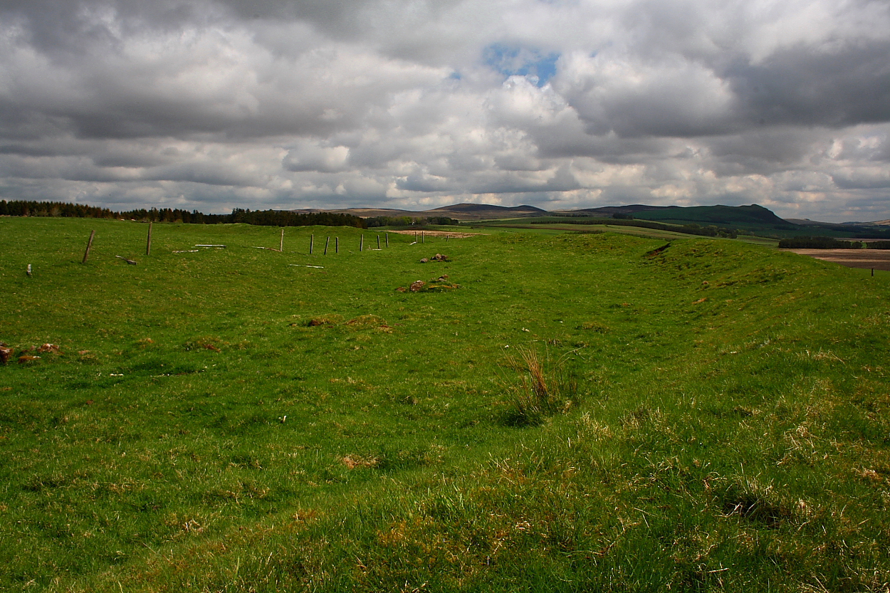

Interior from the pretty substantial bank


Such is the preservation I’d reckon this fine henge would be easily mistaken for a hill fort... if not for the inner ditch.


I neglected to come here when visiting the seriously be-cairned Greens Moor and environs a couple of years back... probably since the map, highlighting a nearby gravel pit and old railway cuttings, conjured up mental images of a more or less ploughed out remnant of a henge in less than salubrious surroundings. I mean, it’s not exactly famous, is it? However finding myself likely to be in the shadow of Tinto again this year, I duly reappraised Tiompan’s (and Bladup’s now deleted) images and concluded my initial assumption might well be wrong. Suffice to say it was. Fair’s fair. Yeah, in my opinion this is an obscure gem of a site, well worthy of consideration if a couple of hours of time out from the world floats your boat. As it does mine.
The optimum approach might well be from Newbiggingmill to the approx south-west, along the route of the disused railway line alluded to above. However, finding nowhere to park that wouldn’t piss me off if I was in the landowner’s (no doubt muddy) shoes, I take the Weston road at Newbigging itself and squeeze onto the verge near a track heading off into Firpark Wood... that is not the track crossing the clearing near the Firpark buildings further along. Seems this a haunt of local dog walkers, one such man returning to his car confirming that I’m literally on the right track. Incidentally he adds that there’s also a monument to covenanters nearby I should see. Won’t have time, but interesting nevertheless. The track emerges from cover, whereby I veer right toward the OS trig pillar, the trees here apparently recently cleared. From here the henge lies to the left of a prominent copse to the south-east.
As I approach the site it looks, for all the world, a reasonably upstanding defended settlement. Closer inspection, however, reveals there to be no ditch.... well, not encircling the earthworks, at any rate. There is one within, though, a demarcation of bank and enclosure. Yeah, clearly this is no hillfort but a well preserved henge featuring, as Tiompan notes, a pretty substantial surviving circumference, not only in terms of diameter, but also bank height. OK, a knackered old fence does bisect a section of the monument to the south-east... and there is significant evidence of damage apparently resulting from animal husbandry. But, all things considered, for a henge this size it is in remarkably good nick indeed. Most certainly not a virtually ploughed-out ghost in the landscape! Speaking of which, despite the gravel pit to approx south drawing parallels with the magnificent Thornborough trio, the monument’s landscape context – and thus vibe – is far better than I anticipated, too, said workings being some distance away, albeit still noticeable. And of course I find that vibe is always enhanced with the sun periodically streaming through the cloud base and cows getting up to all kinds of bovine shenanigans in the next field. Some noises just sort of ‘blend in’, do they not?
Sometimes being proved completely wrong is good for the soul. Helps to feed my rock n’roll!
Class 2 henge , difficult to get a pic of the entire monument . In surprisingly good shape or at least I was expecting much worse . The bank is just under 2m high and the ditch is a typical broad 10m and shallow 0.5 m.Entrances are within 10-15 degrees north/south in common with a few other Class 2’s like the Bull Ring , Cairnpapple ,Broomend and Ballymeanoch .Fwiw the hill seen over the trees in the last pic is Dollar law which is where the winter solstice sun would be seen to set , an unlikely example of intentionality as it’s a wide target (5 degrees of horizon ) not indicated i.e. entrance or foresight , the sun has to set somewhere and as the horizon is relatively hilly it’s likely to be over a hill , if the hill happened to be notable i.e. pointed it might be a wee bit more salient .Plenty lithics have been found in the area dating from the Mesolithic to Late Neolithic .


