
11/08/2014 – Black Meldon hillfort on a wet and windy day.
11/08/2014 – Black Meldon hillfort on a wet and windy day.

If this was indeed constructed in historic times it is a very fine effort, although clearly not worth the removal of material from the ramparts. In fact it is probably the best such attempt I’ve seen in these Isles to date. Unlikely?

Black Meldon viewed from White Meldon across the glen..... the precipitous nature of the hillside can be readily appreciated.

The exquisite panorama to the approx south.... as seen from the cairn.

What I took to be a quite extensive footprint of the cairn is highlighted here, looking approx north-west.

Approx south-west

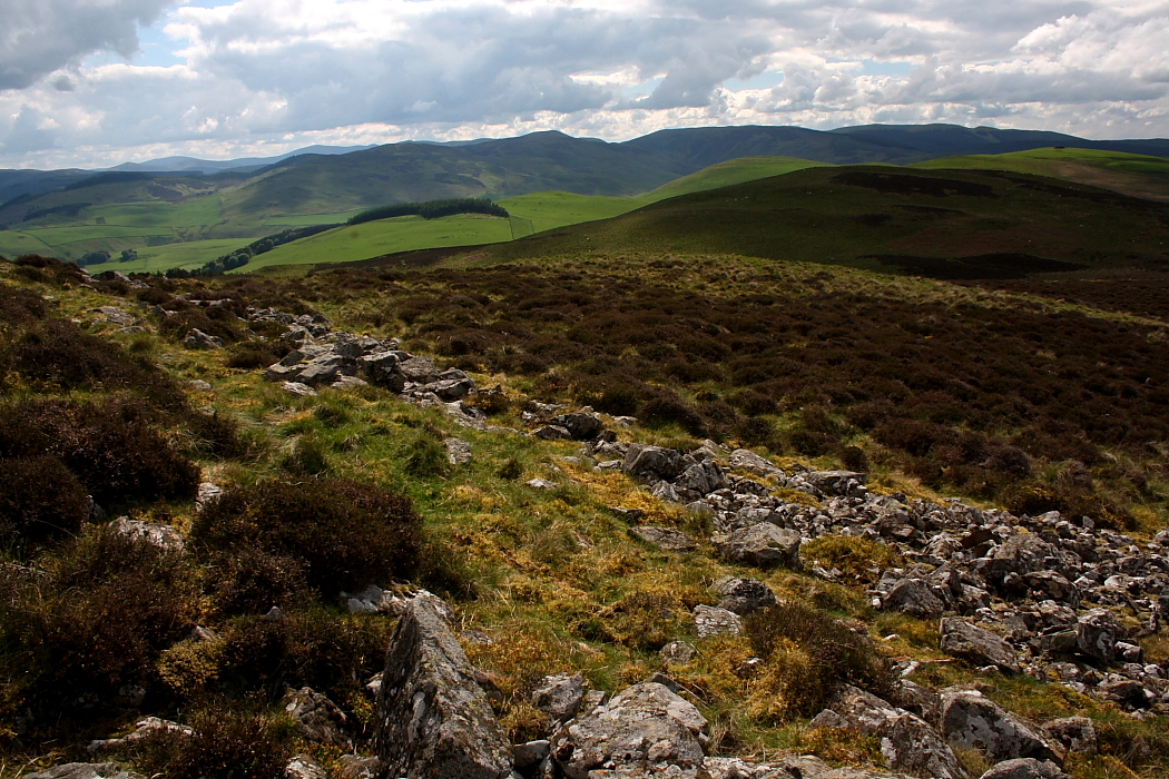
Eastern flank, looking approx south-east.... obviously less substantial defences were required here where the hillside is very steep indeed.

Eastern flank, looking across to a black White Meldon. Ha! Things are seldom clear cut.

Western flank looking approx north-west(ish)

The hill fort is crowned by a substantial cairn... can’t locate it on RCAHMS (etc) so guess the assumption is it’s modern. However after having a close look at the footprint – for what it’s worth – I reckon the evidence does not support that. Yeah, it would seem this has been here quite a while and its status is worthy of reappraisal.

Western flank, looking south. To be honest there isn’t anything I can say to convey the majesty of the view. I’ll try and think of something for a field note.

14/7/02- taken from the summit of White Meldon
11/08/2014 – I visited White Meldon a few years back and had been wanting to get back to have a look at Black Meldon fort since. Started from the road that runs between the Meldons. Short but steepish climb to the top. Nice stones of the wall remain and a cairn (old?) on top. Well worth a visit. Weather today was pretty wild on top with the wind and rain.
Best approach from the north-west side. There are a number of spots to park a car on the road in the glen, but the one by the disused mineworkings is easiest. The ground is dense heather, so not easily accessible to those with mobility issues. The fortlet wall is clearly a discernible oval, about 20m on its longest axis. I was confused that I couldn’t work out where the entrance had been. Excellent views all round, particularly to the south, where ancient field patterns and drove roads are clearly visible.
Lyne Farm to the south of the hill is in the middle of a medium sized roman camp, and in a burn nearby Iron Age burials of an early christian nature were found. It’s also a decent place to stay self-catering if you want to spend a few days exploring the the upper end of the Tweed.


