
Image credit: Robert Gladstone


That’ll be Tinto, then.


Returning from a wander to the summit of Devonshaw Hill... where, incidentally, stands the remains of a probable Bronze Age cairn – oddly, I took no images. The ‘industrial’ activity to the left is the support area for a wind farm. Apparently.

The hillfort is superbly sited overlooking the River Clyde........

A wrecked cairn looks down on Devonshaw Hillfort.

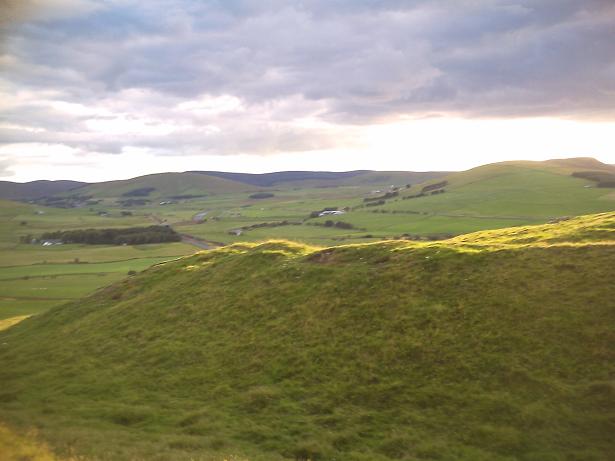
Devonshaw Hillfort and beyond, looking across the Clyde and into the West and the hills of Ayrshire.

The boulders with the Clyde below and the village of Roberton beyond.

The boulders which mark the end of the outer s/west rampart.

Looking down from the steep inner rampart to the big stones on the end spur of the south western outer rampart.
Looking west with the setting sun behind the eastern rampart.

The northern entrance gateway looking down into the green Upper Clydesdale valley with the might of Tinto rising behind.

From the steep south western inner rampart looking down onto the outer rampart.

The southern entrance to the hillfort. There is a small bank outside the gateway blocking direct access rather like a roman titulus.

Devonshaw Hill

Devonshaw Hill
25 August 2010
Devonshaw is one of a string of hillforts planted along the western edge of the Upper Clydesdale Hills. Arbory, Kirkton, Bodbury are others within a few miles. I can see my work’s cut out for the next couple of weeks...
There is a draw-in at the side of the A702 on the Northbound side of the road. Look for the gap in the crash barriers and draw in. If you miss it drive on, turn around a mile ahead and come back. This road is a death trap. There’s a bit of nfty traffic dodging to avoid getting splattered by the stream of artics and juggernauts and a great opportunity for a barbed wire wedgey getting over the fence and onto the hill. The fort is then a ten minute scramble up the steep side of Devonshaw Hill.
Gradually the sound of the traffic disappeared as I climbed higher. On a terrace high above the road I paused for a breather and leaned back against an outcrop of rock. My nostrils were hit by the most hideous smell, when I checked behind the rock there was a half eaten, half decomposed sheep whose partial evisceration was spread across the green, green grass in a scene reminiscent of The Killing Fields meets Shaun the Sheep. My movement set up an immense cloud of blowfly and bluebottles from the carcass and I stumbled away across the maggot crawling grass trying to retain my dinner.
Like most sites in South Lanarkshire, Tinto is always somewhere over your shoulder and she looks onto Devonshaw Fort with a real massiveness. The fort itself is a delight, perched daintily like a fifty pence coin on a western spur halfway up Devonshaw Hill. The hut circles in the interior are clearly visible and the ramparts still very intact. The steep inner rampart is a real challenge to get up.
There are some big boulders which occupy the end spur of the outer rampart which look rather interesting. I’d often seen them when driving up the A702 and noted their monolith-like appearance. Frost shattered and earth fast, they are a group of sizeable stones which mark one side of an approach to the South entrance. On the hill above the fort there is an unremarkable grassed over cairn with a superb outlook.
I stretched out on the high western rampart of the fort for a while watching the lowering sun strafe the valley below, picking out its greens and setting diamond reflections dancing on the waters of the Clyde. Tinto looked on and said nothing.
Panoramic views and atmospheric. Highly recommended.
Devonshaw Hill fort is on a rocky knoll at the end of the steep-sided spur that projects SW from Devonshaw Hill, about 430m NE of Woodend farmhouse, is occupied by the remains of a fort and enclosure. . The site is located about 1 mile from Abington Service station at junction 13 of the m74, on the A702 Edinburgh Road and can be seen from some distance.


