
Northern rampart.
Image credit: A. Brookes (18.8.2018)
Northern rampart.

Looking down on Pen-Twyn Camp from Hatterrall Hill. Ysgyryd Fawr is the distinctive hill to the right.

The curving banks leading to the entrance. The tree artfully contrives to hide Ysgyryd Fawr.

Inside the entrance.

The southwestern rampart, bounded by a metalled track.
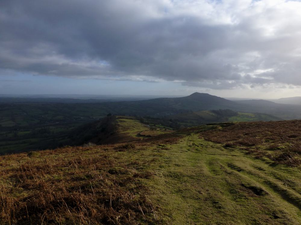
Looking down on the fort (in sunshine, left of centre) from the slopes of Hatterrall Hill.

Sheep helpfully provides scale for the outer northwestern rampart.

The steep slopes below the northeastern side of the fort, looking towards Hatterrall Hill and the Black Mountains easternmost ridge.

Looking across the northwestern half of the fort, towards the prominent Sugarloaf.

Impressive earthwork dividing the two halves of the fort.

The central rampart. The prominent hill on the left is Twyn-y-Gaer, the neighbouring hillfort with a similar layout.

The northeastern side of the fort needs little artificial defence. Looking down on the Monnow/Mynwy valley into Herefordshire.

Pen-Twyn Camp is the light green hill, dotted with trees, in the centre. Behind it, the bulk of Hatterrall Hill rises at the southern end of the eastern Black Mountains ridge. Seen from Wern-Gifford, across the Honddu Valley to the SE.

Pen-Twyn camp seen from the SSE on Offa’s Dyke Path. Hatterrall Hill can be seen behind (right) the fort.

The curving funnel leading to the southern entrance. Although less well-preserved, it reminds me of a similar arrangement at nearby Wapley Hill fort.

The sloping interior of the southern part of the fort. G/F provides scale for the entrance.

The NW rampart, under summer bracken.

Rampart at the SE end of the fort.

The central bank separating the NW and SE enclosures of the fort.

The northern rampart. Looking towards the neighbouring fort of Twyn y Gaer.

The impressive rampart at the northen end of the fort. Looking towards Pen y Fal (The Sugarloaf).

Looking down on Pen-Twyn camp from the southern ridge of Hatterall Hill.
Visited 21.8.11
When visiting a site there are often two ways to approach it – the hard way or the easy way. Needless to say that this is yet another example where I picked the hard way!
I approached from the minor road to the south west, only to find the road east (near the pub) signposted ‘unsuitable for vehicles. This required a longer walk to the Hillfort than I had planned. Much to Karen’s credit she said she didn’t mind waiting in the car with the children whilst I traipsed across country – what a woman!
It was a lovely summer’s day and although it took 25 minutes to reach the Hillfort it was a pleasant walk in the warm sunshine.
By the time I reached the Hillfort it was clear that if I had approached from the south east I could have driven literally right to the site! (There is a small place to park next to the yellow grit boxes – beyond the entrance to Lower Pentwyn Farm).
You then pass through a wooden gate and an information board which tells you all about Hatterall Hill although there is no specific mention of the Hillfort. The board also states that you are now entering common land – so access is not a problem.
Although the whole site is covered with ferns the ditch and rampart of the Hillfort was easy enough to see.
The path through the wooden gate actually runs alongside the western defences and here the rampart is about 3 metres high – elsewhere it is between 2/3 metres.
There are wonderful views to be had and it was lovely standing there in silence, amongst the foxgloves, with only a couple of birds of prey hovering overhead for company.
This is indeed a great hobby of ours – and other than petrol – free!
Well worth a visit when in this pretty part of the world.
Coflein has the following description for the fort:
A subrectangular enclosure, c.140m by 70m, defined by a bank and ditch; before the SE facing entrance is a sub-oval area, c.185m by 104m, multivallate away from the steep natural slopes to the NE, which both enclosures rest upon.


