The ‘W’ (or ‘M’).
Image credit: A. Brookes (8.6.2011)
The ‘W’ (or ‘M’).

Looking SSW, the Black Mountains escarpment can be seen from the stone.

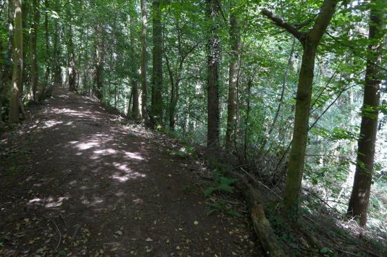
Looking east along the trackway.

You can just make out the OS benchmark at the top of the eastern side (the less lichen-covered one).

If you get down low enough, it almost looks big. Almost.
‘Visited’ 1.4.12
Despite being not too far from Hay-On-Wye this site has a ‘middle of nowhere’ feel about it. You first have to navigate the very minor roads and then try to find the stone!
There is plenty of room to park outside the locked gate leading into the forestry plantation with a handy stile next to it. Dafydd enjoyed learning how to safely climb a stile on his own!
The track leads down the hill and through the saplings. It looks like the mature trees had been cut down a few years ago and been replanted. There were plenty of tree stumps about which doesn’t help looking for a stone – particularly when you have no idea what the stone looks like!
We walked as far as a deserted caravan – which looked further than we needed looking at the O/S map which does have the word ‘stone’ marked on it. We walked back up the hill to have another look but were unable to spot the ‘stone’.
The weather was glorious, the views lovely and Dafydd was happily spotting tractor tyre and horse shoe tracks in the hardened mud – poking about here and there with a stick. Just us and the ‘wildernesses. It somehow didn’t really seem to matter we couldn’t find the stone.
A ‘father and son’ moment.
***
Just read TSC notes. Would have helped if I had read them first! Still didn’’t see the stone!
I head northwest to Llanrosser, where my route runs between the higher ridges of Cefn Hill to the west and Vagar Hill to the east. Keeping on for another mile or so, I reach a sign-board on the left, telling me about Cefn Common. Opposite, a bridleway gate leads onto a permissive track running eastwards.
This little track, running along the south side of Mynydd Brith wood, is the way to approach the Mynydd Brith stone. Sadly, as it comes into view, my first thought is “is that it?” I had expected something taller, especially after the lovely Wern Derys stone whetting my appetite earlier. But this is a much smaller affair, only about four feet tall. SMR has it down as hesitantly “prehistoric?” and I can see why there is doubt. It has clearly been worked. The angles are very sharp, despite weathering. It has a “W” carved on its top (could be an “M” I suppose) and looks like a boundary stone. Oddly, although it is actually on a parish boundary, the reports I have read suggest that this is coincidental and the stone was not known as a boundary marker. Which seems very unlikely. “Disputed antiquity” I think.
But fear not, because it’s still worth coming up to see it, for another reason entirely. Walking further ESE along the track, it emerges onto Vagar Hill near a telecoms mast. And it becomes apparent that, unadvertised at all, Vagar Hill is quietly one of the best viewpoints in Herefordshire. At 433m, it hardly towers above the surrounding countryside – even nearby Cefn Hill is higher. But it’s situated Just Right. To the south, especially on a day of cloud, sunshine, rain and shadow, the Black Mountains escarpment is spectacular. To the east, the jagged ridge of the Malverns and, inevitably, May Hill (which you seem to be able to see from everywhere). Northwest, the mountains of the Radnor Forest – Great Rhos, Black Mixen and Bach Hill, for once not shrouded in mist and cloud. Further NNW, something more prominent, which must be one of the southern North-Walian ranges. North-east, looking down a straight-as-an-arrow enclosure road, are the South Shropshire hills of Brown Clee and Titterstone Clee. Magnificent. So, the stone may not be the most exciting, but it’s still a very worthwhile trek to come up here.
Description from Herefordshire SMR:
At edge of forestry plantation, nr boundary with Michaelchurch. Top surface W cut into it. Not used as boundary stone, or previously recorded. Well cut standing stone, 1.2m above ground level, slight lean to W. In cross section 0.35 x 0.25m. Bench mark cut into E side at top. W on top. No other features to date, but has weathered appearance.