Skip to content
Julian Cope
presents
The Modern
Antiquarian
Latest
Posts
Sites
Map
Blog
Forum
search
Search
⚠️
Sign in
more_horiz
United Kingdom
Scotland
Central Scotland
South Lanarkshire
Black Hill
Cairn(s)
NS90312471
expand_more
Nearest town:
Lanark (19km NW)
OS reference:
NS90312471
OS sheets:
71, 72
Latitude:
55° 30' 13.54 N
Longitude:
3° 44' 12.62 W
Added to TMA by
thelonious
Images (1)
Add
content
Images
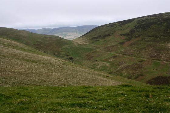
01/06/2018 – Cairn on north side of Black Hill. Good access from the Strand.
thelonious
Jun 10, 2018
Sites within 20km of
Black Hill
Black Hill
Hillfort
•
0.95km ESE
photo
1
Wildshaw Burn
Stone Circle
•
3.17km WNW
photo
3
description
1
Arbory Hill
Hillfort
•
4.18km E
photo
21
description
4
Castle Hill
Hillfort
•
4.29km ESE
photo
5
Kirkton Fort
Hillfort
•
4.31km ESE
photo
2
description
1
Kirkton Fort and Settlement
Hillfort
•
5.29km E
photo
2
description
1
Castle Crawford Farm Fort
Hillfort
•
5.59km E
photo
1
description
1
Viaduct Plantation
Round Cairn
•
5.67km E
photo
4
Devonshaw Hill
Hillfort
•
6.21km NE
photo
18
description
2
Fall Hill
Enclosure
•
6.68km E
photo
2
description
1
Normangill Rigg
Ancient Village / Settlement / Misc. Earthwork
•
7.04km E
photo
3
description
1
Normangill
Henge
•
7.34km E
photo
10
forum
1
description
1
Bodsberry Hill
Hillfort
•
9.9km ESE
photo
1
description
1
Air Cleuch
Cup Marked Stone
•
10.55km ESE
photo
4
description
1
Lamington Hill
Cairn(s)
•
10.6km ENE
photo
5
description
1
link
1
Tinto
Cairn(s)
•
10.83km NNE
photo
29
forum
1
description
7
Crookedstone
Standing Stone / Menhir
•
11.24km ESE
photo
10
description
1
Scaut Hill
Cairn(s)
•
11.6km NE
photo
2
description
1
Fallburn
Hillfort
•
13.36km NNE
photo
18
description
1
Park Knowe
Enclosure
•
13.59km NNE
photo
9
description
1
Quothquan Law
Hillfort
•
16.1km NE
photo
6
description
1
Cow Castle
Hillfort
•
16.22km ENE
photo
12
description
2
Langloch Knowe
Hillfort
•
16.25km ENE
photo
4
description
1
Nisbet, NE of Cow Castle
Ancient Village / Settlement / Misc. Earthwork
•
16.47km ENE
photo
5
description
1
Blackshouse Burn
Cairn(s)
•
16.49km NNE
photo
5
description
2
White Hill
Hillfort
•
17.64km ENE
photo
7
description
1
Nether Dod
Cairn(s)
•
17.76km E
Cairn Table
Cairn(s)
•
17.78km WSW
photo
12
description
1
Cairn Hill
Cairn(s)
•
18.38km SSW
photo
3
description
1
Mitchelhill Rings
Hillfort
•
18.5km ENE
photo
17
description
2
Menzion Standing Stones
Standing Stones
•
18.94km E
photo
4
description
2
link
1
Lightshaw
Standing Stone / Menhir
•
18.96km W
photo
8
description
2
Clarkston Farm
Standing Stone / Menhir
•
19.13km NW
description
1
Giant’s Stone
Standing Stones
•
19.14km E
photo
14
forum
1
description
5
link
1
search
I’m looking for…
location_on
photo
ondemand_video
forum
description
link