The very prominent Backbury seen from the Wye Valley Walk near Hope Springs to the south.
Image credit: A. Brookes (20.8.2022)
The very prominent Backbury seen from the Wye Valley Walk near Hope Springs to the south.

A long-ago landslip has obliterated much of the eastern defences, but there is still enough to see how formidable this site was.


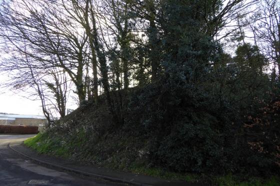
Eastern ramparts.

Very overgrown, but the site has huge charm.

Eastern ramparts.

At the southeastern corner of the fort.

The southeastern ramparts.

Looking down from the inner southern rampart to the outer.

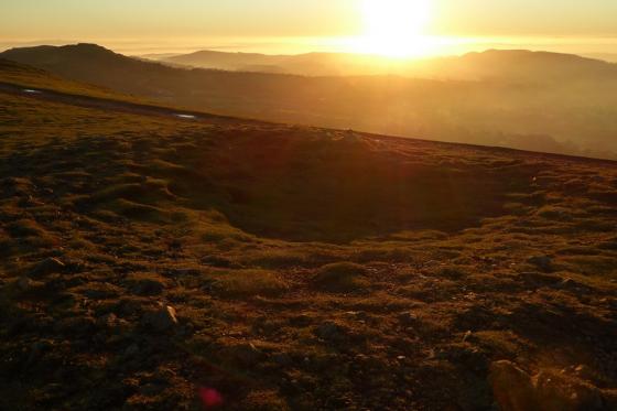
Circular feature found in the overgrown interior. Quarry pit or remains of something like a hut circle?

The southwestern entrance (likely to be one of two original entrances) cuts through the inner bank.

Western ramparts, looking south.

Loooking along the ditch below the inner rampart, rising steeply on the right. There is a slight counterscarp. The ground drops away steeply again on the left, down to the outer defences.
About a mile and a half from [Stoke Edith] Mansion, on the south-west, and ocupying the summit of a commanding eminence, is St Ethelbert’s Camp, said, by popular tradition, to be the spot where Ethelbert pitched his tents when on his journey to the Court of King Offa.*
p590 of ‘The Beauties of England and Wales’ v6 (1805).
The Herefordshire on-line SMR says that the Ordnance survey first changed the name on the map to ‘Backbury’ in 1926. Landslides have obscured the defences in places.
*Sadly that was where he met his fate, at Sutton Walls.