Visited 29.12.10
On the way home following an ad hoc visit to Shrewsbury we happened to be passing this site. I wasn’t going to bother visiting as it was nearly dark and very foggy. However, Karen persuaded me it was worth a quick look (how lucky am I to have a girl like that?!) so we took the old Roman road south off the A44, just east of Leominster. This road runs past the southern end of the Hillfort, where you will find a rather posh house with a public footpath/sign which basically runs through their garden!
As the light was fading fast I didn’t bother to change out of my trainers into my walking boots (mistake!) and headed straight over the wooden stile and followed the footpath signs through the garden, past the still frozen pond.
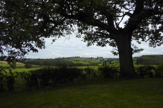
You then go through a gate and the footpath continues alongside the river. I however headed immediately to the right, through the bushes to catch first sight of the lower defences. There is a rampart about 1.5 metres in height, with an inner ditch, about 1 metre deep. Along the edge of this ditch, as far as the eye could see (not very far given the conditions) was a barbed wire fence. There doesn’t appear to be any public right of access to the Hillfort so I wasn’t overly surprised by the fence. I walked along the ditch until I happily came upon a fallen tree which had flattened a section of fence. I scrambled over the fence only to be confronted with an approx 8 metre high very steep and muddy bank. I slipped and slithered my way up wishing I had taken the time to put my boots on. Eventually I got to the top where there is a flatish area of grass about 10 metres across. I then came to the next steep, muddy bank – this time even bigger – about 10 metres high. Again, I managed to scramble to the top, on hands and knees in places, and came out to the top of the Hillfort. This comprised of a large, flat area which had been planted with trees (an orchard perhaps?). The outer edge of this area was surrounded by another rampart, still 2 metres high in places.
By now it was almost dark and I could hear voices in the foggy gloom, somewhere amongst the trees, and even shotgun blasts in the distance – very Hammer House of Horror! Getting down the banks was even harder that getting up but somehow I managed to swing from tree trunk to tree trunk without injuring myself. The patches of snow on the ground didn’t help much!
By the time I got back to the car it was dark but luckily Dafydd was happily looking at the frozen pond through the car window whilst little Sophie (newest member of the clan) snoozed in her car seat (her first experience of ‘old stoning’!) – so no stress for Karen! I only had chance for a quick visit and I guess it would take a fair bit of time for a proper look around – perhaps another day?
Articles
“Near the camp is Hill Hole or Hell Hole Dingle, locally Hello Dingle*. This is said to have been named after the holy well at Pencombe, whose water meets the Humber Brook near the spot, but it is more likely that there was a holy well at Hollywell or Hollywall Farm on the old Roman road above the dingle.”
From “The Healing Wells of Herefordshire” – Jonathan Sant (1994 Moondial).
*On the OS 1:25000 (2006 ed) this is shown as “Hill Hole”, at SO537542.
From “Herefordshire Register of Countryside Treasures” (1981) H&W CC:
“Occupies an area of about 28 acres, the enclosures being about 8.5 acres. Defences, which follow the natural contours consist of of 3 lines on W. + 4 lines on E, with possibly two main entrances. The interior of the fort has been planted with fruit trees.”
The fort is on land owned by Risbury Court:
Sites within 20km of Risbury Camp
-
Westington Camp
description 1 -

Dinmore Camp
photo 14forum 2description 2 -

Uphampton Camp
photo 6description 2 -

Bach Camp
photo 10description 2 -
Hill Croft Field
description 1link 1 -

Ivington Camp
photo 12description 3 -

Sutton Walls
photo 14description 6 -

Wall Hills (Thornbury)
photo 1description 3 -

Bush Bank
photo 4description 3 -
Garmsley Camp
description 1 -

Wergins Stone
photo 8description 5link 1 -

Canon Pyon
photo 5description 3 -

Tillington Common
photo 6 -

Credenhill Camp
photo 30description 3 -
Lower Newton
-
Stanford Bishop
photo 5description 3 -

Croft Ambrey
photo 24 -

Pyon Wood Camp
photo 10description 2 -
Milton Cross
description 1 -

Backbury
photo 13description 1 -

Caynham Camp
photo 14description 2 -

Rotherwas Ribbon
photo 4forum 4description 8 -

Eaton Camp
photo 10description 2link 1 -
Cradley Camp
description 1 -

Dinedor Camp
photo 11description 1