Visited 4.9.10.
What a hassle this was!!
I did manage a brief visit – but only just.
Taking the A438 turning at the A417 roundabout at Ledbury, you quickly come to the turning to Wallhills farm on the left. Take this turning and follow the long drive up to the farmhouse. I then parked outside the farmhouse. So far so good. (There is a new road leading off to the left which I chose to ignore and thought it better to head for the farm house).
There was no-one about to ask for permission to visit the Hillfort (no public right of way) and I then heard voices from the other side of the barn. I climbed over a gate and approached the somewhat surprised people to see if they could give me permission? (They live in the ‘new build’ which the other road led to).
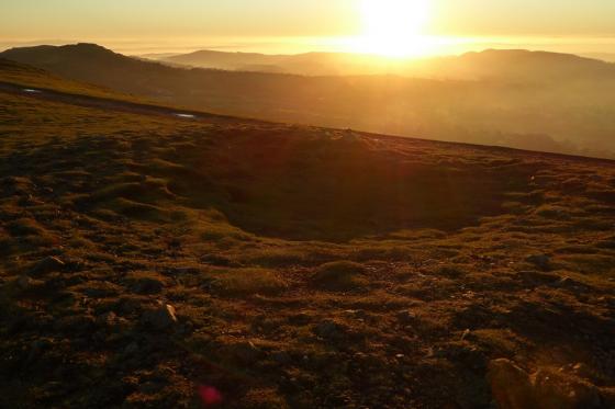
They said they couldn’t but gave me a phone number to ring to ask the land owner. I duly rang the number but the person I spoke to said the land didn’t belong to them and that I had to ask at the farm. One of the people then said it was ok for me to visit but to stay away from the cows and make sure I closed the gates behind me. Leaving the heavily pregnant Karen and Dafydd in the car (he was asleep) I headed up the track which ran around the back of the barn. The path was easy enough to follow (the cows use it!) although it was steep. Just at the top of the hill a large ditch / bank could be seen either side of the path – overgrown but clearly visible. The centre of the Hillfort was flat and used for grazing. As I was about to have a better look my ‘phone went and Karen told me I had to go back to the car as a man had arrived and told me I didn’t have permission to visit. He said the farmer carries a shot gun and no one was allowed to visit the site!! (Needless to say this worried Karen somewhat!) I came back down the track to find the chap had gone into the farmhouse. I then decided enough was enough and headed off.
Although the section of the Hillfort I saw looked fairly well preserved (the bank / ditch was large) I can’t recommend a visit due to the problems associated with access. I get the distinct impression I was luck to get as far as I did.
Articles
Some local names at the fort:
The camp itself is very large. It comprises within its area nearly 30 acres of ground. It has two main entrances; one from the north, through the outer portion, called “Fluck’s Close,” and another from the east – this entrance is approached by a deep fosse road, or covered way, from the north, and it is also defended by a traverse and deep fosse in front of it.
The camp is supplied with water from a spring close to the ramparts, and by two ponds in the southern side of the outer fosse. The portion on which we now stand is the bastion guarding the northern entrance, and is called “The Churchyard,” but whether the human bones which have been found in the camp came from here is not stated.
The portion termed “The Camp” is nearly rectangular, with a small projection at the eastern end, called “The Little Camp.” It is nearly 20 feet higher than the western portion. This is called “Peas Hill,” with the narrow portion near the eastern entrance, called “Humble Bee Park.” [..] You will observe an entrance on the western side; this is not an original entrance. The fosse near it is called “The King’s Ditch,” but the origin of this name is lost.
From “Herefordshire Register of Countryside Treasures” (1981 H&WCC):
“Wall Hills Camp, Ledbury
This camp is defended on S and W by steep scarped slopes. Inner enclosure of 3.6 ha. (9 acres) is defended on S by double rampart with ditch, partly filled with water. Further area to N of 6.4 ha. (16 acres) is defended by less well marked single rampart and ditch. Interior of fort is cultivated. Outer enclosure has two turned-in entrances, the inner one having entries at E and W ends.
Location
On hill overlooking and 1.5 miles W of Ledbury along farm track from road to E of Flights Farm.”
Sites within 20km of Wall Hills Camp (Ledbury)
-

Bradlow Knoll
photo 2description 2 -

Kilbury Camp
photo 8description 2link 1 -
Haffield Camp (Donnington)
description 2 -

Midsummer Hill
photo 36forum 1description 5link 2 -

Waum's Well and Clutter's Cave
photo 8description 5 -

British Camp
photo 67forum 2description 9link 3 -

Shire Ditch
photo 18forum 1description 4 -

The Colwall Stone
photo 6description 5link 1 -
Colwall barrows
photo 22description 2 -
Oldbury Camp
description 2 -
Cradley Camp
description 1 -

Backbury
photo 13description 1 -

North Hill and Table Hill, Malvern
photo 10description 4link 2 -

Capler Camp
photo 18description 5 -

Cherry Hill Camp
photo 11description 2 -
Gadbury Bank
description 1 -
Stanford Bishop
photo 5description 3 -

Rotherwas Ribbon
photo 4forum 4description 8 -

Dinedor Camp
photo 11description 1 -

Wergins Stone
photo 8description 5link 1 -

Castle Hill Wood
photo 6description 2 -

Chase Wood Hill
photo 16description 1 -

Sutton Walls
photo 14description 6 -

Towbury Hill
photo 1description 1 -
Hill Croft Field
description 1link 1 -

Aconbury
photo 16description 4