Showing 1-50 of 214 posts. Most recent first | Next 50  
|
Desk based find, not had a look at this yet.
Working on on-line map based research in the durham area I came across this on Sat Image.
Circular ditch (100m in circumference) enclosing a raised circular feature. Seen a LiDAR image and it really jumps of the page on that but also shows as crop marks.
Not listed on HE records, keys to the past or the recent aerial mapping published by HE so could be one that's not been spotted before - will be interesting if that's the case as the HE aerial maps show ridge and furrow in this field from a 1958 RAF photo - so would be strange if it wasn't spotted then.
|

|

   
|
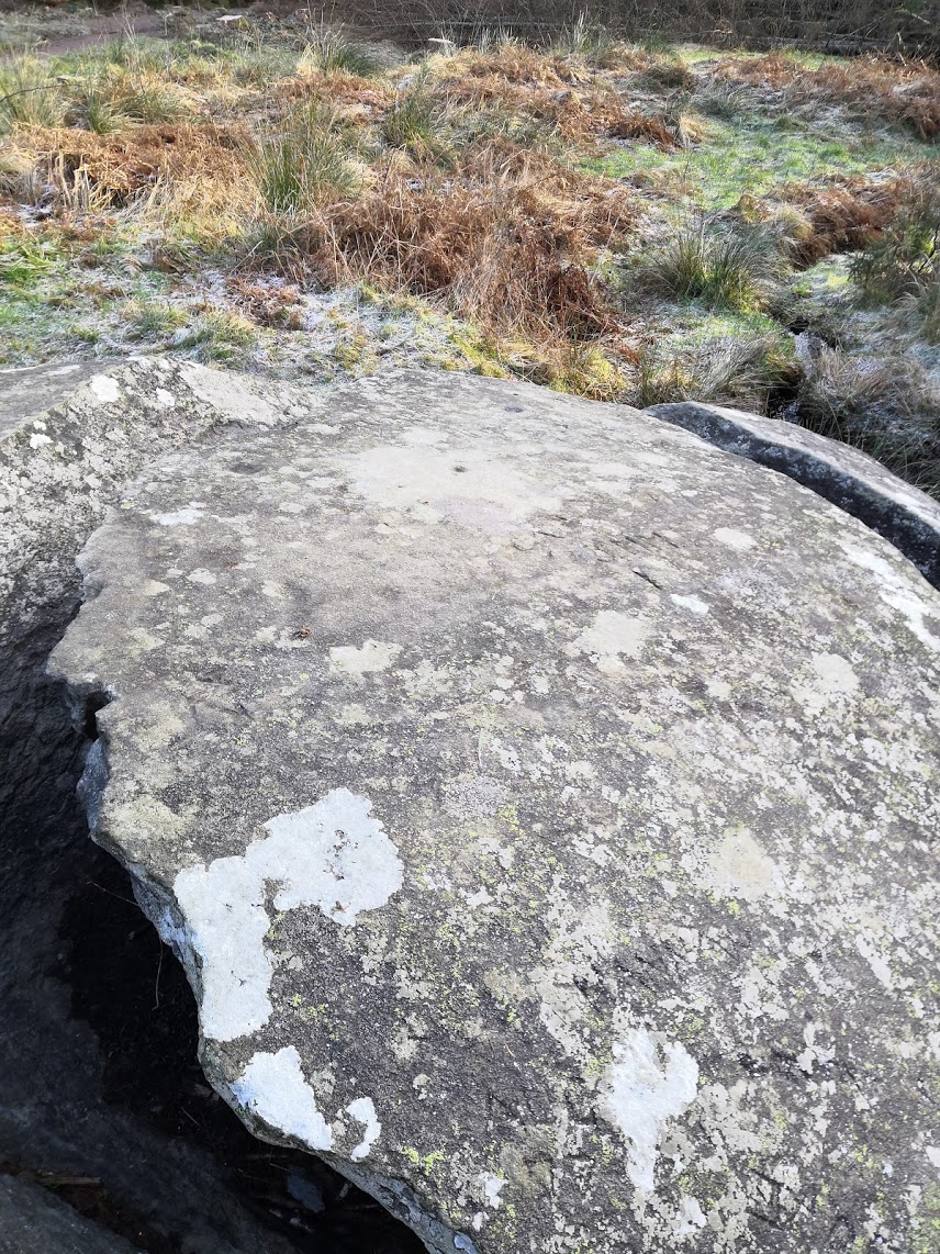
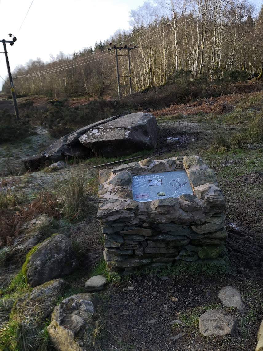
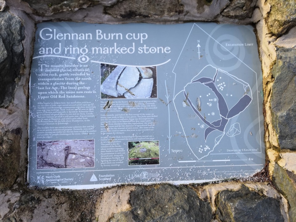
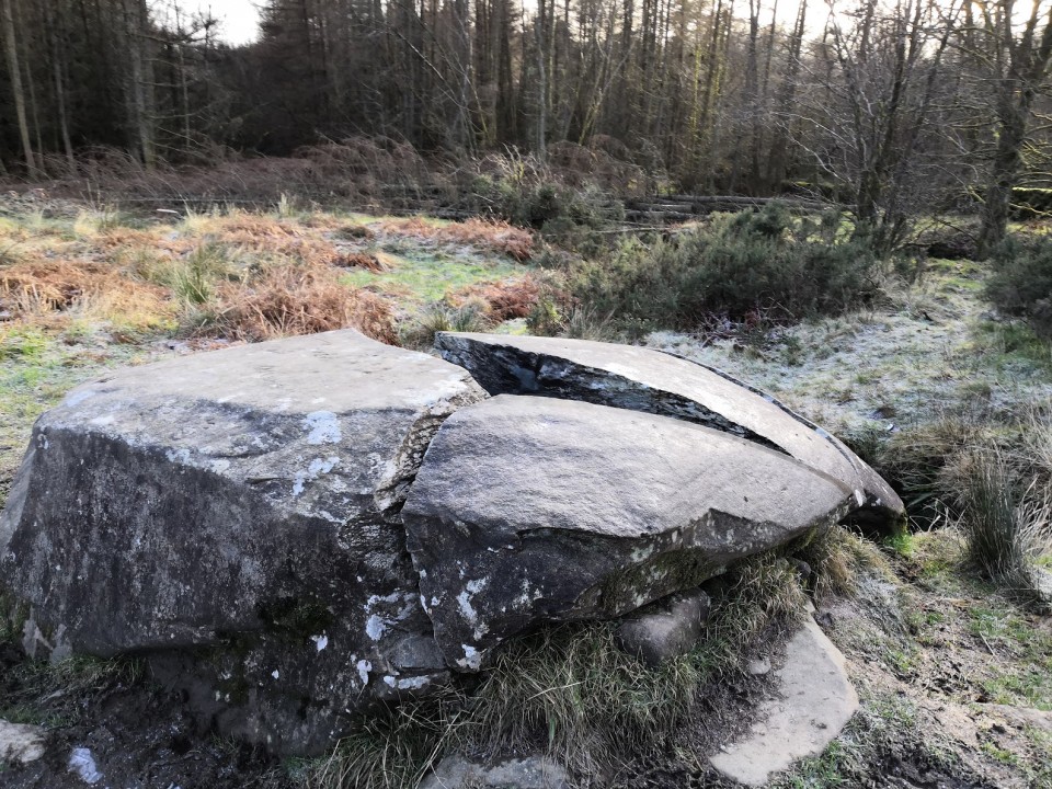
Surprised when I found this one isn't on TMA as it's on a well marked path and has been taken under the wing of the North Clyde Archeology Society.
Easy to visit. Park at Hill House NT car park at the top end of Helensburgh. Take the marked path to Rhu and about 1km (15 min walk along well made paths) from the car park this large rock is on the left of the path in a clearing as you pass through trees.
Still well marked this large rock has been split into roughly 4 chunks. There is a plaque at the side giving details. An impressive stone that would have been stunning before split.
Some details and pictures at https://www.geograph.org.uk/photo/5204250
https://canmore.org.uk/site/41455/drumfad
|
Dun Torvaig, a dun with outworks on a rocky knoll.
The dun, oval on plan measures externally 28.0m NW-SE by 18.0m transversely. The wall is 4.1m thick at the N side of the entrance which is in the W and is 1.4m wide. Except at the entrance the inner wall face is not evident, but the outer face can be traced for most of the periphery. Within the wall is a stabilising face which can also be traced for most of the periphery. Of two circular structures planned RCAHMS in the interior, the more westerly appears to be a ruinous recent structure, and the other is an amorphous scatter of stones with no structural details apparent, but possible fortuitous tumble.
The approach from the W has been blocked by two curving close-set walls of indeterminate thickness whose outer faces are well defined by blocks on edge. An entrance 1.2m wide in the SW is well defined by similar blocks.
Immediately outside the outwork in the N is a level platform, about 7.0m in diameter which although probably natural, would make an excellent hut stance.
Surveyed at 1/500.
RCAHMS 1928; Visited by OS (I S S) 11 October 1971.
|
6,000 year old Tsunami in Ireland?
Archeologists have uncovered evidence of pre-farming people living in the Burren more than 6,000 years ago — one of the oldest habitations ever unearthed in Ireland.
Radiocarbon dating of a shellfish midden on Fanore Beach in north Clare have revealed it to be at least 6,000 years old — hundreds of years older than the nearby Poulnabrone dolmen........
http://www.irishexaminer.com/ireland/6000-year-old-settlement-poses-tsunami-mystery-193230.html
|
Planned Iron Age town near Reading - BBC report
More "news teasers" from the BBC for Digging for Britain - but looks like the series will be worth watching.
This one covers a planned Iron Age settlement near Reading.
http://www.bbc.co.uk/news/science-environment-14555449
|
   
|
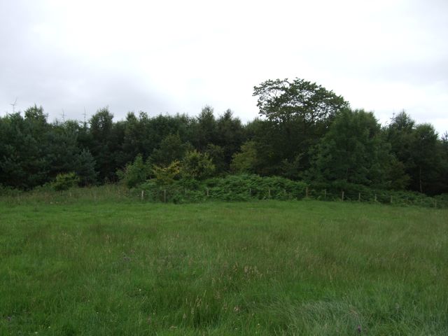
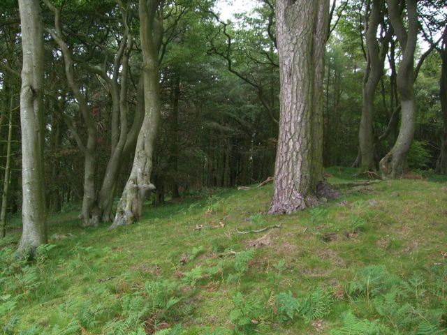
Finally got to visit this one and to be honest I wouldn't recommend it.
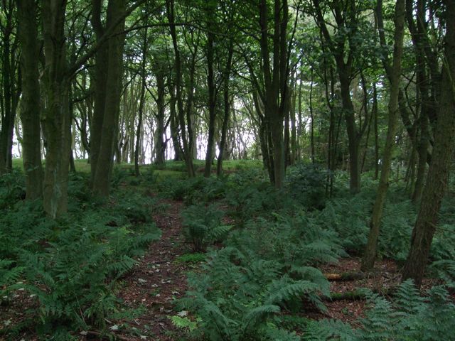
First off while it's just off the old A1 and there is parking close by the woodland between the barrow and the road is jungle like with no clear paths - not an easy 100m to get through.
Second when you get there, there is very little to see. A semi-circle has been cut in the woods and the records show this as the site of the barrow but there is nothing obvious there - through there is a clear ring of bracken growth so the soil is obviously different. You'd need a full day with an industrial strimmer to see any features.
Thirdly the site is close to the A1 so there is lots of noise and very little atmosphere.
All that being said there are some points of note:
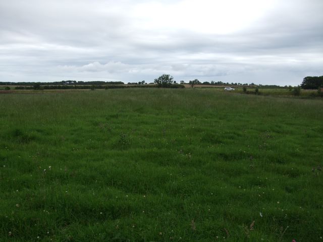
1) This barrow hasn't been built to be seen from a distance. It's not prominent at all and seems to have been located here either because it was close to water (stream nearby) or close to an ancient trackway. It does lie on raised (slightly) ground.
2) There might be a second barrow in the field between the trees and the A1 (or the original position might have been out and this is the barrow). This looks like an over-ploughed feature on top of a raised area of land - roughly 50m from the marked site.
Both can be seen from the A1 if you are passing but don't blink or you'll miss it.
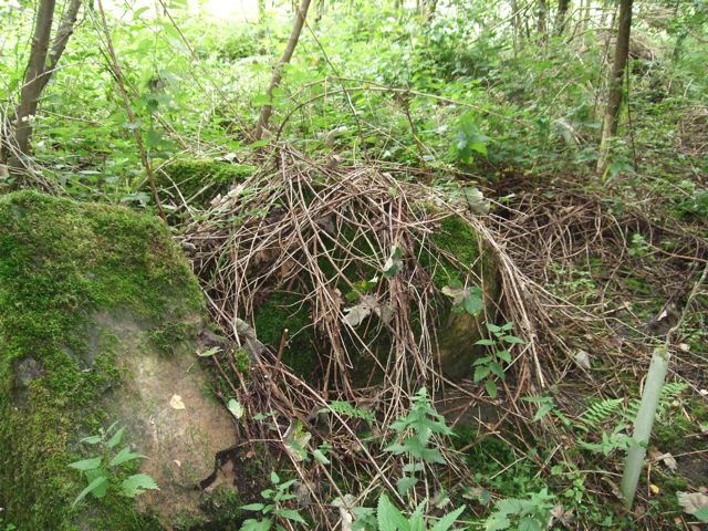
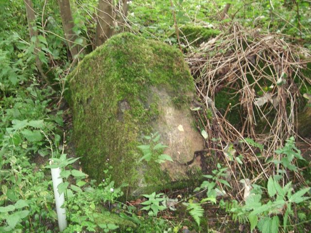
On the way back through the trees I came across what looked like a large piece of worked stone - 1m or so in all directions, roughly rectangular and looked like it had split at some time. Not sure what this is/was but it stands out as an "erratic" in that it's very large and has no obvious context. It's on the north edge of the woods near the stream as you work back from the barrow to the old A1. Photos attached.
|
Describes Cist found in 1921.
"In August, 1921, a cist was excavated by Mr. Bosanquet and his son in the parish of Rock. The site is the plantation known as Heiferlaw Plantation on the old edition (Sheet 27, S.W.), and Ellsnook Wood on the new edition (Sheet 29, N.W.). In the cist was found a beaker. The cist was in the top of a mound, and it is thought that it is not the primary interment. The
mound is certainly partly artificial. Excavations are to be resumed this summer. (Mr. R. C. Bosanquet, Rock Moor, Alnwick)."
|
 
|
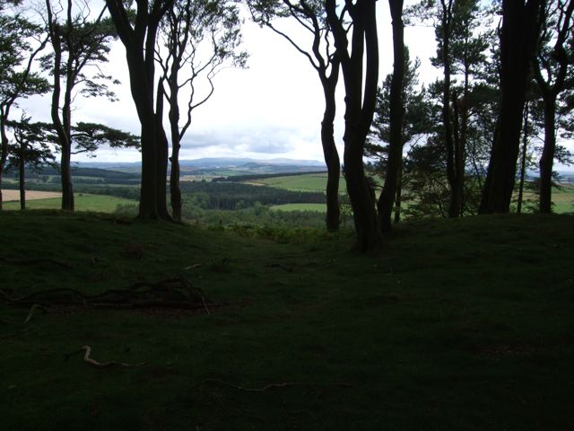
Finally got a chance to visit here - put up some photos. Field notes follow.
I'd put this one down as one to visit mostly due to the lack of any scenery or sense of place until you get nearer the site, then the wonderful views to the west when you get to the site.
Very easy site to get to, park on the old A1 at the edge of the woods and walk in. Best to park north of the pathway shown on the OS maps as the road is very narrow here and there's nowhere to pull in.
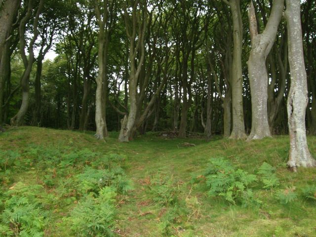
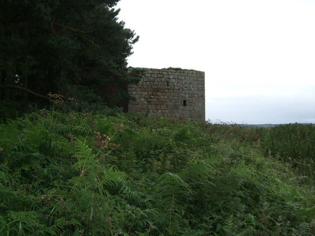
Easy walk in through woodland but no obvious paths so some trail making required. As you follow the rising ground up towards the site it's easy to see that is wasn't built to impress when coming from the East. For a start there is much higher ground to the east. You'll see this as pass the 15th century tower. This is higher than the main site but much smaller in area. Had a look up here (hard going) and no obvious ditches or platforms.
As you pass the tower the ground flattens and you can see the end of the tree line in the West. While the site has been over planted with trees these are far apart and don't interfere with viewing the site.
Main features of the site are as follows:
1) Double ditch with bank between, very easy to see at the Eastern end, less obvious at the west end where there seems to be one larger bank and single deeper ditch. Bank around 1.5m high at the highest point near the western entrance.
2) Round/Oval in form, around 100m across at the widest point.
3) Number of features inside the ditches, bumps, hollows, etc. What looks like two well features - rectangular holes with iron railings over them.
Had a look round the web and this isn't a well feature but the entrance to an underground shelter that would have been used by the British resistance forces if the Germans had invaded in WW2 - link at http://www.coleshillhouse.com/heiferlaw-auxiliary-zero-station.php
That's a first for me!
4) What looks like two entrance gaps in the main bank, one to the East (South East), with the most obvious one at the western end.
5) Obviously built with a "western aspect" in mind. When you get to the Western entrance its obvious that the site would have been most impressive and most visible from the west where it would have been approached up a steep slope from the valley. Views from the site to the west go off to other sites such as Jenny's Lantern, White House Farm, Hunterheugh and the edges of Beanley Moor.
6) As with many "forts" in the area the site doen't look like it was mainly built for defence. From the East there is both higher ground and a wide area of flat land outside the ditches and the ditches here look the least impressive.
7) Possible "mound" feature inside the western entrance, but this also has the entrance to the underground shelter in it so could well be WW2 in date to hide the entrance.
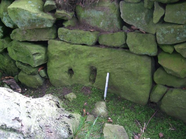
8) Worked stone in the western wall - see photo - probably much later in date.
The views to the west are stunning and my photos don't do them justice - well worth the short walk from the car.
|
   
|
Royal Commission Site summary:
"A robbed broch represented by a turf-covered stony mound about 10ft high and 50ft in diameter, surrounded at a distance of about 31ft, by a wall about 4 1/2ft high which stands on the inner lip of a ditch about 28ft broad and 3 1/2ft deep from the top of the counterscarp. Except on the W, the ditch has been almost destroyed by cultivation. "
|

Notes from Royal Commission Site:
"Broch, 'Cairn of Elsay', Staxigoe, was excavated and planned by the late Sir Francis Tress Barry. The wall was approximately 17ft thick, enclosing an inner area with a diameter of 29ft. Any outbuildings which may exist around the broch have not been uncovered. The plan shows an outer casing wall on the S, through which an entrance passes, but this is not now apparent.
RCAHMS 1911.
The broch is a grass-covered mound situated on level ground close to the shore. It is 18.0m in diameter, has a wall 4.8m thick and stands to a maximum height of 2.7m above the level of the ground at the base of the mound. A fragment of the inner face of the wall is visible on the E side only, but the outer face is exposed to a height of 1.2m and for a length of 7.0m on the NE side; fragments are also visible on the SE side.
The entrance, in the SE, is 0.7m wide, its walls exposed to a height of 1.2m at the outer end.
The court is now a rubble-strewn hollow 2.6m below the top of the broch except for a large, stony, grass-covered mound 1.2m high which extends from the centre to NE of the entrance. In the centre of the court is an upright stone slab 1.0m high, 0.4m wide and 0.1m thick.
No trace of any outbuildings was seen around the broch."
|
Nybster Broch - reported on BBC News and added site.
Royal Commission Site entry states:
"Nybster Broch was excavated by Sir Francis Tress Barry about 1900, revealing neither guard chamber nor mural cells. It has in internal diameter of 23ft and a wall thickness of 14ft. In 1910 the maximum height of the walls was 5ft 3ins.
The broch is defended by a possibly later forework and the whole is fronted by a ditch about 20ft wide which cuts off the promontory on which the broch stands. To seaward of the broch practically the whole promontory is covered by well-built out-buildings, oblong, circular, and irregular in plan.
Finds include a fragment of 2nd century Samian ware, as well as the more usual bone and stone objects."
|
Showing 1-50 of 214 posts. Most recent first | Next 50
Based in Argyll but spend a lot of time in Northumberland I've always been interested in things Iron Age and earlier.
I now have the time to combine this interest with walking and taking photos so I hope to add content where I can.
|
|